A Week of Wonder and Flowers


This past week was my birthday.  The wonder started a week ago when my friends came for dinner and my friend’s father, visiting from Mexico. brought me red roses.  I had not seen my friends in a long time and it was fun.  Then on Sunday, Roberto, the father, and I went hiking in Palo Duro Canyon on a new trail.  I never saw a name for it.

IMG_2638

We found this trail by starting at Chinaberry (for those who go to the Canyon), taking Comanche Trail up to this new trail.  When they intersect, we went north rather than south on Comanche.

IMG_2641

If you read the previous blog in December about hiking Comanche, you saw this peak but from the center and to the south.  This is a view from the north looking south.

IMG_2640

IMG_2642

Eventually, after hiking up and down across an arroyo, you end up above the river which looks tiny here, but when a big rain comes, it can rise many feet in a few hours.  It was very sunny, I had a hard time focusing so occasionally a finger got in the way.

IMG_2643

Roberto has a funny sense of humor.  He could not resist pretending to hold up one of the many giant boulders along the trail.

IMG_2644

IMG_2646

This is not a difficult walk and not too long if you only have a few hours.  We came across a group of wild turkeys, but they moved so much, I was unable to get a good photo so gave up.

Wednesday was my birthday.  It began with my first period class–I teach senior high school English.  They showered the room with confetti, brought me a giant chocolate muffin with a candle in the middle, lit the candle and sang me Happy Birthday.  Then during second period, two of my students arrived with two bouquets of flowers.  The room smelled wonderful for three days.  I brought the flowers home yesterday in a big box.

IMG_2652

My grandson told the florist to make me a giant bouquet with exotic flowers.  This is one side of it.  Orchids, roses, hydrangeas, and some really unusual flowers which I cannot identify.

IMG_2653

This is the other side of the same bouquet.

This bouquet is from my son.  He knows my favorite color is orange and that I have a lot of that color in my house so….

IMG_2656

I am seriously nerdy and asked for an atlas for my birthday.  My daughter outdid herself and bought this one full of all sorts of information I never expected and maps.  I love maps.  When I read a book from Latin America, Africa, etc., I look up the places on maps.

Last night I sang songs, using the poems of Octavio Paz and Pablo Neruda among others, with the Amarillo Master Chorale in a church with perfect acoustics for choral music.  Tonight I will see friends at an opera party.  What a wonderful week!!

Spring Break Adventure–5


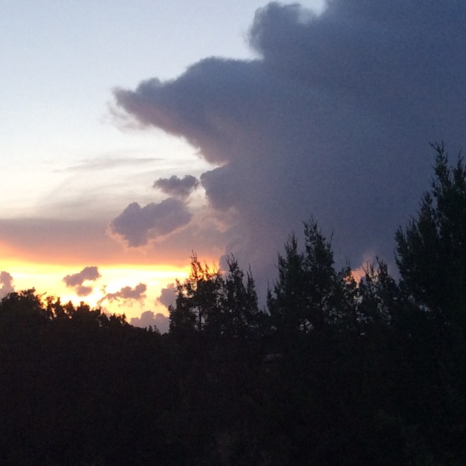
On the fourth day of the adventure we went to Marfa, Texas.  My friends from college, David and Suzy, had booked a tour of the Chinati Foundation.  No photos of that because none allowed.  This foundation is the dream of its founder, Donald Judd.  His art and almost all the rest of the art housed here is not for display in houses.  All but a few consist of grand studies of space and light. An abandoned, refurbished military base, purchased by Judd, houses most of the exhibits.  Judd’s main interest it seems relates to the relationship between light and space.  First, the tour guide takes you to a couple of large buildings where the only changes made were to install new windows and a ceiling.  These buildings house Judd’s large, polished, stainless steel rectangular boxes.  While this may sound boring, I assure you it is not.  Light reflects off these boxes, makes shadows, etc. in all sorts of ways and the entire effect changes with the angles of the sunlight.

Another quite astonishing display can be seen in a series of U-shaped buildings, painted and repaired, in which eight foot long fluorescent light tubes in four colors, pink, green, yellow, and blue, have been installed in the corners of the U.  Depending on where a person stands, other colors appear, not just the four mentioned.  It became apparent to me that the artist, Dan Flavin, knew every scientific detail of the color spectrum and its effects on the human eye and brain.

I also enjoyed a smaller display by artist and poet, Carl Andre.  Even though his fame rests in sculpture, it is mainly his poetry displayed here.  I wanted to read all of it but everyone else went on so I quit.

There are other exhibits, including a lot of smashed and welded vehicles which I liked the least.  The final exhibit displays giant fabric sheets in black and white in a building specially designed by the artist, Robert Irwin.  If you think this sounds boring, take a trip there and look for yourself.  I assure you it is not.  Irwin actually worked on the exhibit himself at the age of 88.  He lives on now at 89.

IMG_2603

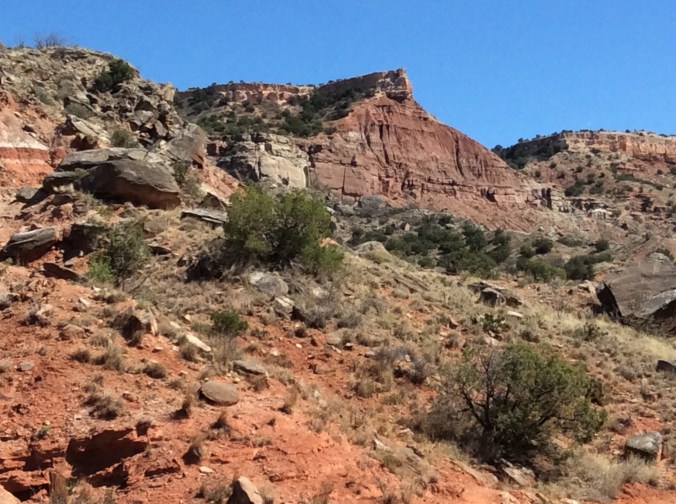
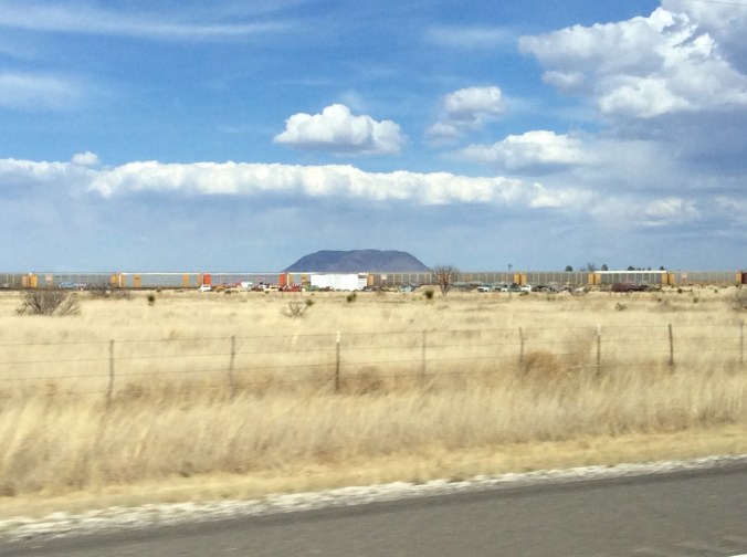
The only photos I managed in the area show the Marfa Courthouse which is, believe it or not, even a brighter pink than this photo and a photo from the vehicle window on the highway to Alpine. The second photo shows a mesa we managed to view on one day or another from nearly all sides.  It looms large in the middle of flat land. Here one of the endless trains slides by.

IMG_2604

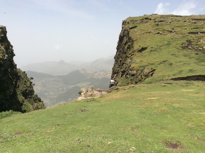
On our last day we decided to drive to Presidio and take the river road which goes through Rio Grande Ranch State Park. While the road goes either along or down to the river in a few places (for people to put some sort of water craft into the river or to camp), most of it is way above the river on cliffs.  This landscape is not for the faint of heart.

IMG_2605

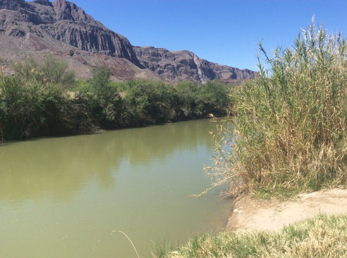
US on the right and Mexico on the left.  The fields and pasture in the distance are in Mexico.

IMG_2606

Looking into Mexico.

IMG_2607

IMG_2609

IMG_2611

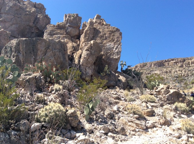
Unusual rock formations near one of the small drives down to a campground by the river.

IMG_2613

IMG_2617

Cliffs in Mexico.

IMG_2619

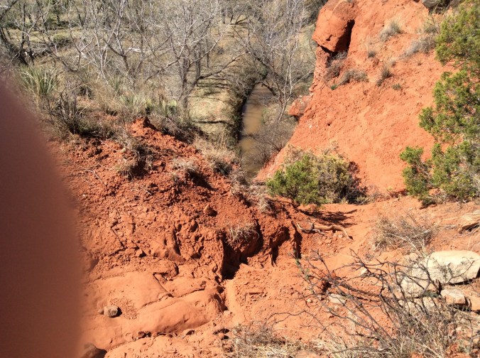
Apparently, in my efforts not to fall in the river while taking this, my finger got in the way.

IMG_2620

IMG_2621

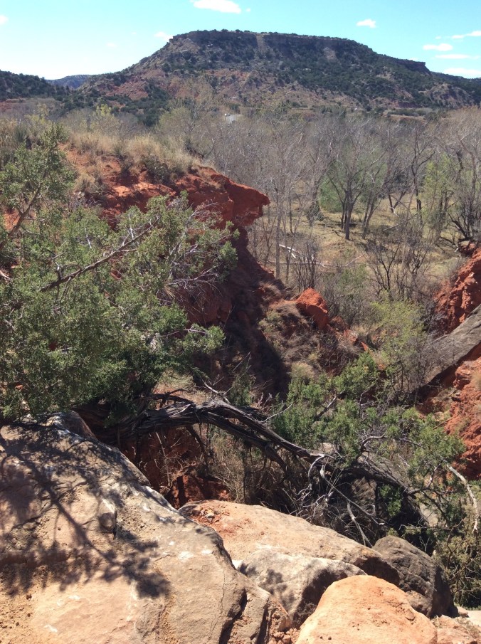
Yes, the river is down there between those cliffs.

IMG_2622

IMG_2623

In case you wonder why the Rio Grande seems so small here, consider that by the time it gets here, 95% of the water has been removed for irrigation and other purposes.

IMG_2624

We drove back through Terlingua to Alpine.  Not much exists in Terlingua except a rather pathetic supposed ghost town area.  The river road is not conducive to speed; we were hungry and stopped for a very late lunch.  It was St. Patrick’s Day and many of the clientele had a good start on the festivities.  On Saturday I learned that Terlingua is a famous biker town.  However, apparently not that day.

Spring Break Adventure–4


Today was the second day at Big Bend.  We spent most of the day in the Chisos Basin where the park lodge is located.  The four of us started the hike all the way to the “window” and two of us finished it, which enabled me to not only experience a hike full of wonder but also to get over 20000 on my Fitbit for the day.  I also have a sunburn now.  For this post I will just add photos with little comment.  Later I will add more details about this astonishing place.

imageimage

image

image

Although I took some of these photos, I did not take anything on the hike so thanks to a friend you are seeing some of these.  This is bear and mountain lion country so there are signs telling you what to do if you see one, hardly likely with so many people around.  However, all the campsites have metal containers in which to lock food from bears.

Spring Break Adventure–2


Today we went to MacDonald Observatory and signed up for a tour.  It was more than we imagined.

The views 360 degrees since you are at the top are, well, spectacular.

In the distance a cloud bank hung over the mountains.

I stood back to take a photo of the different buildings that house the actual telescopes.

We entered the building on the right which houses the 107 inch telescope and walked up 77 stair steps to see it.


image

image

It is too large to get a photo of the entire telescope.  Depending on what the astronomers want to study, different parts are added and subtracted.  The room is temperature controlled between 40 and 50 degrees. The photo below shows another area with a different type of telescope currently under construction.

image

After leaving here, we took a scenic drive in a circle through the mountains.

We were especially impressed with the unusual rock formations and the giant cotton wood trees of which we saw dozens along a stream bed.

A Week of Gratitude (cont.)


Although I intend to continue with gratitude thoughts and lists, this is my last post of this one week exercise.

Saturday’s list includes:

-Cooking for and enjoying the company of close friends.

-Listening to music I love–Angelique Kidjo, Rokia Traore, Cesaria Evora, Conjunto Primavera.

Sunday’s list includes:

-Enjoying springlike weather with birds singing.

-Accomplishing spring cleaning in my xeriscape flower beds.

-Trying a Japanese sauce I never tasted before–yakiniku.  I used it with chicken and bok choy over Jasmine rice.  This included marinating grated carrots in mirin, another Japanese sauce which I especially like.

-Watching a deer disappear through the junipers.

-Enjoying the warm weather from my patio.

SAM_1545

You, yes, you can make a difference


Many tell me or believe that one person, him or herself, cannot do much to change the world, to make a difference.  This short movie tells about a man in northeastern India who transformed a wasteland into a forest by planting one tree at a time over many years.  Now elephants, deer, and even tigers live there.  Take a look for yourself.  Look for the youtube video called “Forest Man”.  The web address is :

It won awards at several different film festivals including Cannes.


Another bill aims to take wolves off endangered list


For a number of years I have mulled over reasons why humans seem to hate wolves considerable more than other predators. I have my own “theories”. What are yours?

Wolf is my Soul's avatarWolf Is My Soul

January 10, 2017

A gray wolf moves through forested country in winter. Credit: MacNeil Lyons, National Park Service

The new Congress wasted little time in efforts to once again remove gray wolves from the federal endangered species list.

A bill introduced Tuesday by U.S. Reps. Collin Peterson, D-Minnesota; Sean Duffy, R-Wisconsin; and Liz Cheney, R-Wyoming, would overrule a federal court action and remove federal protections from wolves in the Great Lakes and mountain west.

That already happened once, but a judge’s decision in late 2014 restored federal protections after wolves spent about three years under state control.

The members of Congress, and the U.S. Fish and Wildlife Service, say wolves have recovered enough in those areas to remove protections. But wolf supporters say the wolf hasn’t recovered over enough of its original range to remove protections in the few states where it is thriving, like Minnesota and Wisconsin. Wolf supporters…

View original post 129 more words

Hiking Palo Duro Canyon State Park–Day Two, New Year’s Day


In spite of having to run/rush, I enjoyed the first hike so much, I decided to go back down with my son on New Year’s Day, another weather perfect hiking and biking day.  I hiked the same trail but had time to enjoy it, take more photos.

img_2411-1

I headed up Comanche Trail from Chinaberry area toward the same peak in the distance.  Although this trail is not difficult, it is not flat until you get to the bottom of the cliffs in the distance.

img_2423

At this point I have reached the same area where I took most of the rock photos on the first Palo Duro post.  Once again, I took off onto the “new” trail to the north.

img_2432

To get to this point one has to climb down a rather steep trail and cross a dry arroyo and start up the other side.  This is across from where I had previously seen the shovels, etc.  They were still there, but the other equipment had been moved to just below where I took this photo.

This trail contains a lot of loose debris and dirt with large boulders laying every which way.

img_2436

Once I reached the flat top area, I saw those orange/red flags here and there and now wonder where the trail will eventually go.  I headed back toward Comanche.

img_2445

Back near Comanche Trail.

img_2447

At this point I had walked far enough down Comanche to be slightly past the cliff toward which I was originally headed.

img_2449

If you look in the middle distance, you can see the road in and out of the park.  Here I have walked considerably past the peak seen in the first photo.

img_2450

All kinds of rocks of all sizes appear everywhere–layers and layers of time.

img_2452

The trail follows the base of miles of cliffs.

img_2453

Fallen rocks and “caves” everywhere.

img_2454

Looking back from where I had climbed up higher and higher toward the flatter area.

img_2458

Another smaller “cave”.  I seriously considered hiking to it, figuring there might be some rattlesnakes sunning.  They do not react a lot unless startled or out hunting.

img_2459

Along the cliff base where the trail is easy.

img_2460

In this area, huge, white boulders appear to have fallen from the whiter area in the cliffs above.

img_2461

Farther down these boulders appear, more porous, darker.

img_2462

A closeup of this boulder shows baby prickly pear and grass growing from its surface.

img_2463

Farther south along the trail looking north.

img_2464

There are many species of prickly pear, including this one with its bright color.

img_2465

I looked up and saw three aoudad sheep.  See if you can find any of them in the middle of the photo.  They really blend in with these rocks.

img_2466

I did walk a bit off the trail to take this photo of “coffin” rock.

img_2467

Past the flat area canyon colors show up really brightly here–layers of color and time everywhere.

img_2468

Farther along the trail, looking toward the south.

img_2473

At this point on the trail past the long cliff wall, the trail becomes steeper and up and down again.

img_2474

Farther and farther past the cliff wall.

img_2475

Then one comes down farther where a small, spring fed stream runs.

img_2480

Here with year round water and shade the trees grow much bigger.  Farther down the trail more water seeps and the trail above contains steeper switch backs.

img_2481

img_2482

Far past the cliff base, Comanche intersects Rock Garden Trail.  Once again, but not running/rushing this time, I start down Rock Garden.

img_2483

Looking south, I headed down.  Rock Garden gets its name from an ancient rock slide.

img_2485

Giant boulders everywhere.

img_2486

Some even have grass growing from them.

img_2488

I wanted to take a photo of this boulder because it looks like a giant face with ears.  However, it was so late that I could not take it without my shadow so being silly…

img_2489

Almost down, I took one final photo.  Comanche is the longest trail in the park.  It keeps going past the Rock Garden intersection.  My son, who was mountain biking there a couple of days later, rode almost its entire length.  Some day I want to start at Chinaberry and walk to the end.  However, if you plan to do this, find someone to meet you at the south (far) end because otherwise you will have miles to hike back.

Hiking Palo Duro Canyon State Park


Even though I live ten minutes from the park entrance and occasionally work at the gift shop there, hiking is rare perhaps because I have more than twenty acres of my own for hiking.  My son came to visit for ten days during this holiday vacation.  He brought his mountain bike and spent every day the past week mountain biking the park’s numerous trails.  Last week and yesterday, New Year’s Day, I went along and hiked.  The following photos and comments are day one’s experience.

For those familiar with the park or who may want to go there, we parked at Chinaberry.  I decided to cut across to the east and found a trail.  It was not until several days later that we figured out the trail’s name mostly because this trail in not on any map provided by the park or on the official park website.  The trail is Comanche.  It is the longest trail in the park.  If you go to your browser and type in Comanche Trail in Palo Duro Canyon State Park, you will come to a mountain biking website that shows the trail in some detail even with a virtual tour.  The trail is occasionally marked with signs that say Comanche Trail but since it does not appear on the official map, I found it somewhat confusing until I found the above mentioned website.

img_2407

I took this photo at Chinaberry, a parking and picnic area from which several trails start.

img_2408

Day one I had not seen the marker for Comanche partly because it is across from Chinaberry at the very north end.  I planned to head for the peak in the background, thinking I would hit a certain trail–it was not the one I found because Comanche is not on the map.

img_2409

The grassy area before I found the trail.

img_2411-1

You can see the trail by the grass on the right.

img_2414

This is prickly pear country.  There are numerous species.  This is important for mountain bikers more than hikers.  Tipping over into a prickly pear patch would not be a pleasant experience.

img_2417

Here the trail is easy.

img_2419

I started my hike around 3:30, a big mistake, but I did not know this yet.  Numerous stream beds occur along the trail.

img_2421

At this point another trail diverges to the left.  Here giant grey boulders appear everywhere.

img_2423

I decided to take the trail to the left to see where it went, all the while thinking I was on one trail when I was on another.

img_2427

When I looked toward the opposite direction, I could see this small cave.

img_2428

A view from the trail to the left.

img_2429

The same giant rocks looking back from the “new” trail.

img_2430

After hiking down a rather steep incline with tiny orange flags along it, I came across this. It appears this is a new trail in the making.  Yet, given the rust on the shovel, I thought perhaps the trail blazers had just carelessly left their “equipment”.

img_2431

At the bottom of a little draw ready to climb back up the other side.  You can see one of the little flags in the middle of the photo.

img_2432

Palo Duro Canyon is a geologist’s dream.  Layers of time lay visible everywhere.

img_2434

On my way up the other side of the draw lay more equipment.  When I went back New Year’s Day, this had all been moved to another spot.

img_2436

Different rocks looking in another direction.

img_2440

Back on Comanche Trail (even though I had yet to know its correct name and thought I was somewhere else) headed south.  This was just before I realized just how far I had to go and how little time to get there.

img_2441

Little areas like this are everywhere along the trail.

It was shortly after this point that I saw two women–this trail has few hikers or mountain bikers on it. They were the only people I saw for miles.  When I asked them how far to the other end, I realized I was in “trouble”,  not real trouble like lost, but rather trouble like I was supposed to meet my son at Chinaberry at 5:30, and I was not even half way on this trail and I still had to get to the bottom.  I realized where I would come out; I would intersect another trail called Rock Garden and would have to go one mile steep downhill.  Unfortunately, I had not taken my phone because I did not think it would work there and had no way to inform him.  I also realized it would be nearly dark when I got to the bottom.  5:30 came and went and I still had quite a way to go. I quit taking photos and ran when the trail permitted and walked as fast as possible when it was too rocky or steep to run safely.

img_2442

I took this photo on my way, hiking the several miles toward Chinaberry.  Luckily, I met a nice couple who offered to stop by Chinaberry and tell my son where I was.  Unfortunately, I had the vehicle keys and he could not even get in his own vehicle.  The light to his bicycle was in the vehicle so he had to ride down the road in the twilight to get the vehicle keys.  I kept walking.  I was just glad he had waited and I met the couple because an unneeded rescue would have been terribly humiliating.  We made it home safely.

My Fitbit told me I had walked more than 11 miles that day.


Note:  Day Two, New Year’s Day, will follow with photos along the entire trail.


Top predators like wolves, bears, lions and tigers have declined dramatically around the world over the past century


Some parts of Eastern Europe have worked at figuring out how to balance saving predators and protecting farmers and herders. Spain has programs to reimburse herders.

Rachel Tilseth's avatarWolves of Douglas County Wisconsin Film Company

Conservationists widen toolkit for predator management

Source:Berkeley News
By Brett Israel, 12/13/16

Top predators like wolves, bears, lions and tigers have declined dramatically around the world over the past century. One major driver of these declines is retaliatory killing by people following predator attacks on domestic livestock. This lethal approach to predator management is increasingly controversial not only because of ethical concerns, but also the role predators can play in healthy ecosystems. A new UC Berkeley study shows that many non-lethal methods of predator control can be highly effective in protecting livestock from predators and in turn, saving predators from people.
A tiger drags a cow at Jennie Miller’s study site in India

The Berkeley study examined 66 published, peer-reviewed research papers that measured how four categories of lethal and non-lethal mitigation techniques — preventive livestock husbandry, predator deterrents, predator removal, and indirect management of land or wild prey…

View original post 752 more words