Spring Break Adventure–5


On the fourth day of the adventure we went to Marfa, Texas.  My friends from college, David and Suzy, had booked a tour of the Chinati Foundation.  No photos of that because none allowed.  This foundation is the dream of its founder, Donald Judd.  His art and almost all the rest of the art housed here is not for display in houses.  All but a few consist of grand studies of space and light. An abandoned, refurbished military base, purchased by Judd, houses most of the exhibits.  Judd’s main interest it seems relates to the relationship between light and space.  First, the tour guide takes you to a couple of large buildings where the only changes made were to install new windows and a ceiling.  These buildings house Judd’s large, polished, stainless steel rectangular boxes.  While this may sound boring, I assure you it is not.  Light reflects off these boxes, makes shadows, etc. in all sorts of ways and the entire effect changes with the angles of the sunlight.

Another quite astonishing display can be seen in a series of U-shaped buildings, painted and repaired, in which eight foot long fluorescent light tubes in four colors, pink, green, yellow, and blue, have been installed in the corners of the U.  Depending on where a person stands, other colors appear, not just the four mentioned.  It became apparent to me that the artist, Dan Flavin, knew every scientific detail of the color spectrum and its effects on the human eye and brain.

I also enjoyed a smaller display by artist and poet, Carl Andre.  Even though his fame rests in sculpture, it is mainly his poetry displayed here.  I wanted to read all of it but everyone else went on so I quit.

There are other exhibits, including a lot of smashed and welded vehicles which I liked the least.  The final exhibit displays giant fabric sheets in black and white in a building specially designed by the artist, Robert Irwin.  If you think this sounds boring, take a trip there and look for yourself.  I assure you it is not.  Irwin actually worked on the exhibit himself at the age of 88.  He lives on now at 89.

IMG_2603

The only photos I managed in the area show the Marfa Courthouse which is, believe it or not, even a brighter pink than this photo and a photo from the vehicle window on the highway to Alpine. The second photo shows a mesa we managed to view on one day or another from nearly all sides.  It looms large in the middle of flat land. Here one of the endless trains slides by.

IMG_2604

On our last day we decided to drive to Presidio and take the river road which goes through Rio Grande Ranch State Park. While the road goes either along or down to the river in a few places (for people to put some sort of water craft into the river or to camp), most of it is way above the river on cliffs.  This landscape is not for the faint of heart.

IMG_2605

US on the right and Mexico on the left.  The fields and pasture in the distance are in Mexico.

IMG_2606

Looking into Mexico.

IMG_2607

IMG_2609

IMG_2611

Unusual rock formations near one of the small drives down to a campground by the river.

IMG_2613

IMG_2617

Cliffs in Mexico.

IMG_2619

Apparently, in my efforts not to fall in the river while taking this, my finger got in the way.

IMG_2620

IMG_2621

Yes, the river is down there between those cliffs.

IMG_2622

IMG_2623

In case you wonder why the Rio Grande seems so small here, consider that by the time it gets here, 95% of the water has been removed for irrigation and other purposes.

IMG_2624

We drove back through Terlingua to Alpine.  Not much exists in Terlingua except a rather pathetic supposed ghost town area.  The river road is not conducive to speed; we were hungry and stopped for a very late lunch.  It was St. Patrick’s Day and many of the clientele had a good start on the festivities.  On Saturday I learned that Terlingua is a famous biker town.  However, apparently not that day.

Spring Break Adventure–4


Today was the second day at Big Bend.  We spent most of the day in the Chisos Basin where the park lodge is located.  The four of us started the hike all the way to the “window” and two of us finished it, which enabled me to not only experience a hike full of wonder but also to get over 20000 on my Fitbit for the day.  I also have a sunburn now.  For this post I will just add photos with little comment.  Later I will add more details about this astonishing place.

imageimage

image

image

Although I took some of these photos, I did not take anything on the hike so thanks to a friend you are seeing some of these.  This is bear and mountain lion country so there are signs telling you what to do if you see one, hardly likely with so many people around.  However, all the campsites have metal containers in which to lock food from bears.

Spring Break Adventure–3


Today was day one in Big Bend National Park.  This place is huge.  We drove down to the Rio Grande, took a hike up a big hill/cliff above it, and later drove off on a gravel road which became a bit daunting at times–four wheel drive only. We saw people riding horses across the desert, others canoeing down the river, all sorts of mountains, cactus in bloom, ruined corrals from a extinct ranch, and passed a border control check point–nothing new really.  Used to get checked all the time down near the border. Here are photos I took along the way.


Spring Break Adventure–2


Today we went to MacDonald Observatory and signed up for a tour.  It was more than we imagined.

The views 360 degrees since you are at the top are, well, spectacular.

In the distance a cloud bank hung over the mountains.

I stood back to take a photo of the different buildings that house the actual telescopes.

We entered the building on the right which houses the 107 inch telescope and walked up 77 stair steps to see it.


image

image

It is too large to get a photo of the entire telescope.  Depending on what the astronomers want to study, different parts are added and subtracted.  The room is temperature controlled between 40 and 50 degrees. The photo below shows another area with a different type of telescope currently under construction.

image

After leaving here, we took a scenic drive in a circle through the mountains.

We were especially impressed with the unusual rock formations and the giant cotton wood trees of which we saw dozens along a stream bed.

Hiking Palo Duro Canyon State Park


Even though I live ten minutes from the park entrance and occasionally work at the gift shop there, hiking is rare perhaps because I have more than twenty acres of my own for hiking.  My son came to visit for ten days during this holiday vacation.  He brought his mountain bike and spent every day the past week mountain biking the park’s numerous trails.  Last week and yesterday, New Year’s Day, I went along and hiked.  The following photos and comments are day one’s experience.

For those familiar with the park or who may want to go there, we parked at Chinaberry.  I decided to cut across to the east and found a trail.  It was not until several days later that we figured out the trail’s name mostly because this trail in not on any map provided by the park or on the official park website.  The trail is Comanche.  It is the longest trail in the park.  If you go to your browser and type in Comanche Trail in Palo Duro Canyon State Park, you will come to a mountain biking website that shows the trail in some detail even with a virtual tour.  The trail is occasionally marked with signs that say Comanche Trail but since it does not appear on the official map, I found it somewhat confusing until I found the above mentioned website.

img_2407

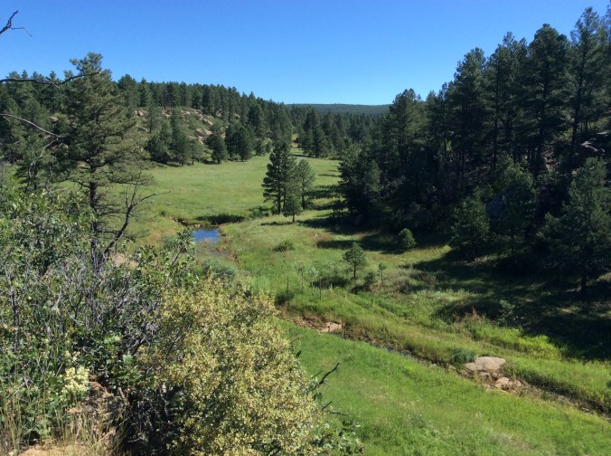
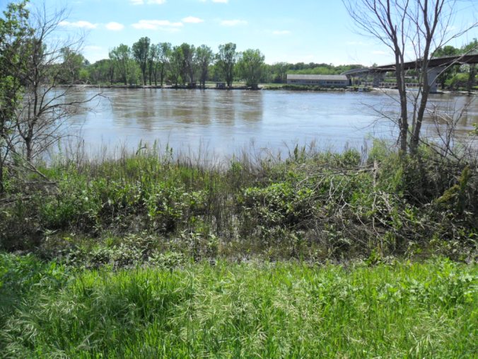
I took this photo at Chinaberry, a parking and picnic area from which several trails start.

img_2408

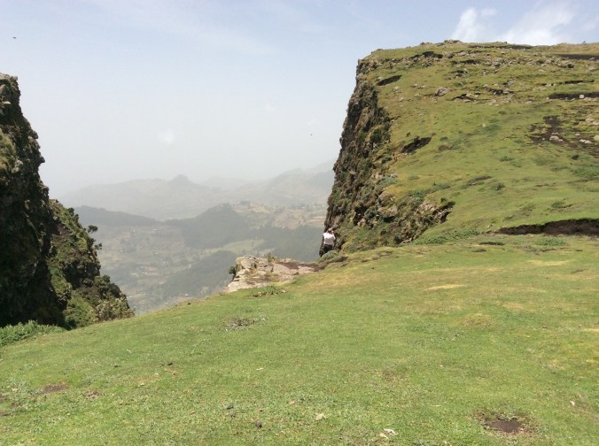
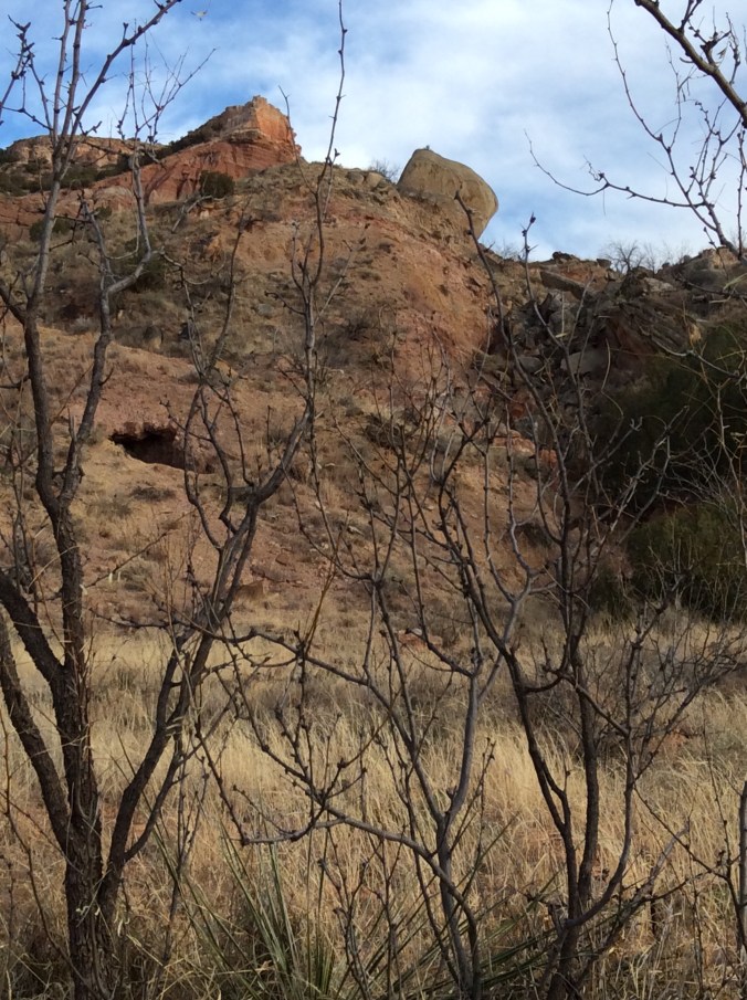
Day one I had not seen the marker for Comanche partly because it is across from Chinaberry at the very north end.  I planned to head for the peak in the background, thinking I would hit a certain trail–it was not the one I found because Comanche is not on the map.

img_2409

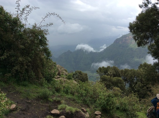
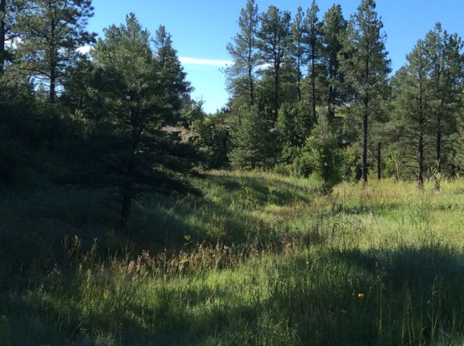
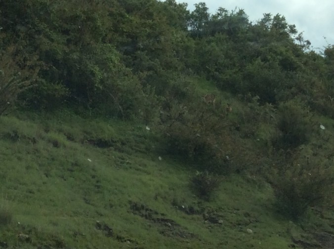
The grassy area before I found the trail.

img_2411-1

You can see the trail by the grass on the right.

img_2414

This is prickly pear country.  There are numerous species.  This is important for mountain bikers more than hikers.  Tipping over into a prickly pear patch would not be a pleasant experience.

img_2417

Here the trail is easy.

img_2419

I started my hike around 3:30, a big mistake, but I did not know this yet.  Numerous stream beds occur along the trail.

img_2421

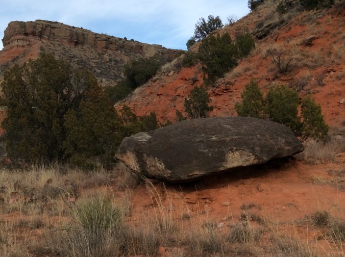
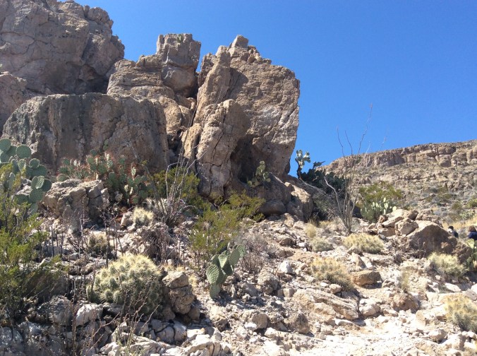
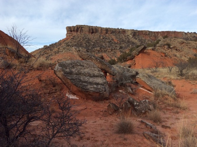
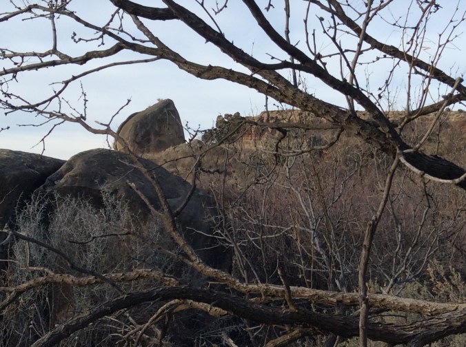
At this point another trail diverges to the left.  Here giant grey boulders appear everywhere.

img_2423

I decided to take the trail to the left to see where it went, all the while thinking I was on one trail when I was on another.

img_2427

When I looked toward the opposite direction, I could see this small cave.

img_2428

A view from the trail to the left.

img_2429

The same giant rocks looking back from the “new” trail.

img_2430

After hiking down a rather steep incline with tiny orange flags along it, I came across this. It appears this is a new trail in the making.  Yet, given the rust on the shovel, I thought perhaps the trail blazers had just carelessly left their “equipment”.

img_2431

At the bottom of a little draw ready to climb back up the other side.  You can see one of the little flags in the middle of the photo.

img_2432

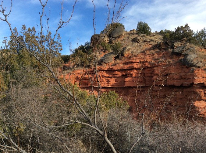
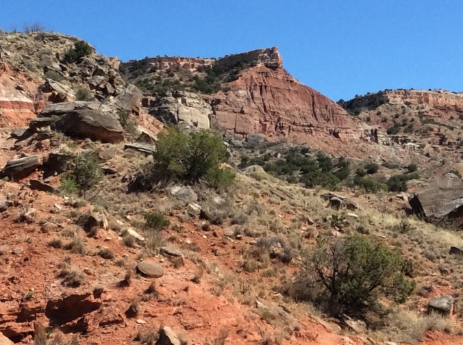
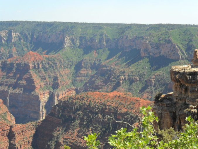
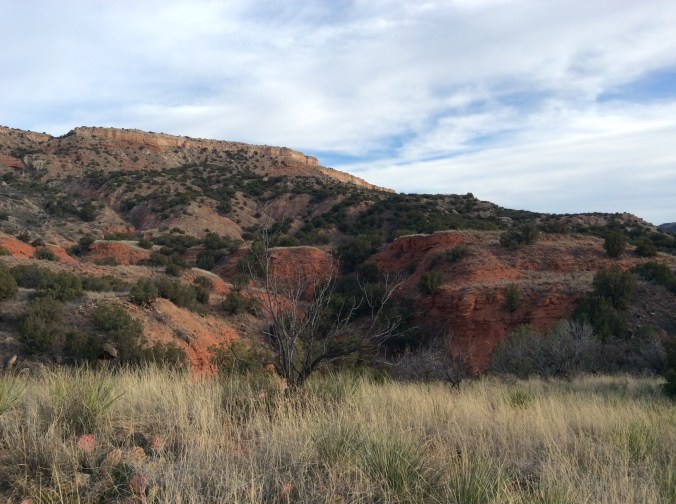
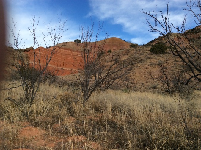
Palo Duro Canyon is a geologist’s dream.  Layers of time lay visible everywhere.

img_2434

On my way up the other side of the draw lay more equipment.  When I went back New Year’s Day, this had all been moved to another spot.

img_2436

Different rocks looking in another direction.

img_2440

Back on Comanche Trail (even though I had yet to know its correct name and thought I was somewhere else) headed south.  This was just before I realized just how far I had to go and how little time to get there.

img_2441

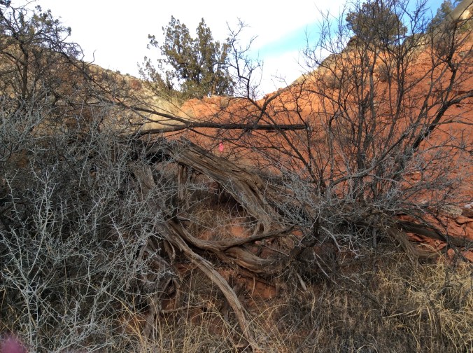
Little areas like this are everywhere along the trail.

It was shortly after this point that I saw two women–this trail has few hikers or mountain bikers on it. They were the only people I saw for miles.  When I asked them how far to the other end, I realized I was in “trouble”,  not real trouble like lost, but rather trouble like I was supposed to meet my son at Chinaberry at 5:30, and I was not even half way on this trail and I still had to get to the bottom.  I realized where I would come out; I would intersect another trail called Rock Garden and would have to go one mile steep downhill.  Unfortunately, I had not taken my phone because I did not think it would work there and had no way to inform him.  I also realized it would be nearly dark when I got to the bottom.  5:30 came and went and I still had quite a way to go. I quit taking photos and ran when the trail permitted and walked as fast as possible when it was too rocky or steep to run safely.

img_2442

I took this photo on my way, hiking the several miles toward Chinaberry.  Luckily, I met a nice couple who offered to stop by Chinaberry and tell my son where I was.  Unfortunately, I had the vehicle keys and he could not even get in his own vehicle.  The light to his bicycle was in the vehicle so he had to ride down the road in the twilight to get the vehicle keys.  I kept walking.  I was just glad he had waited and I met the couple because an unneeded rescue would have been terribly humiliating.  We made it home safely.

My Fitbit told me I had walked more than 11 miles that day.


Note:  Day Two, New Year’s Day, will follow with photos along the entire trail.


Gratitude


Thanksgiving brings so many thoughts, including thoughts about the divisive political discourse in the country now.  However, it seems more productive and in keeping with the day to focus on gratitude.  As I write this I think of both personal and broader things for which I am grateful, one of which is that I live in a country where divisive political discourse can actually and legally occur.  Now to the more personal (even though I think the personal is political, I will not focus on that)–here is my starter list:

-my family–daugher, son, and grandson; daughter and grandson will join me shortly to prepare a traditional Thanksgiving dinner.

-my mother’s pumpkin pie recipe which my grandson will help me prepare when he arrives; he says it is the only pumpkin pie he really likes.

-my job which I truly love–teaching public high school; my students frequently make my day.

-where I live in beauty truly on the Rim of Wonder.

IMG_2376

IMG_2373

IMG_2323

IMG_2165

IMG_1645

IMG_1584

IMG_1807

IMG_1596

IMG_1580

IMG_1589

IMG_1419

-my health

-my friends

-my ability to travel to all sorts of fascinating places

IMG_0592

IMG_0577

IMG_0169

IMG_0198

IMG_2069


IMG_2040

IMG_1966

-a life I love


Ethiopian Journey–The Castles of Gondar


When my friend told me we were going to visit the Castles of Gondar, I thought he was kidding.  It sounded too much like a movie title, plus castles in Ethiopia?  Seriously.  Then I looked it up and sure enough, there are a lot of them, built by a series of kings, fathers and sons, and a queen.  Some remain in reasonably good repair at least on the outside.  Others crumble in the rain and humidity.  All are in a sort of compound arranged together.

IMG_0677

This castle is near the entrance and in rather good condition.  Restoration work is most complete here so it is safe to walk to the second floor.

IMG_0684

The view from a second floor window.  Because of the altitude and moisture–contrary to popular opinion, a large portion of Ethiopia is mountainous and green–especially during the rainy season, upkeep is not easy.

IMG_0688

The same castle, looking out the door onto the balcony which can be seen in the first photo.  The floors have been restored.

IMG_0685

Looking in the opposite direction from the first castle, several castles and the ruins of others show the layout of the compound.  Our hotel was near the top of the mountain in the distance. Many locals roamed around when we were here.  It is popular to take wedding, anniversary, etc. photos here.

IMG_0707

This photo shows the first castle–in the background–from another side.

IMG_0715

The style of some of the castles, like this one, is more intricate than others.

IMG_0725

This building housed the royal lions.  Tradition for keeping lions goes back several centuries.  The last Ethiopia emperor, Hailie Selassie, was often referred to as the Lion of Judah, the latter referring to the Ethiopia tradition of believing that they are descendants of Solomon and Sheba.  Ethiopian lions are a different sub-species than other African lions, smaller with darker, sometimes black, manes and tails.

IMG_0731

These castles provide a perfect venue for photography.  You can see my friends sitting on the stone wall.

IMG_0743

The royal stables obviously housed many horses.

IMG_0747

The royal dining hall currently receiving restoration work.

IMG_0755

The path to the exit.

The news the last couple of weeks from Gondar has not been pleasant.  Many people have been protesting the government which they view as tyrannical and favoring one ethnic group over the others.  More than ten protesters were killed during the first protest.  Just this past week thousands came out in another peaceful protest.

Gondar (sometimes spelled Gonder) is a business, commercial, and education center.  It is a main route for commerce between Ethiopia and Sudan.  For more detailed information about Gondar, the castles, and the surrounding area, see my blog posts from Aug-Sept. 2014.


My Ethiopian Journey–Simien Mt. Natl. Park


No way was I prepared for these mountains.  Do you think of numerous peaks over 13,000 feet when you think of Ethiopia?  Probably not. There are even a few over 14,000 feet.  The whole area is often referred to as the Roof of Africa.

IMG_0573

There is only one road into the park.  To get in, a tourist must stop at the park office, sign in, passport number, address, etc.  Plus, you will be assigned a guard and a guide.  Our guard in the photo above carried an assault rifle.  No, it is not to protect people, it is to protect their rare animals from people, from poachers.  Wonder why he is wearing all these clothes?  It is cold at 12,000 feet even if you are near the Equator.

IMG_0577

The drop offs are terrifying, thousands of feet, the vistas endless.  Even though I have lived and been all over the Rocky Mountains and been to the Himalayas in both Kashmir and Nepal, I have never seen anything like these mountains for beauty, green, and endless vistas.

IMG_0579

My friends near the cliff are much braver than I.  In the foreground stands our guide, Michael, who spoke excellent English and was super funny.  He had us laughing all the time. People live and farm in these mountains–if you look closely in the middle of the photo, you can see fields.  However, the government is slowly relocating people in order to make the park a refuge for rare wildlife.

IMG_0582

The above photos were all taken on a hike early one morning.  Everything was wet because it was either raining or misty or we were in the clouds.

IMG_0592

Because I kept slipping and sliding, I decided not to walk along the cliff with my friends and the guard, who spoke the same Ethiopian language as my friend.  Michael and I took off across a meadow and suddenly here we were in the middle of all these gelada baboons, who paid no attention to us at all.  They were very afraid, however, of a predatory bird that decided to fly over. How do I know?  They suddenly started “talking” to each other in frightened voices.  Experts now think these primates actually have a language and do talk to each other.  Gelada are the last primates that are herbivores.  They eat grass.  All other herbivorous primates are extinct.  Gelada live only in the high mountains of Ethiopia and no where else on earth, a reason for a guard.  At night they climb down the cliffs into caves to protect themselves from hyenas and leopards.

IMG_0603

If you look very carefully in the middle of this photo, you can see several duiker which are considered so common it seems no one thought to stop to really take a look so I took the photo as we drove along.

IMG_0614

Here we are above the timberline where some very unusual plants thrive.

IMG_0625

And some exceedingly rare animals whose camouflage makes them almost invisible until they move.  At this point we are about 14,000 feet just under one of the highest peaks in Africa.  Look carefully in the middle and you will see walia ibex.  People come from all over the world to see these endangered animals that live only in this park.  Sometimes the fog rolls in and no one sees anything.  We were lucky; we saw more than twenty of them. And then the fog rolled in.

IMG_0630

These giant lobelia thrive above timber line.  Some were considerably taller than I am.

IMG_0632

If you grow red hot pokers in your flower beds and think they are semi-arid flowers, think again.  Here they are growing wild.

IMG_0633

You can see red hot pokers in the middle of this photo by the stream.  These mountain streams run down to and often across the road, making the road a muddy mess.  Without 4-wheel drive and an expert driver we would have gone nowhere.  In fact, at one point we did have to stop because two stuck trucks blocked the road, one of which had a flat tire.

IMG_0635

The highest waterfall in Ethiopia is hard to hike to unless you are not at all afraid of heights.  My friends did hike there. Look a bit to the right of the groove through which the water actually falls.  You will see a sort of flat area.  It is only a few feet wide with a drop-off on each side.  Yes, that is where you hike.  When I saw this view, I was rather glad I decided to wait, look for birds, and chat with the driver.

IMG_0595

The fire pit at the highest bar in Africa is a very popular place on a cold night.  Even though we had beautiful rooms, with no heat at 12,000 feet it is not exactly warm.  Even the guides and guards were bundled up.  The only people who seemed toasty were Scandinavian tourists with their heavy wool sweaters.  The hotel staff gave us hot water bottles to put in bed with us at night.  Actually, it works.  Nevertheless, when you get up in the morning, it is really cold.

IMG_0609

The guards and guides live near the park.  We dropped off the guard here and watched him walk toward his house down where the trees are.  We dropped off the guide near his house in the town when we left the park.


Ethiopian Journey–Ancient Churches of Lalibela


In the 12th century the king of Ethiopia decided to build a New Jerusalem.  Eleven churches were carved out of solid rock on the mountain top in the village of Lalibela.  A UNESCO World Heritage site, these churches remain intact and in use.

IMG_0428

They were all carved from the rock top of the mountain down into the earth so that they remain invisible unless the person is only a few feet away.  This protected them from the vision of potential invaders, usually Muslims from what is now Sudan.  The above is probably the most photographed of these churches and stands separate from the others.

IMG_0429

My friend is standing near where the stairs lead down to the bottom where visitors and worshippers can enter the church.  Visiting all these churches in one day is not an activity for the faint of heart or for one terrified of heights.

IMG_0401

This is the first church we visited.  It still mystifies many as to how such incredibly intricate structures could me carved by hand out of solid stone.  Even these columns are carved out of the rock.  The “official” Ethiopian Orthodox Christian story relates how angels helped the builders.

IMG_0402

This and most of the other churches are connected by “waterways” where in the rainy season a sophisticated system of drainage keeps all of them from flooding and makes it possible for visitors and worshippers to walk along from church to church.

IMG_0407

Everything in the Christian churches in Ethiopia  symbolizes something related back to Jerusalem and the Bible.  Even though the guide explained it all in detail, keeping up with all the symbolism proved a daunting task.  Notice the swastikas.  They are ancient symbols of the eternal circle of life and death.  Hitler turned them backwards and into a totally different meaning.  There are also many different styles of crosses there, two of which can be seen in the windows of this church.

IMG_0408

This is a fertility pool.  In the past a priest got in the water–it is very deep–with a woman who could not conceive and bless her in the water.  At one point when it began to fill too much, they cleaned out the bottom and found many treasures buried there, apparently dumped into the pool to protect them from enemy invaders.

IMG_0412

The inside of the churches are intricately carved and sometimes painted.

IMG_0417

Two types of basalt exist on this mountain, soft and hard.  Churches carved out of the soft basalt have begun to deteriorate and as a consequence are covered.  As can be seen here, people still come to these churches to pray and attend services.

IMG_0419

Our guide lead us from church to church through these narrow passageways which are, as previously mentioned, used to drain water away from them in the rainy season.  If Ethiopia had a national color, it would be white.  It is not only worn to go to church and for religious purposes but in daily life as well.  It mystifies me as to how they keep whites so very white.

IMG_0430

The slit dug in the rock is part of the system of drainage.  The grass in the foreground grows out of a pool of holy water.  While we were there, a boy filled a plastic bottle with the water and left.

IMG_0435

St. George and the dragon are everywhere, not only in churches but also on beer.  He is the patron saint of the country, symbolizing the triumph of Christianity over paganism as symbolized by the dragon.

IMG_0448

The carving in many of the churches reveal a sophisticated knowledge of how to work in stone.  It is difficult to believe that this was carved by hand downward into solid basalt centuries ago.

IMG_0491

The road to Lalibela is rather daunting, climbing  higher and higher with no guard rails, nothing.  As you can see from this photo, patchwork quilt  fields cover even the mountainsides.


To learn more about Lalibela, see detailed information and explanations of their River Jordan and other religious symbolism, go to my blog posts from August 2014.

Ethiopian Journey–From Addis Ababa to Debre Birhan


Addis is the second highest capital in the world.  Only La Paz, Bolivia, is higher.  To a large extent, altitude determines climate in Ethiopia.  Addis and the surrounding area, much of which is high altitude farmland, receives a lot of rain this time of year and looks totally unlike what a lot of people think of when they hear the word Ethiopia–not desert but rather miles and miles of green.

IMG_0248

IMG_0249

We had not driven far from Addis when we crossed a river, an area of which is considered healing.  Many people had come for priests to bless them and to experience the healing power of the water.

IMG_0246

I saw only three tractors in ten days of criss crossing farmland.  Why so few?  One reason is rocks.  Many of the fields remain rather full of rocks in spite of many having been removed.

IMG_0258

Therefore, they farm the “old fashioned” way; horses or cattle pulling plows with a human behind.

IMG_0251

Houses in the villages in the farming areas demonstrate old ways alongside new.

IMG_0257

IMG_0259

Winnowing the way we did in the USA a century ago.

IMG_0253

IMG_0261

Much of the farmland is a picturesque patchwork quilt of browns and greens.

IMG_0266

Before dropping down to lower country, we drove by Menelik’s Window.   The drop off here is steep and far.  I did not go near it–I had not yet become used to the endless drop-offs or even realized that I would need to do so.  This is one of four places in Ethiopian where you can see gelada baboons.  They are extinct elsewhere. Menelik was an Ethiopian emperor.  This “window” allows one to look from the high country for miles and miles to the landscape beyond.

IMG_0262

The large tufts of grass provide food for the gelada which are grass eating herbivores, the last of the grass eating primates.  All others are extinct.  This same grass is used by the locals for roofing material so boys stay in these areas all day chasing off the baboons.

IMG_0264

To keep themselves busy they weave woolen baskets and hats to sell which they display in the grass.

IMG_0267

This ten year old boy happily donned the hat he had made.  I bought it for my grandson who was the same age when I took the trip.

IMG_0268

Except for the different vegetation, driving down the mountain looked a lot like driving through Colorado.

IMG_0271

IMG_0272

IMG_0276

Down from the mountain the landscape appears quite different and considerably drier.  We drove through several smaller towns on our way to Debre Birhan where we stayed the first night.

IMG_0279

Driving in Ethiopia requires navigating around animals.  Everyone drives their cattle, camels, horses, all livestock down the road whenever possible.  The roads are generally very good.  Many, built by the Italians, have stood the test of decades.

IMG_0282

Along the road we saw many of these “apples”.  My friend told us how they played with them as a child.  However, the adults all warned the children not to touch their eyes when they did–it will make you blind.  They are called Apples of Sodom–so many things in Ethiopia have symbolic meaning.

IMG_0283

These fruit could be seen all along the road and even on the road.  After driving through this drier area we rose above a huge valley with miles and miles of grass.

IMG_0285

A semi-nomadic group brings their immense herds of cattle here in the rainy season to graze.  When we drove further on above the valley, I saw the first tractor working a field as big as this grazing land.