Spring Break Adventure–3


Today was day one in Big Bend National Park.  This place is huge.  We drove down to the Rio Grande, took a hike up a big hill/cliff above it, and later drove off on a gravel road which became a bit daunting at times–four wheel drive only. We saw people riding horses across the desert, others canoeing down the river, all sorts of mountains, cactus in bloom, ruined corrals from a extinct ranch, and passed a border control check point–nothing new really.  Used to get checked all the time down near the border. Here are photos I took along the way.


Frozen


Two weeks ago today, the sickening news came:  my daughter’s father, my ex-husband, suffered a massive heart attack while working.  Rushed to the hospital, resuscitated, then open heart surgery. He never regained consciousness, not yet.  He lies there, part of his brain not working, tube-fed, not breathing on his own.

She drove all night, six hours to get there.  She thought they had taken her to the wrong room, unrecognizable.  Last week end, I drove with her.  Except for his hands, I would not have recognized him myself, so thin, so aged. How could someone change that much in the ten years since I had last seen him?  She went back again late this week, returned late last night.  Moved to a longterm care facility, he remains the same except he no longer even opens his eyes, no more staring into the void.

I feel frozen.  This morning I delivered my grandson to my daughter–he stayed with me this trip.  Checking on her father’s apartment, my daughter found his photos, some from when we were young.  She showed a few to me.  I stared, shocked, dismayed.  My today’s to-do list just sits here.  I force myself to work at it bit by bit, write two peer review assignments for a class I am taking–I do not want to disappoint, vacuum and dust one room at a time, tell myself I need to go out on this 20 degrees warmer than normal day and garden, write this blog post.   I feel frozen.

He had plans neither she nor I knew about, plans to perhaps make him happier, return to the land of his birth.  Will some miracle occur, will he awaken, recover?  Is there some appropriate time for which we wait?

I feel frozen.  When will I thaw?


Meeting Phrike: Feminist Theology and the Experience of Horror by Jill Hammer


Today, I planned to write my own blog post this evening after work. Just before I read this post, I mulled over topics, whether I wanted to share a recipe or write about so many disturbing as well as inspiring events I experienced or watched in the past week. Then today a student in one of my classes loudly questioned whether the Holocaust even occurred. This was followed by another student announcing that Jews are not people. As I read through my emails, this blog post appeared. It seemed especially telling given that experience. I refuse to tolerate comments that denigrate the religion, race, ethnicity, gender, sexual preference of anyone.

Jill Hammer's avatarFeminism and Religion

Myself, I saw the numb pools amidst the shadows; myself, the wan gods and night in very truth.  My frozen blood stood still and clogged my veins.  Forth leaped a savage cohort… Then grim Erinys (Vengeance) shrieked, and blind Furor (Fury), and Horror (Phrike), and all the forms which spawn and lurk amidst the eternal shades.

Seneca, Oedipus (trans. Frank Justus Miller)

Horror is not a cognitive but a physiological or affective extra-discursive state of being. Not unlike the state of, say, feeling nausea, horror is a state of being, whose manifestation, based on the etymologies of the Greek φρiκη [phrike] and the Latin horror, may be described, as Adriana Cavarero writes, as “a state of paralysis, reinforced by the feeling of growing stiff on the part of someone who is freezing,” and further, through her mythological reference to the prototypical figure of horror, Medusa, as a state of “petrification”…

View original post 1,420 more words

Hiking Palo Duro Canyon State Park–Day Two, New Year’s Day


In spite of having to run/rush, I enjoyed the first hike so much, I decided to go back down with my son on New Year’s Day, another weather perfect hiking and biking day.  I hiked the same trail but had time to enjoy it, take more photos.

img_2411-1

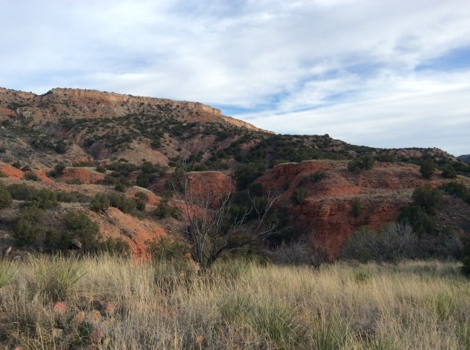
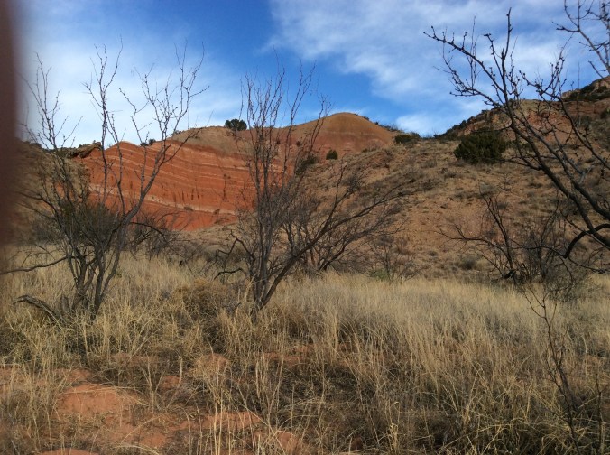
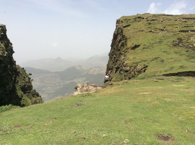
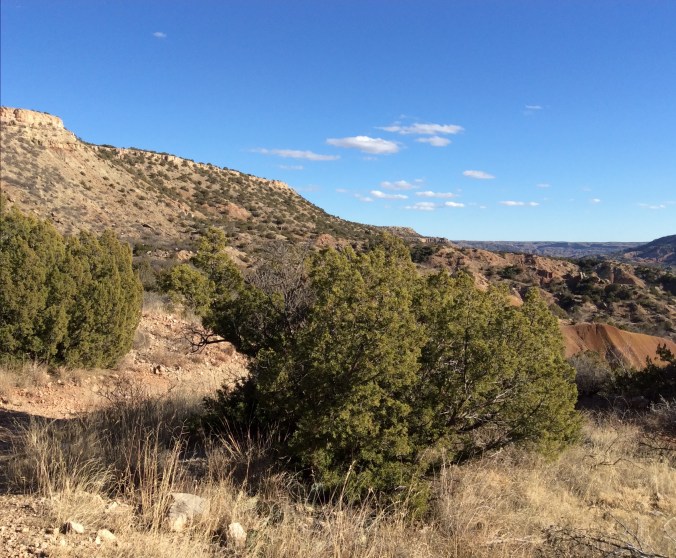
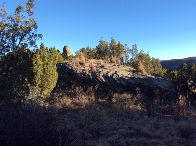
I headed up Comanche Trail from Chinaberry area toward the same peak in the distance.  Although this trail is not difficult, it is not flat until you get to the bottom of the cliffs in the distance.

img_2423

At this point I have reached the same area where I took most of the rock photos on the first Palo Duro post.  Once again, I took off onto the “new” trail to the north.

img_2432

To get to this point one has to climb down a rather steep trail and cross a dry arroyo and start up the other side.  This is across from where I had previously seen the shovels, etc.  They were still there, but the other equipment had been moved to just below where I took this photo.

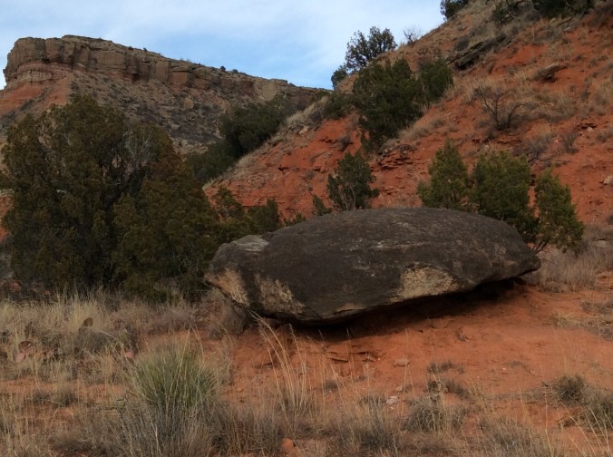
This trail contains a lot of loose debris and dirt with large boulders laying every which way.

img_2436

Once I reached the flat top area, I saw those orange/red flags here and there and now wonder where the trail will eventually go.  I headed back toward Comanche.

img_2445

Back near Comanche Trail.

img_2447

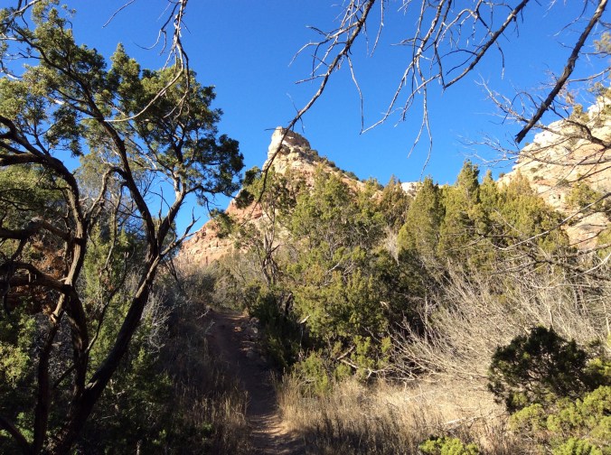
At this point I had walked far enough down Comanche to be slightly past the cliff toward which I was originally headed.

img_2449

If you look in the middle distance, you can see the road in and out of the park.  Here I have walked considerably past the peak seen in the first photo.

img_2450

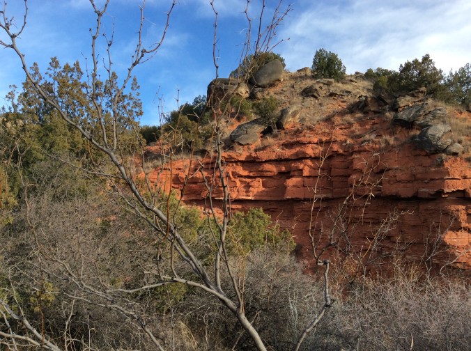
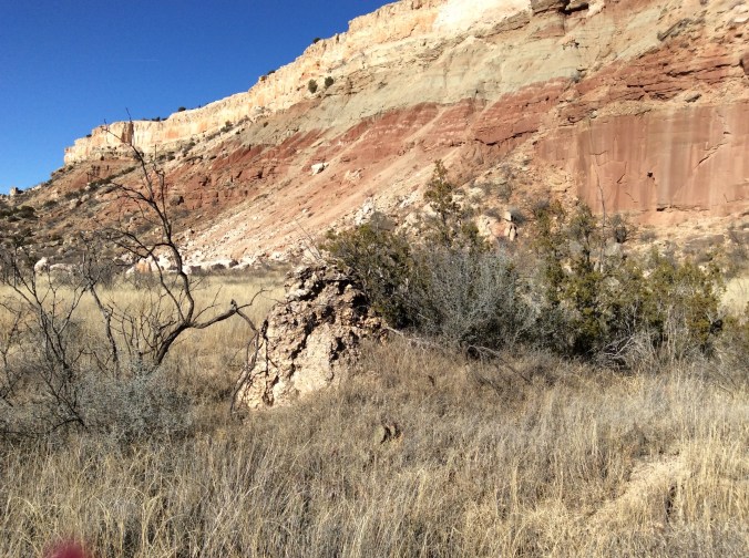
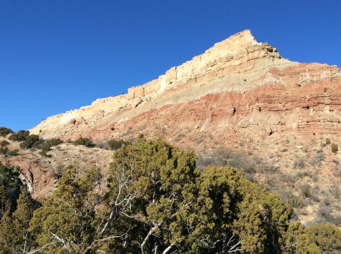
All kinds of rocks of all sizes appear everywhere–layers and layers of time.

img_2452

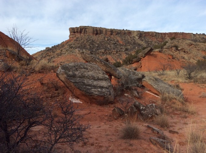
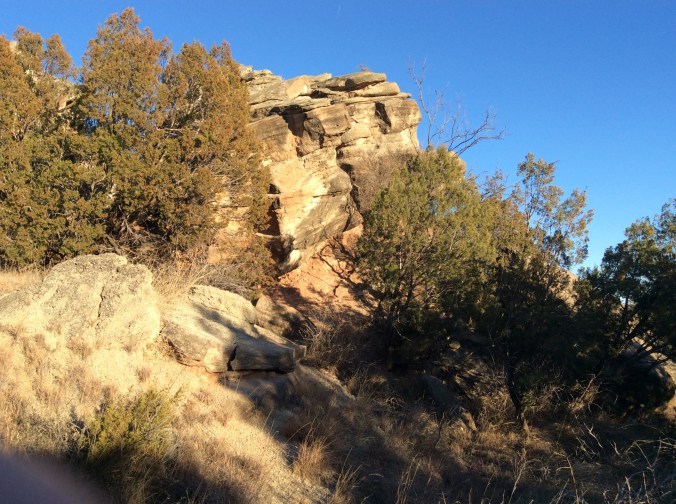
The trail follows the base of miles of cliffs.

img_2453

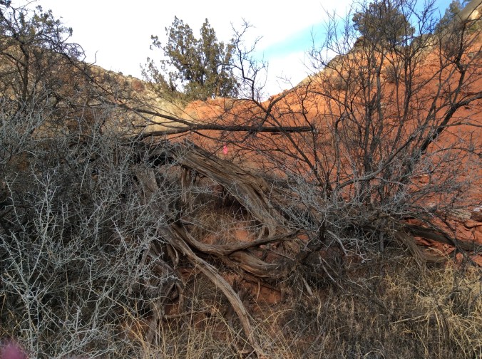
Fallen rocks and “caves” everywhere.

img_2454

Looking back from where I had climbed up higher and higher toward the flatter area.

img_2458

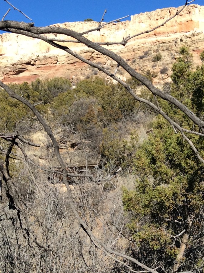
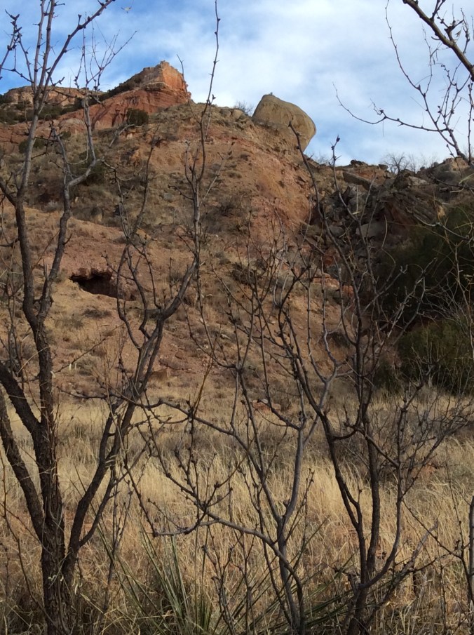
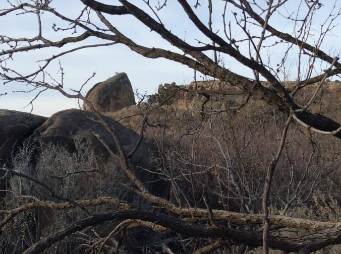
Another smaller “cave”.  I seriously considered hiking to it, figuring there might be some rattlesnakes sunning.  They do not react a lot unless startled or out hunting.

img_2459

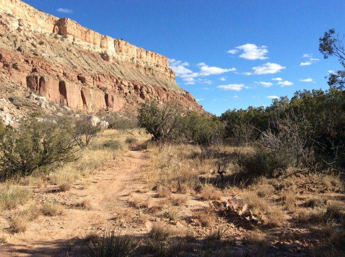
Along the cliff base where the trail is easy.

img_2460

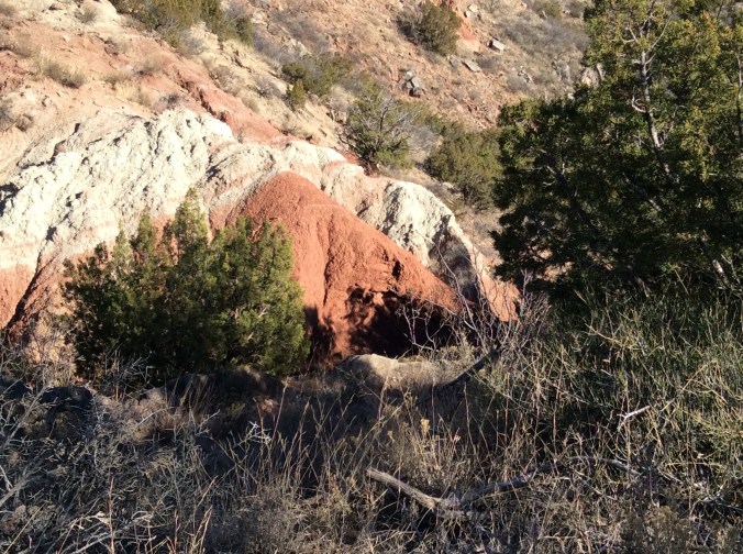
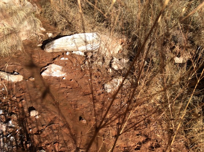
In this area, huge, white boulders appear to have fallen from the whiter area in the cliffs above.

img_2461

Farther down these boulders appear, more porous, darker.

img_2462

A closeup of this boulder shows baby prickly pear and grass growing from its surface.

img_2463

Farther south along the trail looking north.

img_2464

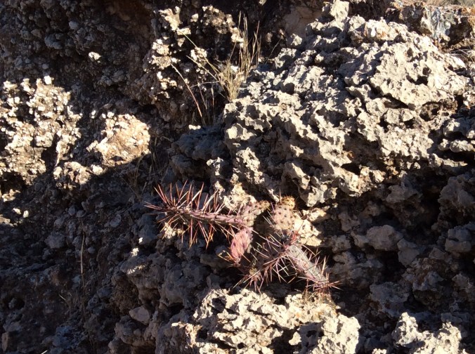
There are many species of prickly pear, including this one with its bright color.

img_2465

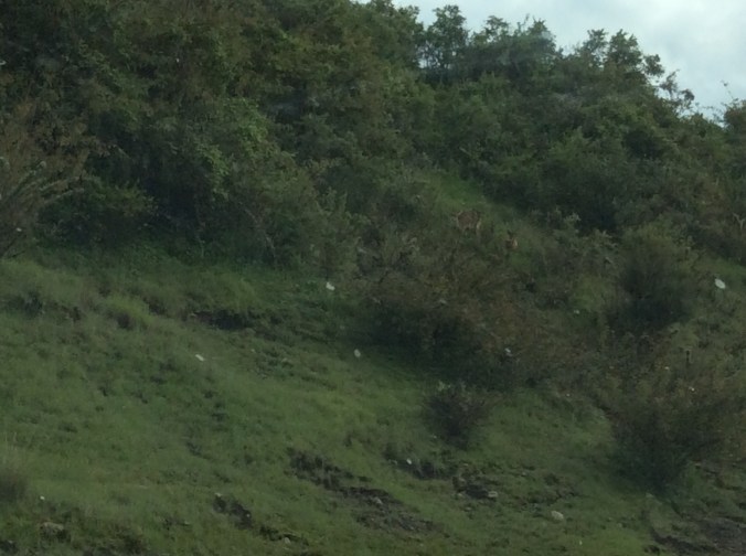
I looked up and saw three aoudad sheep.  See if you can find any of them in the middle of the photo.  They really blend in with these rocks.

img_2466

I did walk a bit off the trail to take this photo of “coffin” rock.

img_2467

Past the flat area canyon colors show up really brightly here–layers of color and time everywhere.

img_2468

Farther along the trail, looking toward the south.

img_2473

At this point on the trail past the long cliff wall, the trail becomes steeper and up and down again.

img_2474

Farther and farther past the cliff wall.

img_2475

Then one comes down farther where a small, spring fed stream runs.

img_2480

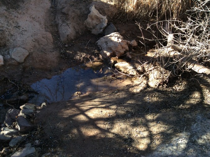
Here with year round water and shade the trees grow much bigger.  Farther down the trail more water seeps and the trail above contains steeper switch backs.

img_2481

img_2482

Far past the cliff base, Comanche intersects Rock Garden Trail.  Once again, but not running/rushing this time, I start down Rock Garden.

img_2483

Looking south, I headed down.  Rock Garden gets its name from an ancient rock slide.

img_2485

Giant boulders everywhere.

img_2486

Some even have grass growing from them.

img_2488

I wanted to take a photo of this boulder because it looks like a giant face with ears.  However, it was so late that I could not take it without my shadow so being silly…

img_2489

Almost down, I took one final photo.  Comanche is the longest trail in the park.  It keeps going past the Rock Garden intersection.  My son, who was mountain biking there a couple of days later, rode almost its entire length.  Some day I want to start at Chinaberry and walk to the end.  However, if you plan to do this, find someone to meet you at the south (far) end because otherwise you will have miles to hike back.

Hiking Palo Duro Canyon State Park


Even though I live ten minutes from the park entrance and occasionally work at the gift shop there, hiking is rare perhaps because I have more than twenty acres of my own for hiking.  My son came to visit for ten days during this holiday vacation.  He brought his mountain bike and spent every day the past week mountain biking the park’s numerous trails.  Last week and yesterday, New Year’s Day, I went along and hiked.  The following photos and comments are day one’s experience.

For those familiar with the park or who may want to go there, we parked at Chinaberry.  I decided to cut across to the east and found a trail.  It was not until several days later that we figured out the trail’s name mostly because this trail in not on any map provided by the park or on the official park website.  The trail is Comanche.  It is the longest trail in the park.  If you go to your browser and type in Comanche Trail in Palo Duro Canyon State Park, you will come to a mountain biking website that shows the trail in some detail even with a virtual tour.  The trail is occasionally marked with signs that say Comanche Trail but since it does not appear on the official map, I found it somewhat confusing until I found the above mentioned website.

img_2407

I took this photo at Chinaberry, a parking and picnic area from which several trails start.

img_2408

Day one I had not seen the marker for Comanche partly because it is across from Chinaberry at the very north end.  I planned to head for the peak in the background, thinking I would hit a certain trail–it was not the one I found because Comanche is not on the map.

img_2409

The grassy area before I found the trail.

img_2411-1

You can see the trail by the grass on the right.

img_2414

This is prickly pear country.  There are numerous species.  This is important for mountain bikers more than hikers.  Tipping over into a prickly pear patch would not be a pleasant experience.

img_2417

Here the trail is easy.

img_2419

I started my hike around 3:30, a big mistake, but I did not know this yet.  Numerous stream beds occur along the trail.

img_2421

At this point another trail diverges to the left.  Here giant grey boulders appear everywhere.

img_2423

I decided to take the trail to the left to see where it went, all the while thinking I was on one trail when I was on another.

img_2427

When I looked toward the opposite direction, I could see this small cave.

img_2428

A view from the trail to the left.

img_2429

The same giant rocks looking back from the “new” trail.

img_2430

After hiking down a rather steep incline with tiny orange flags along it, I came across this. It appears this is a new trail in the making.  Yet, given the rust on the shovel, I thought perhaps the trail blazers had just carelessly left their “equipment”.

img_2431

At the bottom of a little draw ready to climb back up the other side.  You can see one of the little flags in the middle of the photo.

img_2432

Palo Duro Canyon is a geologist’s dream.  Layers of time lay visible everywhere.

img_2434

On my way up the other side of the draw lay more equipment.  When I went back New Year’s Day, this had all been moved to another spot.

img_2436

Different rocks looking in another direction.

img_2440

Back on Comanche Trail (even though I had yet to know its correct name and thought I was somewhere else) headed south.  This was just before I realized just how far I had to go and how little time to get there.

img_2441

Little areas like this are everywhere along the trail.

It was shortly after this point that I saw two women–this trail has few hikers or mountain bikers on it. They were the only people I saw for miles.  When I asked them how far to the other end, I realized I was in “trouble”,  not real trouble like lost, but rather trouble like I was supposed to meet my son at Chinaberry at 5:30, and I was not even half way on this trail and I still had to get to the bottom.  I realized where I would come out; I would intersect another trail called Rock Garden and would have to go one mile steep downhill.  Unfortunately, I had not taken my phone because I did not think it would work there and had no way to inform him.  I also realized it would be nearly dark when I got to the bottom.  5:30 came and went and I still had quite a way to go. I quit taking photos and ran when the trail permitted and walked as fast as possible when it was too rocky or steep to run safely.

img_2442

I took this photo on my way, hiking the several miles toward Chinaberry.  Luckily, I met a nice couple who offered to stop by Chinaberry and tell my son where I was.  Unfortunately, I had the vehicle keys and he could not even get in his own vehicle.  The light to his bicycle was in the vehicle so he had to ride down the road in the twilight to get the vehicle keys.  I kept walking.  I was just glad he had waited and I met the couple because an unneeded rescue would have been terribly humiliating.  We made it home safely.

My Fitbit told me I had walked more than 11 miles that day.


Note:  Day Two, New Year’s Day, will follow with photos along the entire trail.


Gratitude


Thanksgiving brings so many thoughts, including thoughts about the divisive political discourse in the country now.  However, it seems more productive and in keeping with the day to focus on gratitude.  As I write this I think of both personal and broader things for which I am grateful, one of which is that I live in a country where divisive political discourse can actually and legally occur.  Now to the more personal (even though I think the personal is political, I will not focus on that)–here is my starter list:

-my family–daugher, son, and grandson; daughter and grandson will join me shortly to prepare a traditional Thanksgiving dinner.

-my mother’s pumpkin pie recipe which my grandson will help me prepare when he arrives; he says it is the only pumpkin pie he really likes.

-my job which I truly love–teaching public high school; my students frequently make my day.

-where I live in beauty truly on the Rim of Wonder.

IMG_2376

IMG_2373

IMG_2323

IMG_2165

IMG_1645

IMG_1584

IMG_1807

IMG_1596

IMG_1580

IMG_1589

IMG_1419

-my health

-my friends

-my ability to travel to all sorts of fascinating places

IMG_0592

IMG_0577

IMG_0169

IMG_0198

IMG_2069


IMG_2040

IMG_1966

-a life I love


Ethiopian Journey–The Castles of Gondar


When my friend told me we were going to visit the Castles of Gondar, I thought he was kidding.  It sounded too much like a movie title, plus castles in Ethiopia?  Seriously.  Then I looked it up and sure enough, there are a lot of them, built by a series of kings, fathers and sons, and a queen.  Some remain in reasonably good repair at least on the outside.  Others crumble in the rain and humidity.  All are in a sort of compound arranged together.

IMG_0677

This castle is near the entrance and in rather good condition.  Restoration work is most complete here so it is safe to walk to the second floor.

IMG_0684

The view from a second floor window.  Because of the altitude and moisture–contrary to popular opinion, a large portion of Ethiopia is mountainous and green–especially during the rainy season, upkeep is not easy.

IMG_0688

The same castle, looking out the door onto the balcony which can be seen in the first photo.  The floors have been restored.

IMG_0685

Looking in the opposite direction from the first castle, several castles and the ruins of others show the layout of the compound.  Our hotel was near the top of the mountain in the distance. Many locals roamed around when we were here.  It is popular to take wedding, anniversary, etc. photos here.

IMG_0707

This photo shows the first castle–in the background–from another side.

IMG_0715

The style of some of the castles, like this one, is more intricate than others.

IMG_0725

This building housed the royal lions.  Tradition for keeping lions goes back several centuries.  The last Ethiopia emperor, Hailie Selassie, was often referred to as the Lion of Judah, the latter referring to the Ethiopia tradition of believing that they are descendants of Solomon and Sheba.  Ethiopian lions are a different sub-species than other African lions, smaller with darker, sometimes black, manes and tails.

IMG_0731

These castles provide a perfect venue for photography.  You can see my friends sitting on the stone wall.

IMG_0743

The royal stables obviously housed many horses.

IMG_0747

The royal dining hall currently receiving restoration work.

IMG_0755

The path to the exit.

The news the last couple of weeks from Gondar has not been pleasant.  Many people have been protesting the government which they view as tyrannical and favoring one ethnic group over the others.  More than ten protesters were killed during the first protest.  Just this past week thousands came out in another peaceful protest.

Gondar (sometimes spelled Gonder) is a business, commercial, and education center.  It is a main route for commerce between Ethiopia and Sudan.  For more detailed information about Gondar, the castles, and the surrounding area, see my blog posts from Aug-Sept. 2014.


Isabella–En Memorium


477729_3059472219691_1596792929_o

The crematorium handed me the 6″ by 4 ” dark brown wooden box.  I knew it would be heavy; Isabella was an eighty pound wolf dog. I thought I was prepared.

Driving home, memories:

March 2006, daughter calls; two year old grandson wants a beta. I drive to PetSmart.  Daughter tells me I must see these unusual, incredible seven-week-old puppies.  Alert brown eyes look at me.  Too big, black ears wiggle.  The label says wolf, German Shepard, Blue Heeler.  The two remaining puppies look like light colored German Shepherds or Belgium Malinois.  I had not planned to get a dog, not yet.

Two years later I move into my new house:  canyon edge, horses, bobcats, coyotes, foxes, road runners, mockingbirds, rattlesnakes.  Isabella guards her property, sits on the patio where she can check for invaders.  She rarely barks, growls.  When she does, high alert–I check.  Neighbor dogs, coyotes, foxes, chased off–not bobcats.  She watches them.

I remember the day she dismembered a skunk, drug the carcass everywhere.  After eleven baths at PetSmart, the skunk smell remained.  The one day she growled, I shocked, investigated–a man walking down the arroyo toward the house.  Growls became increasingly loud.  Out on the patio, she stands, the man sees her, turns and runs.  I feel safe, Isabella guarding, telling me if something unusual occurs.  She’s mixed breed; I think she’ll live long.

Every morning, evening, she completes horse chores with me, chases bunnies, roadrunners.  Two months ago, I, mesmerized, watch her catch, gobble two half-grown bunnies in less than one minute–nothing left.  Mixed breed; I think she’ll live long.

Friday morning she helps me with chores, chases bunnies.  Friday afternoon she can hardly move.  At the vet, blood work like a four year old; x-ray shows a little something wrong.  They give her two shots, schedule an ultra-sound for Saturday morning at another vet’s.  Meds working, Saturday morning she’s her usual lively self, eager to travel in the truck, nose wet and cold.

Ultrasound vet tells me there’s little hope.  Shocked, I stand there.  “If she were your dog, what would you do?”

“Put her to sleep.  She’s not in pain.  She has a tumor the size of your small fist on her intestines–might be cancer, hard to operate.”

I look at the vet, frozen.

At 8:00 Wednesday evening, I open the box, take out the bag of Isabella’s steel grey ashes, walk out to her patio spot, the place where she guarded her kingdom, toss a handful of ashes into the wind, watch them float and scatter down into the canyon, tears tracking down my face.  I close the bag, walk to the place where our long yearling colt, Star, is buried, dig an eight inch hole, bury another handful of ashes.  I take the one tablespoon of ashes left back to the house, put them back in the black velvet bag and into the box with the card with her paw print, the crematorium certificate, the sympathy card signed by all the employees where they euthanized her, place it on top of a stack of old magazines in the Chinese cabinet.

At bedtime, I forget, go to call her in.  This morning I find her hairs–she shed so much, wolf undercoat.  Evidence of her presence permeates.

It will never end.

11999567_10203872023954904_7742039751577593507_o


My Ethiopian Journey–Simien Mt. Natl. Park


No way was I prepared for these mountains.  Do you think of numerous peaks over 13,000 feet when you think of Ethiopia?  Probably not. There are even a few over 14,000 feet.  The whole area is often referred to as the Roof of Africa.

IMG_0573

There is only one road into the park.  To get in, a tourist must stop at the park office, sign in, passport number, address, etc.  Plus, you will be assigned a guard and a guide.  Our guard in the photo above carried an assault rifle.  No, it is not to protect people, it is to protect their rare animals from people, from poachers.  Wonder why he is wearing all these clothes?  It is cold at 12,000 feet even if you are near the Equator.

IMG_0577

The drop offs are terrifying, thousands of feet, the vistas endless.  Even though I have lived and been all over the Rocky Mountains and been to the Himalayas in both Kashmir and Nepal, I have never seen anything like these mountains for beauty, green, and endless vistas.

IMG_0579

My friends near the cliff are much braver than I.  In the foreground stands our guide, Michael, who spoke excellent English and was super funny.  He had us laughing all the time. People live and farm in these mountains–if you look closely in the middle of the photo, you can see fields.  However, the government is slowly relocating people in order to make the park a refuge for rare wildlife.

IMG_0582

The above photos were all taken on a hike early one morning.  Everything was wet because it was either raining or misty or we were in the clouds.

IMG_0592

Because I kept slipping and sliding, I decided not to walk along the cliff with my friends and the guard, who spoke the same Ethiopian language as my friend.  Michael and I took off across a meadow and suddenly here we were in the middle of all these gelada baboons, who paid no attention to us at all.  They were very afraid, however, of a predatory bird that decided to fly over. How do I know?  They suddenly started “talking” to each other in frightened voices.  Experts now think these primates actually have a language and do talk to each other.  Gelada are the last primates that are herbivores.  They eat grass.  All other herbivorous primates are extinct.  Gelada live only in the high mountains of Ethiopia and no where else on earth, a reason for a guard.  At night they climb down the cliffs into caves to protect themselves from hyenas and leopards.

IMG_0603

If you look very carefully in the middle of this photo, you can see several duiker which are considered so common it seems no one thought to stop to really take a look so I took the photo as we drove along.

IMG_0614

Here we are above the timberline where some very unusual plants thrive.

IMG_0625

And some exceedingly rare animals whose camouflage makes them almost invisible until they move.  At this point we are about 14,000 feet just under one of the highest peaks in Africa.  Look carefully in the middle and you will see walia ibex.  People come from all over the world to see these endangered animals that live only in this park.  Sometimes the fog rolls in and no one sees anything.  We were lucky; we saw more than twenty of them. And then the fog rolled in.

IMG_0630

These giant lobelia thrive above timber line.  Some were considerably taller than I am.

IMG_0632

If you grow red hot pokers in your flower beds and think they are semi-arid flowers, think again.  Here they are growing wild.

IMG_0633

You can see red hot pokers in the middle of this photo by the stream.  These mountain streams run down to and often across the road, making the road a muddy mess.  Without 4-wheel drive and an expert driver we would have gone nowhere.  In fact, at one point we did have to stop because two stuck trucks blocked the road, one of which had a flat tire.

IMG_0635

The highest waterfall in Ethiopia is hard to hike to unless you are not at all afraid of heights.  My friends did hike there. Look a bit to the right of the groove through which the water actually falls.  You will see a sort of flat area.  It is only a few feet wide with a drop-off on each side.  Yes, that is where you hike.  When I saw this view, I was rather glad I decided to wait, look for birds, and chat with the driver.

IMG_0595

The fire pit at the highest bar in Africa is a very popular place on a cold night.  Even though we had beautiful rooms, with no heat at 12,000 feet it is not exactly warm.  Even the guides and guards were bundled up.  The only people who seemed toasty were Scandinavian tourists with their heavy wool sweaters.  The hotel staff gave us hot water bottles to put in bed with us at night.  Actually, it works.  Nevertheless, when you get up in the morning, it is really cold.

IMG_0609

The guards and guides live near the park.  We dropped off the guard here and watched him walk toward his house down where the trees are.  We dropped off the guide near his house in the town when we left the park.


Ethiopian Journey–From Addis Ababa to Debre Birhan


Addis is the second highest capital in the world.  Only La Paz, Bolivia, is higher.  To a large extent, altitude determines climate in Ethiopia.  Addis and the surrounding area, much of which is high altitude farmland, receives a lot of rain this time of year and looks totally unlike what a lot of people think of when they hear the word Ethiopia–not desert but rather miles and miles of green.

IMG_0248

IMG_0249

We had not driven far from Addis when we crossed a river, an area of which is considered healing.  Many people had come for priests to bless them and to experience the healing power of the water.

IMG_0246

I saw only three tractors in ten days of criss crossing farmland.  Why so few?  One reason is rocks.  Many of the fields remain rather full of rocks in spite of many having been removed.

IMG_0258

Therefore, they farm the “old fashioned” way; horses or cattle pulling plows with a human behind.

IMG_0251

Houses in the villages in the farming areas demonstrate old ways alongside new.

IMG_0257

IMG_0259

Winnowing the way we did in the USA a century ago.

IMG_0253

IMG_0261

Much of the farmland is a picturesque patchwork quilt of browns and greens.

IMG_0266

Before dropping down to lower country, we drove by Menelik’s Window.   The drop off here is steep and far.  I did not go near it–I had not yet become used to the endless drop-offs or even realized that I would need to do so.  This is one of four places in Ethiopian where you can see gelada baboons.  They are extinct elsewhere. Menelik was an Ethiopian emperor.  This “window” allows one to look from the high country for miles and miles to the landscape beyond.

IMG_0262

The large tufts of grass provide food for the gelada which are grass eating herbivores, the last of the grass eating primates.  All others are extinct.  This same grass is used by the locals for roofing material so boys stay in these areas all day chasing off the baboons.

IMG_0264

To keep themselves busy they weave woolen baskets and hats to sell which they display in the grass.

IMG_0267

This ten year old boy happily donned the hat he had made.  I bought it for my grandson who was the same age when I took the trip.

IMG_0268

Except for the different vegetation, driving down the mountain looked a lot like driving through Colorado.

IMG_0271

IMG_0272

IMG_0276

Down from the mountain the landscape appears quite different and considerably drier.  We drove through several smaller towns on our way to Debre Birhan where we stayed the first night.

IMG_0279

Driving in Ethiopia requires navigating around animals.  Everyone drives their cattle, camels, horses, all livestock down the road whenever possible.  The roads are generally very good.  Many, built by the Italians, have stood the test of decades.

IMG_0282

Along the road we saw many of these “apples”.  My friend told us how they played with them as a child.  However, the adults all warned the children not to touch their eyes when they did–it will make you blind.  They are called Apples of Sodom–so many things in Ethiopia have symbolic meaning.

IMG_0283

These fruit could be seen all along the road and even on the road.  After driving through this drier area we rose above a huge valley with miles and miles of grass.

IMG_0285

A semi-nomadic group brings their immense herds of cattle here in the rainy season to graze.  When we drove further on above the valley, I saw the first tractor working a field as big as this grazing land.