Ethiopian Journey–From Addis Ababa to Debre Birhan


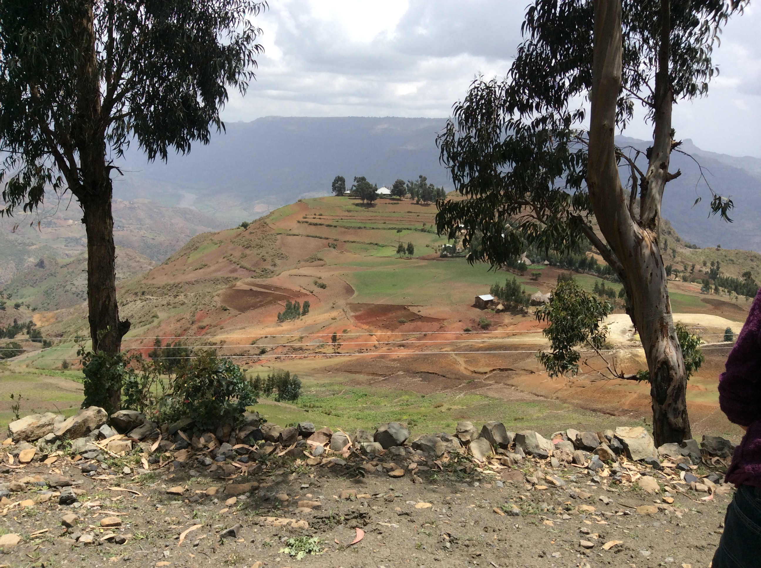
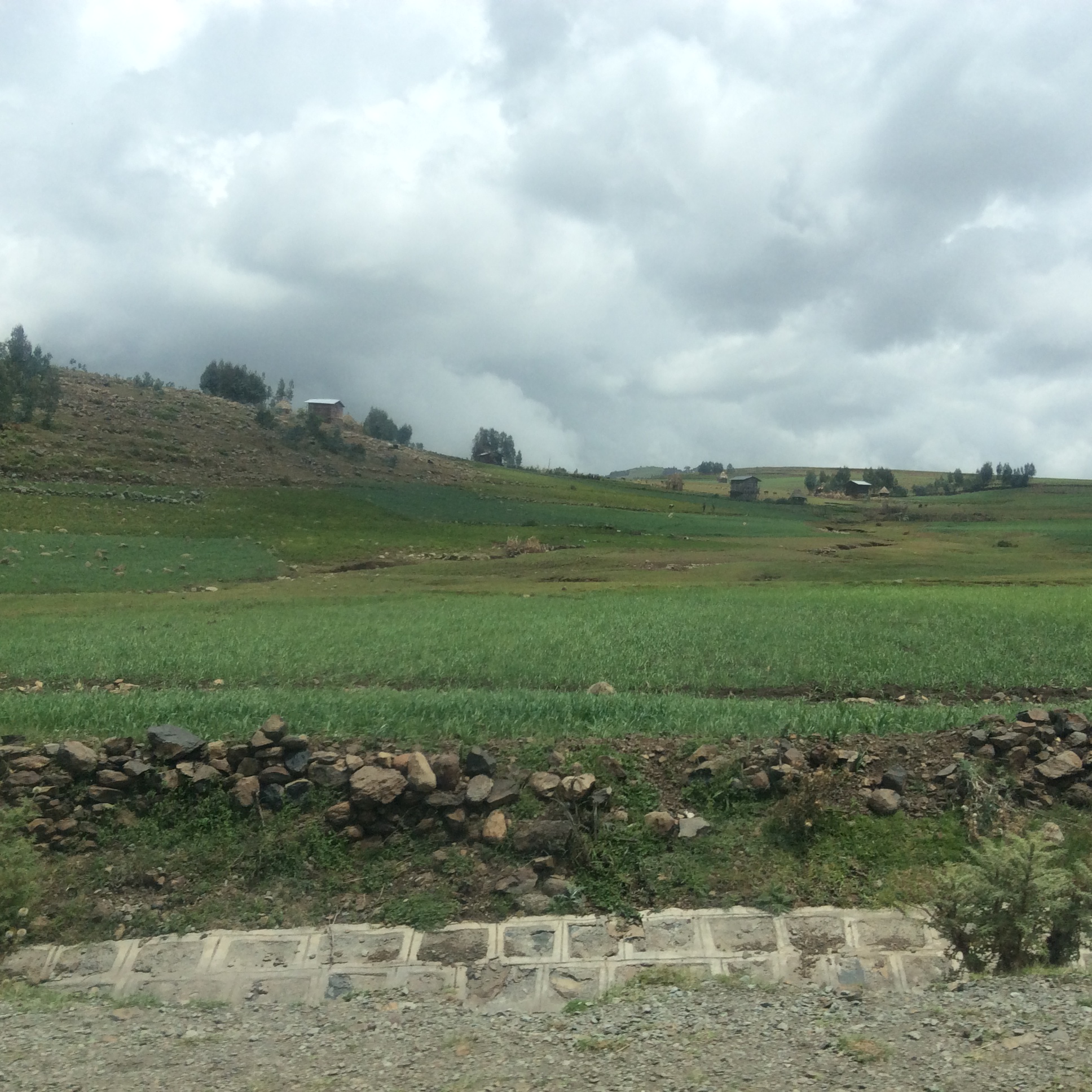
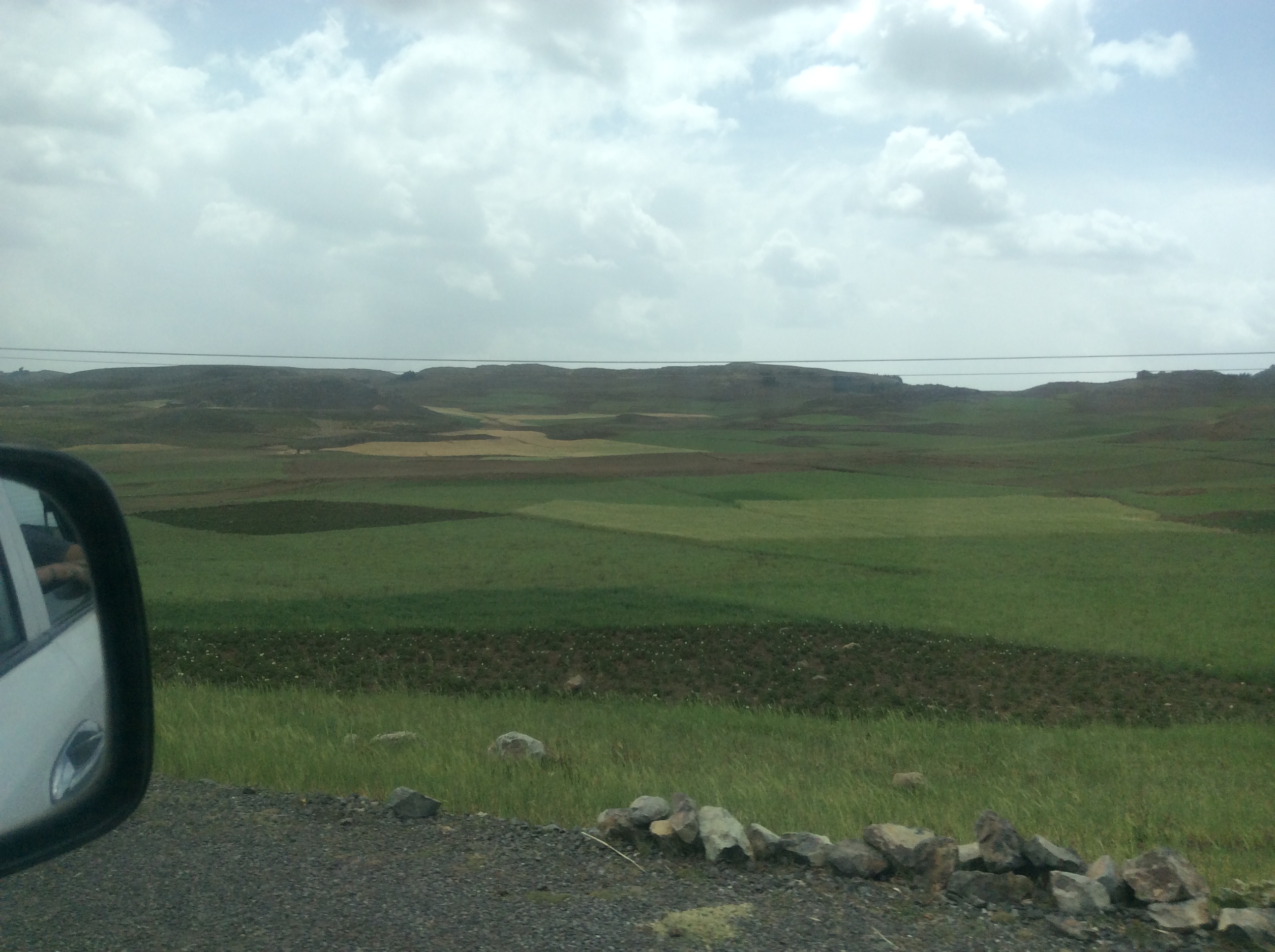
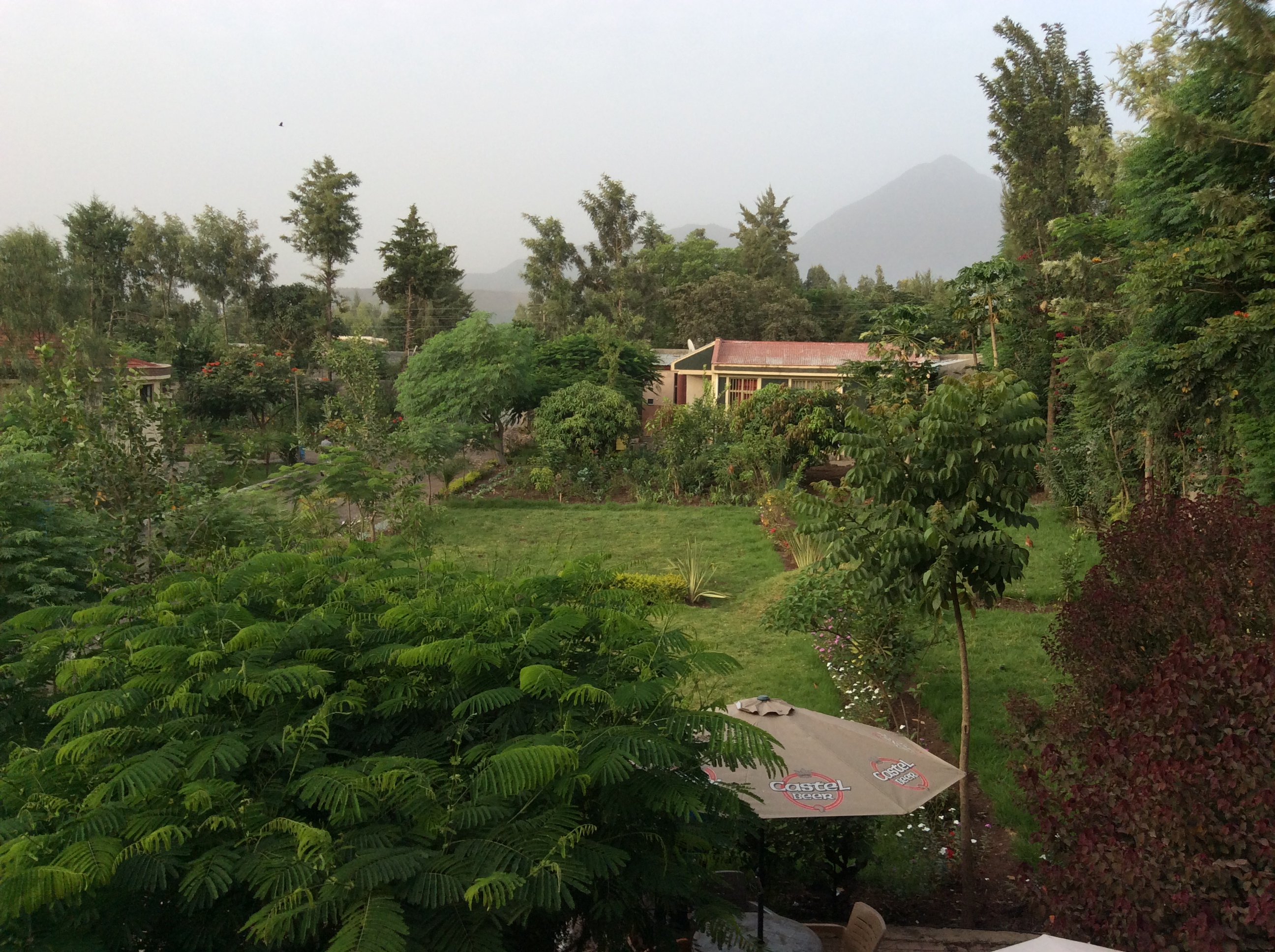
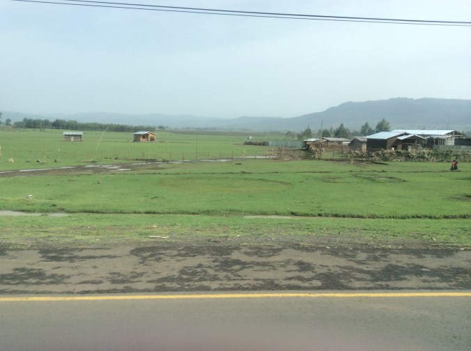
Addis is the second highest capital in the world.  Only La Paz, Bolivia, is higher.  To a large extent, altitude determines climate in Ethiopia.  Addis and the surrounding area, much of which is high altitude farmland, receives a lot of rain this time of year and looks totally unlike what a lot of people think of when they hear the word Ethiopia–not desert but rather miles and miles of green.

IMG_0248

IMG_0249

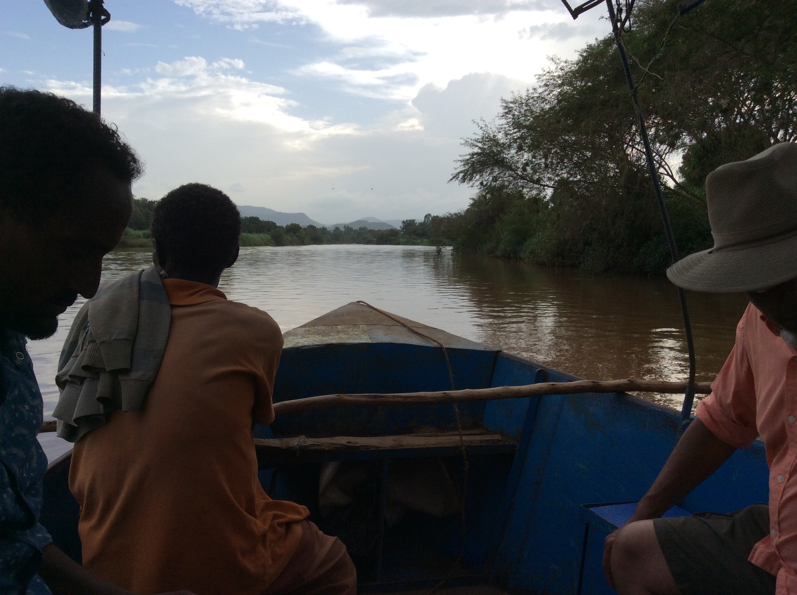
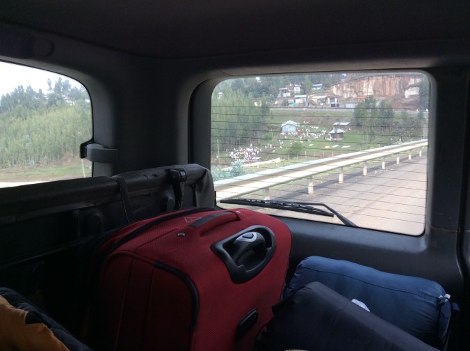
We had not driven far from Addis when we crossed a river, an area of which is considered healing.  Many people had come for priests to bless them and to experience the healing power of the water.

IMG_0246

I saw only three tractors in ten days of criss crossing farmland.  Why so few?  One reason is rocks.  Many of the fields remain rather full of rocks in spite of many having been removed.

IMG_0258

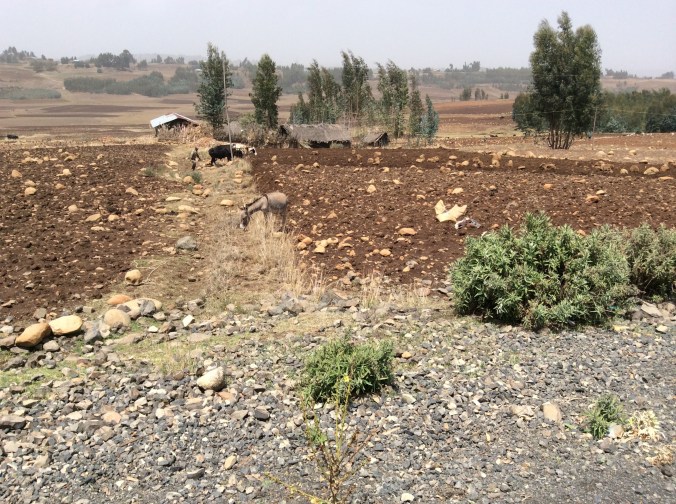
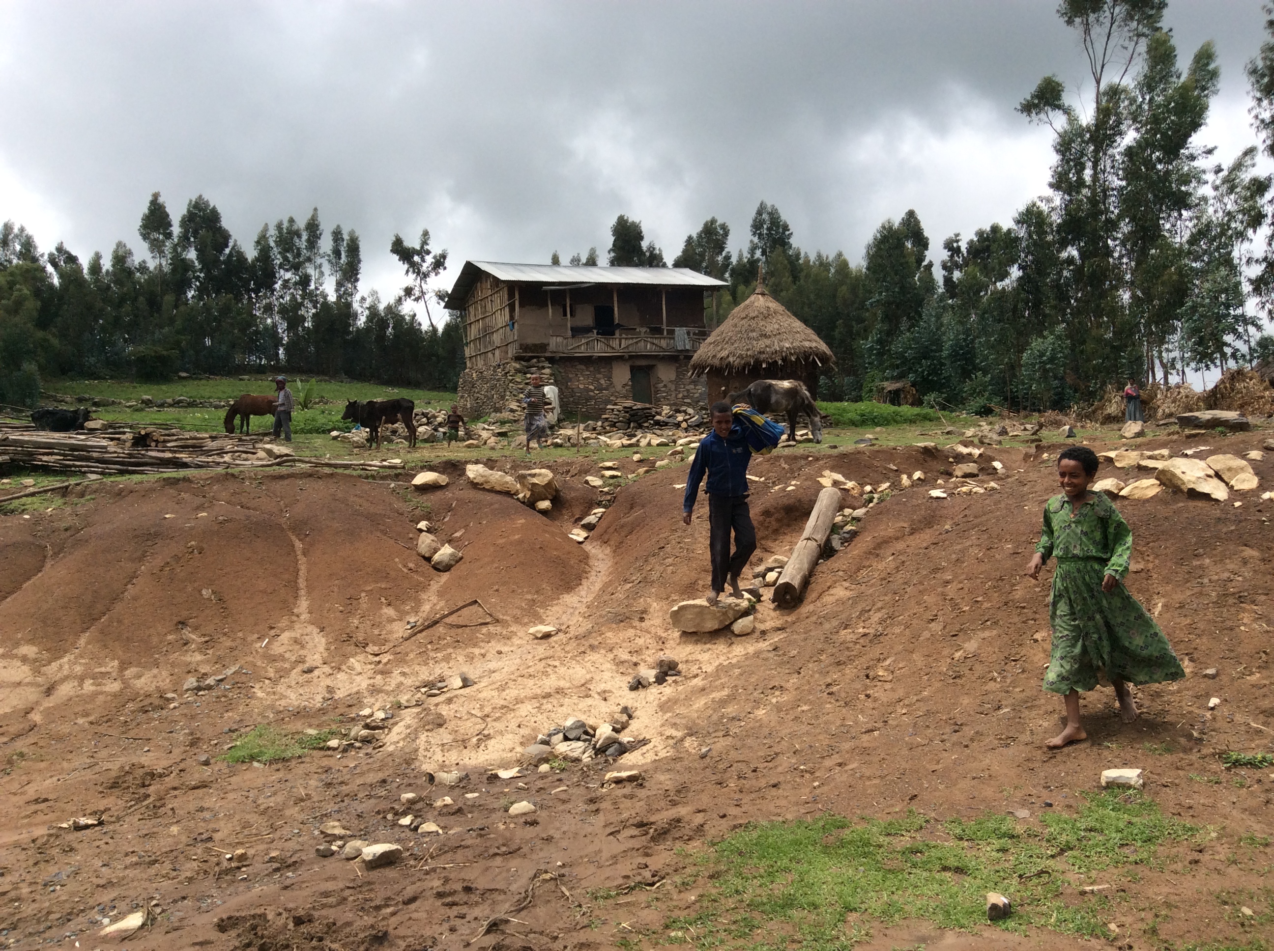
Therefore, they farm the “old fashioned” way; horses or cattle pulling plows with a human behind.

IMG_0251

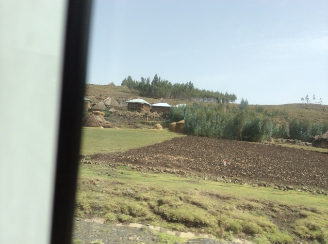
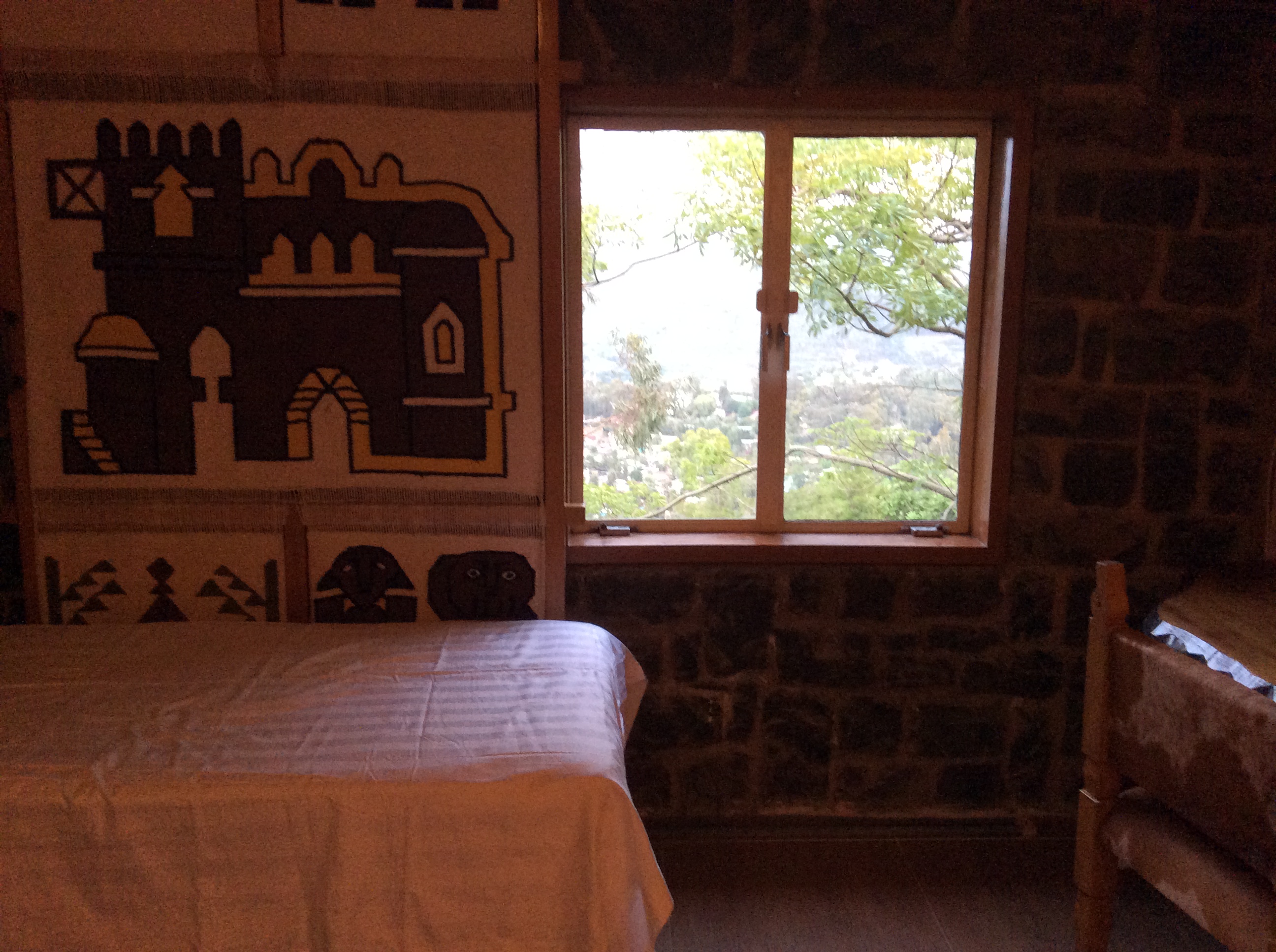
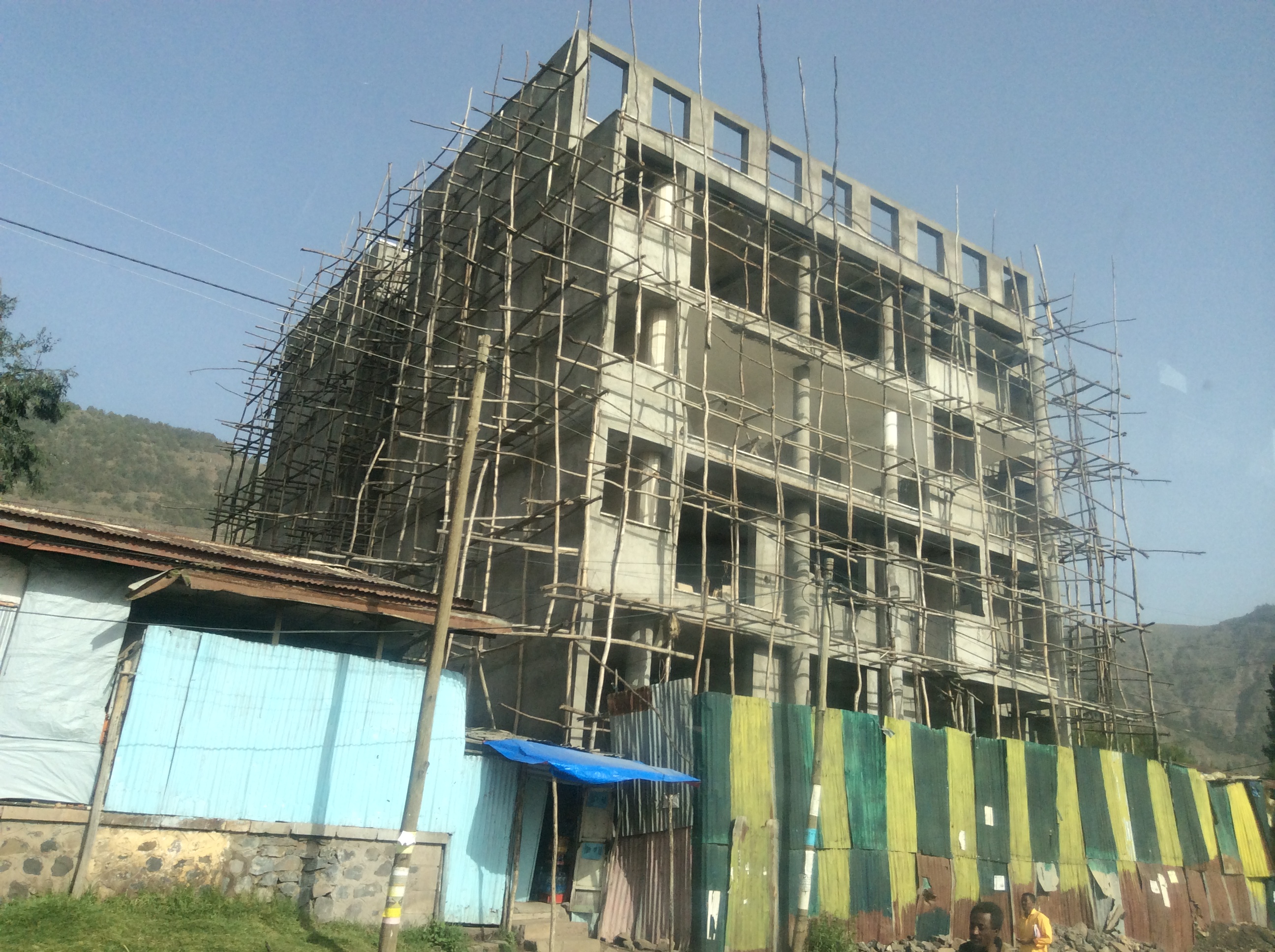
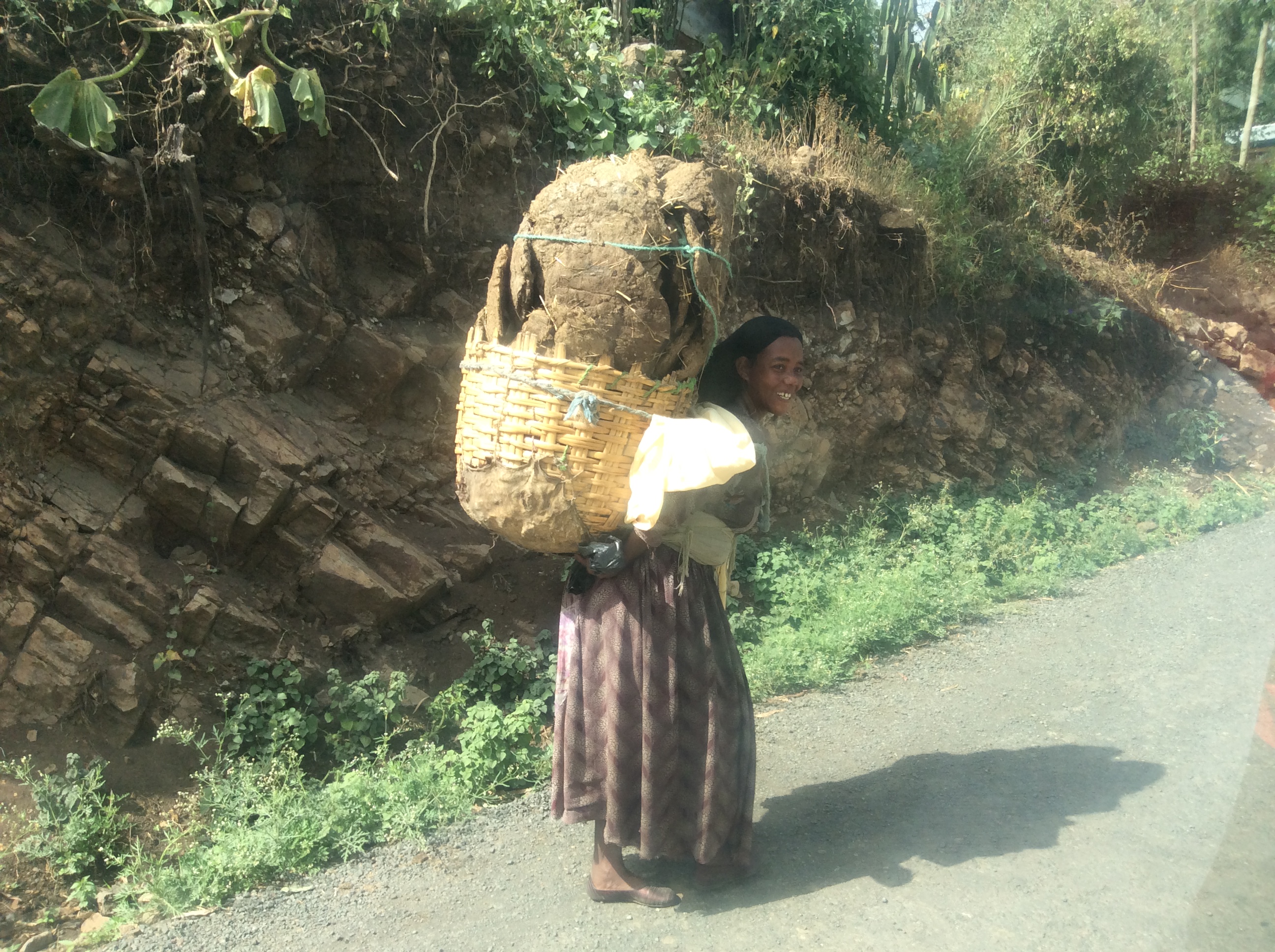
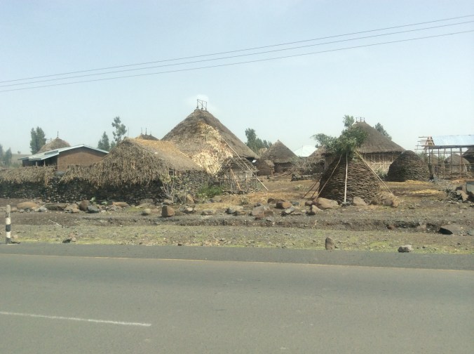
Houses in the villages in the farming areas demonstrate old ways alongside new.

IMG_0257

IMG_0259

Winnowing the way we did in the USA a century ago.

IMG_0253

IMG_0261

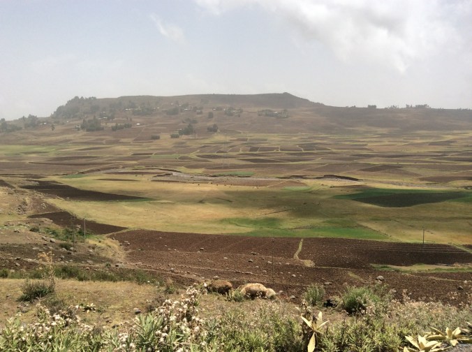
Much of the farmland is a picturesque patchwork quilt of browns and greens.

IMG_0266

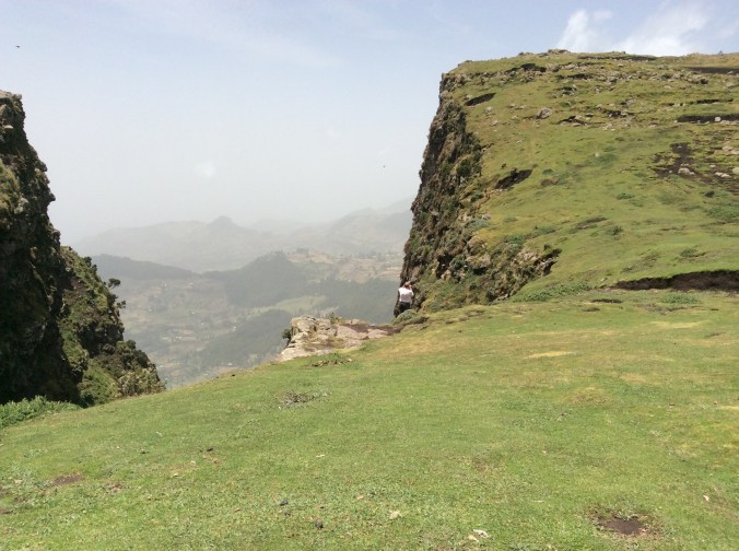
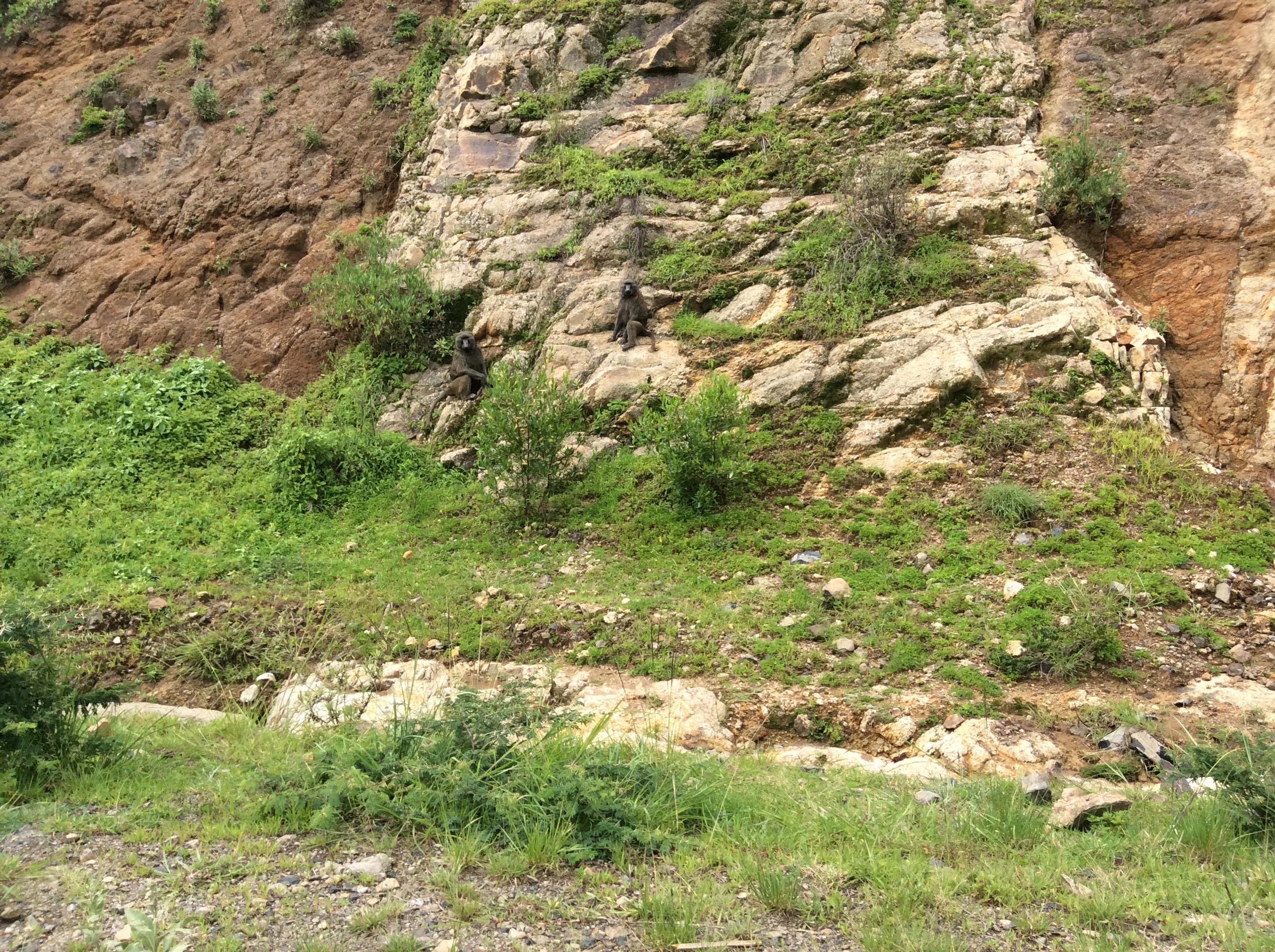
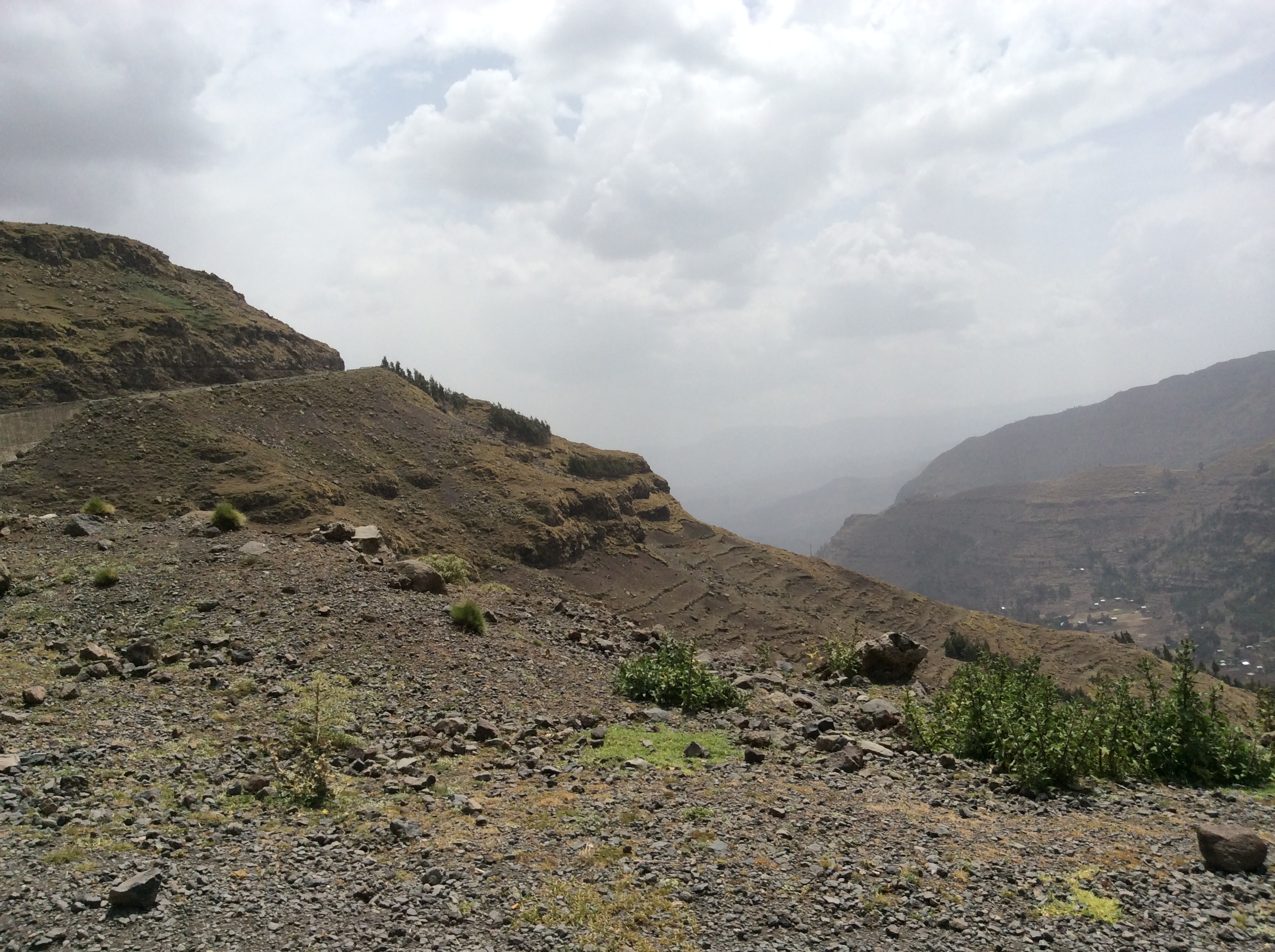
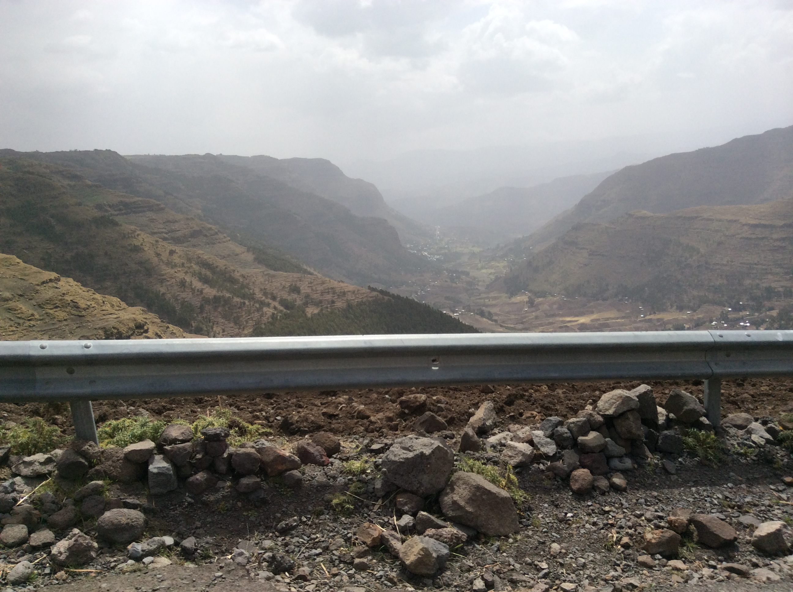
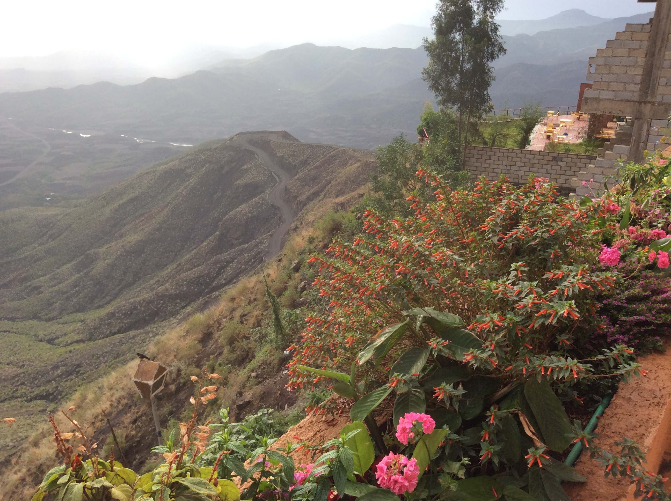
Before dropping down to lower country, we drove by Menelik’s Window.   The drop off here is steep and far.  I did not go near it–I had not yet become used to the endless drop-offs or even realized that I would need to do so.  This is one of four places in Ethiopian where you can see gelada baboons.  They are extinct elsewhere. Menelik was an Ethiopian emperor.  This “window” allows one to look from the high country for miles and miles to the landscape beyond.

IMG_0262

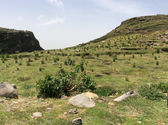
The large tufts of grass provide food for the gelada which are grass eating herbivores, the last of the grass eating primates.  All others are extinct.  This same grass is used by the locals for roofing material so boys stay in these areas all day chasing off the baboons.

IMG_0264

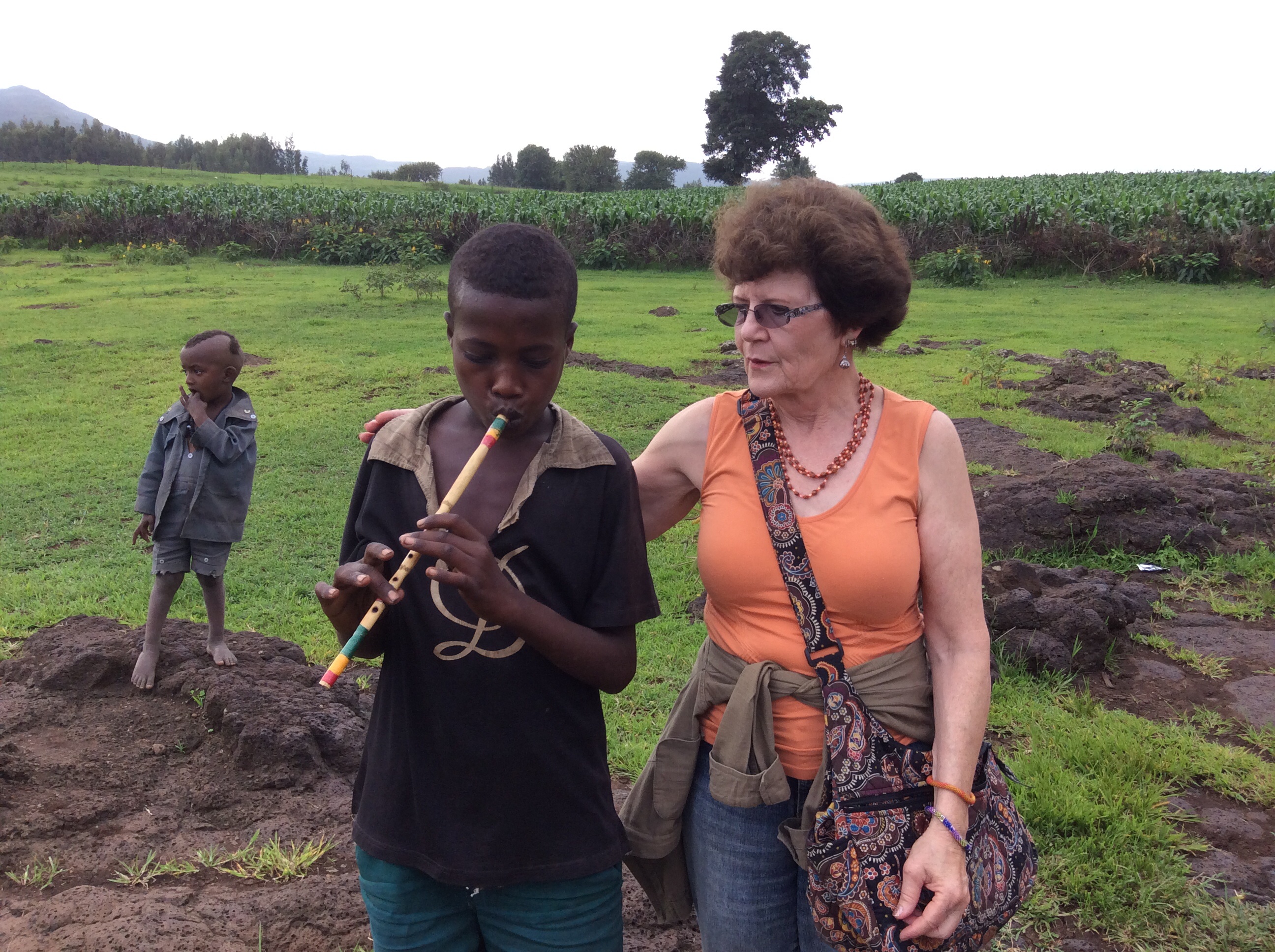
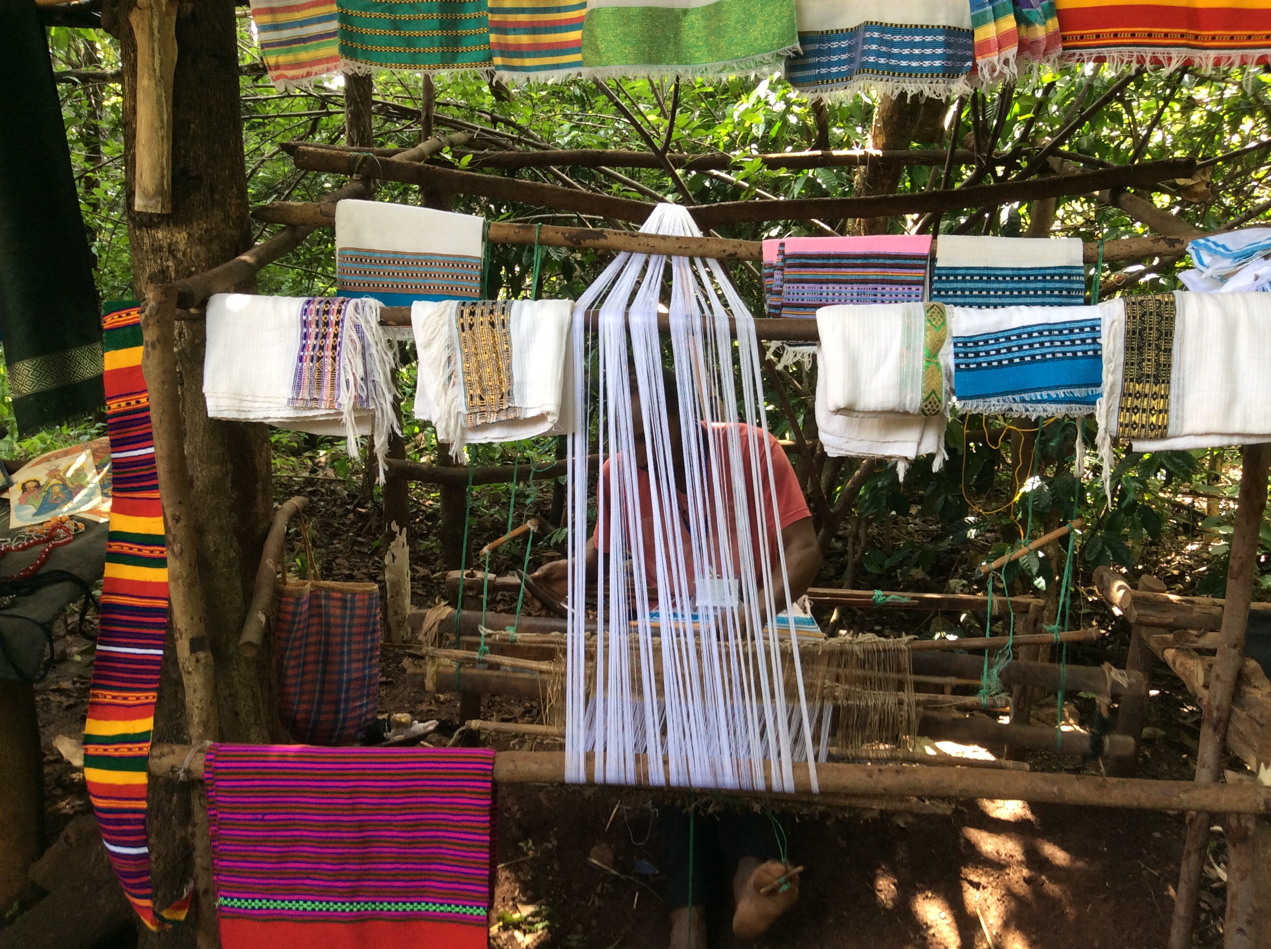
To keep themselves busy they weave woolen baskets and hats to sell which they display in the grass.

IMG_0267

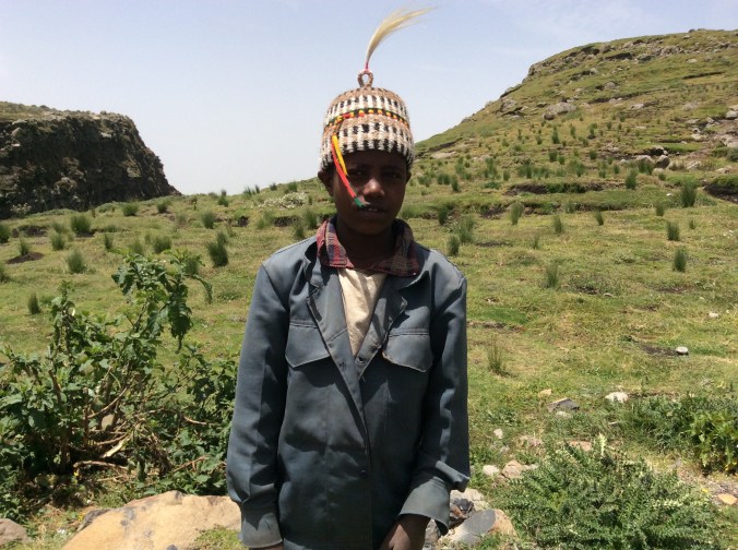
This ten year old boy happily donned the hat he had made.  I bought it for my grandson who was the same age when I took the trip.

IMG_0268

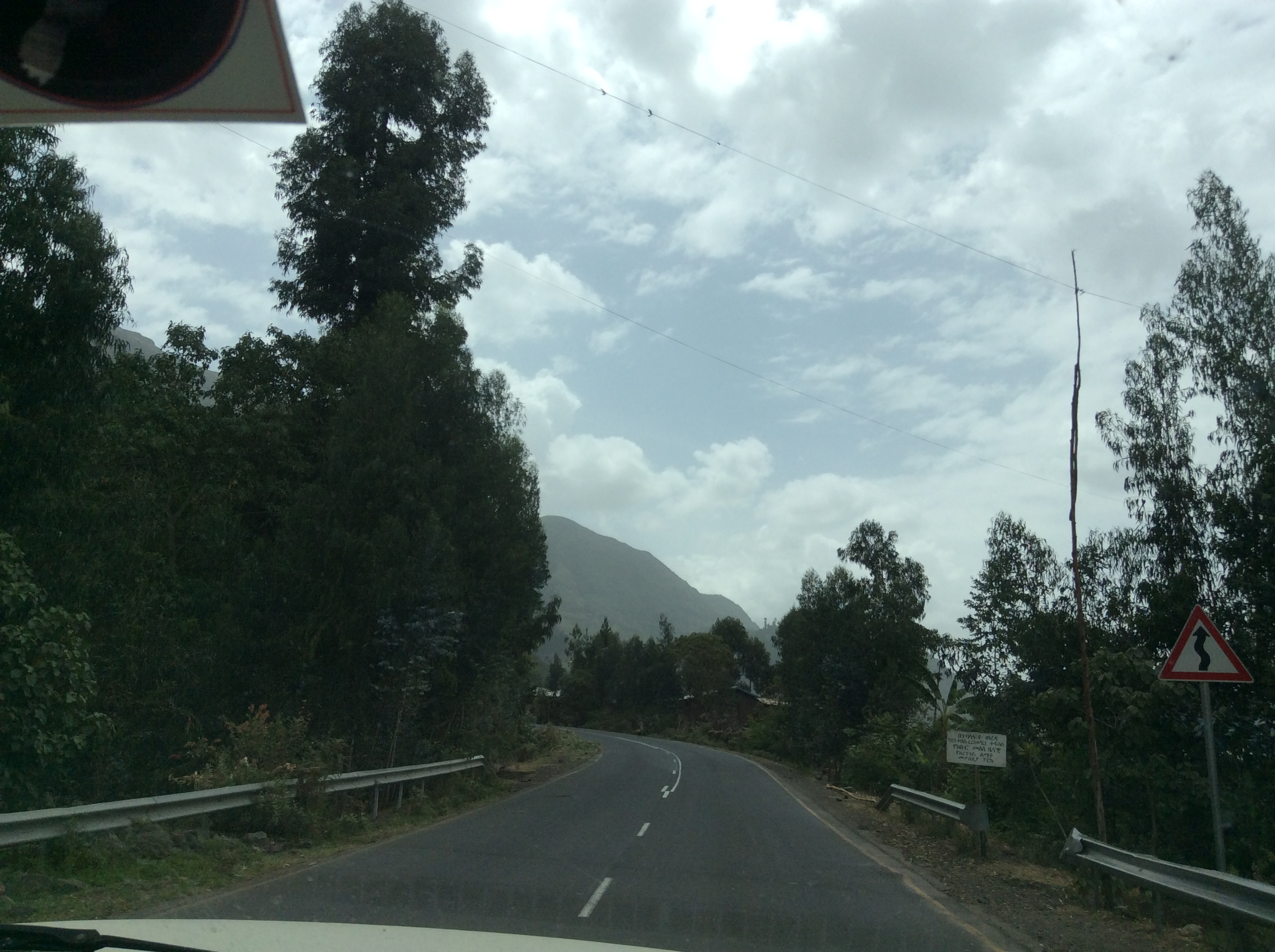
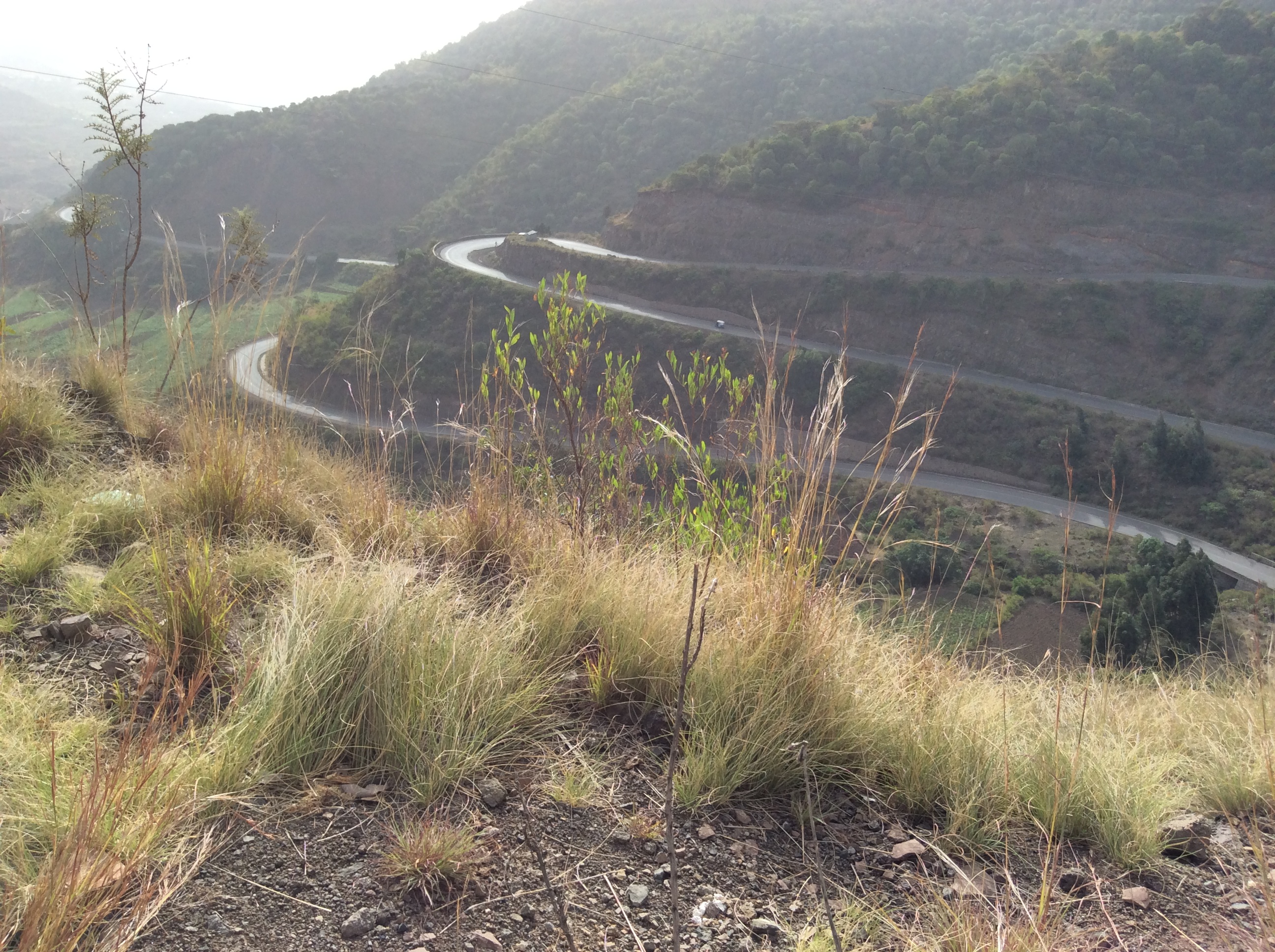
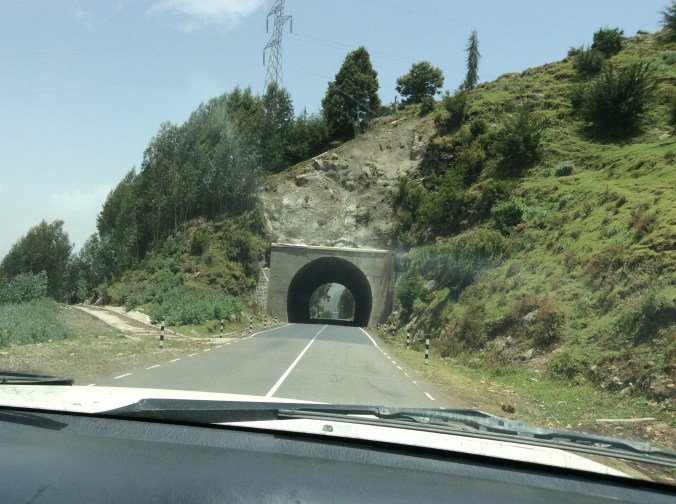
Except for the different vegetation, driving down the mountain looked a lot like driving through Colorado.

IMG_0271

IMG_0272

IMG_0276

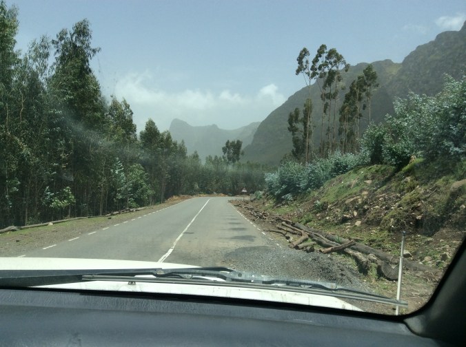
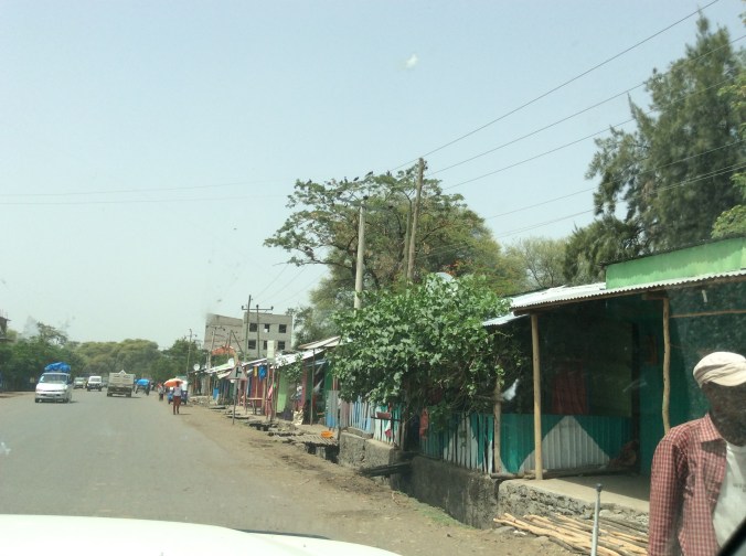
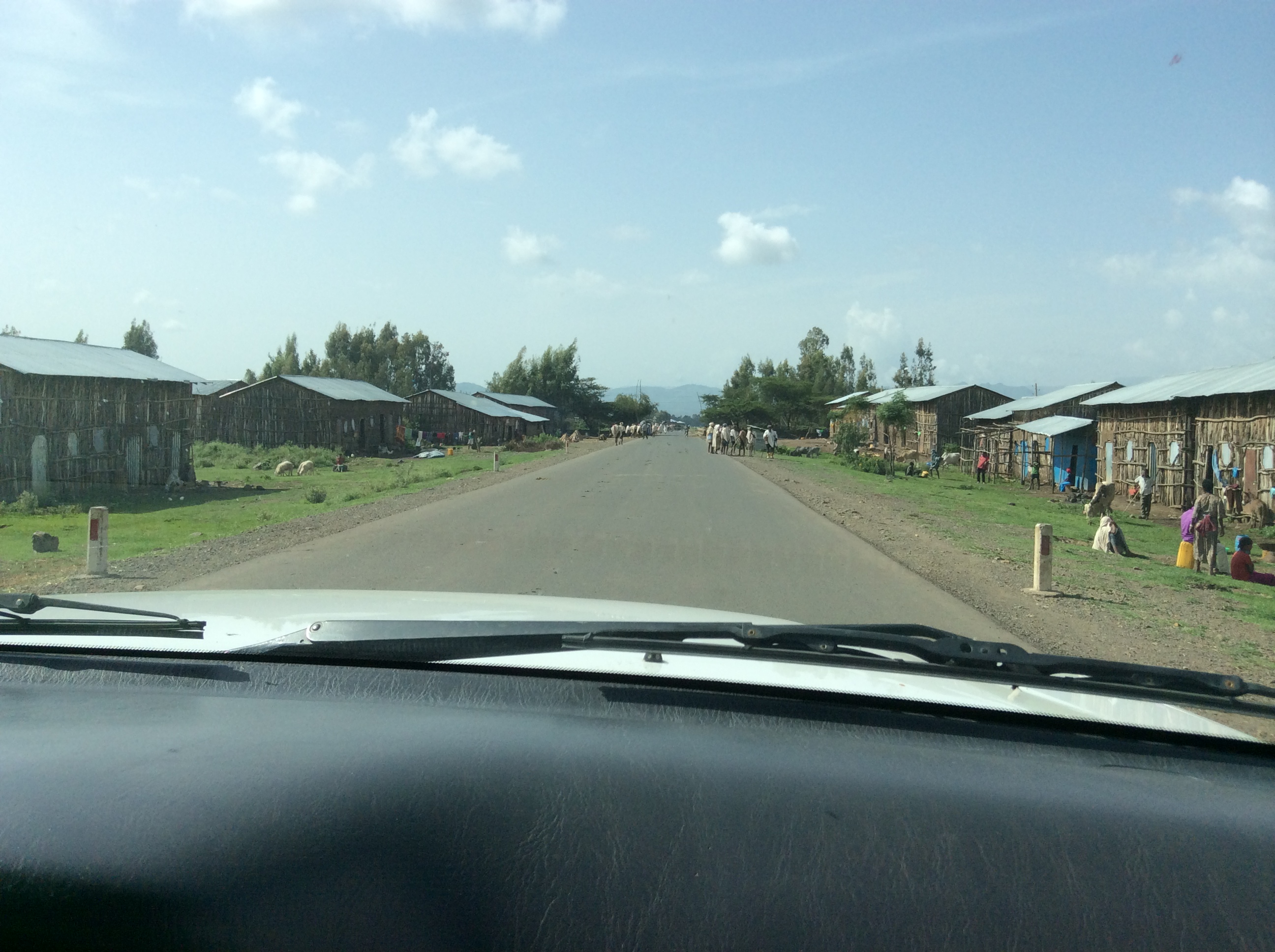
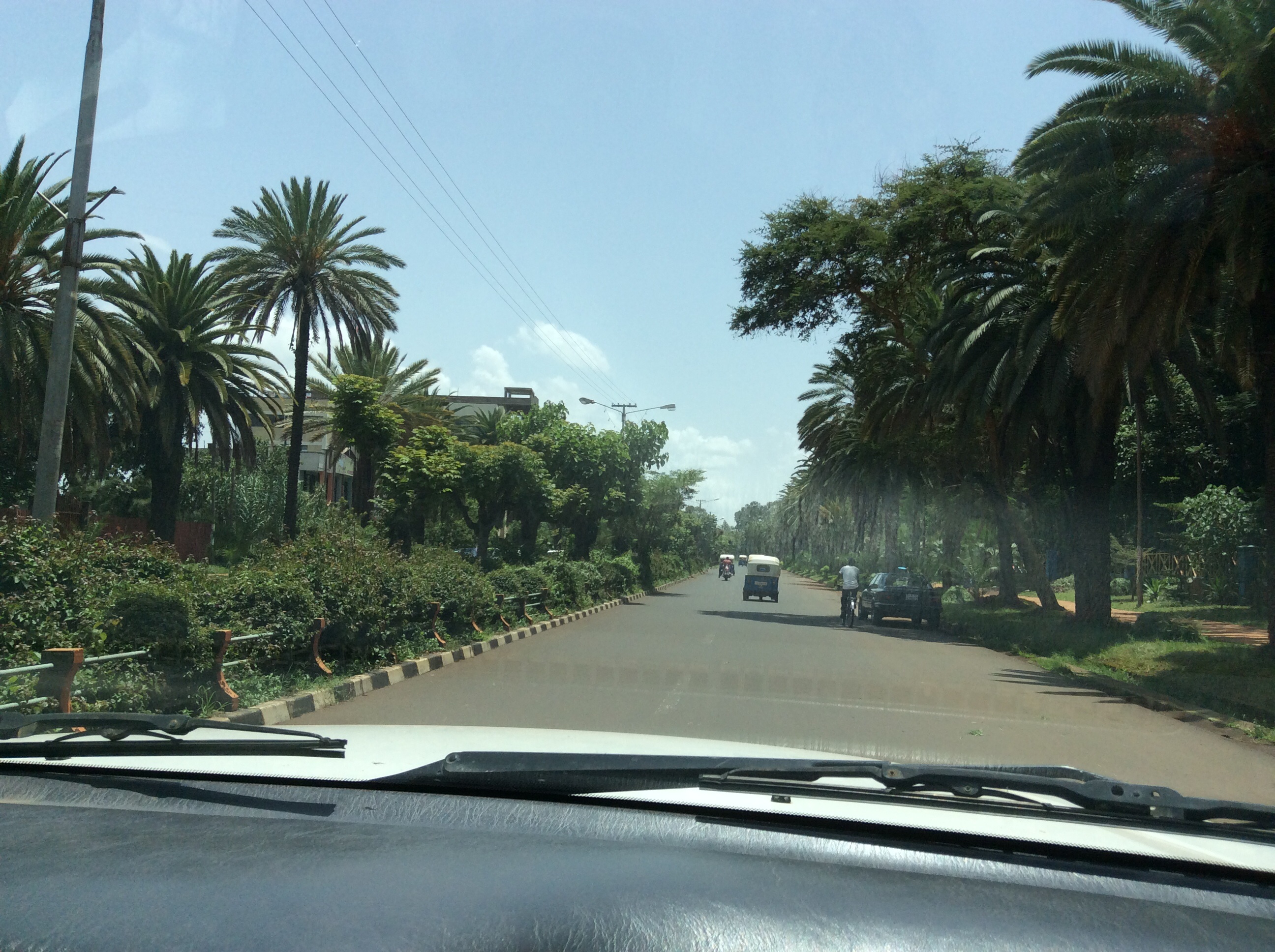
Down from the mountain the landscape appears quite different and considerably drier.  We drove through several smaller towns on our way to Debre Birhan where we stayed the first night.

IMG_0279

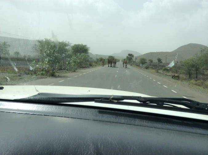
Driving in Ethiopia requires navigating around animals.  Everyone drives their cattle, camels, horses, all livestock down the road whenever possible.  The roads are generally very good.  Many, built by the Italians, have stood the test of decades.

IMG_0282

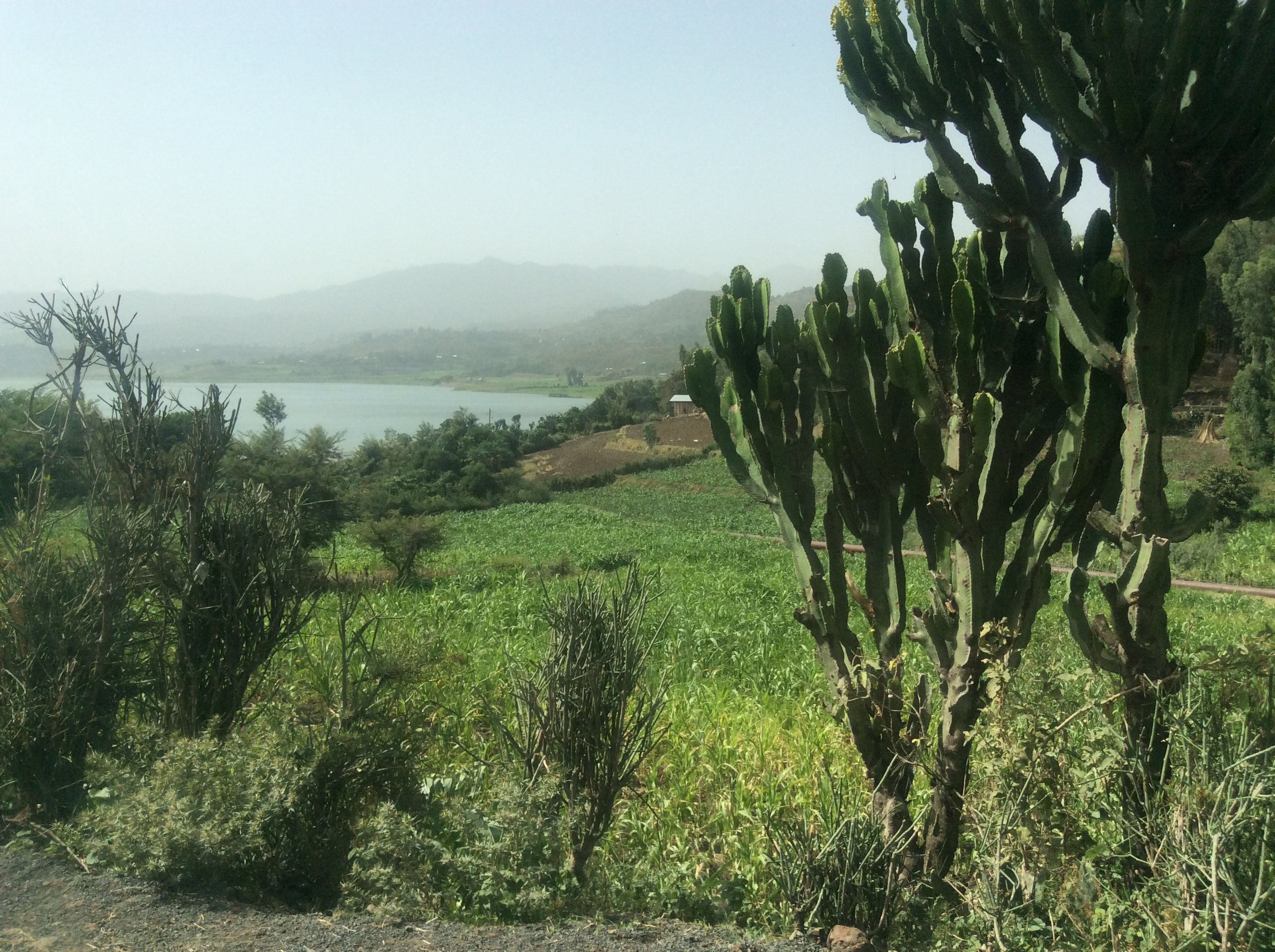
Along the road we saw many of these “apples”.  My friend told us how they played with them as a child.  However, the adults all warned the children not to touch their eyes when they did–it will make you blind.  They are called Apples of Sodom–so many things in Ethiopia have symbolic meaning.

IMG_0283

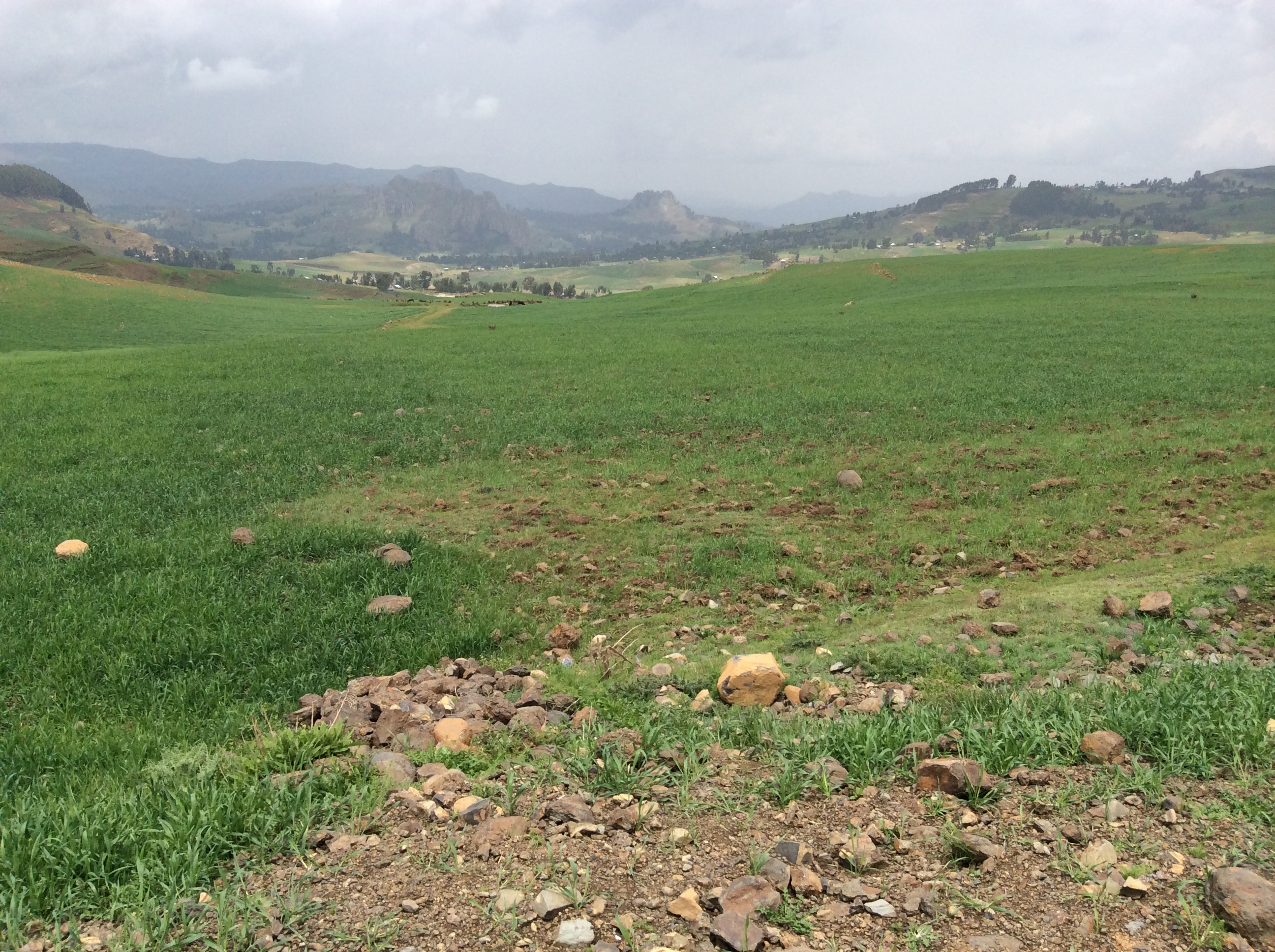
These fruit could be seen all along the road and even on the road.  After driving through this drier area we rose above a huge valley with miles and miles of grass.

IMG_0285

A semi-nomadic group brings their immense herds of cattle here in the rainy season to graze.  When we drove further on above the valley, I saw the first tractor working a field as big as this grazing land.


My Ethiopian Adventure–on the Road from Lalibela to Gonder


Since there is only one road in and out of Lalibela, we headed back to the main road after an 8:00 breakfast.  By this time, after three times on this road, the heights hardly bothered me.

IMG_0491

We drove through mountains a large part of the day, through the large towns of Nesfas Mawcha, Debre Tabor, and turned north at Wereta. By this time, I had become accustomed to seeing endless beautiful scenery, hardly knowing when to take photos.

IMG_0501

IMG_0502

The invasive eucalyptus trees and pastoral mountain villages show up everywhere.

IMG_0503

IMG_0505

Most villages have their own church.  The building with the round roof in the distant middle is one such little church.

IMG_0507

Excellent roads, mostly built by the Italians years ago,  crisscross this part of the country. Some newer roads have been built by the Chinese.  Many Ethiopians made jokes about this, implying they do not expect them to last  long.  After reaching a high plateau, we drove through endless pastures and fields of green.

IMG_0508

IMG_0509

Up in this high country, farmers grow wheat, barley, and oats.  Horses and cattle graze in large pastures.

IMG_0510

IMG_0512

IMG_0514

The mountains appear to continue forever.

IMG_0515

IMG_0516

Buildings, like the one in this photo above, usually house animals at night to protect them from predators such as hyenas.

IMG_0517

Whenever we stopped, children ran up sometimes asking for pens, occasionally for money.  Dino and Alemu, the driver, usually scolded them in Amharic for begging.

IMG_0518

Houses here seemed bigger, usually two story, with rocks used as a main building material.

IMG_0519

We drove by two men galloping along on horseback, their horses adorned in fancy tack.

IMG_0520


IMG_0523

As we began a long descent into a huge valley, common baboons appeared along the road.

IMG_0524

IMG_0525

These huge rocks left my millions of years of erosion, provide a dramatic contrast to the intense green.

IMG_0527

IMG_0528

It took more than an hour to cross this valley.  As usual cattle, goats., burros, people mingled with vehicles.  What a surprise:  Rice fields as far as I could see on either side of the road.

IMG_0530

The villages in this area are built higher–above the rice paddies. And then as we climbed out of the valley…

IMG_0533

The name of this rock really surprised me, the Finger of God.

IMG_0535

A big later, suddenly Alemu turned off on a dirt road and this appeared.

IMG_0538

The sign says:  Guzara Palace, G.C. 1563-1597.

IMG_0539

When a person goes on such a trip, sometimes places hold your heart, places unexpected.  I loved this place.  It seemed magical.  With no other people around, it felt private and special.  It becomes obvious quite quickly why a king would build a castle here.  You can see forever, for miles and miles, all the way  to Lake Tana in the background.

IMG_0541


IMG_0542

IMG_0544

We climbed up to the second story and could see Lake Tana even more clearly in the distance.  I felt a sudden rush of emotion, looking at Lake Tana, my first glimpse of where the Nile River begins.

IMG_0546

IMG_0548

On the other side of the castle, looking toward the mountains, the remains of the old wall around the castle show up clearly.  The part of the wall on the path to the castle has been restored.  This part still awaits restoration. We drove on to Gonder.  We stayed there two nights at  Hotel Goha, but not in sequence.  I found the window coverings so unique I had to take a photo.

IMG_0550

Fabric, stretched over a frame slides back and forth so you can slide it to cover the window.  This hotel possesses fantastic, modern showers.


My Ethiopian Adventure–On the Road to Lalibela, Part Two


IMG_0344

Mountains pervade everywhere it seems.  We continually drove up and down mountainsides.  Eucalyptus is not native.  They were brought in by the Australians many years ago and became invasive.  They are a mixed blessing–grow rapidly and have many uses, but they take a lot of water and drive out native species.  When simply cut down, they grow right back.  In some places, we saw preserves where the original species of trees still exist and are protected.  Otherwise, eucalyptus reign.

IMG_0348

IMG_0350

And there are several species of eucalyptus as you can see here.  Not only do the leaves differ, but also the color of the trunks.

IMG_0352


IMG_0353

Almost all the mountainsides are covered with fields.  Ones, like this one, may have been just plowed or just planted.  In the mountains barley, wheat, and oats are grown and sometimes teff.  Barley seems to ripen first.

IMG_0356

At first, I suffered minor terror because of the steep roads and huge drop-offs, sometimes thousands of feet.  However, eventually I became rather used to it.

IMG_0357

These roads, mostly built a long time ago by the Italians, remain excellent and do have guardrails.  The Chinese have built some of the newer roads.  The Ethiopians make jokes regarding how long they think these Chinese roads will last.

IMG_0359

Eventually, we rose to a high plateau area across which we drove for hours.

IMG_0360

The endless shades of green, indicating different crops, or in some cases, the gold of ripening grain.

IMG_0363

Winnowing grain the old fashioned way.

IMG_0364

IMG_0365

Houses on this high plateau seemed mostly built of rocks which lay everywhere.

IMG_0366

IMG_0368

Amelu asked us if we wanted to see inside one of the houses and visit with some people.  Of course, we said yes.

IMG_0373

This couple had a somewhat older child who was out herding their animals–cattle as I recall.  At night they bring the animals inside their house to protect them from predators, e.g. hyenas.  They also provide body heat which helps them keep warm.  He explained in Amharic that   he did not own land, but was saving up and when he could, would build a separate house so that their animals would be able to stay in one and his family in another. I thought Amelu knew these people, but he did not.  His own children had outgrown some of their clothes.  He had brought them to give away so he gave them to this family.

IMG_0375

After we crossed the plateau, we dropped down and crossed a river. Because it was the rainy season, rivers raged everywhere, running dark with mud.

IMG_0381

The little shed is for the river guard.  We did not see anyone here when we crossed, but major rivers have guards often armed with an assault rifle.

IMG_0385

IMG_0388

Almost to Lalibela–we discovered later that the rains were late and people were very concerned.  Crops had been planted and they were waiting.

IMG_0379


IMG_0392

The first photo in Lalibela–the view from my room at the edge of a cliff–the Maribela Hotel.


My Ethiopian Adventure–on the Road to Lalibela, Part One


Although the Sunny Side Hotel’s rooms in Kombolcha seem elemental to say the least, the food there is some of the best I had in Ethiopia.  One of the reasons for this may be their extensive gardens which not only hold flowers, but vegetables and fruit trees.

IMG_0292

IMG_0294

That’s a papaya in the middle.

IMG_0296

IMG_0290

Dinner consisted of fresh talapia–Lake Tana is full of talapia and is a common item on menus, perfectly grilled, julienned vegetables sautéed in sunflower oil and seasoned with a sprig of rosemary.  The next morning we headed for Lalibela.  The first larger city through which we drove is Dese.  As in most Ethiopian cities, new construction could be seen everywhere.  They do not use steel for scaffolding.  They use eucalyptus as in this building.

IMG_0307

IMG_0305

We continually climbed switched back roads.  Usually, terraced fields lay as far as we could see on the mountainsides.

IMG_0303

IMG_0301

IMG_0311

Not too far from Dese, we came to the smaller town of Hayk.  Hayk is the Amharic word for lake.  The town is named after this nearby lake.

image

Seven species of acacia grow in Ethiopia.  These, higher in the mountains, appear considerably more lush than those farther south in semi arid places. You cannot swim in this lake because, like many bodies of water in Africa, the schistosomiasis parasite lives here.  There is a cure, but not very pleasant.  Huge fig trees and acacias provide a setting like one sees in movies.

IMG_0316

IMG_0317

IMG_0319

This monastery resides on a small peninsula that juts out into the lake.  The sign says no women allowed.  Foreign male visitors may enter for a fee–locals free. Lush fields surround the lake.

IMG_0314

IMG_0322

Yes, that is cactus on the right–not exactly a place I expected to see cactus.  On the road out of the lake, we saw this girl walking and asked to take her photo.  She is carrying dried dung.  Houses are first framed in eucalyptus and then plastered with a mixture of dung and mud or just mud.  Sometimes they are left the natural dark brown color.  Some home owners prefer to paint them bright colors.

IMG_0324

IMG_0331

This is a typical house in most areas left unpainted with a metal roof.  Everywhere people worked the fields the “old” way with a beautiful result.

IMG_0327

IMG_0328

We passed villages and towns of all sizes.

IMG_0330

And always children as well as adults drove animals along the road.

IMG_0335

IMG_0336

IMG_0343

Eighty languages are spoken in Ethiopia.  Some, like Amharic and Oromo, are spoken my millions, others by only a particular small tribe. Everywhere we went people knew Amharic, an Afro-Asian, Semitic language (like Arabic and Hebrew) which originates in the ancient language of Geez, a language now only used as the sacred language of the Ethiopian Orthodox Church.  English is taught in elementary school, which is compulsory through the eighth grade.  Because of too many students and too few schools and teachers, especially in rural areas, school is half a day.  One group goes in the morning and another in the afternoon.

Ethiopia–Lake Tana and the Blue Nile


I spent yesterday evening and today here in Bahir Dar, Ethiopia, looking at, riding across or around on Lake Tana and the Blue Nile.  The out flow of Lake Tana is the beginning of the Blue Nile, the world’s longest river.  I crossed the Nile three times today in a relatively small motor boat.  Due to a diversion of water for hydroelectric power, the Nile falls are only a fraction of what they used to be.  Fishermen still fish Lake Tana in boats made from papyrus, scarves are still woven on hand looms, and corn, beans, and sugar cane are cultivated by hand, The following photos were all taken today, including the exquisite gardens at the restaurant where we ate lunch.


imageimageimageimageimageimageimageimageimageimageimageimageimageimageimage
image