Trip to Honey Island Swamp


On our third day in New Orleans, we headed to Slidell, LA, to visit the swamp.  Many swamp tours exist in the area and some in Lafayette as well.  After reading extensively online about the various tours, I decided to take Dr. Wagner’s Honey Island tour early in the morning.  Depending on traffic, it is about a 3/4 to one hour drive from downtown New Orleans.  For at least half this time, you are driving on a bridge across Lake Pontchartrain.

IMG_2773

This little swampy area is right next to the small cabin where they sell alligator souvenirs and you pick up your ticket.  This place requires cash.

IMG_2747

After boarding the boat which holds about 20 passengers, we headed down the Pearl River.  This view looks upriver.

IMG_2748

Many expensive houses rise above the river banks.  You can see the for sale sign.  According to the boat captain, the fancier ones cost about one million.  However, for all the elegant houses, there are more just the opposite and close by.

IMG_2750

Like this one which appears boarded up.  Some appeared abandoned, some in decent repair, some recently used.  When we asked how high the water rose during Katrina, we were told that it would be above the roof of a house like this.  The tours were abandoned for over a year after the hurricane except for the occasional hurricane cleanup crew who wanted a tour.

IMG_2749

This is one of the nice houses along the river, modern, large, well kept.

IMG_2751

We saw a large blue heron, wings outstretched, sunning itself on a large tree stump.  When the captain tried to get closer, it slowly lifted off and flew away before I could get a photo.

IMG_2757

We turned to the right off the river and began to see alligators of all sizes.  Because of harvesting for skins, meat, etc., few really large ones remain.  More common is 8-10 footers.

IMG_2762

Even the boat captain was astonished at the number of alligators we saw.  They seemed to be everywhere and one exceedingly large male followed us deeper into the swamp.

IMG_2764

Although the water flows rather rapidly on the river, once in the swamp, the water is very quiet.  Many different types of trees live here including cypress.  Most of the trees are deciduous and lose their leaves in the winter.  I was extremely surprised to learn how cold it can get here, below freezing, sometimes even down in the teens.  However, the captain said it always rises above freezing during the day.

IMG_2765

IMG_2766

Most of the really large cypress have been cut down in the past for lumber.  Now this is a reserve.  The tree on the left is really large and a lot of moss hangs from it.

IMG_2767

Hogs, like these, are not native anywhere in the Western Hemisphere.  It seems feral hogs can live anywhere.  We also saw raccoons.  The trees and other vegetation are so dense during the summer, wildlife could be a few feet away and remain unseen.

IMG_2769

IMG_2772

The swamp possesses a wild, magical beauty.


Spring Break Adventure–5


On the fourth day of the adventure we went to Marfa, Texas.  My friends from college, David and Suzy, had booked a tour of the Chinati Foundation.  No photos of that because none allowed.  This foundation is the dream of its founder, Donald Judd.  His art and almost all the rest of the art housed here is not for display in houses.  All but a few consist of grand studies of space and light. An abandoned, refurbished military base, purchased by Judd, houses most of the exhibits.  Judd’s main interest it seems relates to the relationship between light and space.  First, the tour guide takes you to a couple of large buildings where the only changes made were to install new windows and a ceiling.  These buildings house Judd’s large, polished, stainless steel rectangular boxes.  While this may sound boring, I assure you it is not.  Light reflects off these boxes, makes shadows, etc. in all sorts of ways and the entire effect changes with the angles of the sunlight.

Another quite astonishing display can be seen in a series of U-shaped buildings, painted and repaired, in which eight foot long fluorescent light tubes in four colors, pink, green, yellow, and blue, have been installed in the corners of the U.  Depending on where a person stands, other colors appear, not just the four mentioned.  It became apparent to me that the artist, Dan Flavin, knew every scientific detail of the color spectrum and its effects on the human eye and brain.

I also enjoyed a smaller display by artist and poet, Carl Andre.  Even though his fame rests in sculpture, it is mainly his poetry displayed here.  I wanted to read all of it but everyone else went on so I quit.

There are other exhibits, including a lot of smashed and welded vehicles which I liked the least.  The final exhibit displays giant fabric sheets in black and white in a building specially designed by the artist, Robert Irwin.  If you think this sounds boring, take a trip there and look for yourself.  I assure you it is not.  Irwin actually worked on the exhibit himself at the age of 88.  He lives on now at 89.

IMG_2603

The only photos I managed in the area show the Marfa Courthouse which is, believe it or not, even a brighter pink than this photo and a photo from the vehicle window on the highway to Alpine. The second photo shows a mesa we managed to view on one day or another from nearly all sides.  It looms large in the middle of flat land. Here one of the endless trains slides by.

IMG_2604

On our last day we decided to drive to Presidio and take the river road which goes through Rio Grande Ranch State Park. While the road goes either along or down to the river in a few places (for people to put some sort of water craft into the river or to camp), most of it is way above the river on cliffs.  This landscape is not for the faint of heart.

IMG_2605

US on the right and Mexico on the left.  The fields and pasture in the distance are in Mexico.

IMG_2606

Looking into Mexico.

IMG_2607

IMG_2609

IMG_2611

Unusual rock formations near one of the small drives down to a campground by the river.

IMG_2613

IMG_2617

Cliffs in Mexico.

IMG_2619

Apparently, in my efforts not to fall in the river while taking this, my finger got in the way.

IMG_2620

IMG_2621

Yes, the river is down there between those cliffs.

IMG_2622

IMG_2623

In case you wonder why the Rio Grande seems so small here, consider that by the time it gets here, 95% of the water has been removed for irrigation and other purposes.

IMG_2624

We drove back through Terlingua to Alpine.  Not much exists in Terlingua except a rather pathetic supposed ghost town area.  The river road is not conducive to speed; we were hungry and stopped for a very late lunch.  It was St. Patrick’s Day and many of the clientele had a good start on the festivities.  On Saturday I learned that Terlingua is a famous biker town.  However, apparently not that day.

Ethiopian Journey–From Addis Ababa to Debre Birhan


Addis is the second highest capital in the world.  Only La Paz, Bolivia, is higher.  To a large extent, altitude determines climate in Ethiopia.  Addis and the surrounding area, much of which is high altitude farmland, receives a lot of rain this time of year and looks totally unlike what a lot of people think of when they hear the word Ethiopia–not desert but rather miles and miles of green.

IMG_0248

IMG_0249

We had not driven far from Addis when we crossed a river, an area of which is considered healing.  Many people had come for priests to bless them and to experience the healing power of the water.

IMG_0246

I saw only three tractors in ten days of criss crossing farmland.  Why so few?  One reason is rocks.  Many of the fields remain rather full of rocks in spite of many having been removed.

IMG_0258

Therefore, they farm the “old fashioned” way; horses or cattle pulling plows with a human behind.

IMG_0251

Houses in the villages in the farming areas demonstrate old ways alongside new.

IMG_0257

IMG_0259

Winnowing the way we did in the USA a century ago.

IMG_0253

IMG_0261

Much of the farmland is a picturesque patchwork quilt of browns and greens.

IMG_0266

Before dropping down to lower country, we drove by Menelik’s Window.   The drop off here is steep and far.  I did not go near it–I had not yet become used to the endless drop-offs or even realized that I would need to do so.  This is one of four places in Ethiopian where you can see gelada baboons.  They are extinct elsewhere. Menelik was an Ethiopian emperor.  This “window” allows one to look from the high country for miles and miles to the landscape beyond.

IMG_0262

The large tufts of grass provide food for the gelada which are grass eating herbivores, the last of the grass eating primates.  All others are extinct.  This same grass is used by the locals for roofing material so boys stay in these areas all day chasing off the baboons.

IMG_0264

To keep themselves busy they weave woolen baskets and hats to sell which they display in the grass.

IMG_0267

This ten year old boy happily donned the hat he had made.  I bought it for my grandson who was the same age when I took the trip.

IMG_0268

Except for the different vegetation, driving down the mountain looked a lot like driving through Colorado.

IMG_0271

IMG_0272

IMG_0276

Down from the mountain the landscape appears quite different and considerably drier.  We drove through several smaller towns on our way to Debre Birhan where we stayed the first night.

IMG_0279

Driving in Ethiopia requires navigating around animals.  Everyone drives their cattle, camels, horses, all livestock down the road whenever possible.  The roads are generally very good.  Many, built by the Italians, have stood the test of decades.

IMG_0282

Along the road we saw many of these “apples”.  My friend told us how they played with them as a child.  However, the adults all warned the children not to touch their eyes when they did–it will make you blind.  They are called Apples of Sodom–so many things in Ethiopia have symbolic meaning.

IMG_0283

These fruit could be seen all along the road and even on the road.  After driving through this drier area we rose above a huge valley with miles and miles of grass.

IMG_0285

A semi-nomadic group brings their immense herds of cattle here in the rainy season to graze.  When we drove further on above the valley, I saw the first tractor working a field as big as this grazing land.


Ethiopian Journey–The Beginning


Two years ago today, two friends and I flew from here to Dallas to Dubai.  The final destination:  Ethiopia, where I spent nearly three weeks with them and my friends’s family plus a road trip through the north.  Ethiopia was nothing like what one sees in the news, in famine photographs, nothing like the image most people in the USA have of it.  My main goal when I returned home was to show people photos and inform them what it really looks like, how incredibly beautiful it is there.  This mission continues two years hence.  For the next several weeks I plan to relive this journey and share it on my blog here.

It is a short trip from Amarillo to Dallas via air.  In order to carry the baggage allowed on Emirate Airlines, we first flew via Southwest to Love Field, then took a taxi to Dallas International.  If you plan to fly long distances, I highly recommend Emirates Airlines.  Compared with all the others I have experienced even coach class is wonderful:  bigger seat room, more than a hundred movies to watch, good food, an area where you can help yourself to fruit and snacks, unlimited wine and beer, and an international group of flight attendants.

From Dallas to Dubai is fifteen hours of flying.

IMG_0155

IMG_0163

People wonder why they fly over Greenland, Iceland, northern Europe to get to Dubai.  Do not look at a flat map.  Get a globe and trace the route.  It is the shortest way to go.  Dubai is not like many think here.  No, I did not see endless lines of Lamborghinis and Ferraris.  In fact, I do not recall seeing any at all.  Tomorrow, photos of Dubai before heading on to Addis.

20 Reasons why Slovenia must be on your travel wishlist for 2015


20 Reasons why Slovenia must be on your travel wishlist for 2015.  I do not usually share a lot of posts, but this one from a blogging friend is a must share.  It includes such incredibly beautiful photos–for all of you out there who like travel.

My Ethiopian Adventure–Lalibela, Part One


IMG_0393

The final climb to Lalibela nearly terrified me–switchbacks up and up, no guard rails as I recall, and drop-offs more than a thousand feet.  This photo, taken from my hotel room patio, fails to really show just how far down the drop really is.  The other buildings in the photo are also hotels.  Having been told that only one really good restaurant exists there, we ate at the same place two evenings.  It rests at the end of a narrow unpaved road at the edge of a cliff.

IMG_0497

The second evening there, we met the owner, an older woman from Scotland who originally came to Lalibela at the request of a friend to teach.  She stayed, bought this land, and hired two young architects from Addis to design the restaurant–to look like a flower.

IMG_0498


IMG_0494

To get to this restaurant from the hotel, Alemu had to turn the corner as tightly as he could, backup a bit, and then proceed on this road.  Immediately below where we backed up,  there is a steep cliff.  I asked him if anyone ever fell off. He said a friend of his did.  I assumed he had died, but no, his vehicle was caught by a tiny ledge and he survived.

image

The road up to Lalibela as viewed from my hotel patio.  We stayed at the Maribela Hotel which was one of the nicest on the road trip.  They were still building a restaurant but served an excellent breakfast.

IMG_0395

Lalibela is to the Ethiopian Orthodox Church what Jerusalem is to Jews and many western Christians.  It is famous for its eleven churches carved from solid rock.  It has been called the New Jerusalem, a New Golgotha.  In approximately 1200 AD, King Lalibela, one of the last kings of the Zagwe dynasty, came to power after God told his brother, who was king, to abdicate.  The name Lalibela comes from honey, sweetness because when a baby, King Lalibela was surrounded by bees which prophesied his future greatness.  The story becomes quite complicated but in essence, angels took his soul to heaven and showed him the churches he was to build.  They were built in twenty four years with the help of angels.  Lalibela then became the holy city.  Like the ancient rulers from Axum (the original holy city where they believe a church holds the Ark of the Covenant), the Zagwe dynasty traced their origin to King Solomon and the Queen of Sheba.

In Lalibela two types of rock churches still stand:  rock hewn monolithic churches which were cut out of solid basalt from the top down with trenches surrounding them and rock hewn churches which were cut inward from a cliff or by using a natural cave or indentation in a cliff as a starting point.  The architectural and technical building skill required is clearly evident.  The churches are on several levels and built in such a way that they drain to carry off the heavy rain flow during the rainy season.  The trenches around the churches also serve to feed the River Jordan–an area made to duplicate the original River Jordan.  The architecture of the monolithic churches exists nowhere else in the world.

To tour the churches requires a professional guide who knows the history and architecture intimately.  Our guide held the position of deacon in the Ethiopian Orthodox Church.  While many Muslims live in parts of Ethiopia, Lalibela is a Christian town in a heavily Christian area.  Deacons and priests can marry, but if a male wants to become a bishop, he cannot marry.  The Ethiopian Orthodox Church, like the traditional Catholic Church with Latin, has its own ancient religious language, Ge’ez.  The alphabet of modern Amharic is the same as Ge’ez. Priests learn to read Ge’ez.  Later, in Gondar, we were able to get a priest to chant from a religious text in Ge’ez.  For more details regarding the Ethiopian Orthodox Church, a list books in both the New Testament and Old Testament, as well as other sacred texts and hymnals, go to:   http://www.ethiopianorthodox.org. There are many more books in the Orthodox Bible than in those used by European and American churches.

IMG_0396

My Ethiopian Adventure–from Addis to Kombolcha


Saying goodbye to Addis at 8 in the morning, we headed northeast and later north toward Kombolcha–spelling differs, depending on whose map you view.  The official Ethiopian map spells the town as Kombolch.  Addis is high, the second highest capital in the world.  We drove northeast all morning across rivers and through green fields.

IMG_0246

Not far outside Addis we saw this scene, a river with many people near it.  Our driver, Alemu explained this river contains holy, healing water and all those people you see through the window are pilgrims coming to be blessed by the resident priest and hopefully healed by the river waters.

IMG_0249

Who would know this is Ethiopia if no one told you? Not what I expected at all honestly.

IMG_0248

IMG_0250

Most of the farmland is very rocky.  Farmers gather rocks, in some places make fences out of them or just pile them up.  Even with these efforts fields remain full of rocks.

IMG_0251

We drove for hours through this type of farmland.

IMG_0257

This is a typical country village which appeared off and on continuously along the highway.  Traditional buildings are usually round with thatched roofs.  More and more people have begun to use metal roofs which forces the building shape to rectangular rather than round.  We heard a story about a thatched roof house that caught on fire.  Nothing but the thatch burned because underneath the thatch was a meter of mud.

IMG_0258

Most Ethiopian farming is done the old way:  either horses or cattle pull the plow with a man guiding it usually through a lot of rocks.  I commented about seeing no tractors so then every time we saw one everyone shouted, “Juliana, there’s a tractor.”  I think I saw only five of them in ten days and only one was actually working in a field.  It became obvious rather quickly how totally impractical a tractor and its equipment would be in much of the farmland:  too many rocks and as you will soon see, too steep.  The tractor would fall over.

IMG_0261

Eventually we started climbing higher and higher.  To the left was one of Ethiopia’s high peaks near or over 4000 meters–13 to 14 thousand feet.

IMG_0262

And then, there it was, Menelik’s Window.  This was the first area we saw with numerous gelada baboons.  However, these ran away unlike the ones later in Simien National Park.

IMG_0266

That’s Dino down on the edge.  At this point in the trip, I was still quite horrified by all the steep cliffs and stayed way back.  He was trying to get a good photo of the baboons.  Menelik II, the last Ethiopia leader to be able to claim himself as a direct male descendant of King Solomon, found this place special, a view into the real Ethiopia across miles of mountains. He is known for defeating the Italian invaders, expanding the kingdom, and especially for modernizing Ethiopia.

IMG_0267

My grandson now owns this hat.  This boy and his friends spend their days chasing the baboons away from the tufts of grass, which their families use to make the thatched roofs, and making hats for sale.

IMG_0264

You can see the selection of different styles of hats on display on the grass.  On the mountainside in the back lots of herbs grew, including thyme.  The boys also sold packets of herbs they had gathered and dried.

IMG_0268

We dropped down on a winding mountain road through eucalyptus forests.  Eucalyptus is not native to Ethiopia, but grows everywhere there.  It is used as a basic material for building their houses, for scaffolding to build tall city buildings, for just about everything.  Several different species grew along the road.

IMG_0271

Ethiopia’s main highways are excellent.  Many were built years ago by the Italians, more recent ones by the Chinese.  Ethiopians make jokes about how long the Chinese roads might last.

IMG_0272

Eventually, we dropped down out of the mountains into an area that was much drier.

IMG_0276

A typical town with all sorts of shops right along the road.  When driving in Ethiopia, dodging people, cattle, camels, horses, burros, and goats is the norm. Everything it seems likes these good roads.

IMG_0279

A boy driving camels down the highway.  Loose animals, like the burro on the right, roam seemingly unattended.  I saw few fences.

IMG_0280

In the small towns in this semi arid area, we saw several totally veiled women, faces covered totally except for their eyes.  Alemu informed us that this was a new thing, not seen until the last few years.  He seemed to think it had become fashionable to copy Saudi women.

IMG_0281

We stopped to look at certain plants beside the road.

IMG_0282

Dino recalled playing with these pretty green balls as a child with this forewarning,  “Do not eat them, do not touch your eyes or you will go blind.”  They are called the Apples of Sodom.

IMG_0284

At this juncture near the beginning of this adventure, I had not yet realized how everything in Ethiopia possesses symbolic meaning.

IMG_0285

We drove along this immense, lush valley for miles.  Alemu said this huge herd of cattle belonged to a semi nomadic group who brought their cattle here during the rainy season to graze and fatten.  A bit farther down the road the land belonged to one of the richest men in Ethiopia, indeed the world, Al Amoudi.  It was the only place where I saw a tractor actually used in a field.

IMG_0288

Arriving in Kombolcha, we saw this new college in the process of creation.  This became a common sight–new buildings, new schools, construction everywhere.

IMG_0289

My first hotel room in Ethiopia at the Sunny Side Hotel in Kombolcha complete with mosquito netting–the blue blob above the bed.  At least it had a shower and toilet.  Many places use the style of accommodations one finds in a lot of Asia.  Forget toilets as you know them–just a tiled area with a hole in the ground and the ever present water with which to wash.  We carried our own toilet paper just in case.  However, many places had both so customers could choose.

Volunteering at Palo Duro Canyon


424908_2650517636082_1731467384_n

In front of the Visitor’s Center with Eduardo and Gaston, exchange students who lived with me several years ago.


Occasionally, I volunteer in the gift shop at Palo Duro Canyon, the second largest canyon in the United States.  If  individuals drove through Amarillo on I-40 through the endless flat prairie land and never ventured far, they would not even be able to dream up this canyon only twenty miles away.  To get there, you have to drive through more flat land, covered in wheat pasture, corn, milo, and the few remaining pastures of native grass.  You can see for miles; you can even see the taller buildings in Amarillo which are not all that tall.  Then, unexpectedly the land opens up, cliffs appear.  The first time you see it, you feel astonishment.  Nothing you see on the way there prepares you.  Years ago Battelle Memorial Institute sent me on a business trip to Amarillo.  People told me I should go see the big canyon.  I laughed to myself, thinking they must be just talking about a large arroyo.  When I finally did drive down, my mouth gaped in shock.  How could this be?

Palo Duro Canyon is still being created by water erosion.  The Prairie Dog Town Fork of the Red River (no I did not make this name up) runs through it.  Barely a running stream now with the drought, when a big summer thunderstorm blasts it fury, this river can rise ten feet almost immediately.  When it does this, campers remain stranded inside the park until the river calms down because to get into the park, depending how far in you go,  you have to literally cross the river repeatedly.  Because of this, they have decided to build bridges across the five water crossings.  Some of us who love driving through the water find this innovation unacceptable.

Today, I volunteered from 1-5.  People came in from Indiana, Minnesota, Ecuador, south Florida–on a trip to Californian and back, Ohio, Germany–a young woman working as a nanny here.  Usually, I meet even more people from other countries, especially European countries.  When I ask the Germans in particular how they know about this place, they tell me Palo Duro Canyon and its history is featured on the Internet there.  Here come all these people from far away and I have students who live a mere 25 miles away and have never seen it.  The family from Indiana came because their daughter wants to attend West Texas A & M University in Canyon, Texas–named after the canyon of course.  She told me she wants to bring her horse and WT is one of the few universities in the country where you can major in agriculture and participate in an extensive horse program.  She exuded excitement and enthusiasm.

In the midst of chatting with all these visitors, I noticed the unusual behavior of one woman in particular.  She had medium grey hair pulled back in a ponytail with hair a lighter shade of grey framing her face. All her clothes were dark grey.  She walked to the book area–we sell a lot of books, and started flipping slowly through several of them.  She picked them up as if they were delicate flowers or fragile glass.  She held them as if she thought they might break if she held them tight.  When she put one up to look at another, it appeared as if she barely touched them.   She never smiled, just looked and looked and looked.  She did not buy a book.

Holiday Break Fun and Recipes


Because of my job, I am on the last day of a two week holiday break.  What a productive and fun time it has been.  Christmas Eve, my friends, my daughter, and my grandson came over.  For the first time ever, I made ham in a big Crock Pot and it melted in our mouths.  They requested I make my signature Refried Black Bean Cassserole and roasted vegetables so I did.  Other food requests included chocolate spiders for dessert–they are cookies.

Ham in the Crock Pot

Cover the bottom of the slow cooker with a 1/2 inch thick layer of brown or turbinado sugar mixed with 2-3 T tapioca. Place ham on top of the sugar.  Cover the top of the ham with preserves of your choice.  I used homemade pineapple/apricot preserves I had made several years previously.  Cook on low for 6-8 hours.  Note:  I used spiral sliced ham precooked.  You do not need to add any liquid, it will make its own.  If you wish, once some liquid has accumulated, you can periodically baste the ham.

SAM_1400

Christmas Eve dinner, eating and relaxing at the dinner table.

SAM_1398

At the bar before dinner while I am still cooking.

SAM_1405

Lingering and relaxing around the dinner table.

These same friends came over about 1 1/2 weeks later.  The special request that time was for another round of Refried Black Bean Casserole.   This is one of those recipes I invented but never measure anything, just make to taste.  This last time I decided to work at paying attention to what I used so I could share.  It may or may not be exactly what I do every time, but it is close.

Refried Black Bean Casserole

2 cans black beans drained

Enough olive oil to cover bottom of large skillet

1/2 red onion, finely chopped

3-4 Tablespoons organic ketchup

3 Tablespoons cumin–add or subtract to suit you taste

Tortillas

Grated white cheese–I usually use monterey jack

Heat oil in skillet and add onions.  Cook until translucent.  Add black beans, one can at a time.  Take a regular table fork and mash beans repeatedly until most of the beans are mashed–I like to leave some not totally mashed to add a bit of texture.  This is easier to do if you only add one can at a time.  Thoroughly mix beans and onions.  Add the cumin and ketchup and stir thoroughly and keep mixing until the mixture it thick and heated through.  Use a round slow cooker or casserole dish.  Oil bottom of dish and place one tortilla in bottom.  Place enough of the black bean mixture on top to cover the tortilla, then sprinkle the grated white cheese on top.  Repeat layers, ending with grated cheese.  You may use any kind of tortilla.  However, I prefer whole wheat flour, but anything works.  Heat through until cheese is melted.  You may also make the bean mixture a day in advance and refrigerate.  If you do this, it will take longer to heat the casserole.

In between cooking adventures, one of my best friends and I decided to take a quick trip to Albuquerque, NM.  We visited our favorites places in Old Town, ate here and there when we felt like it, and stayed someplace new to both of us, Los Poblanos.  We loved this place.  It is located a bit north of downtown and Old Town, off of Rio Grande Blvd. by the river,  and includes 25 acres of lavender fields, a barn, a solar powered swimming pool–not open in the winter, a restaurant, a farm store, an herb garden, paths for strolling here and there, and an impressive tree lined entry drive.

SAM_1421Looking down the entry drive of Los Poblanos.

SAM_1418The barn and other out buildings.

SAM_1420

The lavender field.  They offer many lavender products in the Farm Store as well as balsamic vinegar, cookbooks, and various other items related to what they grow and organic farming and cooking.

SAM_1414

A view of the main house and restaurant area.

SAM_1422

A view near one of the many walking paths.

SAM_1413

The fireplace in our room.

Although I have been to Old Town in Albuquerque many, many times, never before did I go inside the beautiful old church on the square.  They allow photography so I took a photo.  It was all decorated for Christmas with a nearly life sized nativity scene.

SAM_1425

Tomorrow I go back to work.  With friends coming over for Christmas Eve, a trip to the local museum with my friend Roberto Borja, his family coming over for dinner again, the trip to Albuquerque with my friend Zuriash, hanging out with my daughter and grandson, it turned out to be one of the best holiday breaks ever.  Here’s to an equally wonderful 2014.

Family Roadtrips


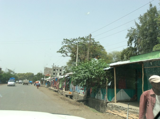
During my childhood, my father took us on regular road trips.  The first one occurred when I was three.  He actually drove all the way from northwestern Missouri to Monterey, Mexico, via Padre Island and back.  Every year we took at least one, sometimes two.  Later in life, I truly realized the value and magic of these family road trips.  Although my daughter, grandson and I take short road trips to New Mexico in particular, we had never taken a really long one until two weeks ago when we left Amarillo, Texas, headed for Carmel, California.

At our first stop, Old Town, Albuquerque, for lunch, we experienced a most refreshing and delightful drink which I plan to duplicate the next time I invite friends over for dinner.

SAM_1176

This feast for the eyes and mouth consists of water infused with pineapple and strawberries.  It tastes best after letting it set to allow the fruit to meld into the water.

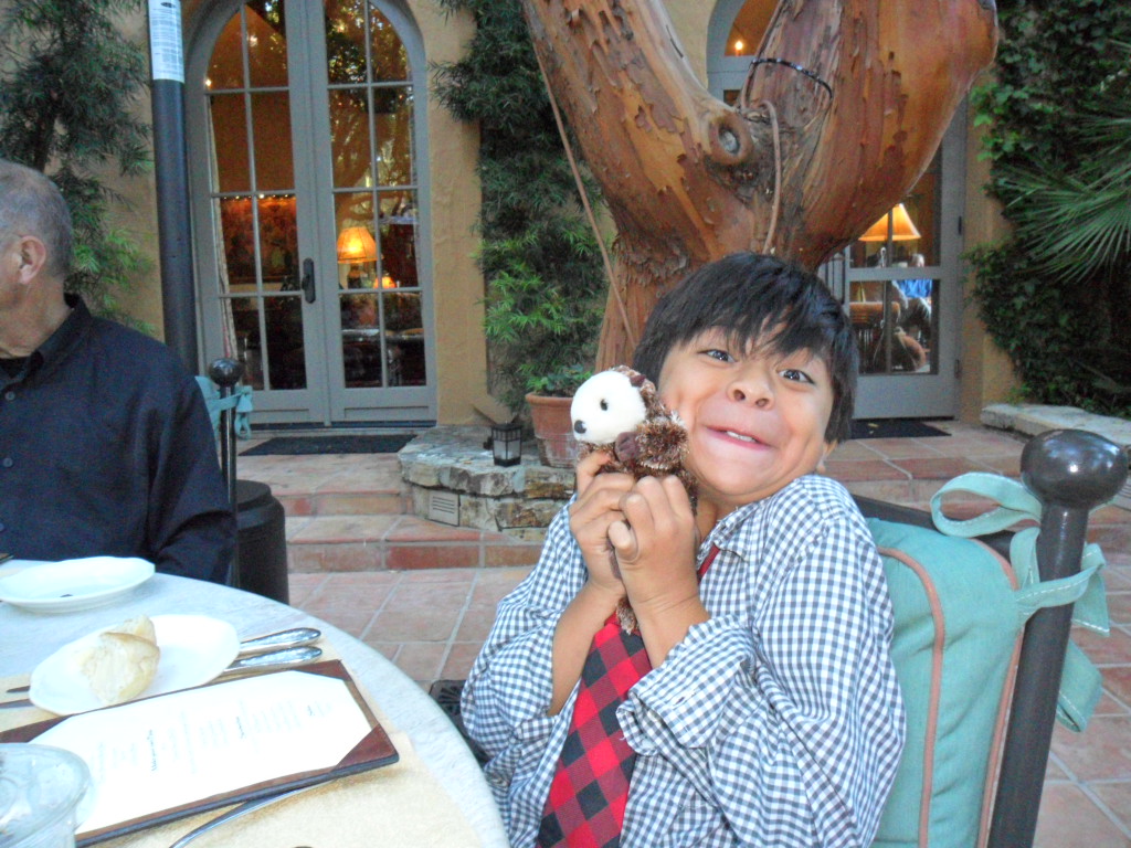
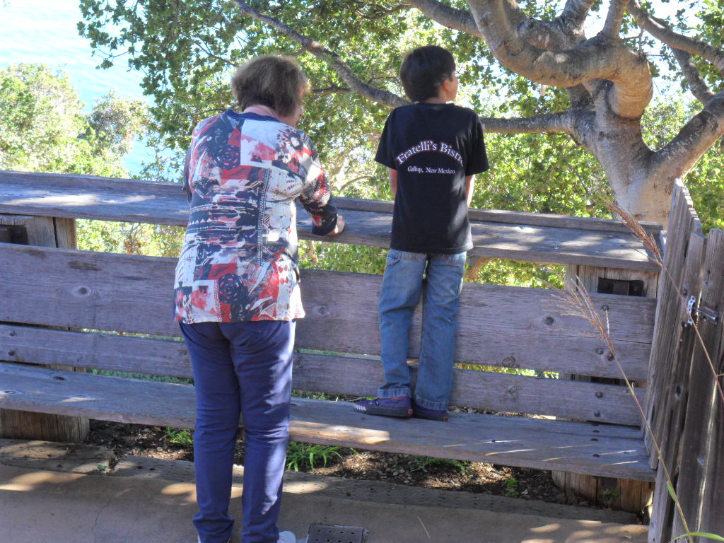
We spent the night in Gallup, but arrived too late to visit the galleries and shops so headed to a little Italian restaurant where my grandson, D’mitri, donned a black shirt which reads Got Mafia.  Friday morning we headed to Window Rock, capital of the Navaho Nation.  Since D’mitri’s great grandfather was Navaho, D’mitri’s interest in this stop remained high.

SAM_1178

SAM_1179

SAM_1180

After strolling around the park here, we stopped to visit the ladies selling the jewelry they were making on site.  As a person a bit obsessed with corn plants, I could not resist a pair of turquoise earrings that look exactly like tiny ears of corn.  D’mitri had to have a necklace with a soccer ball pendant which he wore the rest of the trip.

SAM_1183

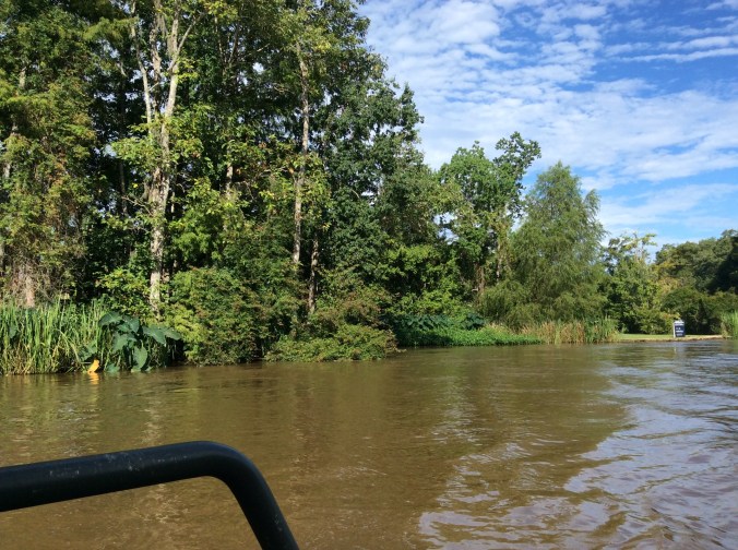
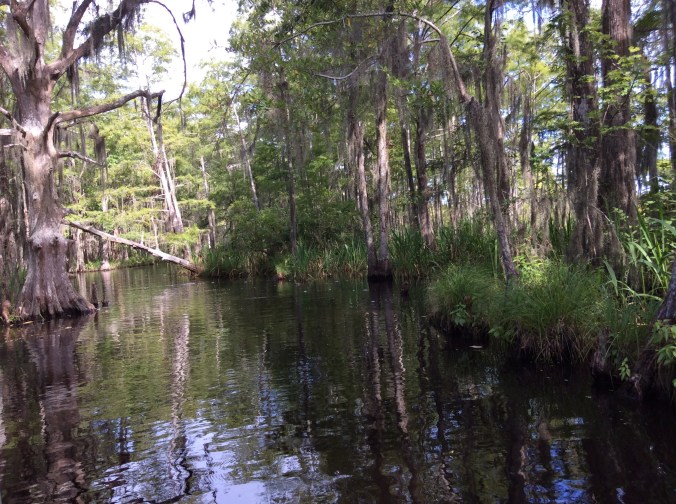
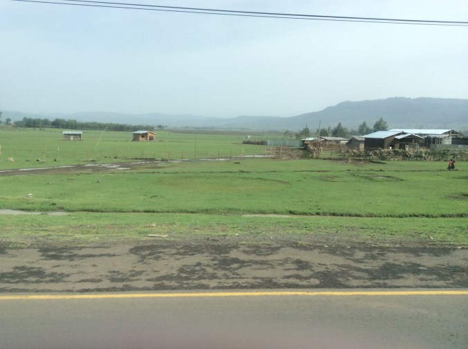
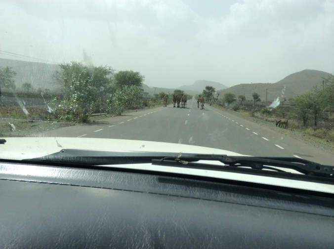
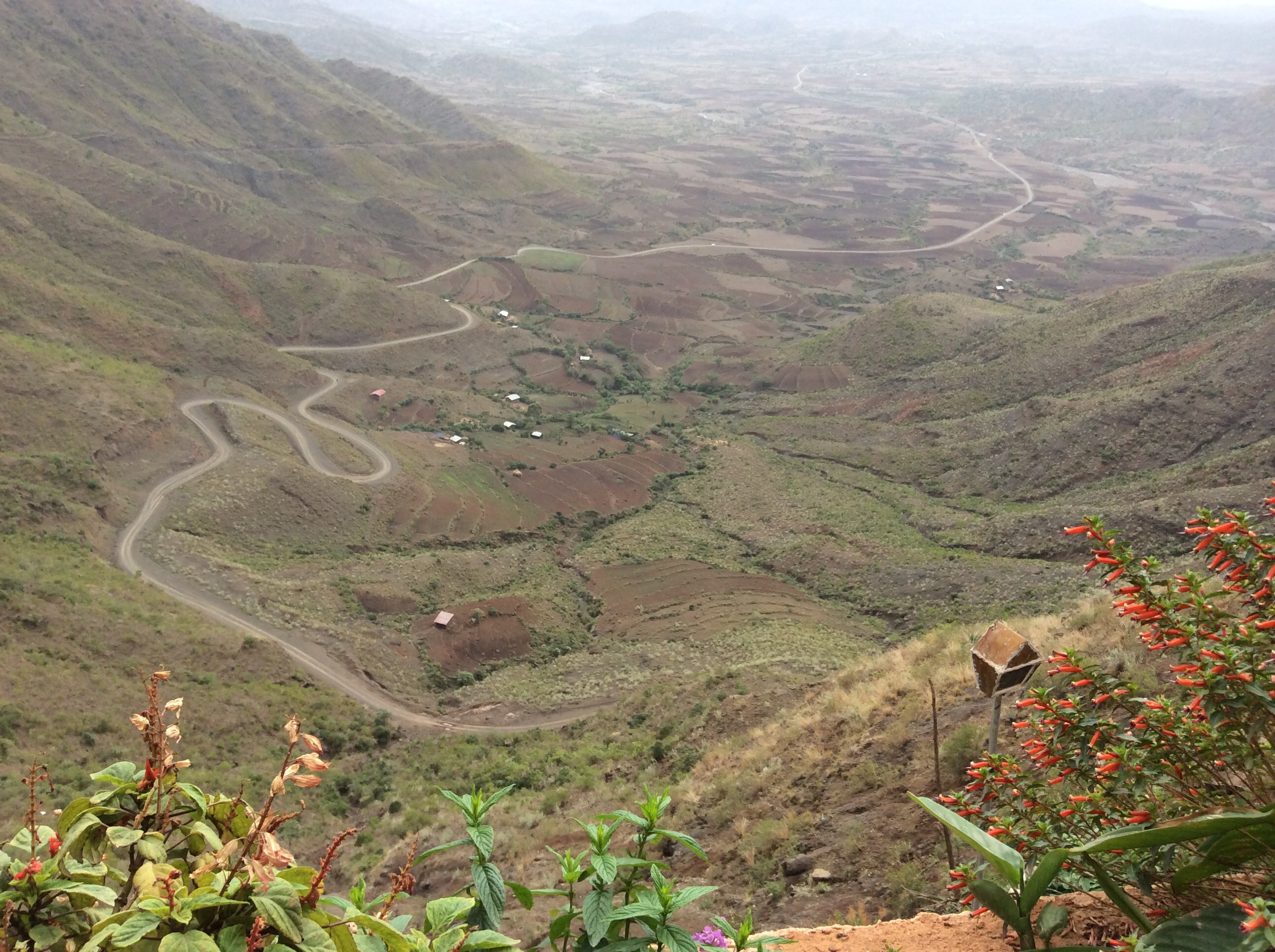
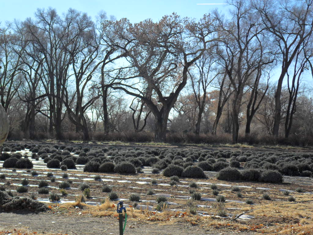
After the morning at Window Rock, we drove off across the Navaho Nation and the Hopi, headed for the North Rim.  We stopped off and on to visit vendors along the side of the road.  The dwellings throughout the Navaho Nation seemed scattered across the landscape with many hogans next to or close to what appeared to be a main house.  Horses roamed in the semi-arid fields.  The Hopi area, however, held a different view with no scattered dwellings.  Everyone seemed to live in villages along the way and I never saw a horse in Hopi country.  Finally, we crossed the mighty Colorado River at Navaho Bridge from which I took this photo.

SAM_1186

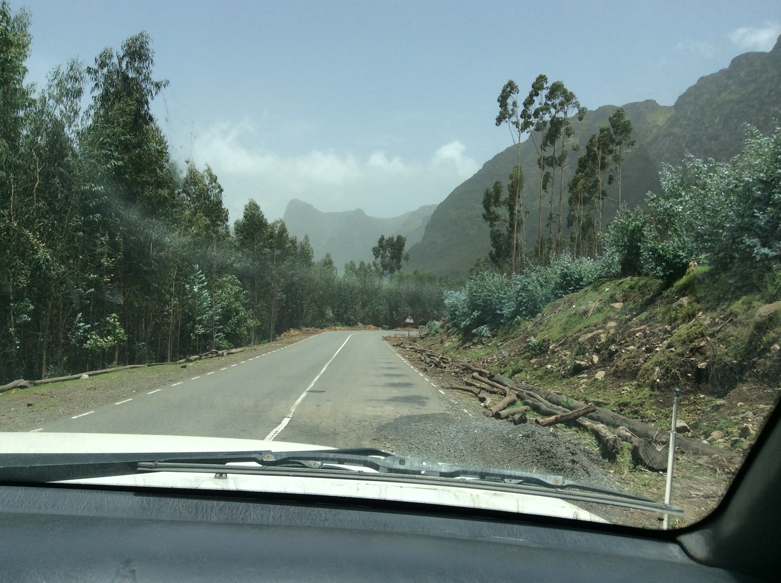
The road follows the base of the cliffs of Vermillion Cliffs National Monument.  We could see them looming large long before we arrived.  Huge rocks appeared to have tumbled off the cliffs and lay near the road.  I kept wondering if they ever fall and hit cars.

SAM_1188

SAM_1190

SAM_1189

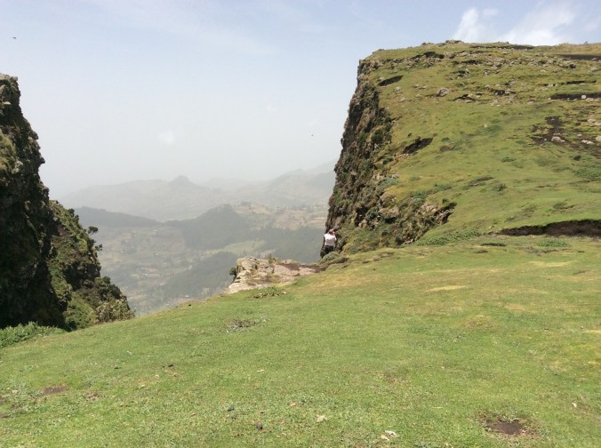
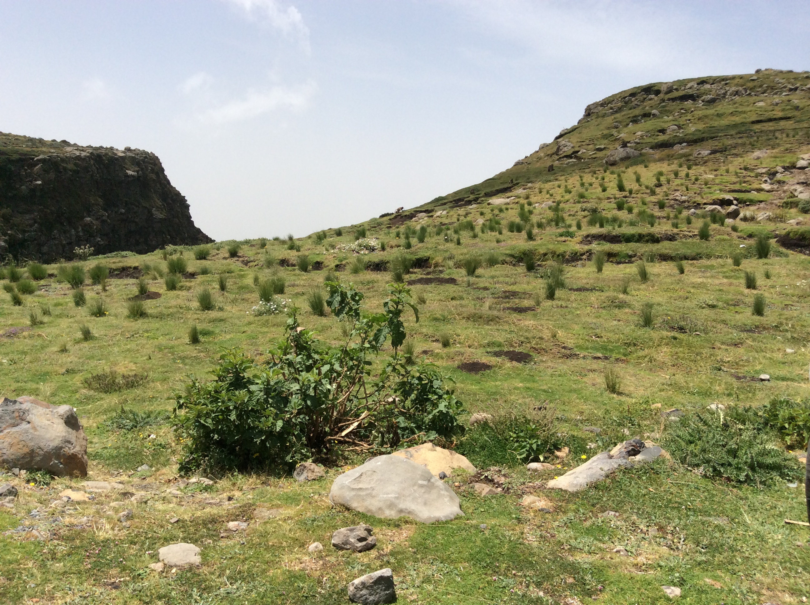
We finally made it to the Jacob Lake Inn near the North Rim of the Grand Canyon.  We arrived too late to go to the Grand Canyon  so took a hike through the ponderosa pines supposedly headed to a lake.  Dry, hot weather apparently turned the lake into a mere puddle.  We barely made it back before dark, disappointed.  The next morning we drove the forty some miles through heavy woods interspersed with giant meadows to the North Rim.  If you have never been to the Grand Canyon, its size and grandeur remain impossible to convey via photos.  Perhaps due to the rather warm, dry conditions, a heavy haze hung over the Canyon all day.  We took a few tiny hikes, only to discover just how very much out of shape we are.  Additionally, the altitude affected D’mitri quite negatively, making him more tired than customary.  Nevertheless, determined to not miss out too much, I took several photographs from Imperial Point.

SAM_1191

SAM_1192

SAM_1193

SAM_1195

SAM_1197

SAM_1196

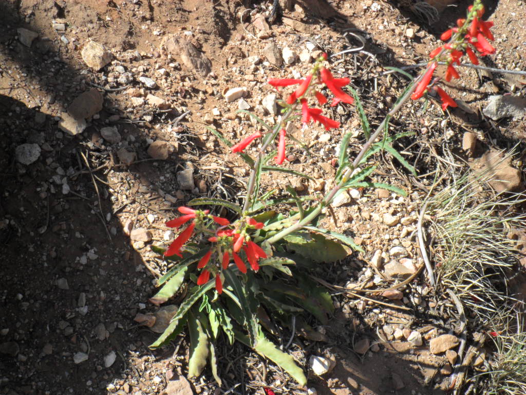
Flowers exactly the same as grow where I live on a little canyon in the Panhandle of Texas grew along the path.  We spent another night at Jacob Lake and then continued toward Las Vegas.  The fastest route drops off the Kaibab Plateau rather dramatically with spectacular long views, the depth and breadth of which no ordinary camera can capture.  We ate a late breakfast in Hurricane, Utah, a bit after the infamous Colorado City, Arizona,  where the houses appeared quite large with high walls around many of them.  Then off to Las Vegas, Nevada, to meet an elementary school classmate, Craig Prater,  whom I had not seen in years.  He treated us to a fabulous lunch at the Mandalay Bay, took us to a shopping area down road, and he and I attempted to catch up for all those years while Ema and D’mitri shopped.  We marveled how two children who attended a rural school (at first it had only one room and then later two) eighteen miles from any town of more than a couple of hundred could attain what we have attained.  He produces films and travels all over the world.  I have lived, worked,  and traveled to many different places.

SAM_1198

SAM_1200

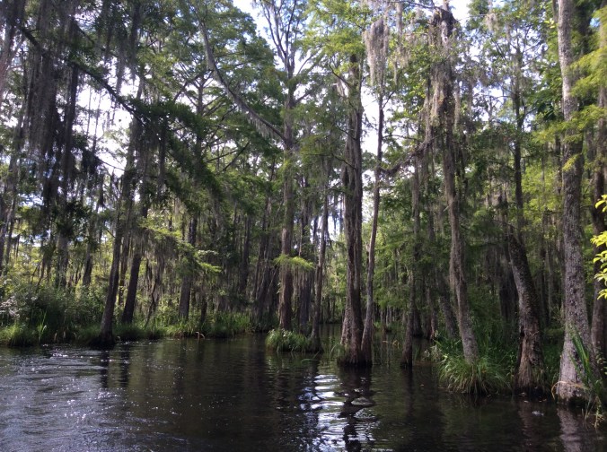
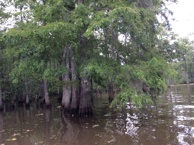
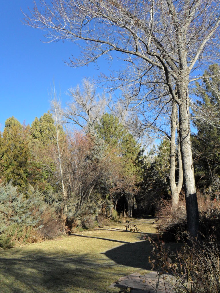
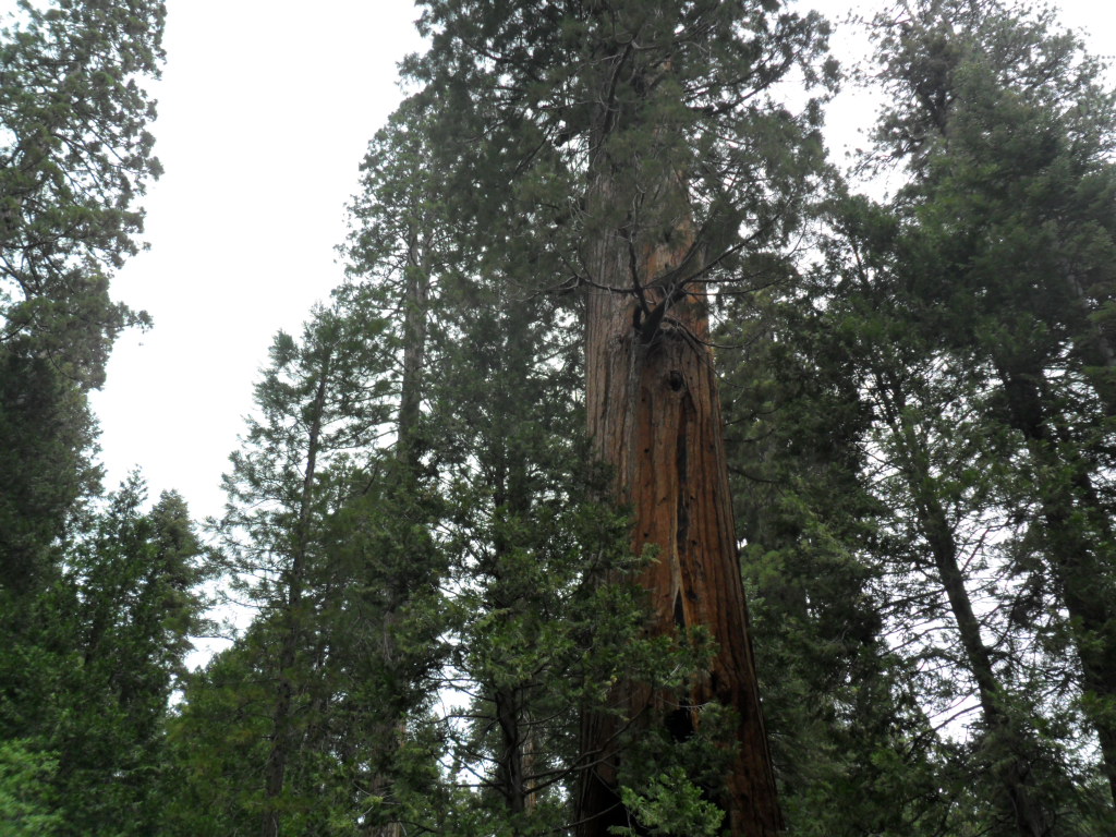
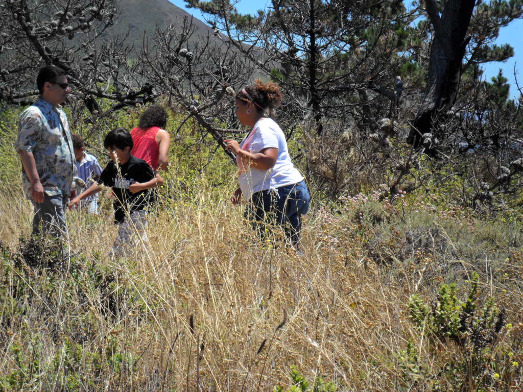
After Las Vegas, we drove to Mojave, California, for the night. The only  scenery on this drive is through a canyon on the Interstate.  We experienced high winds and a sand storm and arrived after dark.  The next morning we solved the mystery of the hundreds of red blinking lights on the hillsides, wind turbines.  From there it is a rather short drive,  a couple of hours, to the Trail of 100 Giants in Sequoia National Monument.  To say we experienced amazement is an understatement.  What a magical forest so wet and dark and alluring after miles and miles and miles of hot desert.

SAM_1204

SAM_1205

SAM_1207My daughter, Ema, and her son, D’mitri really enjoy clowning around and what better place than surrounded by the largest trees in the world.  The squirrels here also “talked” a lot and we tried to get close.

SAM_1209

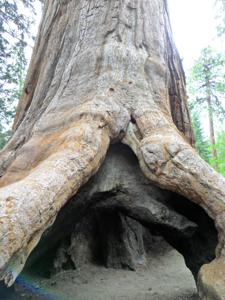
Usually, I frequently dislike photos of me, but this one is an exception.  Although not large, this tree stood out as so unique I could not resist a photo shot.  Even with the best camera, I doubt a photo of an entire sequoia tree is possible.  You have to see them to obtain the full effect.

SAM_1210

We wanted more time with the trees, but needed to make it to Carmel by evening so headed down the mountain toward California Hot Springs.  Altitude is everything here.  In ten minutes the golden hills replace giant trees.

SAM_1218

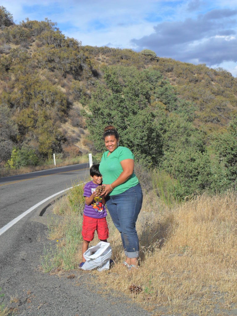
Then, in an hour or less, we were driving across the Central Valley past miles of vegetables and at least three types of trees in huge orchards or groves.  The only tree species I was able to identify was almonds.  I wanted to take pictures, but did not desire to arrive in Carmel at my college roommate’s house in the dark so I kept driving.  No quick road exists that crosses California except way to the south.  This still astonishes me.  Two lanes with heavy truck traffic take a long time to get from one destination to another.  We decided to cross on 198 through Coalinga to San Lucas which resulted in a fun, scenic drive with lots of twists and turns.  Much to our surprise, huge pine cones lay everywhere beside the road.  It seemed strange that these cones came from a tree much smaller than the Sequoia.  Ema and D’mitri collected some to display at home.

SAM_1219

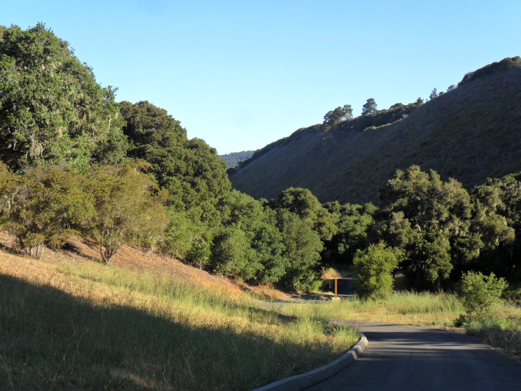
Finally, just before dark we arrived at the Rinaldo’s.  Suzy and I roomed together at Grinnell College at the ages of 18-19.  David attended Grinnell also.  We only see each other once or twice a year but can pick up conservations as if it were a few moments ago.  They live in the Santa Lucia Preserve.

SAM_1268

SAM_1258

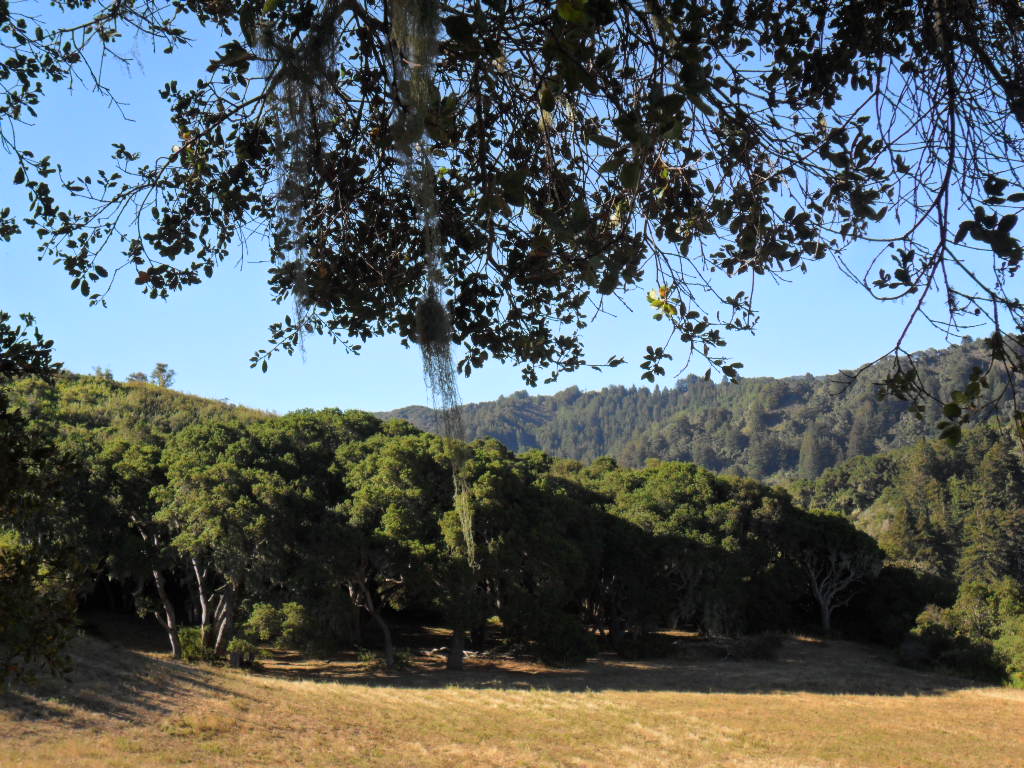
Every morning this deer casually ate California poppies and ran away only if I went outside too quickly.  One morning I took a long walk up one of the few roads on the Preserve.  I love the live oaks and learned they are very fire resistant so residents are allowed to let them grow close to their houses.  Everything else, except for a few native grasses and plants–no trees or brush, must be cleared for 150 feet all around any house.

SAM_1259

SAM_1265

SAM_1264

SAM_1262

SAM_1261

I commented on the radiant red colors I saw in the leaves of an attractive plant only to find out it is poisonous oak and if I touched it, the result would not make me very happy.  It must love this particular environment because it grows everywhere.

One of my favorite restaurants is at the Hacienda at Santa Lucia Preserve, not because of the food, but due to the impeccable service and enchanting atmosphere, what I imagine to have existed in old California.  D’mitri says it is his favorite fancy restaurant on the trip.

SAM_1221

SAM_1223

SAM_1228

SAM_0103

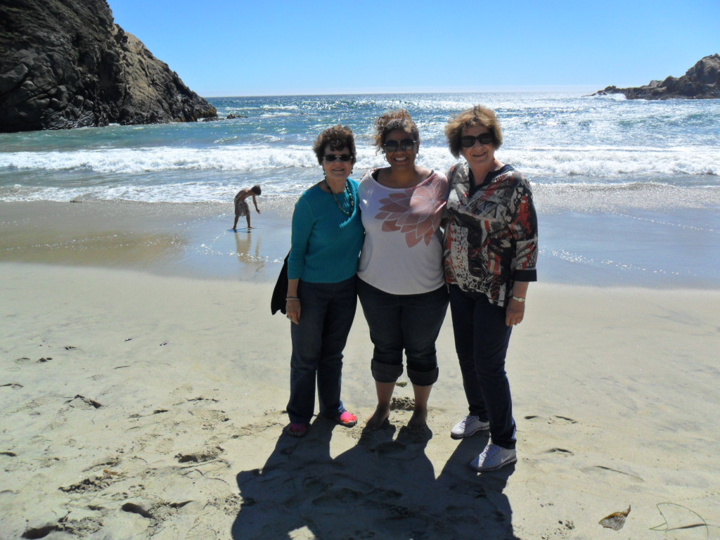
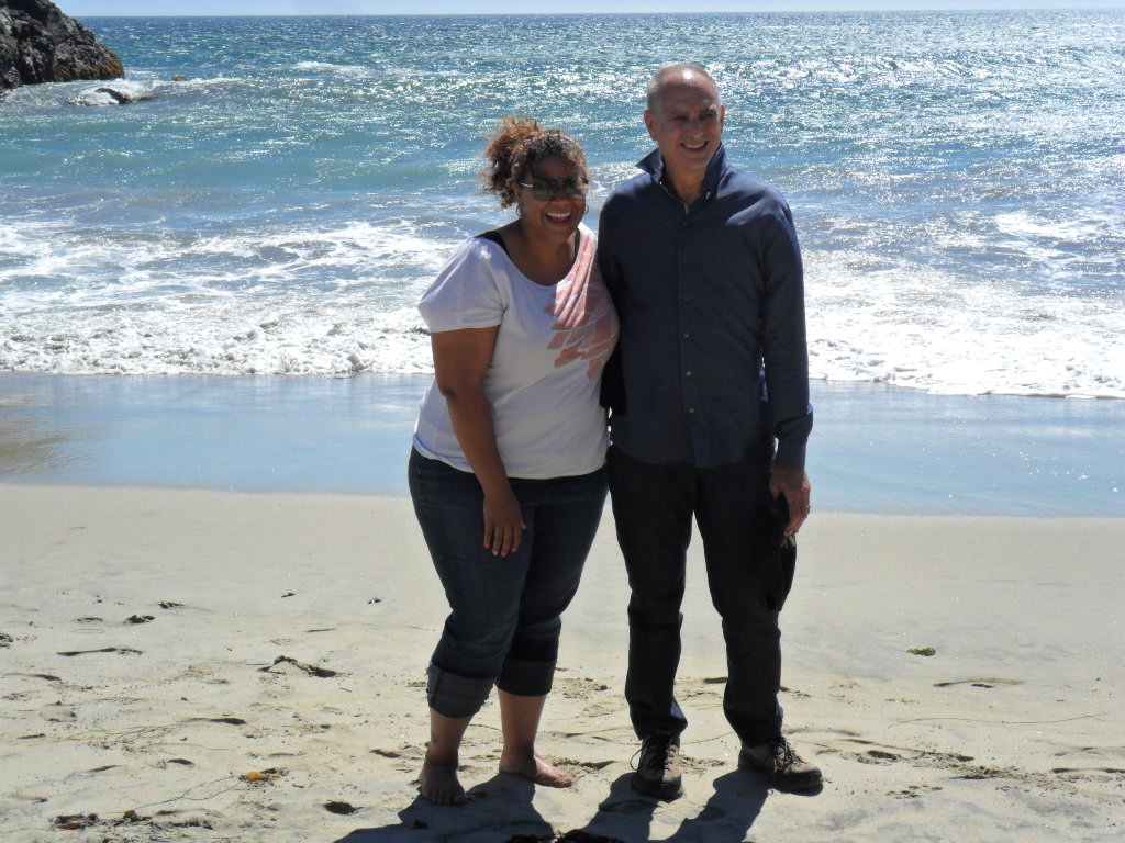
In the dark, driving back home to David and Suzy’s, we saw a bobcat, several deer, wild turkeys, a skunk, and another animal we could not identify.  The next day we ladies went shopping in Carmel while David and D’mitri took a ride in the Porsche and swam.  No one can go near Carmel surely and not drive the glorious drive south to Big Sur.  D’mitri loves water so we stopped at two different places along the way.

SAM_1238

SAM_1239

SAM_1241

D’mitri became quite alarmed when Suzy told him many of the bushes along the path are poison oak.  David informed us that a really wonderful beach existed down the road if we could get in.  Off we drove to Julia Pfeiffer Burns State Park.  They only allow so many cars into the park at once so we had to wait until someone left.  It was worth the wait.  This beach does not allow swimming; people have drowned here.  Nevertheless, who cares; the drama of crashing surf, giant holes in rocks worn by water, and trees shaped by wind and erosion make it magical.

SAM_1245

SAM_1252

SAM_1251

SAM_1250You cannot go down highway 1 without stopping at Nepenthe.  This restaurant’s views alone are worth going there, plus a gift shop full of finds from all over the world.  The wine list and hamburgers finish off the list of why you must stop here if you are anywhere near Big Sur.

SAM_1255

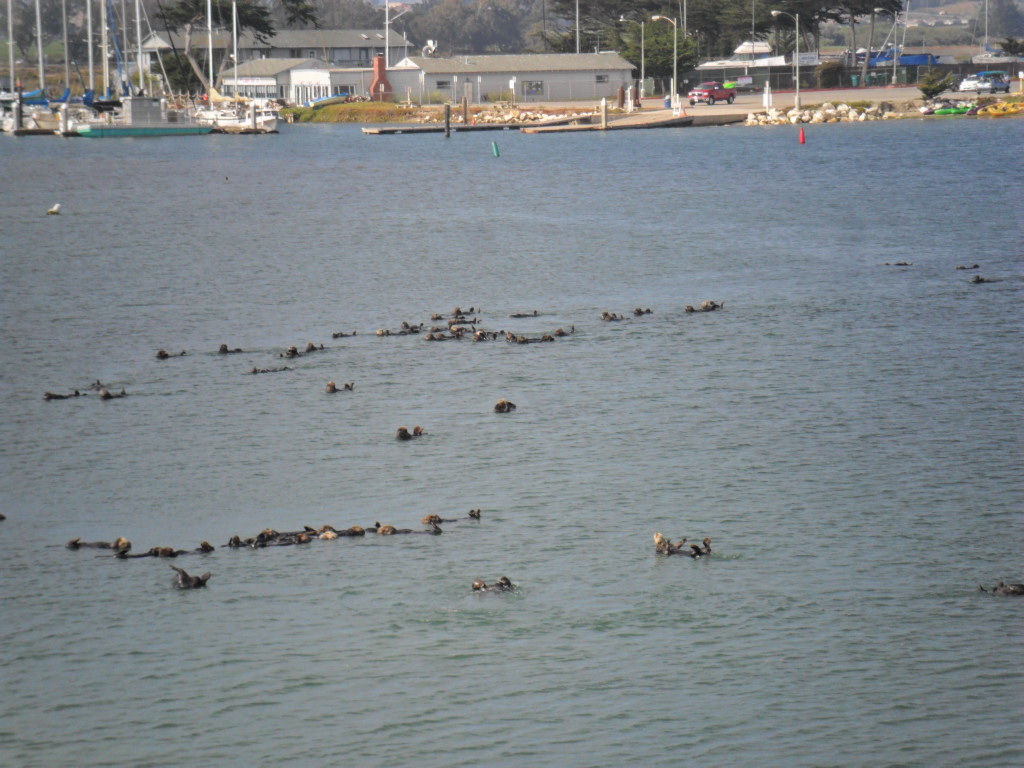
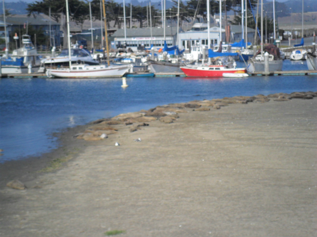
Time seemed to run rapidly; with only one day left, we decided to head to Moss Landing to see the seals.  Much to David’s astonishment, not only did seals lay all along the beach, but a large number of sea otters were playing in the water, rolling over and over, splashing.  David had been there many times and never seen anything like this.  The sea otters delight the watcher with their playful antics.

SAM_1271

SAM_1272

Unlike the ever playful sea otters, the seals just lay still like large rocks along the beach.

SAM_1274

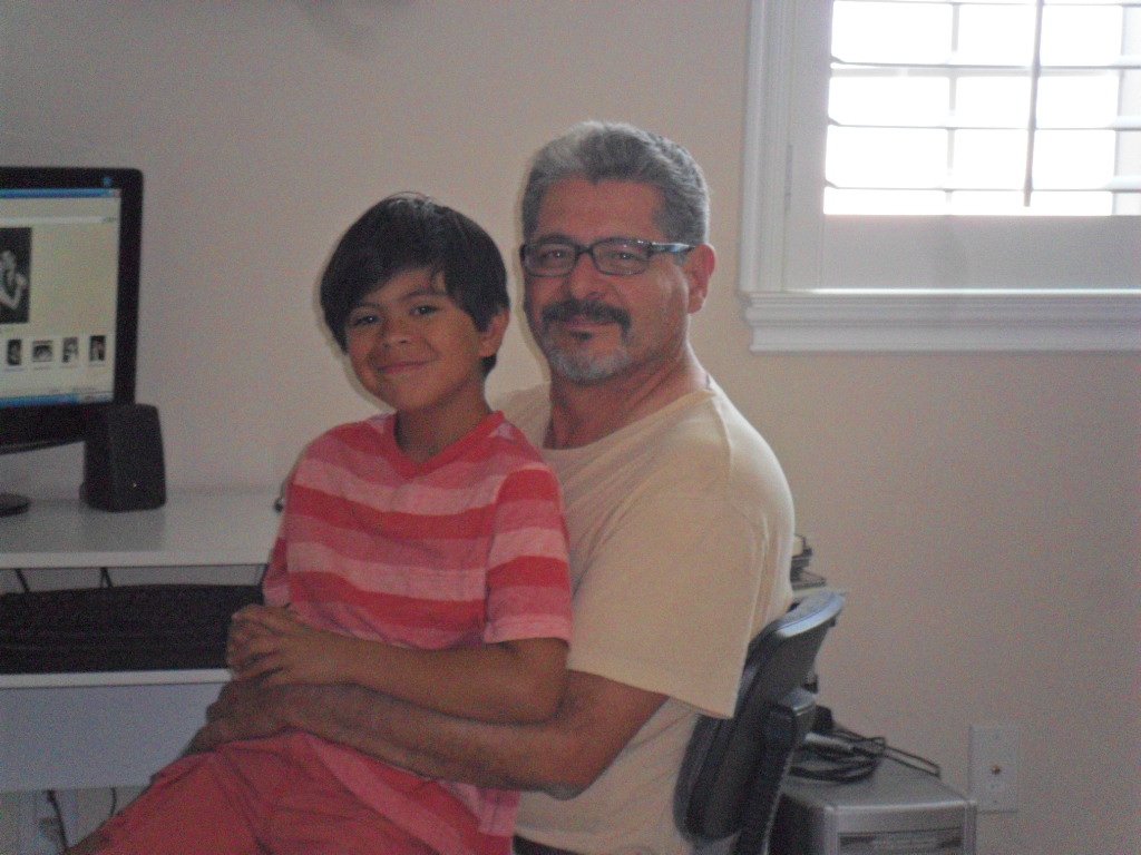
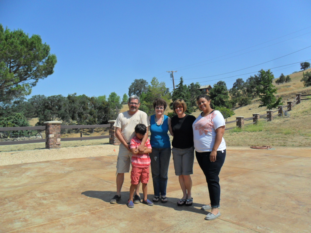
Early on a Saturday morning, Suzy and David fed us waffles to fortify us for the long drive to Flagstaff, nearly 700 miles.  We crossed over to Salinas, then down 101 and finally through Bakersfield where we found a delightful, rather elegant Italian restaurant for lunch.  The good looking waiter chit chatted and provided excellent service, three pluses when you go out to eat.  As we cut across the middle of California, headed for I-40 eventually and neared Tehachapi, Ema decided to call D’mitri’s other grandparents who have a house there. When we went the other direction almost a week before, they had been vacationing in France.  To our surprise, they answered and asked us to stop for the night.  D’mitri’s excitement was contagious.  He expressed special delight to have his grandfather to himself for hours instead of needing to share him with other grandchildren.  The Herreros live on a hillside with a breathtaking view for miles.  Unfortunately, the haze prevented proper photography so I gave up on the idea of capturing the endless panorama.   However, this presented itself as the perfect opportunity for family photos.

SAM_1278

SAM_1280

SAM_1285

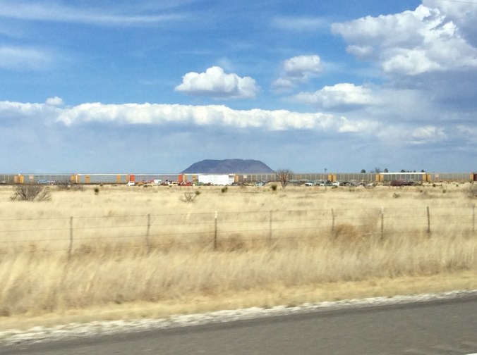
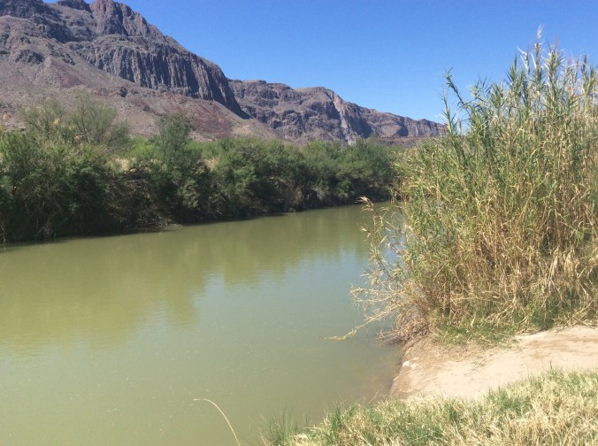
The California desert never comes to mind when I think of California.  I always fly to San Francisco or Oakland and visit friends or conduct business.  Unlike the glorious red rocks and drama of southern Utah and northern Arizona or the saguaros of  southern Arizona, the California desert maintains an endless pale tan color with only a few tiny plants.  Thanks to air conditioned automobiles, you can drive for miles, escaping the intense heat.  When we finally stopped at a Dairy Queen for a refresher, D’mitri and I stepped out of the car and were nearly knocked over by the hideously hot wind.  In general, I like heat, but this seemed overwhelming.  When we drove off, I asked Ema about the temperature.  She looked it up on her smart phone, 118.  The only truly beautiful I sight I saw (and I think nearly everywhere possesses some sort of loveliness) occurred when I drove over the mighty Colorado River, surrounded by the only green for miles.  After this heat, the cool, green beauty of Flagstaff enchanted us.  We settled into our hotel room, then drove off to our third Italian restaurant in two days, Oregano’s.  Instead of the usual coloring books, puzzles, etc. offered to children, this place gives them pizza dough to mold.

SAM_1287

As we drove home, I noticed how terribly dry it is once we dropped out of the mountains around Flagstaff.  Off and on we crossed areas where there had been enough rain to create a pale green.  Apparently, it had not rained west of Albuquerque because it still looked like brown winter just as it had eleven days before on the first day of the trip.  East of Albuquerque we encountered such an intense downpour with some hail that I could not see to drive.  I pulled off the road and waited. From Albuquerque to Amarillo, in the eleven days we were gone, it had rained enough to make the mountains, foothills, and high plains a lovely soft emerald.   We had missed the hot, 100 plus week and came home to rain and cooler weather that lasted several days.  In one week, the weather had changed from record highs to record lows, the typical extremes one learns to live with on the Llano Estacado.