This book was not quite what I expected. It is somewhat memoir in that she talks about her career as a journalist accompanied by photographers and such which is not really on your own, about her marriage and divorce, the new guy, and actually traveling on her own. However, a large part of it, which is quite fascinating, is the history of the solo women travelers in history starting with the nun Egeria, who wrote about her own travels throughout the Middle East in the years AD 381-384. Centuries later the book, “Itinerarium Eerie”, provides the details of her journeys and her “boundless curiosity”.
The book provides details of the adventures of many women who traveled solo: Emily Hahn, Nellie Bly, Martha Gellhorn–once married to Hemingway, Annie Londenberry, Gertrude Bell–the first woman to ride by camel across the Empty Quarter in Saudi Arabia, Helena Swanwick, Ethel Smyth, Jean Baret–the first woman to circumvent the globe, Isabelle Eberhardt, Elspeth Beard. I realized in reading this I had actually read about one of these women, Sarah Hobson, who rode all over Persia (Iran) on horseback disguised as a man and have read several books about Gertrude Bell. In the 1700s, Jeanne Barat sailed around the world on a scientific expedition disguised as a man. In 1983, Elspeth Beard circumvented the globe on a motorcycle to heal the trauma she had suffered. Others rode bicycles, some used various forms of navigation, but all defied the norms of their time. Many encountered all sort of dangers and nearly died.
Yes, the book does give women advice on how to travel safely alone, what to pack, etc. And toward the end she tells the reader how to find adventures nearby in the countryside or streets where you live, how to open the eyes and ears, all the senses, and notice your surroundings in new ways.
Arcosanti, an innovative village 70 miles north of Phoenix in the high desert, houses between 80-100 people who currently live there full-time. To become a resident, a person has to apply, take a five week course, and be able to contribute to the community. Their major business is making bronze bells in their foundry. They also host conventions. The week before I arrived, they hosted a convention of the executives of a corporation.
A few rooms of varying sizes are available to rent. They are pleasant with a view and modern amenities but not luxurious in the way some top hotels are. Here are views from my room.
After I arrived and unpacked, I took a walk up the hill and around the buildings.
This is a sort of giant classroom where it appeared they had been teaching how to make ceramics. The buildings are unique with the concept to fit in with the surroundings and take as little energy and resources from nature as possible.
This is the other side of the building in the previous photo. It is very hilly here and the buildings are build on the side of a steep hill.
The same building from a different angle. It was very windy when I was there and part of the area was closed due to the wind. There are bells everywhere and all were ringing in varying musical tones.
I walked down the road from my room, on a long trail, and up a steep incline to arrive across from the buildings so I could take these photos.
A closer view from across the arroyo.
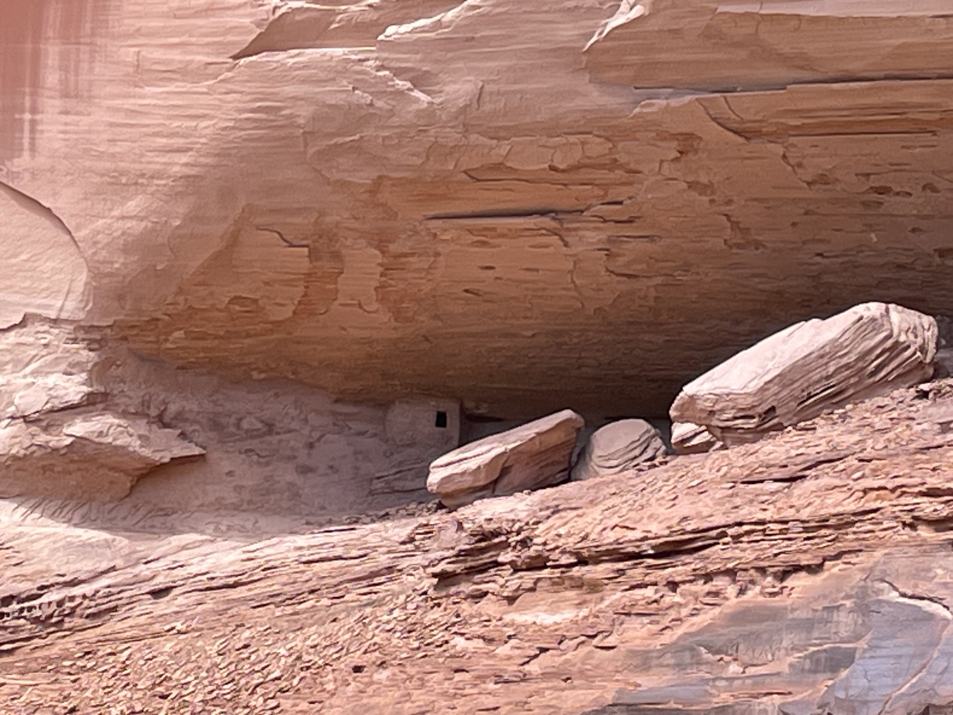
This is across the arroyo from the main buildings. In the shadow, there is a door. I never learned what all this is for or what might exist behind the door.
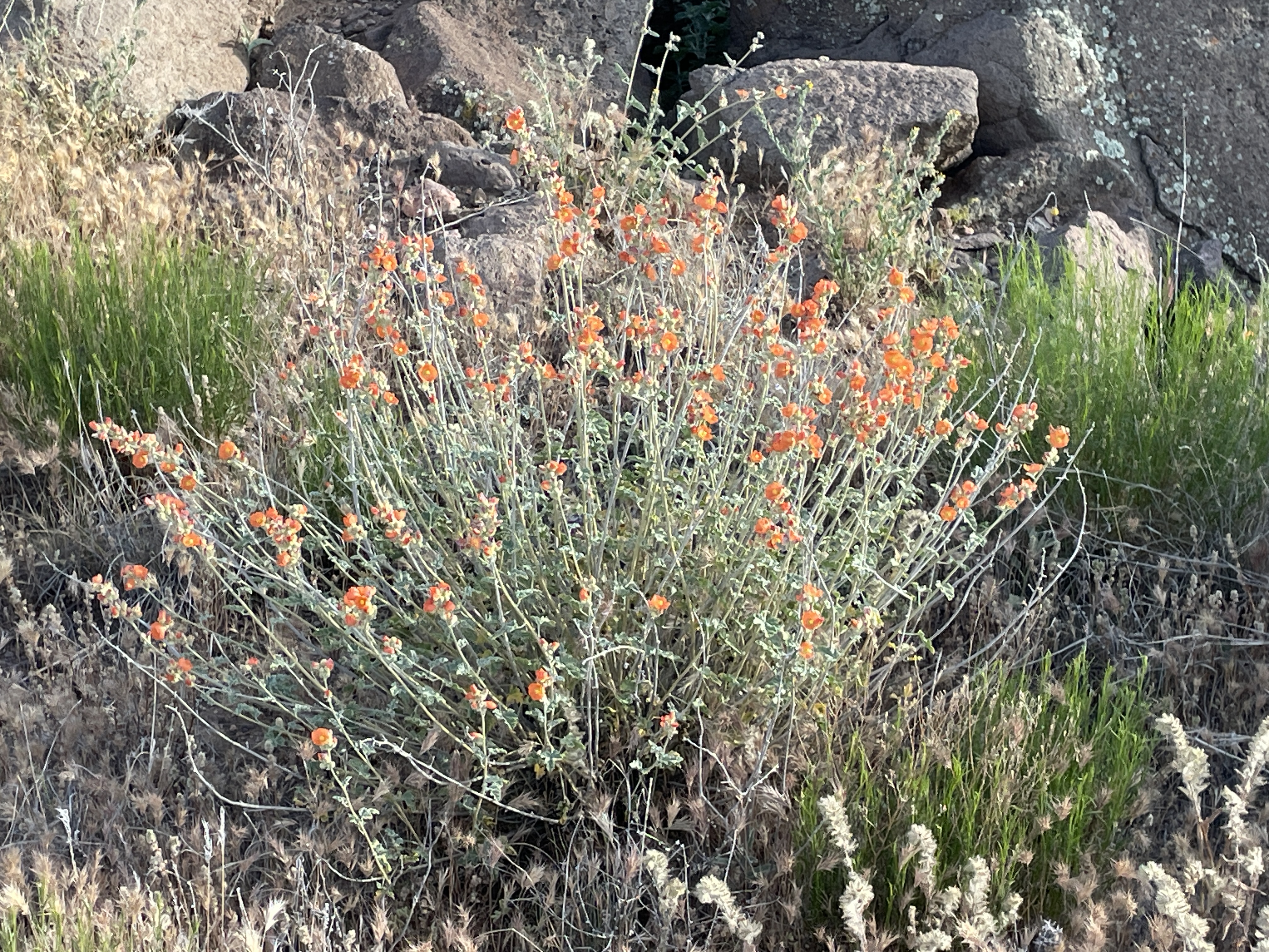
All sorts of wildflowers were blooming when I was there in May.
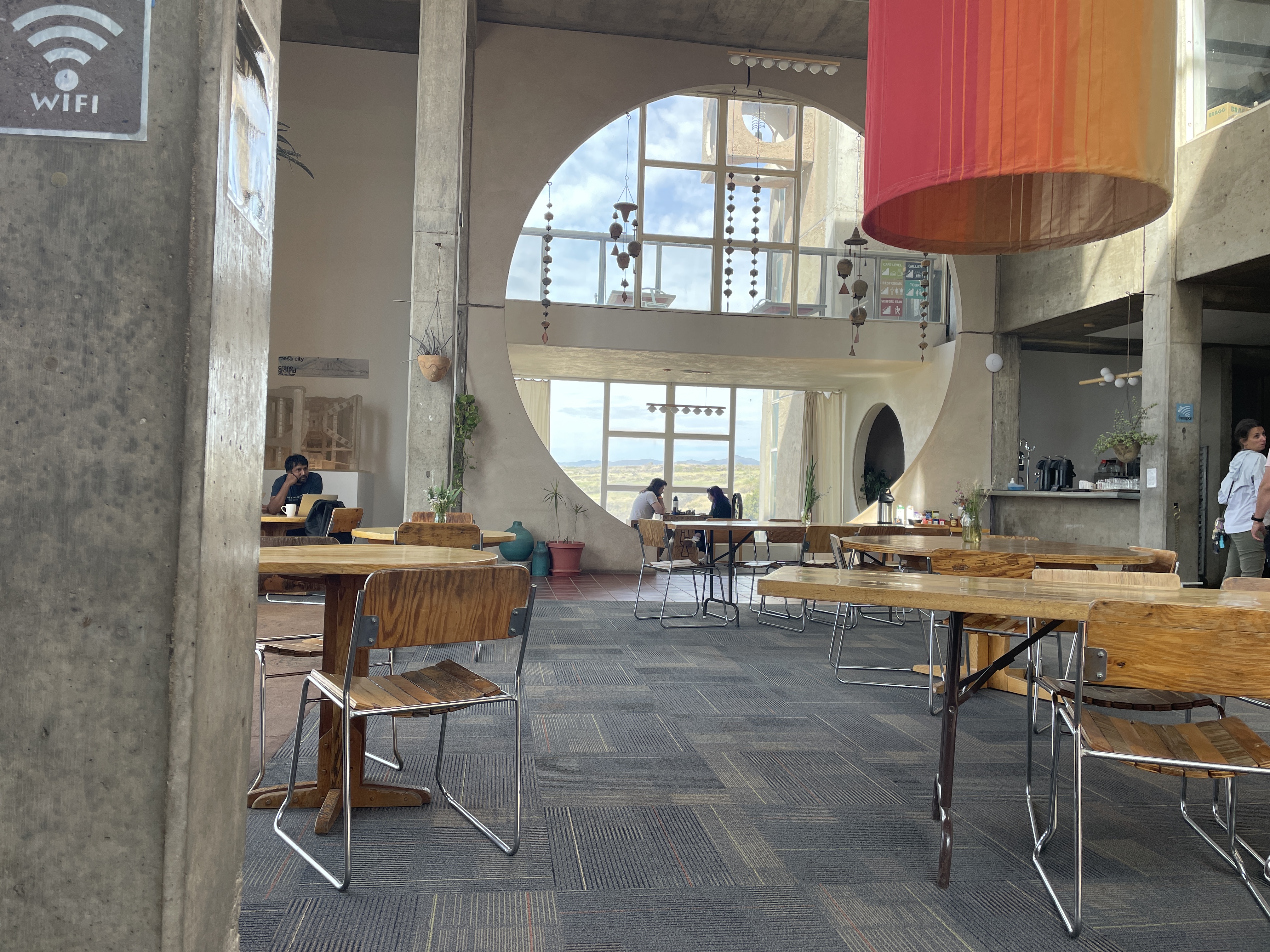
The restaurant is unique and delightful. They serve excellent coffee–one day some was lavender infused–and various other simple dishes and pastries they make on site. The orange column you see is installed in winter to provide natural heating using natural airflow and taken down in late spring. This is a unique and pleasant place to visit. You can take tours. If you stay there, you can wander around freely. And, of course, you can purchase bells from the very small to some that are quite large and like metal works of art.
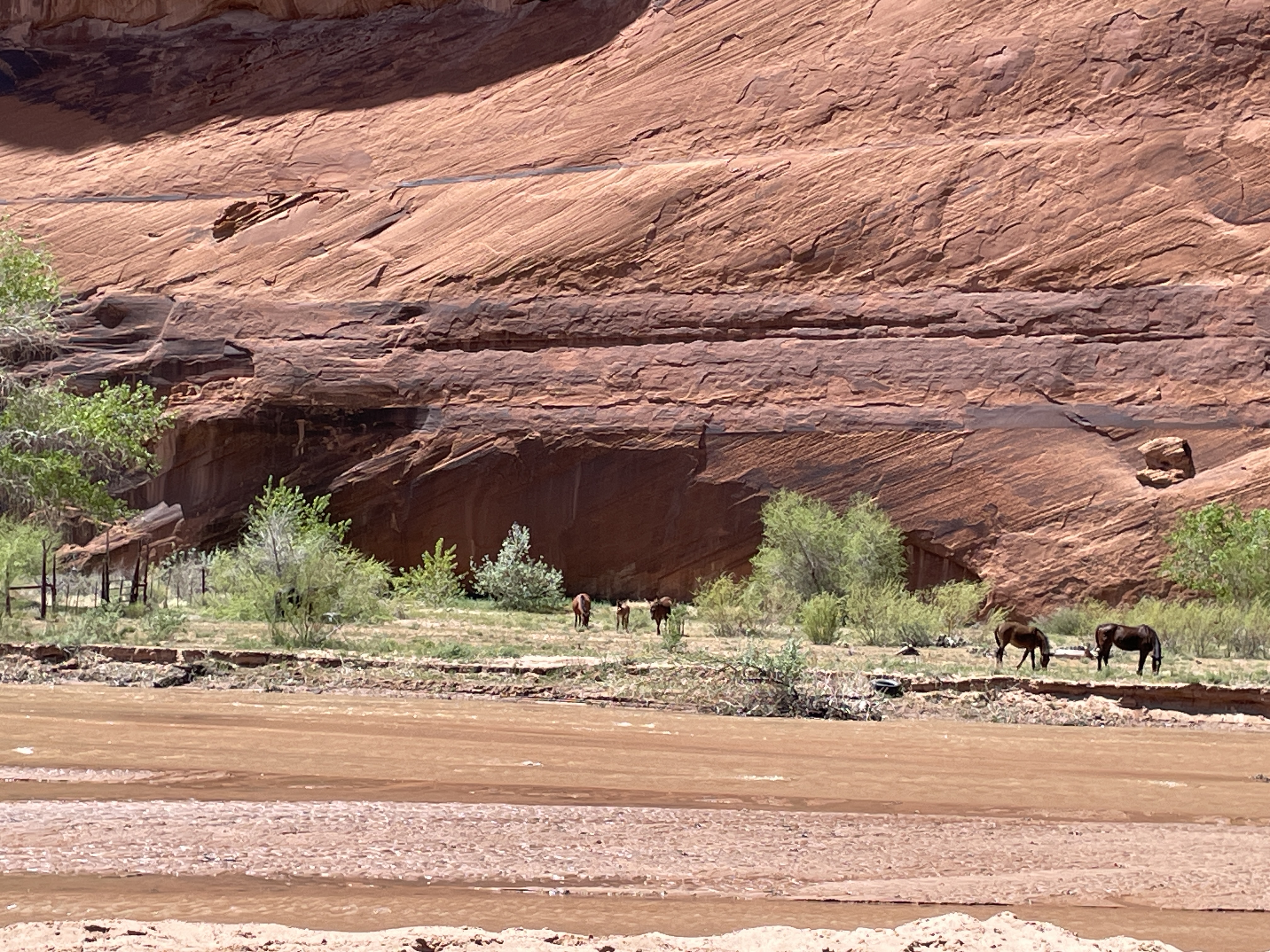
Canyon de Chelley was named by the Spanish who could not quite pronounce the Diné (Navaho) word for it and hence this name which is pronounced like de shay. It is more than 30 miles long and has a river running through it at least a substantial part of the year. In summer native people live there with sheep, horses, etc. even though fewer and fewer of the younger generation choose to do so. To enter the bottom of the canyon, you must acquire a permit and hire a Navaho driver. This is to protect it from the vandalism that occurred in the past. Canyon de Chelley is jointly managed by the National Park Service and the Navaho Nation.
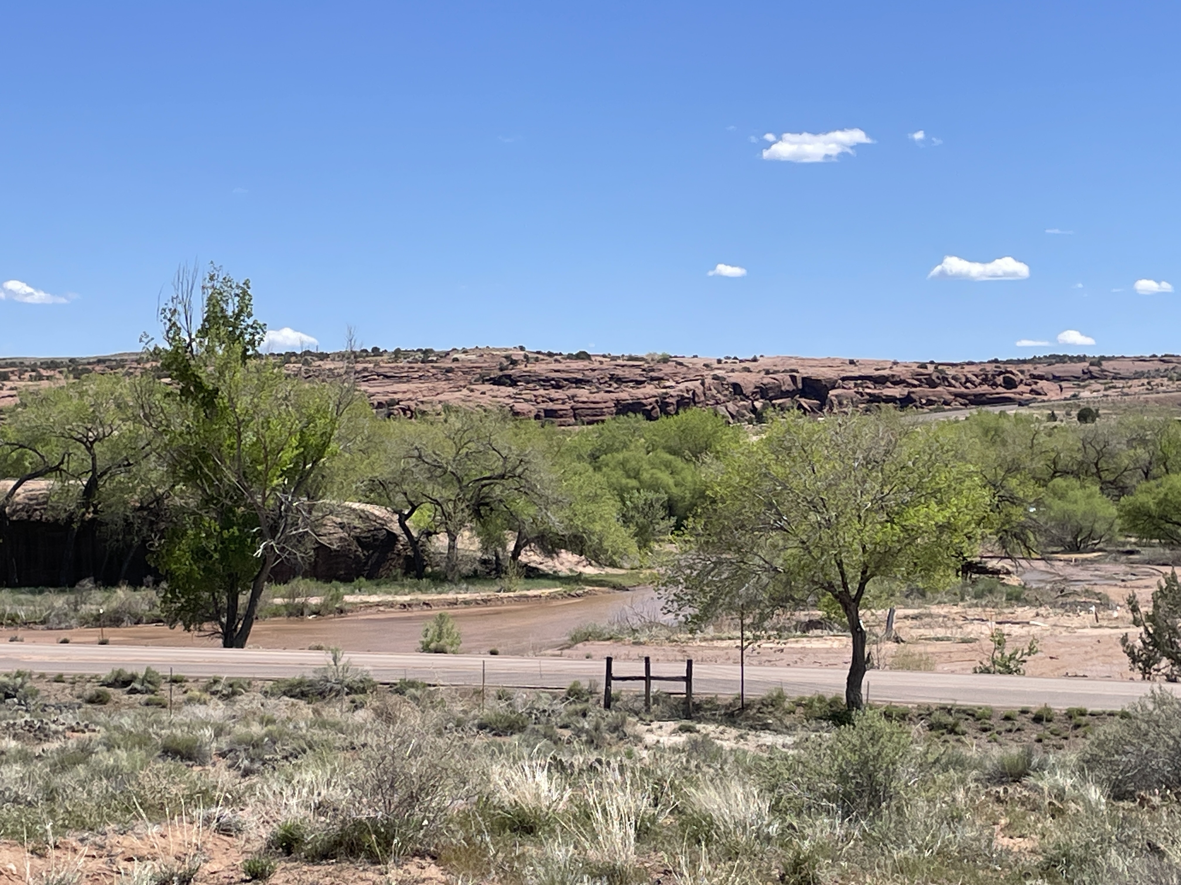
Canyon de Chelley begins at the edge of Chinle, AZ, near the Holiday Inn which, by the way, serves traditional food such as mutton stew and blue corn fry bread. Yes, I ate both. This photo shows the beginning.
It was quite a trip; I sat between two women in the back of a Jeep with a perfect view of everything right in front of me. Oscar, the driver, knew exactly how to traverse the water, the wash (what they call this stream), run up and down the banks.
Driving right up the middle of the wash.
Petroglyphs can be seen in so many places we stopped that I lost count. Oscar said they are nearly endless and can be found throughout the canyon walls.
A few days previous to our arrival it had snowed so everything was green and lush from snow melt.
In addition to petroglyphs, there are etchings in the rock walls.
In this case an etching/rock carving of horses.
Yes, we drove under this overhanging tree limb.
Sometimes the wash was narrower and deeper and we drove up and down steep banks and through deeper water.
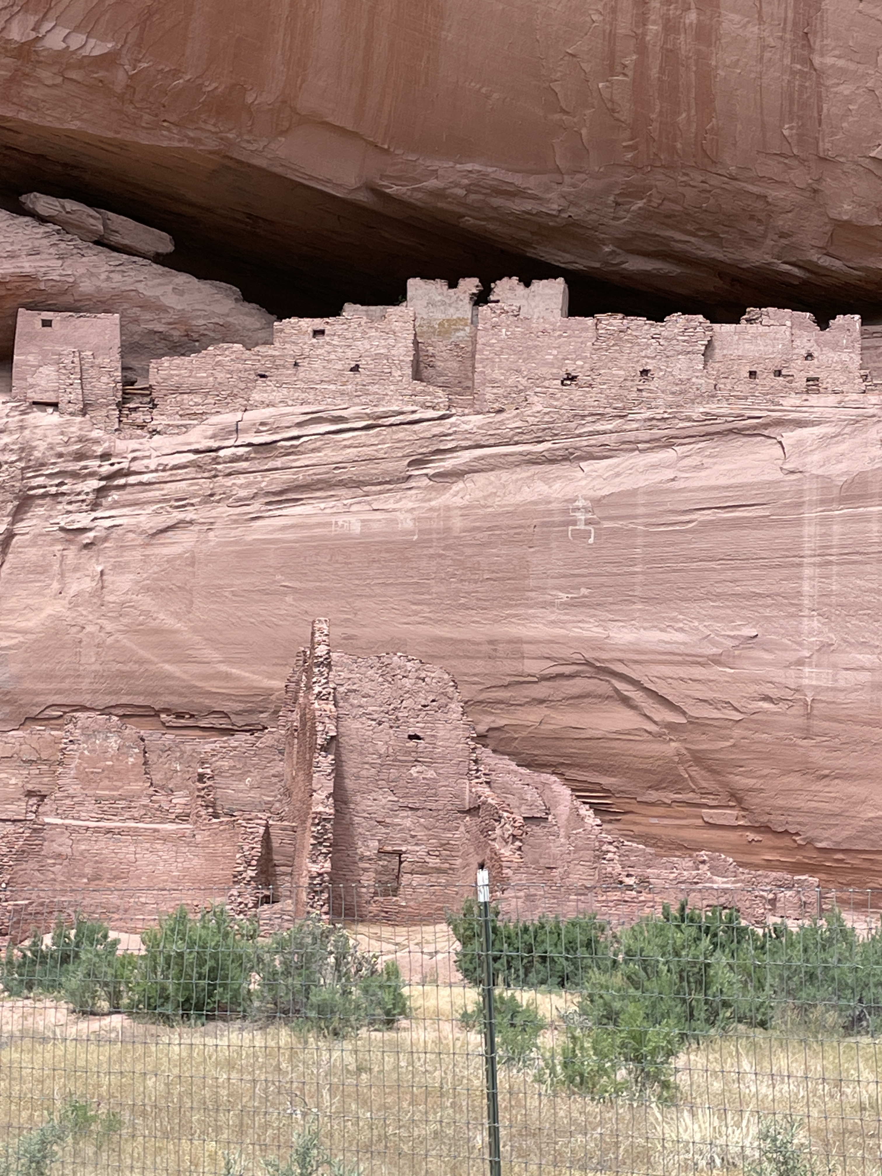
Ancient pueblo people lived here for centuries, some more than 5,000 years ago. This is one of the largest pueblo structures in the canyon (The White House–due to a white washed wall which you cannot see from this vantage point). The fence was built to protect it from vandals. We saw many smaller dwelling places and Oscar said there are hundreds in the canyon.
Headed back down the wash. This was a half day trip so only saw less than half of the canyon. You can hire for an all day trip complete with picnic lunch and go all the way to some of the famous formations that can be seen from the road at the edge of the top. There is also a side canyon called Muerto–due to a massacre of the natives that occurred after the Navaho forced long march.
The Jeep needs a bath after this trip.
Note: With a permit and guides, there is camping and horseback riding trips up the canyon in addition to this type of tour.
One of the most famous canyons in the country resides inside the Dine (Navaho) Nation. While administered by the National Park service, it is also the home of several Dine families. You can drive through the roads on the top freely, stop at various viewpoints, take photos, etc. Here are the various views I saw last week while there. The bottom of the canyon is restricted. To go there, you need a permit and a Dine (Navaho) guide. More about that in the next post.
Several families live in the bottom of the canyon, especially during the summer months. You cannot go into the bottom of the canyon without a permit and a Navaho guide.
This past weekend I headed to Mexicali in Northern Baja to visit the town of San Felipe and see a new development about an hour south of there. San Felipe is a small fishing town of approximately 20,000 people where there are no fast food restaurants and no Starbucks. Excellent restaurants and good coffee can be found but not at the places mentioned above. They do not exist there. The town of San Felipe has a long boardwalk right along the Sea of Cortez with restaurants across the street. This past weekend they were holding a ceviche contest and fiesta on a cross street. This is shrimp season and the city is known for its shrimp. Unlike the Pacific side of Baja, there is no large commercial fishing allowed in this part of the Sea of Cortez because it contains many endangered fish and the place where whales come to mate. Locals can fish and you see smaller fishing and shrimp boats in the sea. Not only is the Sea of Cortez protected but so are the plants and animals in the desert. Certain plants, like ironwood trees, are ancient and rare. If you want to build a road, it has to be around them. Many other species are also protected.
Unlike the Pacific side of Baja, the water in San Felipe is safe to drink from the tap. It comes from an aquifer up in the mountains to the west.
We spent most of Sunday at the new green development (it is totally off grid) called Rancho Costa Verde. Solar is used for power and each house has a large underground water tank where water comes from an aquifer up in the mountains. This is a newer development so although many of the lots are already sold, except for beachfront, many houses are just now under construction.
This is a very modern beachfront property with marble floors and a glass wall facing the Sea of Cortez.
This photo is of the clubhouse and looking the opposite direction toward the mountains. Here I am standing on the roof of the house in the previous photo.
Here I am in front of the pool in front of the clubhouse facing the Sea of Cortez. The house in the first picture is on the left in the distance.
This is desert land where even though it can get hot in summer, the sea breeze keeps it relatively cool.
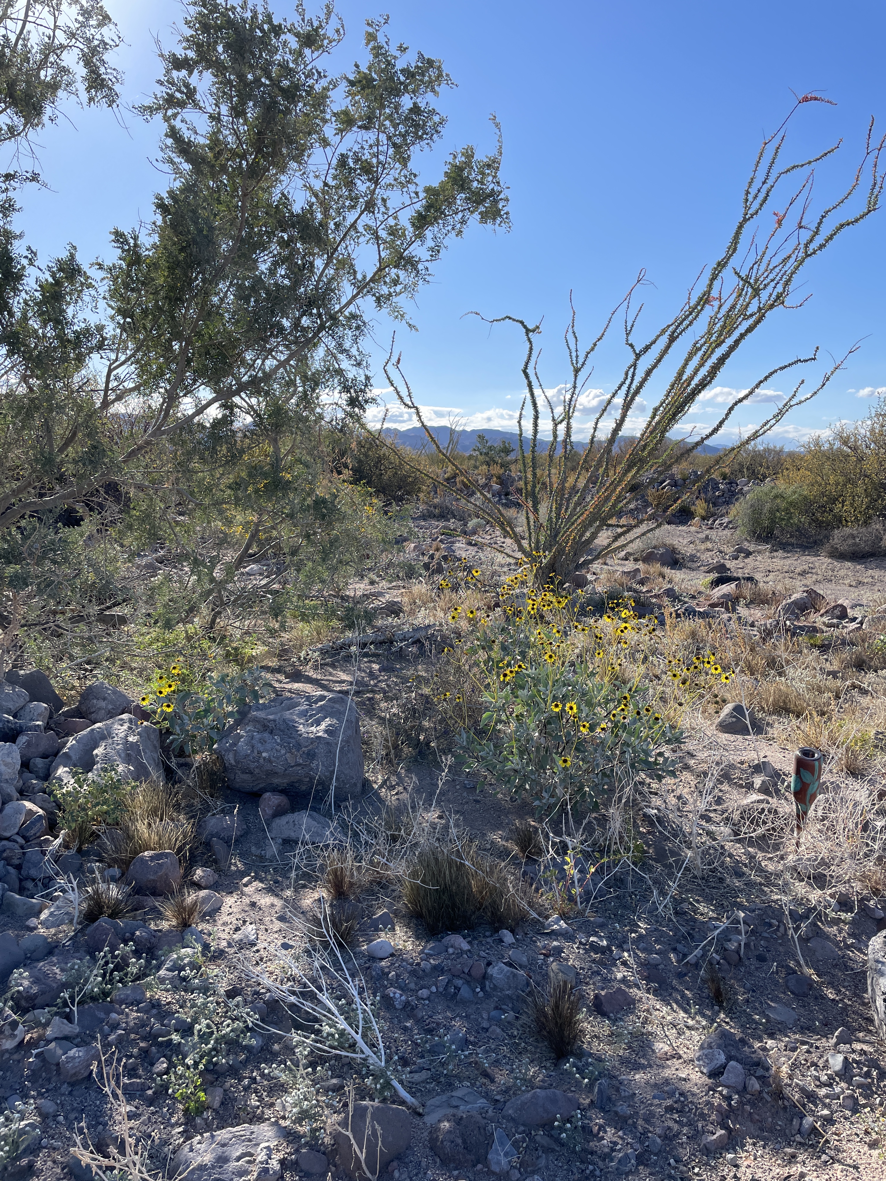
The plant on the right is ocotillo which is protected. If you are building a house and it is in the way, you have to move it elsewhere. You cannot just get rid of it.
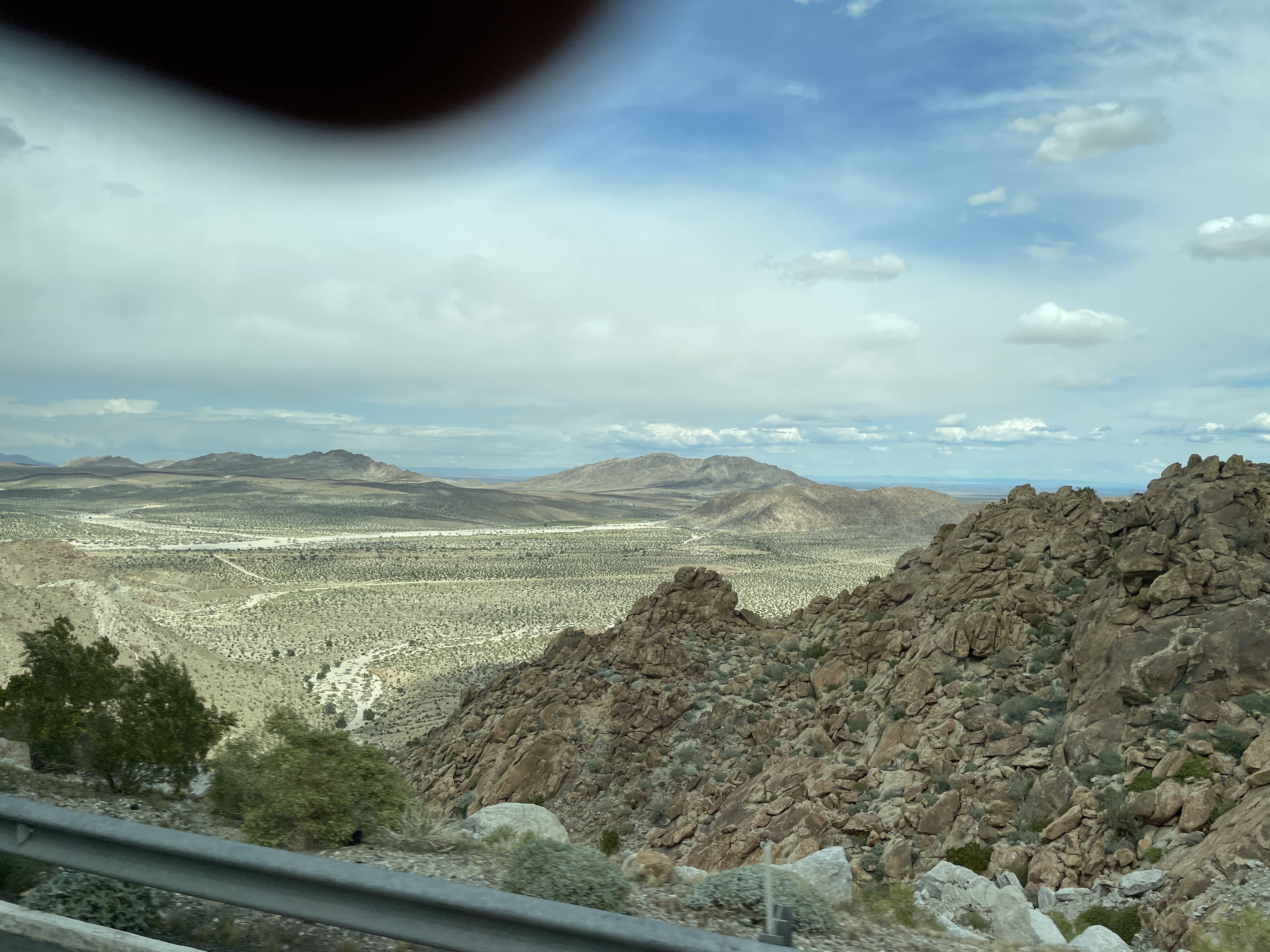
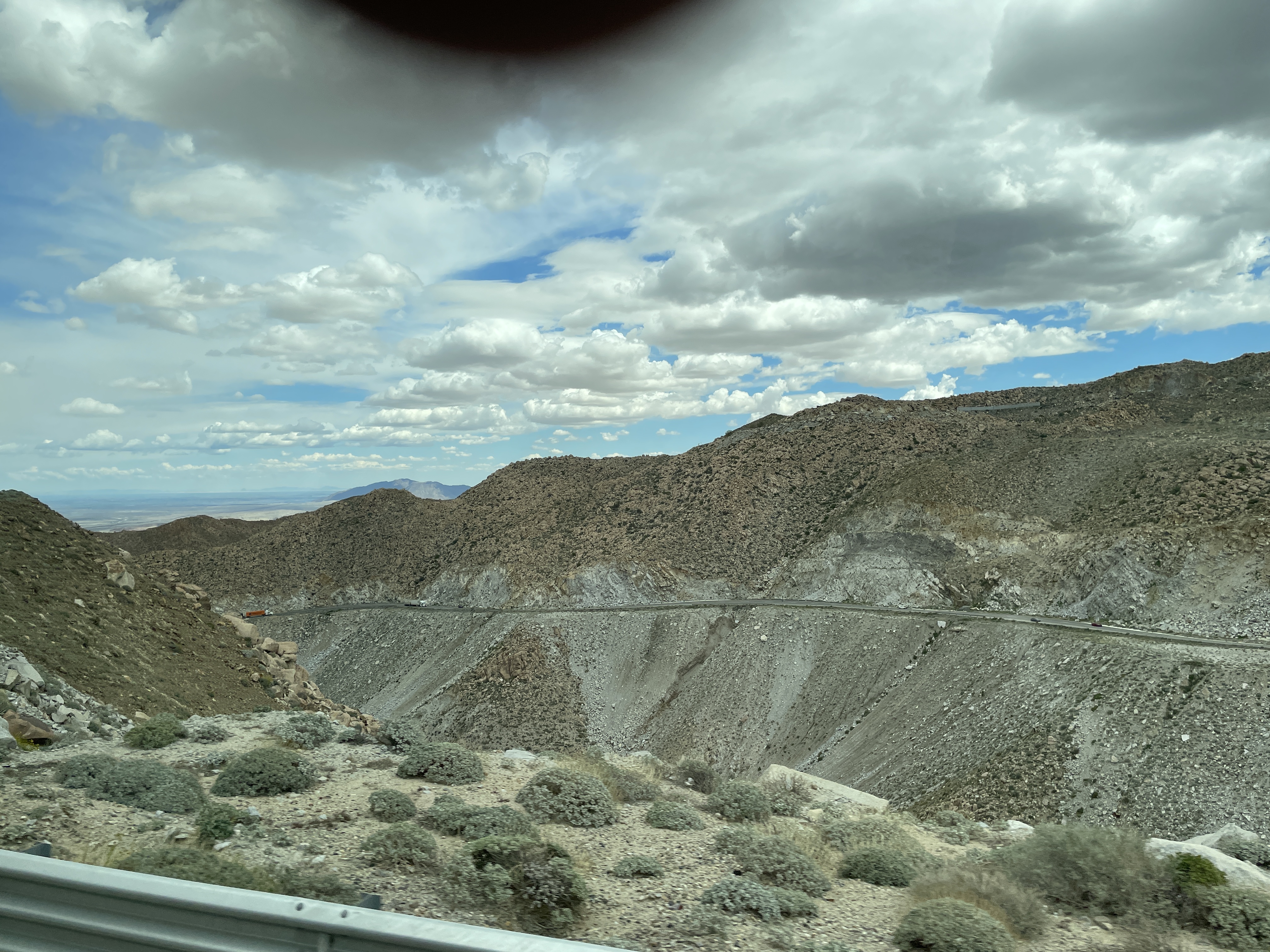
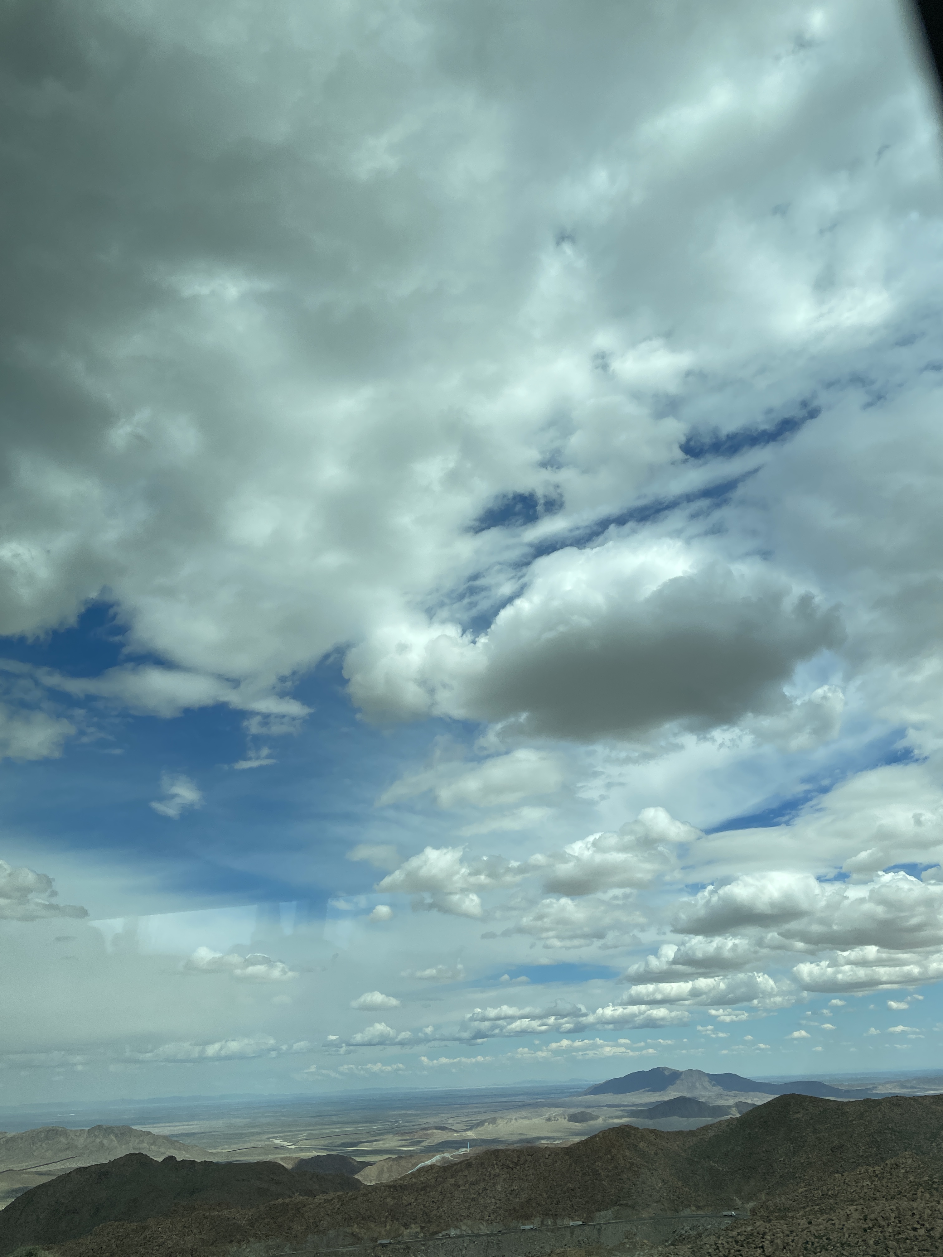
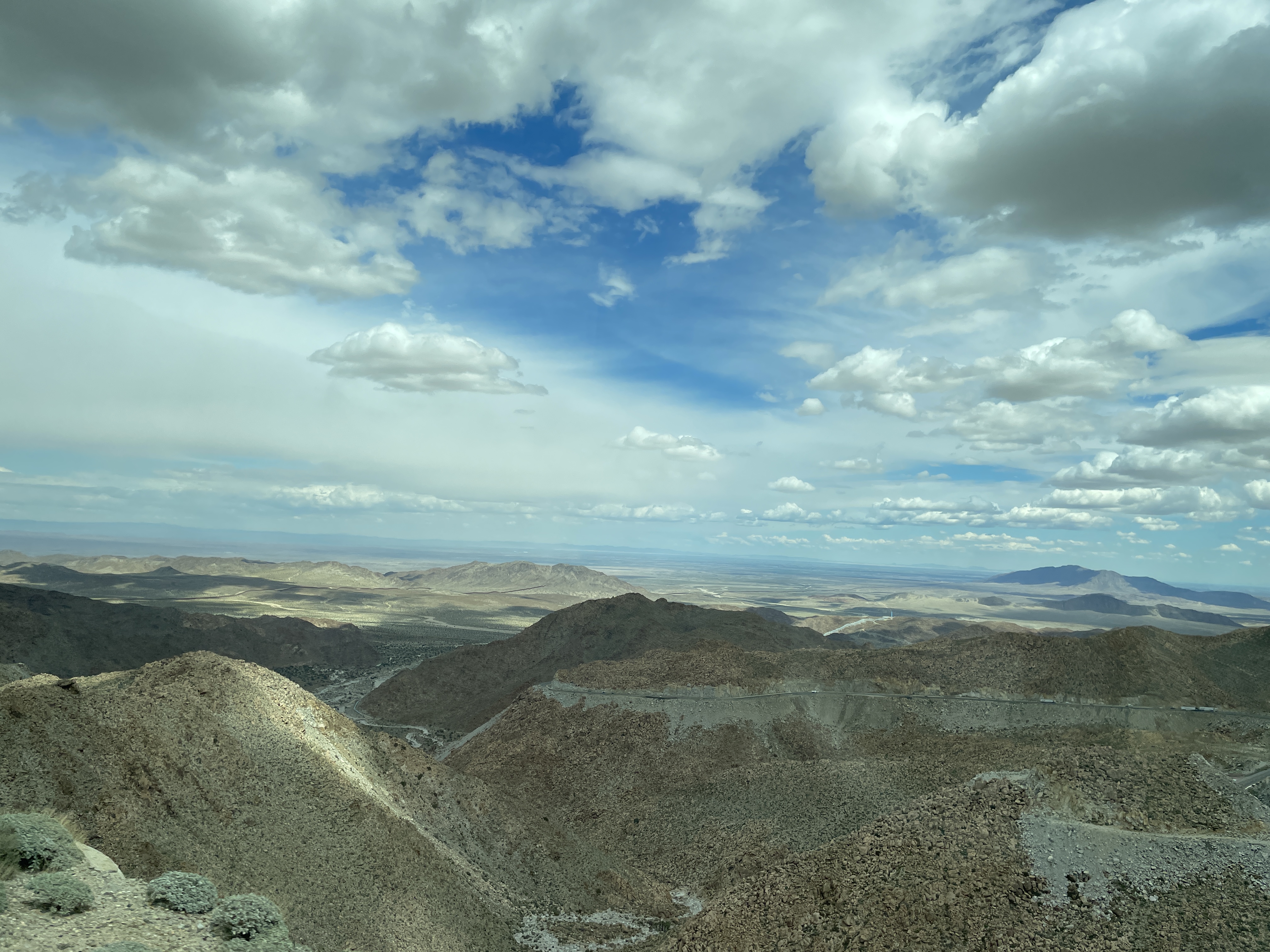
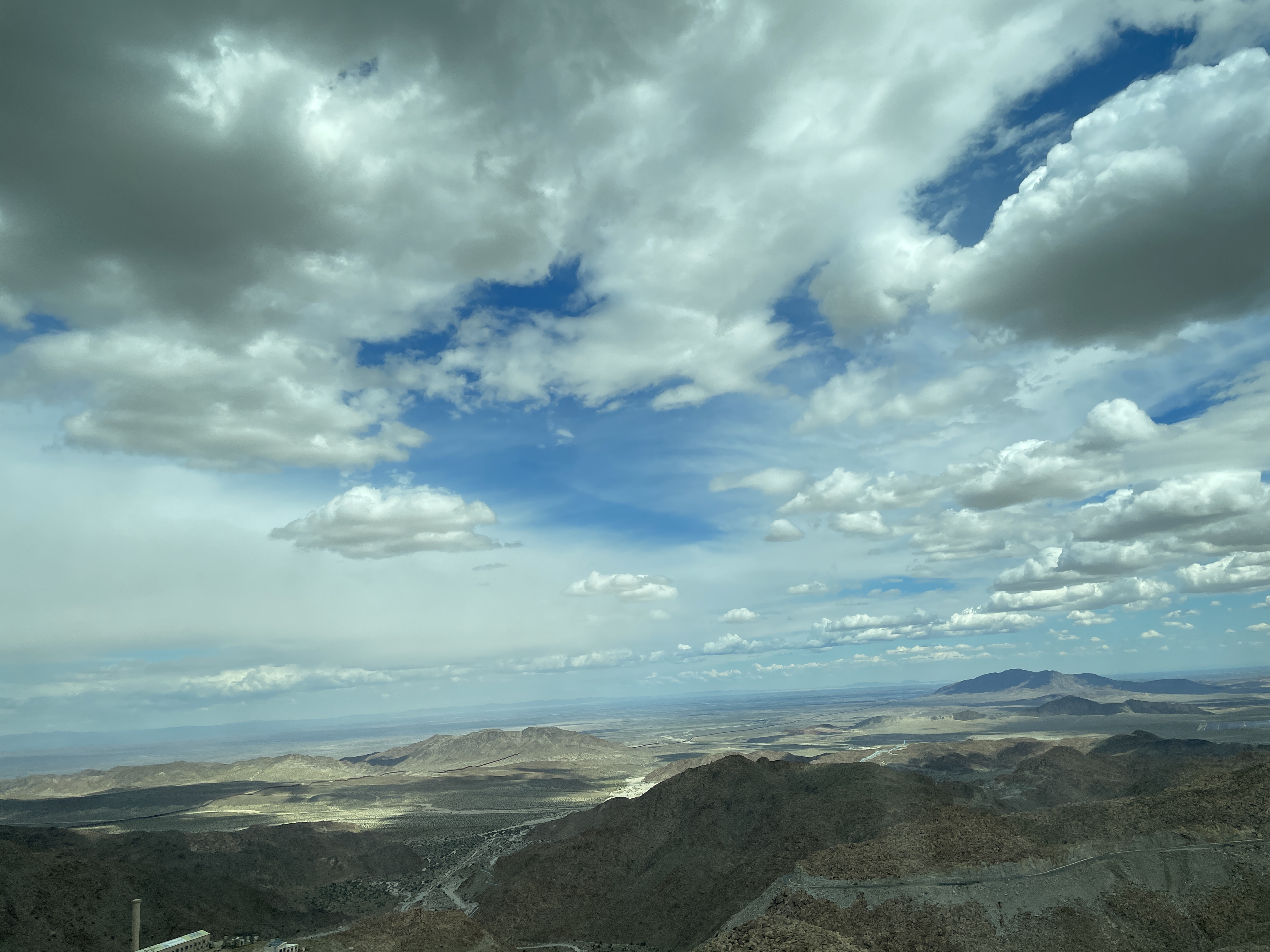
Monday was a big adventure trying to cross the border. We arrived in Mexicali only to discover no busses could cross the border there so we had to take the highway to Tijuana and cross there. To do this you must cross a mountain pass. What a feat of engineering building this road must have been. It is quite incredible and as you climb higher and higher the views go on forever into the far distance. The following are photos I took from the bus window as we drove higher and higher.
These mountains are made of rocks of all sizes that are just stacked on top of each other. Here only these small blue-green plants seem to thrive.
In this photo you can see the highway where we had just traversed.
Here you can see how at this height the mountains are nothing but stacked rocks of all sizes.
After the summit as we went down toward the town of Tecate, it started to rain and it rained most of the way to Tijuana. The Pacific side of this part of Baja gets rain and it was lush green this time of year while the Sea of Cortex side is desert.
I do not recommend crossing at Tijuana in a large bus. Even though we had sent all our passport information in advance, they made the bus sit there for nearly an hour and wait. Meanwhile those on foot and in cars were just zooming along at a rather rapid pace. Then we had to get out of the bus with all our luggage and everything and wait more. I crossed the border (not in a bus) last April and it did not take long at all. I have heard that Tijuana is the busiest port of entry from one country to another in the world but have not verified that. It certainly was busy yesterday.
Off to another winery, Santo Tomas, after visiting the fish market where I glanced at all the fish and saw fish I could not begin to identify. This winery is in a different valley, Santo Tomas Valley, and the second oldest winery in Mexico. Although their official sign says it is 130 years old, it is actually older and originated years before that to produce wine for communion and the Catholic Church.
Rather than have the wine tasting in a building or patio, here they put us on a wagon pulled by an old tractor and transported us to the vineyards where they drove around then stopped to give us various wines to try while we sat on the wagon. Our guides brought along cheese and other goodies for snacks as we tasted the wine.
The main building for production.
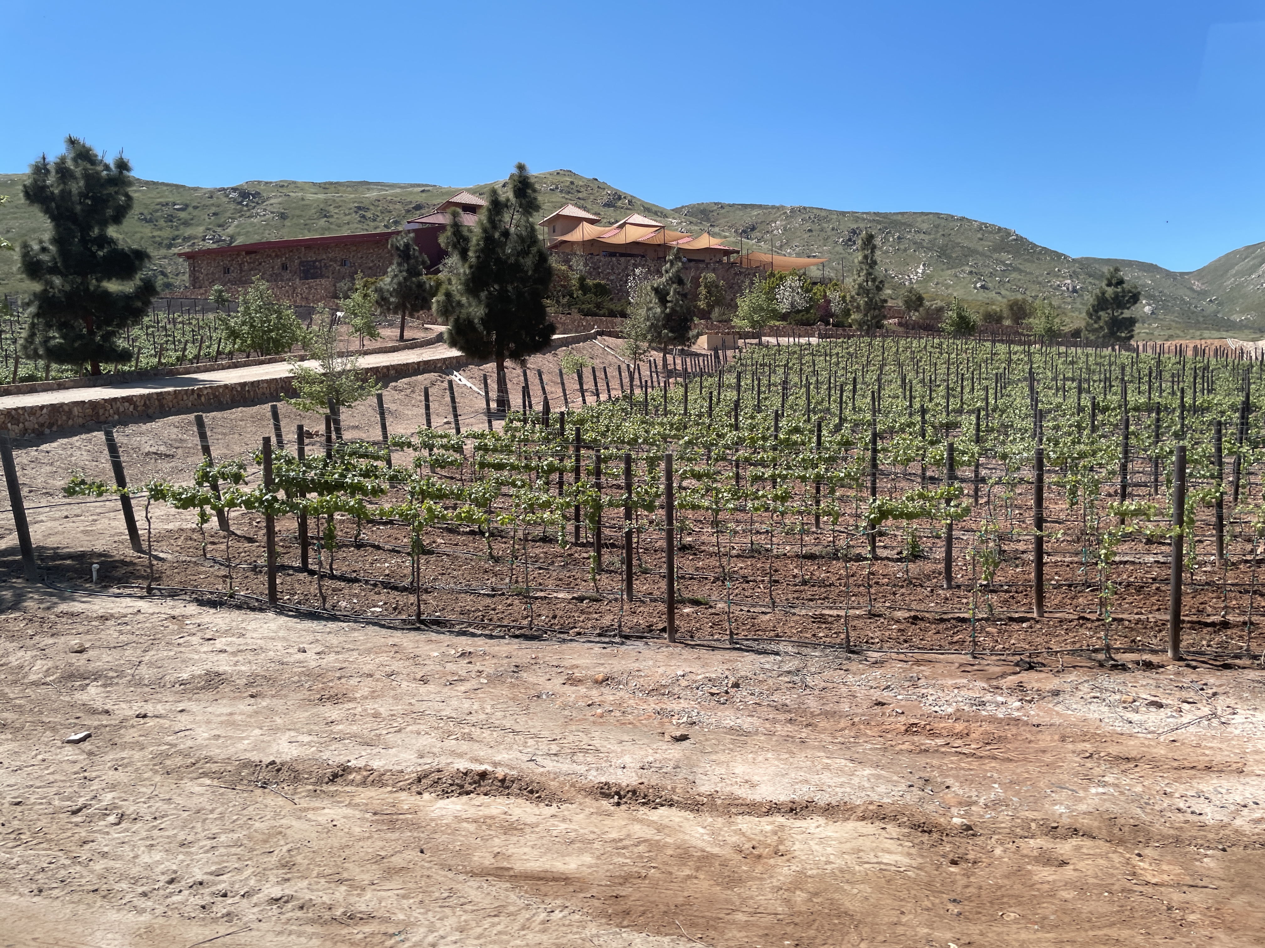
Vineyards for miles. They have 800 acres of vineyards mostly in this valley but a few in another area we did not visit.
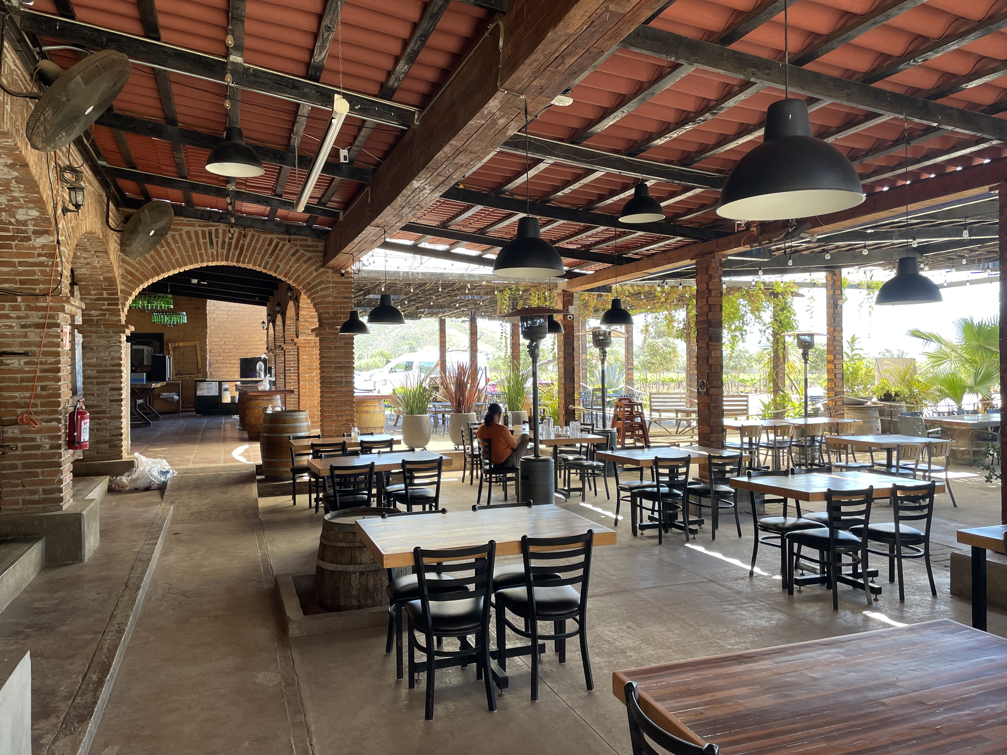
After visiting the winery in the previous trip post, we headed to another winery, Las Nubes (The Clouds), for more tasting and lunch. We did not visit the cellars here but the lunch view was spectacular as were the sandwiches. Like many other buildings at other wineries, a lot of the building material is local stone.
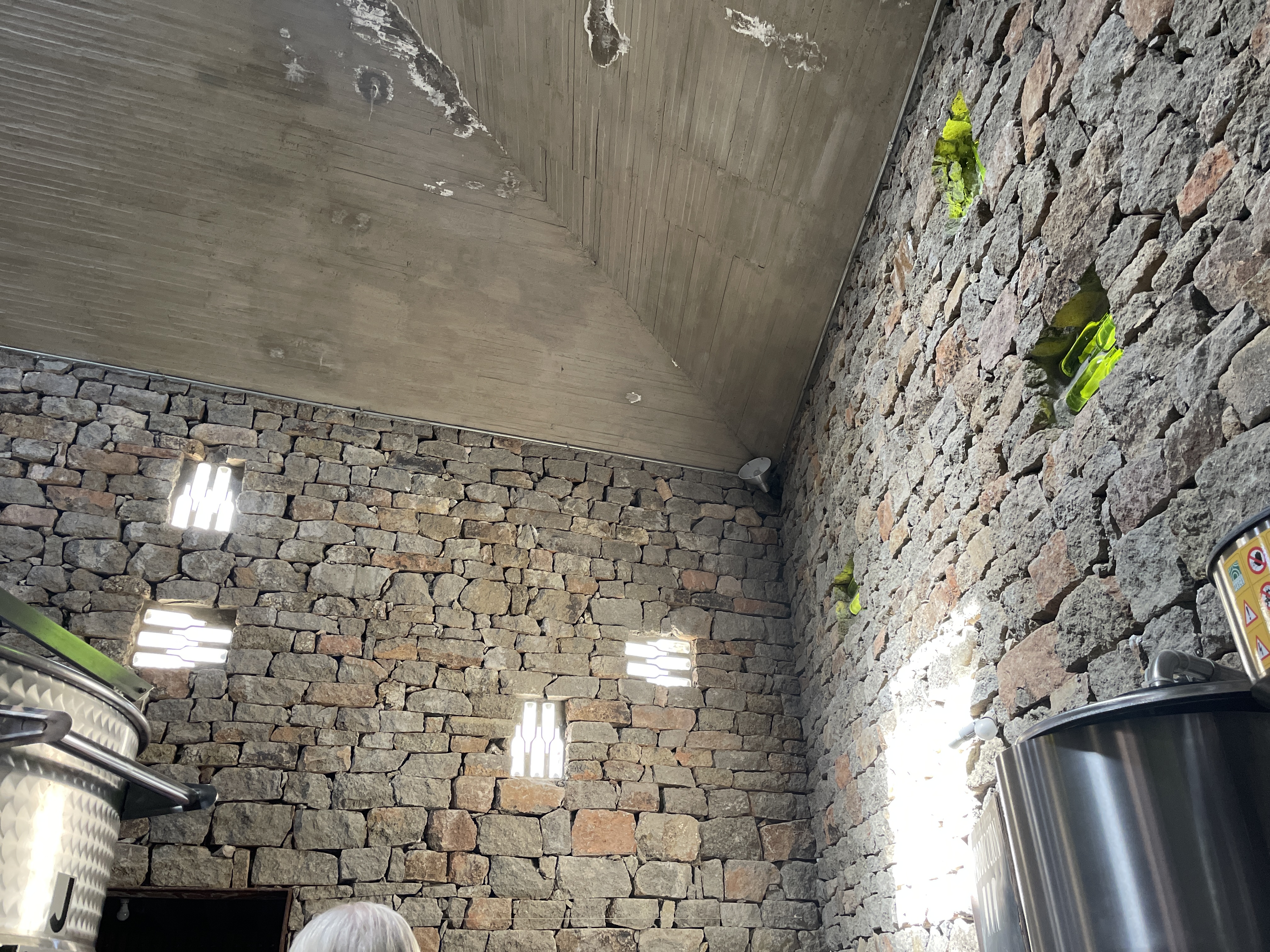
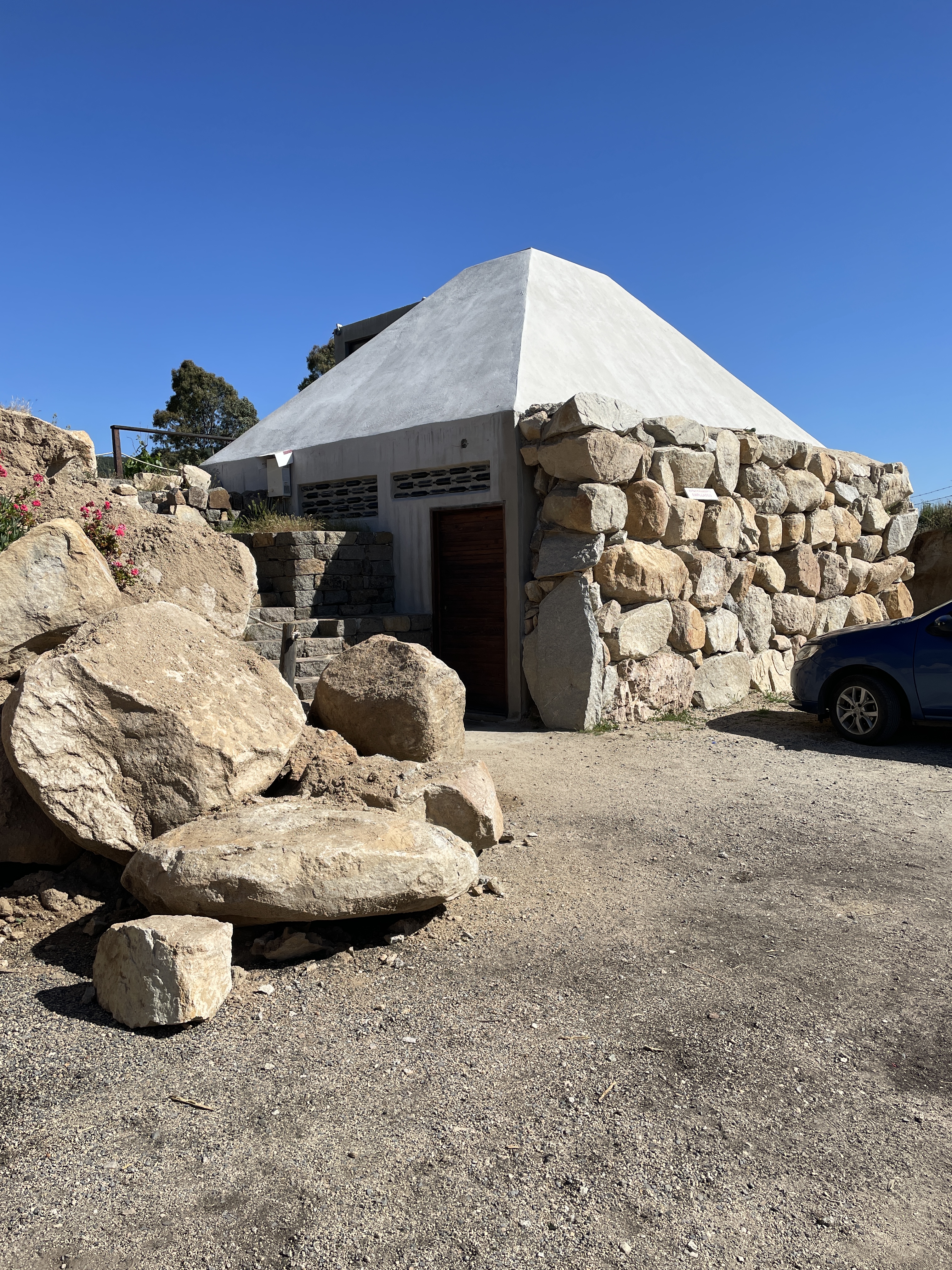
Taken from below the winery and restaurant area. Then off we went to winery three for the day, Clos de Tres Cantos. This winery is created with a philosophy dedicated to making natural wine, caring for Earth, and blending into nature. They also have deliberately grown varietals that can best withstand climate change. All the buildings are made from local materials and designed by a local architect.
A wall made from wine bottles.
A shrine to the Virgen de Guadalupe with wine aging to the side.
A natural roof of soil and flowers.
From here we drove through the countryside to La Laja restaurant for dinner. It is located way out in the country where they grow what they serve except for the fish which is locally caught in Ensenada area. It is rated as one of the top 50 restaurants in Latin America. We experienced a six course meal including two desserts, one of which was a slice of mango steeped in mescal.
Day Two we visited several wineries and went to dinner at one of the top 50 restaurants in Latin America, La Laja. The following photos are from the first winery where we not only tasted various wines but also took a tour of their remarkable wine cellar dug deep into solid rock.
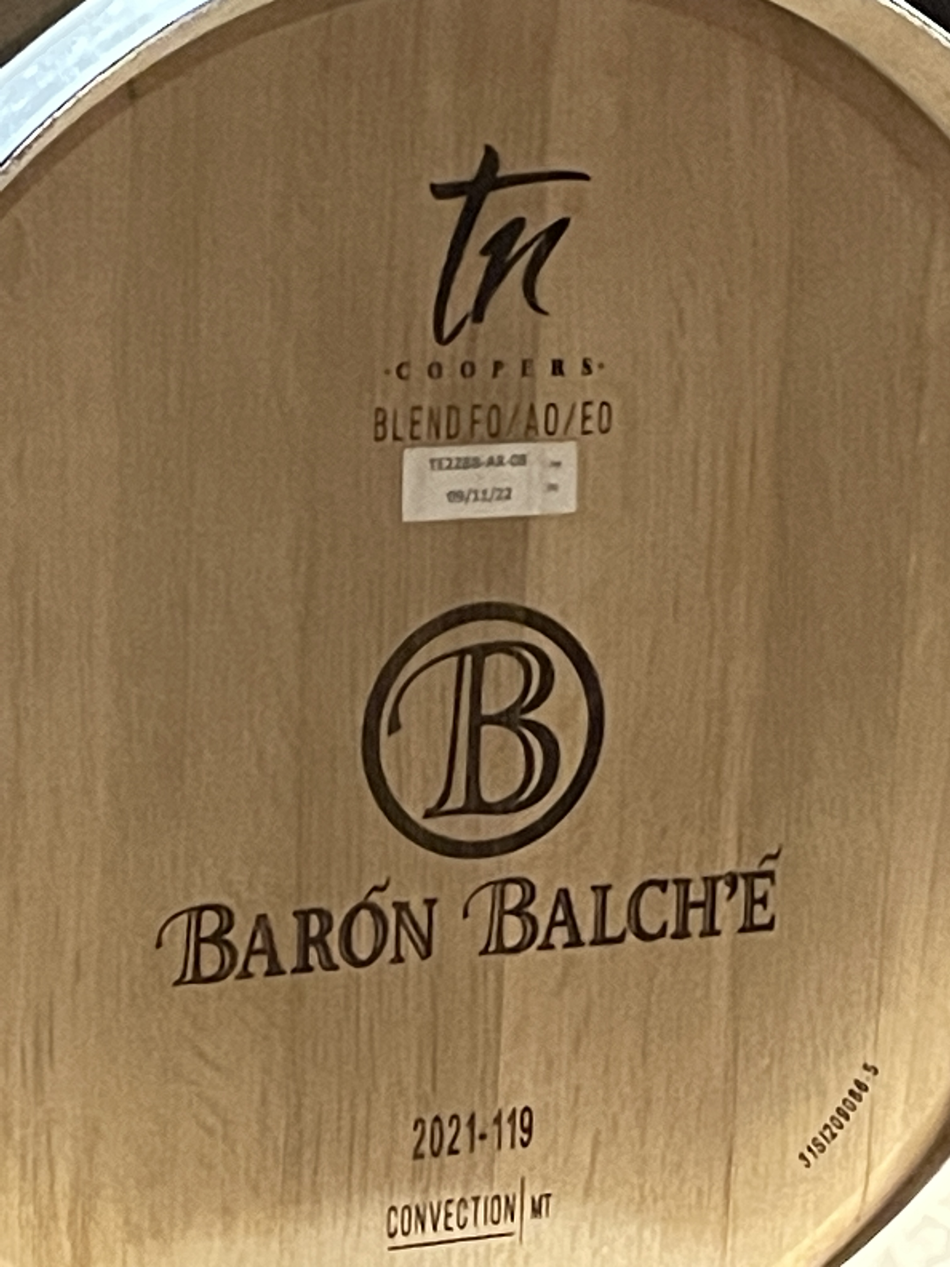
This is the name of the winery and each barrel is marked with varietal, date, etc.
The hills in some part of Valle de Guadalupe reminded me of the hills near Temecula, CA.
Here you can see how the cellar is dug out of the rock. The rock was oozing moisture due to the unusual amount of rain they received this winter.
I loved this message so much I had to take a photo of it.
I wish I could find a duplicate to hang outside on one of the empty sides of my house.
The wines here are all natural. Many of the wineries we visited do not use pesticides or herbicides.The sophistication of many of the wineries in Baja is very impressive.
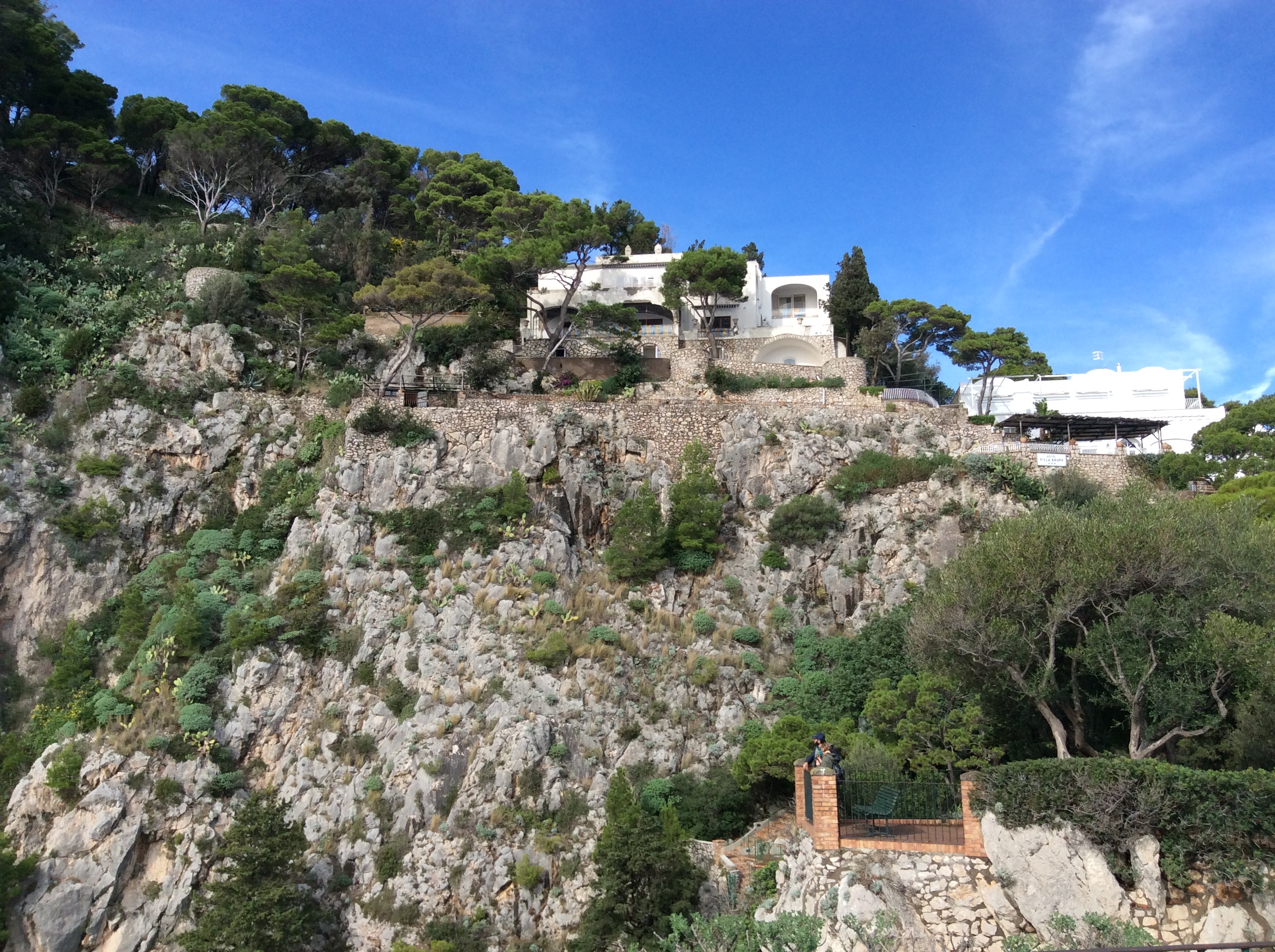
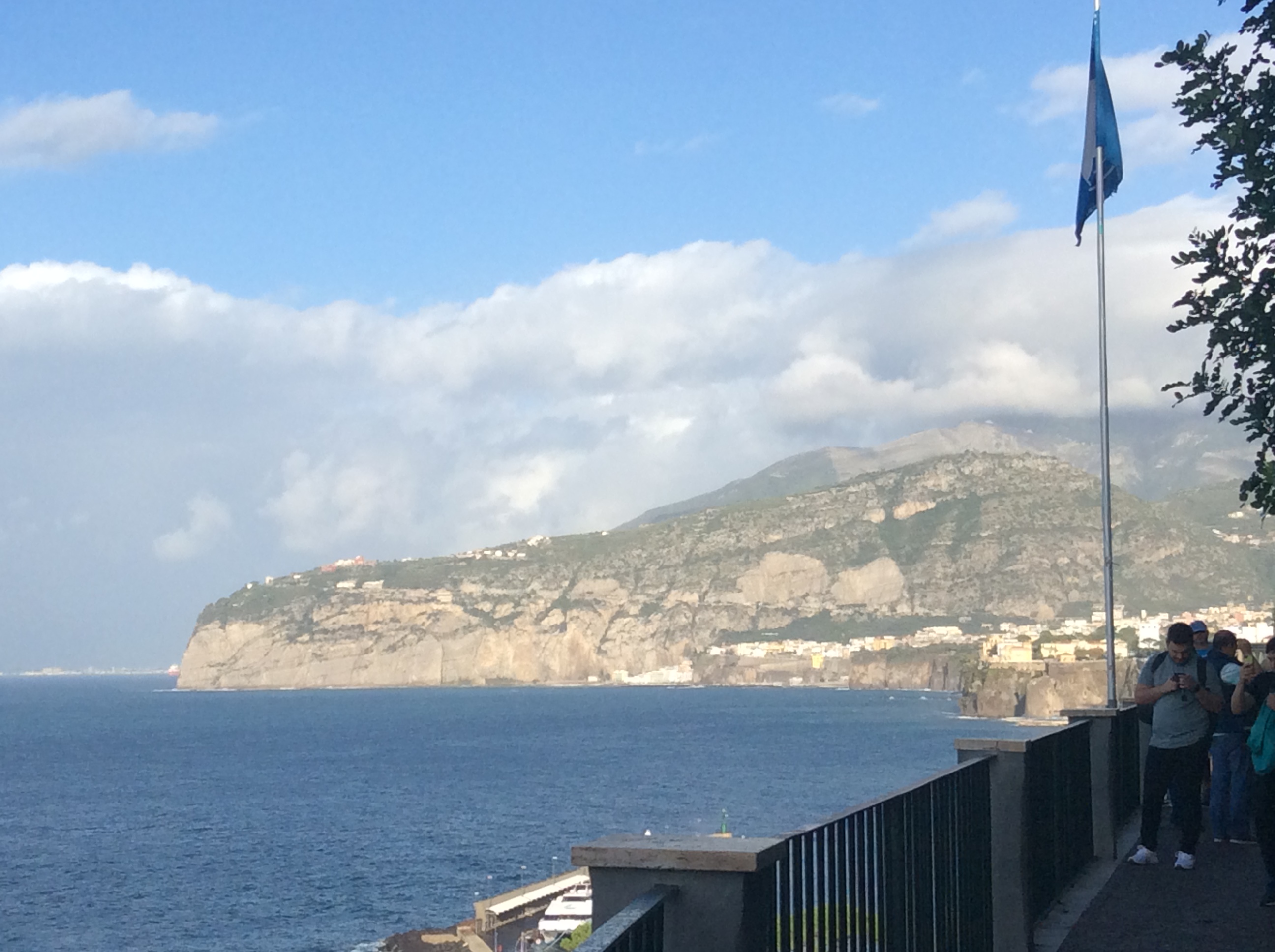
It is an hour or so boat ride from Sorrento to Capri. Although not very crowded in November, apparently it is tourist heaven in the summer. The lower town contains many of the world’s major high end stores. This time of year most remained closed. Even though I am not a big fan of touristy destinations, I thoroughly enjoyed our day on Capri. I doubt I would like it so much in high season.
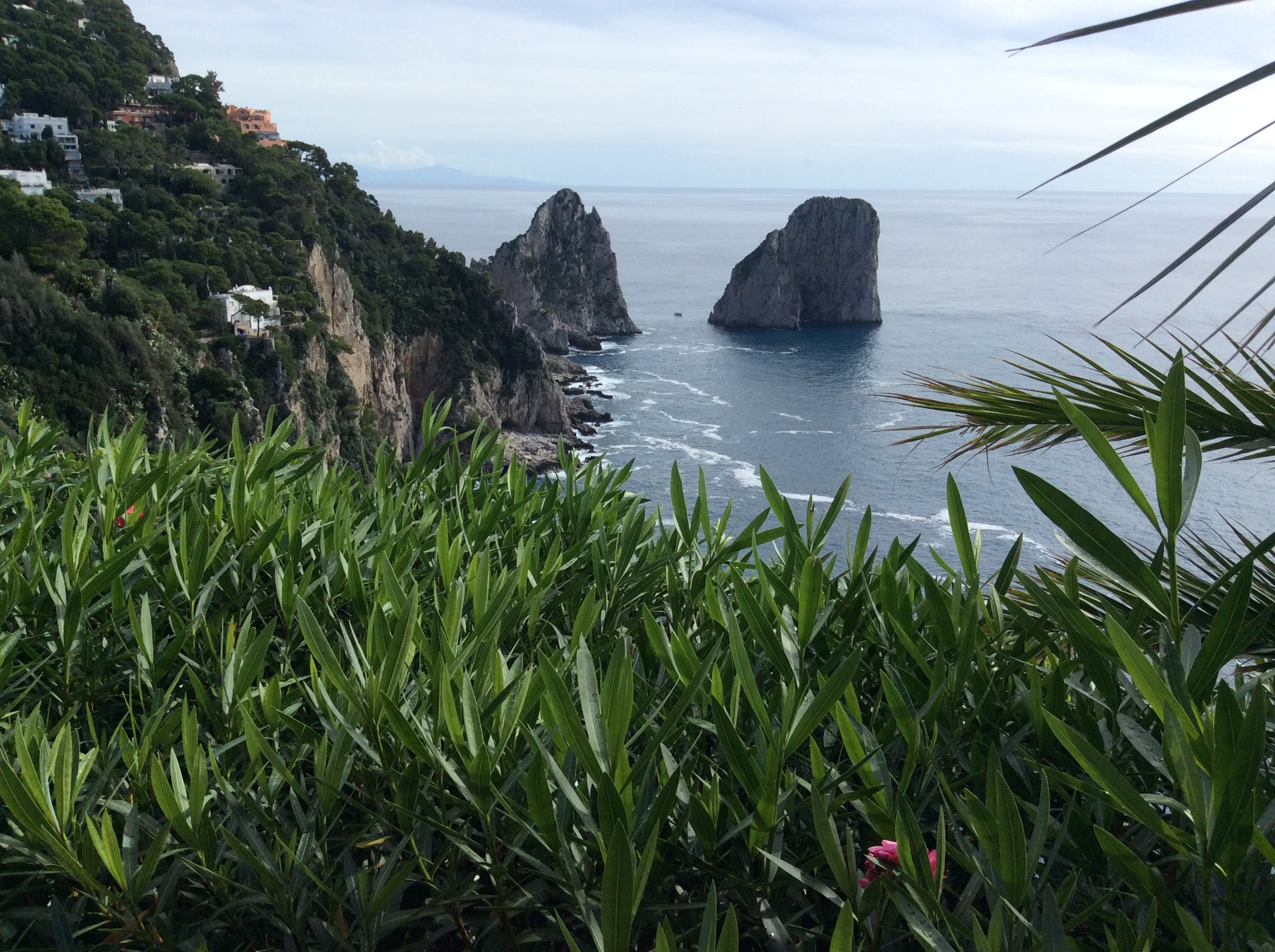
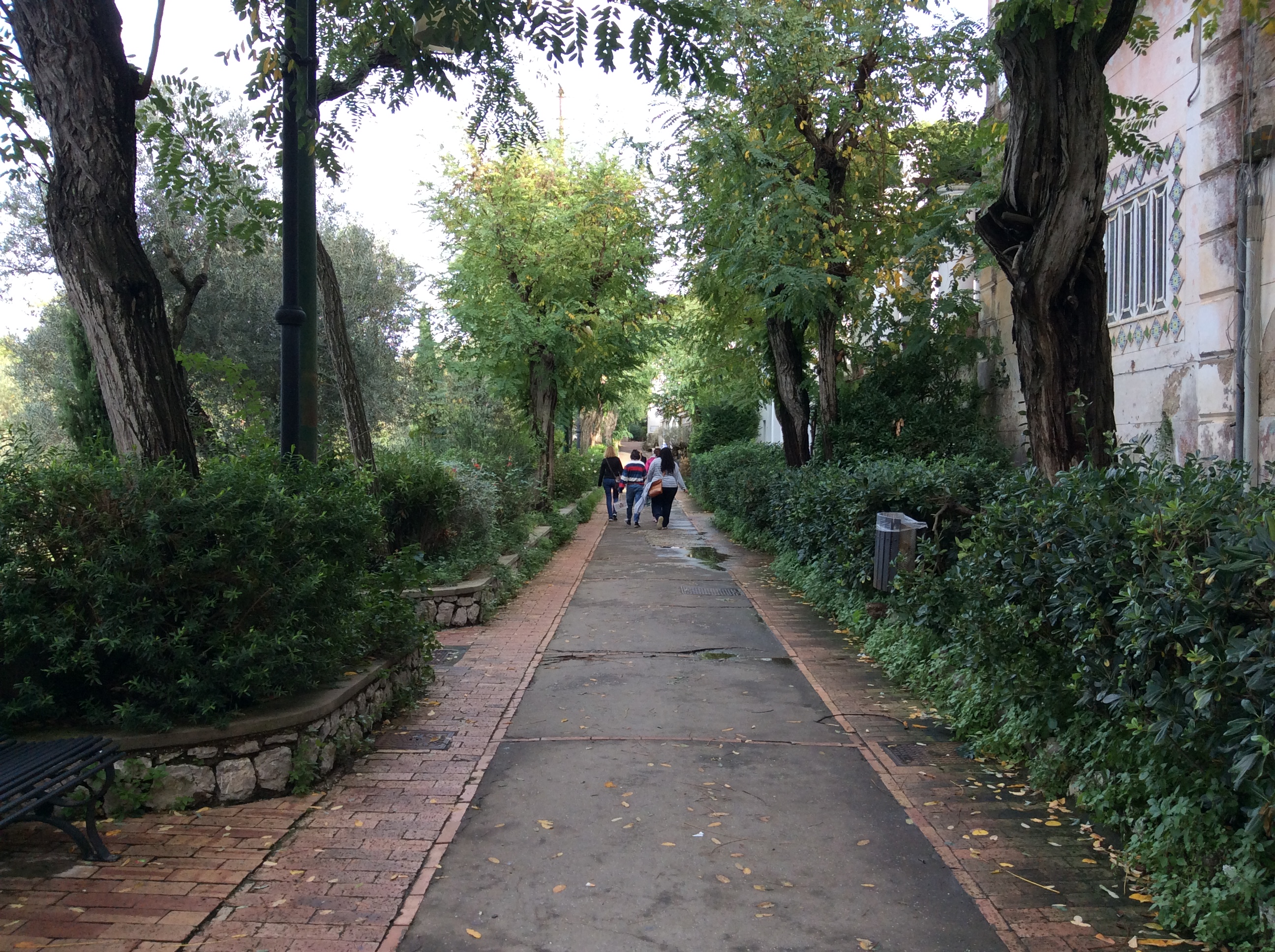
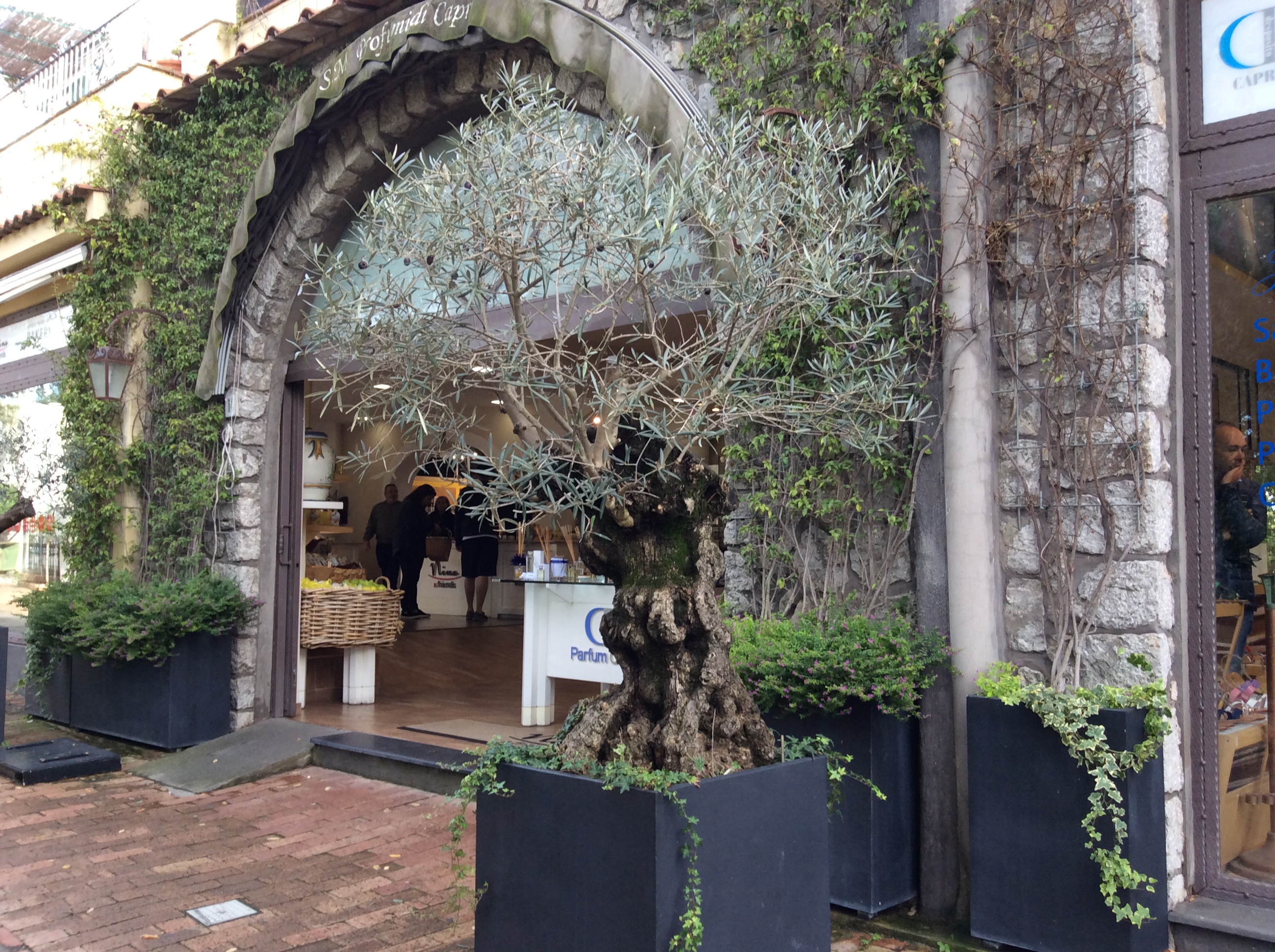
Looking down on the lower, main town from the town high on the island, Ana Capri. At the far point one can hike to the remains of Tiberius’ villa, where he hid the last ten years of his reign as Emperor of Rome. If he did not like you, off the cliff you went. I was standing on a trail with over 900 steps, carved by the Greeks even before the Roman times, that lead down to the lower town. This walkway leads to the path mentioned in the previous photo. This time of year Capri is lush, relaxing, and peaceful.This shop, among the few that were open, sold all sorts of chocolates with various limoncello products. The combination of chocolate, limoncello, and almonds is a taste of heaven.
I took all the above photos while strolling along the walkway shown in the third photo. Beauty lay everywhere I looked.
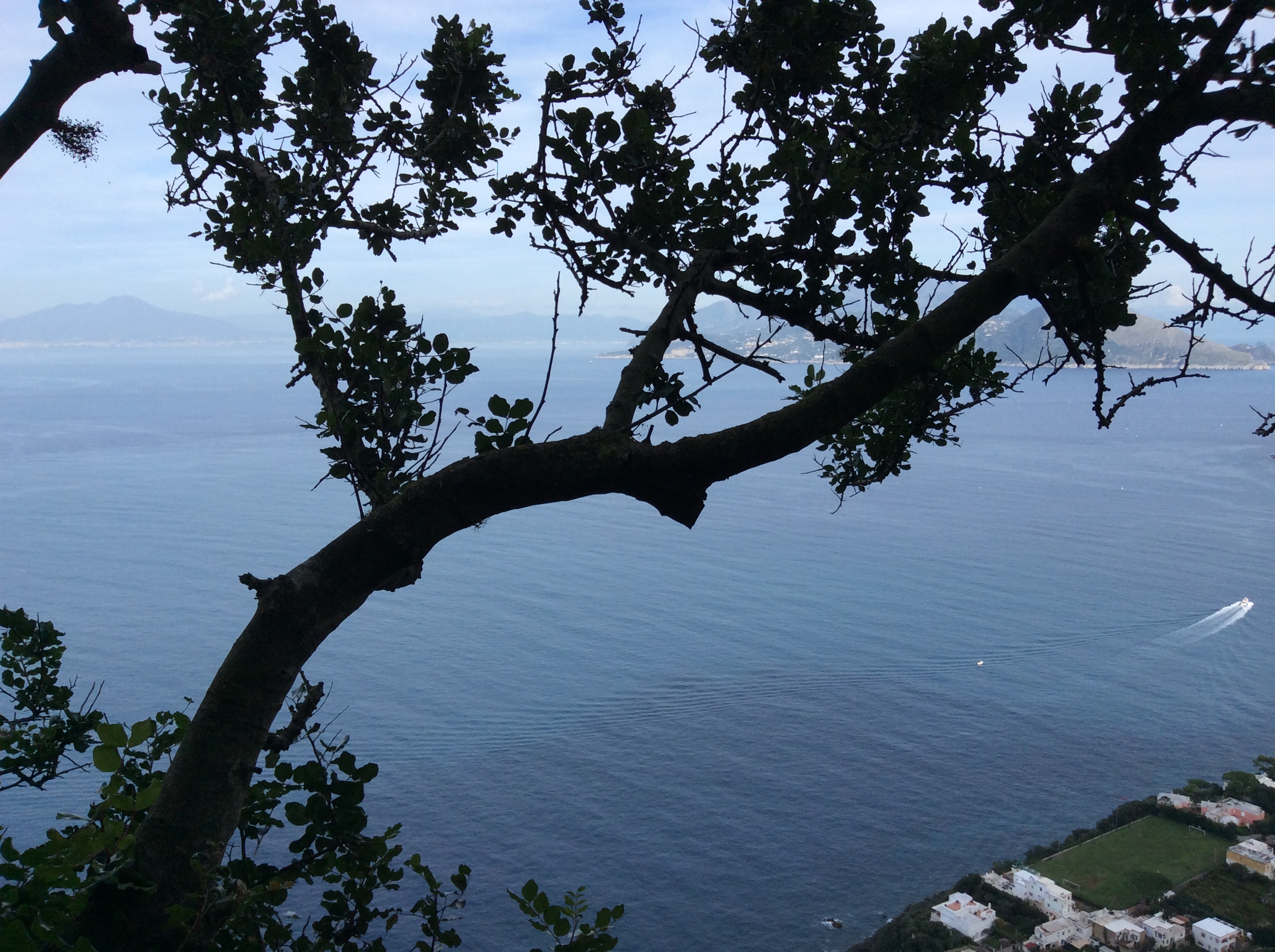
Capri is rugged. Houses hang off cliff edges, steep roads climb up and down near the sea’s edge. We strolled, went to a garden, found a little place to sit on steps and drink cappuccino .
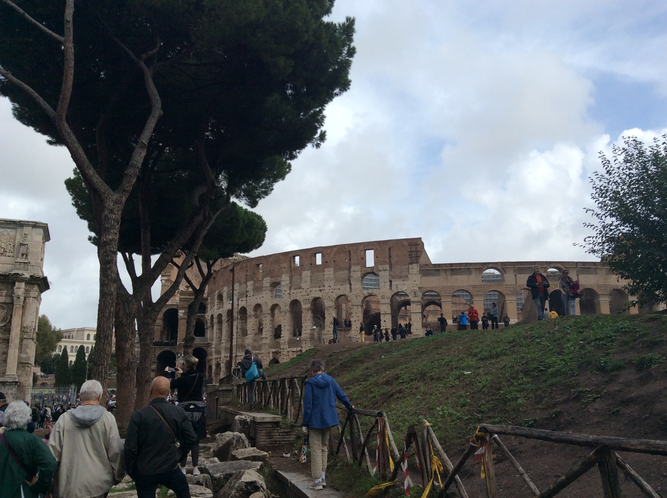
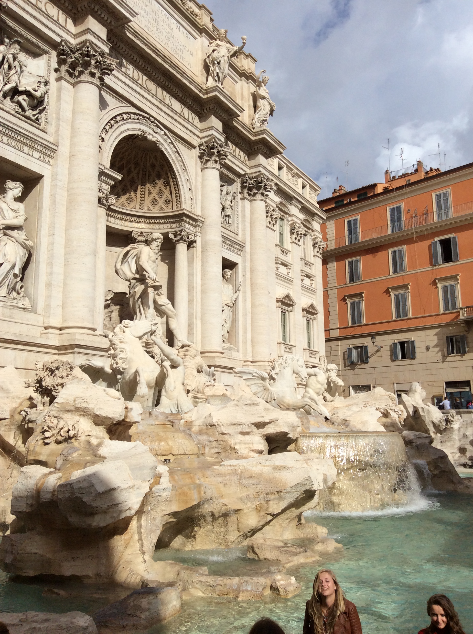
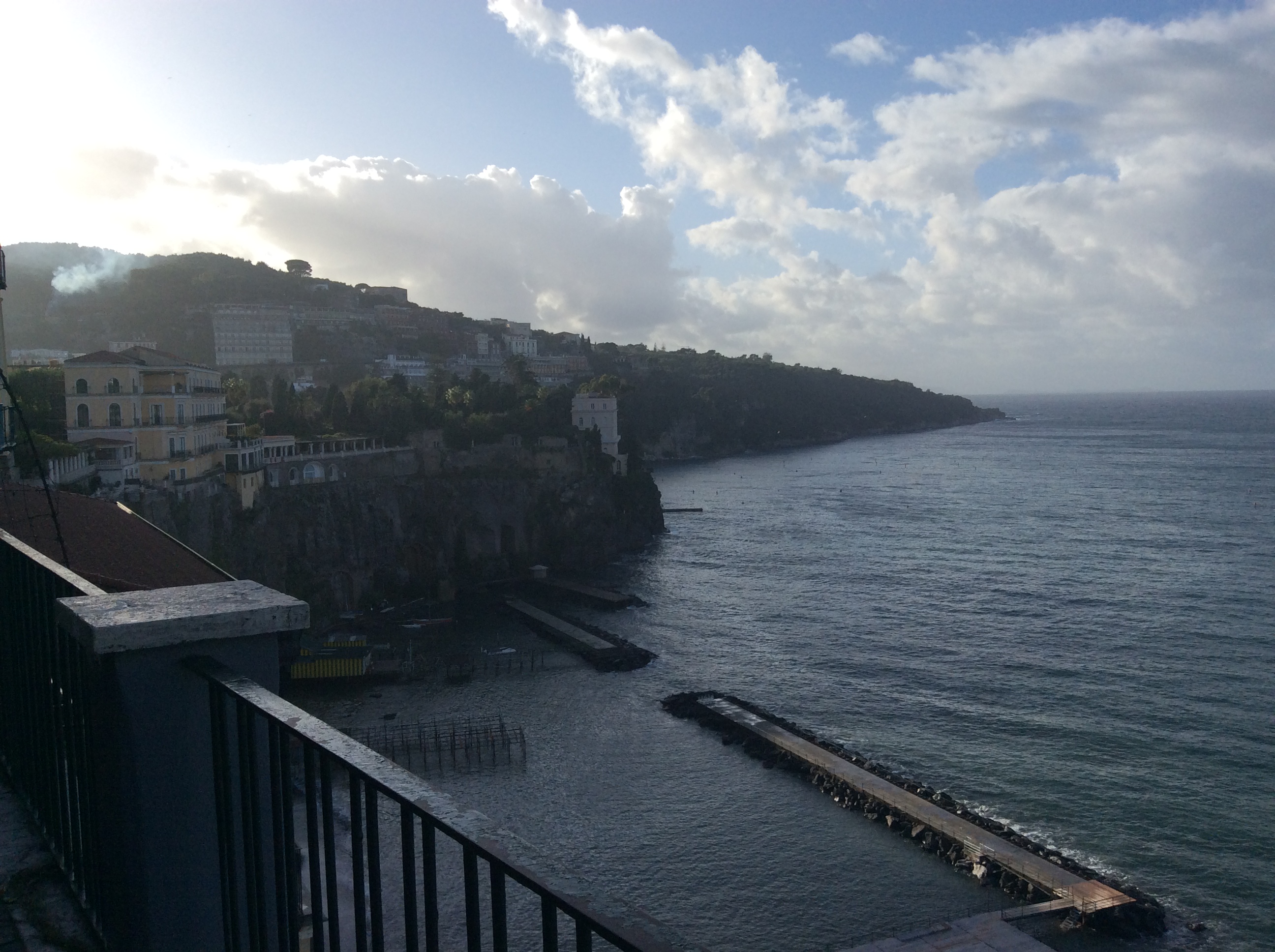
Last November I spent a little over a week in Italy. We spent only 1/2 day in Rome then drove to Sorrento where we stayed for a week. From there we wandered down the Amalfi Coast, over to Naples, Pompeii, and Capri. Want to avoid the summer heat and crowds? Go in November. Yes, it is chilly and sometimes rainy with big storms at night. Nevertheless, you can really see what people do who live there and avoid masses of tourists. Here are some of my favorite photos:
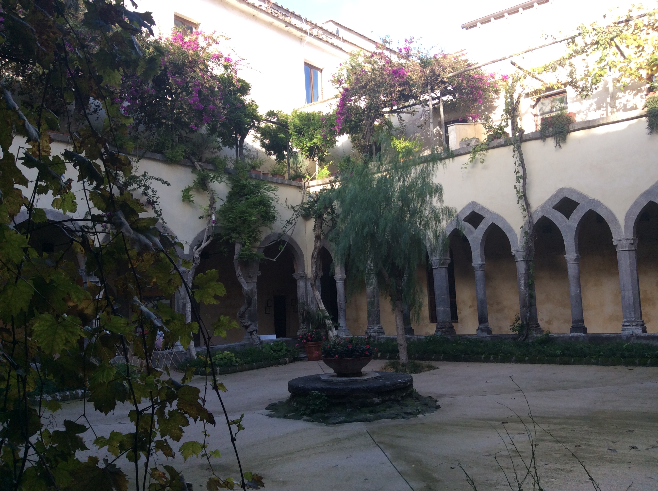
The above photos taken in Rome. The following were taken in Sorrento.