Apocalyptic Planet-Part Seven: Species Vanish


We all know extinction occurs.  Nearly everyone knows different species of dinosaurs at varied times roamed the earth for millennia.  Bones of all sorts of animals and various hominids are dug up off and on.  Scientists study them, determine their age, where and how they lived.  Scientists and sometimes even average persons develop theories about why they went extinct.  Regardless of which theory a person decides is accurate, these ancient extinctions generally took thousands of years. Recent extinctions are different, e.g. carrier pigeons.  Millions existed a couple of hundreds of years ago; now they are gone.  Why?  Humans.

Various causes exist for the extinctions of ancient species.  A major cause is the climate change caused my the changing tilt of the earth’s axis.  These changes occur over thousands and thousands of years.  What is different now?  Let’s take corn.  Native Americans cultivated rainbow colors of corn in small, frequently irrigated fields.  Where is most corn grown now?  Giant fields of GMO corn grow from horizon to horizon in the Midwest.  And if Monsanto had its way, no other corn would continue to exist for long.   Iowa is a good example.  Wherever this corn is grown, native grasses and other native plants totally disappear, in part due to cultivation.  A bigger issue is herbicides–to have clean fields, nothing and I mean nothing but corn must grow there.  A farmer’s expertise as a farmer is measured my just how super clean his fields are.  The only way to get these totally weedless fields is to use herbicides.  Biodiversity is a key to environmental health.  Little biodiversity exists in giant fields of crops like corn and soybeans.  Fertilizers to obtain huge yields wash downstream and in the Midwest eventually end in the Gulf of Mexico and cause giant marine algae blooms which pulls oxygen from the water to create a dead zone where no marine animals or fish can live.

Perhaps readers have heard of the plight of monarch butterflies.  Compared to just ten years ago, the population has dropped dramatically.  What happened to them?  Roundup.  Over 100,000 tons of Roundup and other brands of glyphosate herbicides are annually applied to crops in the US.  What do monarchs eat?  Milkweed.  Since 1999, 58 per cent of the milkweed has disappeared.  Recently, monarchs experienced a 30 per cent reduction in their numbers in one year.  Are we headed toward a mass extinction?  Some scientists think so.  These scientists are not talking about tigers, elephants, and rhinos being killed at an ever increasing rate for their body parts, but rather about the less noticeable extinctions of various plants and less obvious animals like frogs.  And then there is the problem with bees.  Bees are disappearing at an ever increasing rate due to not only diseases but due to herbicides and pesticides.  Without bees to pollinate the giant fields of almonds and various fruits in California, for example, those foods won’t exist.  See a previous post for more discussion on the importance of bees.  So why care about frogs?  Scientists consider frogs and amphibians in general an indicator of the health of an ecosystem.  Certain more tropical species of frogs are especially subject to the effects of climate change and they are disappearing.

Where I live big bluestem, blue grama, buffalo grass, and other native species grew from horizon to horizon.  This is the high plains.  Root systems of some plants grow twelve feet deep.  It has not rained in over a month.  Where the native grass once grew, crops are now grown.  This time of year finds open fields. Without rain, with the recent endless high winds, dust fills the sky.  To safely return home from town Sunday, I had to turn on the car lights to see.  The dryness fuels wildfires.  Earlier this week, over one hundred homes burned down in a wildfire north of Amarillo.  Drought.

Many human inventions are wonderful and make many lives better, but for some of them, I cannot help but wonder at what cost.


Amazon


His milk chocolate, heavy lidded eyes stare at me from the

front of the magazine.

His cheeks display charcoal tattoos, a criss cross

design, tiny Xs on top, stopping where his nostrils flare.

His straight hair barely touches his shoulders.

not the black I expected, but the color of mahogany.

His eyebrows grow thin and wide,

no visible eyelashes.

His skin, color of morning coffee with two teaspoons of milk,

looks clear, smooth.

His full lips only slightly darker than his skin

do not smile.

He, a Kayapo Indian, continues staring.

He lives in Kayapo Territory, Brazil, land the size of

Great Britain and Ireland.

He plans to save it from the rest of us.

He plans to save us from our own worst selves.


SAM_1502


The Kayapo and other indigenous Amerindians have lived in the rainforest for millennia.  They and most environmentalists view their rainforest as a priceless haven for biodiversity.  Their Amazon remains a major defense in the fight against global warming and habitat destruction.  Fifteen per cent of greenhouse emissions, more than all the trucks, cars, buses, and planes combined, come from deforestation.  Although Brazil has slowed the deforestation rate by 70 per cent in the last nine years, last year saw a reversal with an sudden increase of 30 per cent.  Brazil also began construction of a network of canals, dams, and a huge hydroelectric project on the Xingu River in the middle of Kayapo territory.  The Kayapo and other Amerindians defeated a larger project in the 1990s. They intend to defeat this one.

The chief of the Kayapo, Megaron, knows what is at stake, not only for his tribe, but also for the rest of us, long term survival.  One  National Geographic article noted, “It is one of the richest ironies of the Amazon that the supposedly civilized outsiders who spent five centuries evangelizing, exploiting, and exterminating aboriginal people are now turning to them to save ecosystems recognized as critical to the health of the planet–to defend essential tracts of land from the outside world’s insatiable appetite.”

Kayapo success can be attributed to their ability to embrace some of the best of the modern world while retaining a strong sense of identity, culture, and traditions, all of which come from the forest.  As Megaron notes, “Before the white man, we were always fighting other tribes.  Not anymore.  We stopped hitting each other over the head and united against a bigger threat.”  For our own long term health and success, we can support them and hope they succeed.


Water, Water, Where?


Today, I drove about fifty miles to watch a play especially produced by my friend, King Hill, for the Gem Theatre in Claude.  I almost did not go because of high winds and blowing dust.  Between 8 and 10 this morning visibility was so low  it was impossible to see the horizon.  High wind and blowing dust warnings started yesterday.   Now, as I write this, these warnings have continued for more than 24 hours.  Red flag warnings flash across the TV screen. Thankfully, not quite the dust bowl extremes, not yet anyway.

Originally, a green sea of grass covered all the land where I live in the Panhandle of Texas, the Llano Estacado. Immense herds of buffalo roamed free.  This prairie grass protected the land from erosion.  Rivers and an occasional canyon interrupted this endless sea, including the Canadian River, Palo Duro Canyon and the network of canyons running into it.  Once the Spanish brought horses, Kiowa and Comanche ruled this sea for more than a hundred years.  Under a full moon, the Comanche reigned by night raids from Nebraska to Mexico.

What happened?  Plows brought by people from the East dug up the grass.  These people planted the crops they knew, wheat, corn.  They settled in towns and homesteaded the country. They brought cattle and in some areas developed gigantic ranches.  Hunters killed all the buffalo except a few the famous rancher Charlie Goodnight and his wife managed to save.  Remnants of this southern herd now live at Caprock Canyons State Park near the tiny town of Quitaque, Texas.  Those who farmed dry land farmed.  In a normal year crops grew, the people prospered.  In dry years dust blew because there was no grass to hold the dirt.

Today, giant pumps pull water from the aquifers, the Ogallala, the Santa Rosa. My well is 400 feet deep, some are nearly 900.  More and more people move here from other parts of the United States.  They want lawns like the ones they had where it rains forty inches a year.  It does not rain much here, twenty in a good year, ten in a bad year.  These aquifers lose much more water to irrigation in a year than are replenished by rain.  Farmers grow corn,wheat, cotton, and milo, all irrigated.  In some places where  the water became to saline for crops, the pumps sit abandoned.

Today, I drove by miles and miles of dry, thirsty grass, perfect fuel for the wind driven wildfires which sometimes start this time of year.  In other places irrigation pivots rained water on immense emerald fields of wheat.  I could not help but wonder how much of this water evaporated in the sixty mile an hour wind.  As I finish writing this with the TV on  weather watching, I see Fire Weather Watch, High Wind Warning, Red Flag Warning flash across the screen. I hear the wind roar and heavy outdoor furniture slide across the patio.  I’ve seen wildfires, had a half mile of cedar post fence burned down.  All it takes is a tiny piece of cigarette thrown from a truck or car, a flash of dry lightning.  They predict three more days of this.

I love the space, the vermillion sunsets, the intense blue of the sky.  I watch my neighbors water, water, water their new houses in the country.  I think about those pivots irrigating in the wind, and I wonder what will happen when all the water’s gone.


SAM_1369


Apocalyptic Planet-Part Five: Civilizations Fall


Whether it is my innate ambition, something my parents instilled in me, or something else unknown, I try to learn something new every day.  Craig Childs starts this chapter of his book by talking about a Phoenix landmark.  Back when I travelled to Phoenix regularly, I knew this place as Squaw Peak.  Now its name Is Piestewa Peak.  The name change is probably a good thing.  I never knew before reading this how dreadfully pejorative the word squaw is.  Basically, it means Indian bitch as well as other things related to the privates of women.  All languages seem to possess an accumulation of dreadful words geared to putting women down one way or another.  Slang words for the private parts of a man rarely mean anything pejorative, at least not that I know of.  The new name, a Hopi name, a blessing word, is a word that calls water to this place.  Not a bad idea in Phoenix or most of the Southwest for that matter.

The name Phoenix fits.  Underneath modern day Phoenix, an ancient city lays buried, a quite sophisticated city with ball courts, temples, irrigation canals.  This city existed at least a thousand years ago.  Its inhabitants grew corn, cotton, beans, and agave.  Farmers, hunters, carvers, all sorts of artisans and merchants apparently lived there.  Now they are called Hohokam taken from an O’odham word meaning “ancestors”, the “ones who have gone”.  We find forgotten cities all over the world, Palmyra, Machu Picchu, Angkor Wat.  What causes these sophisticated civilizations to fall?  If you read a bit, look further, you find common themes:  environmental decay, resource depletion, conflict, disease, social problems.  Angkor Wat fell because it could not maintain its complex irrigation network.  Ur in Iraq fell because a drought caused its port to dry up.  Usually, the demise of particular civilizations occur over time, e.g.Rome.

Childs notes that human patterns often follow animal patterns, or at least mammalian patterns.  For example, when over population occurs, behavior changes.  Parental care and cooperation become replaced with aggression, violence, competition for resources, dominant behaviors.  These types of behaviors are particularly detrimental to females and the young without whom the society (or animal population) cannot replace itself.  Generally, in animal populations, when this occurs, reproduction slows for several generations and the imbalance corrects itself.  For humans, it is not so simple.  Hohokam bones indicate mass starvation and malnutrition.  Other civilizations, e.g. the Anasazi, seem to have disappeared without a trace.

Today, most of the world’s largest cities have immense infrastructures that keep them going, miles of underground sewage tunnels, water mains, etc.  Here in the US in our oldest cities, much of what we take for granted is very old and deteriorating.  New York City and Chicago have water main systems that some experts claim are near collapse or at the very best badly in need of repair.  Doubtless such conditions exist in old cities throughout the world, most of which are much older and larger than the majority of cities in the US.  Yet, they continue to prosper.  Have we passed a point when civilization cannot fall?

Childs completes this discussion by describing his visit with his wife to Guatemala.  They visited all the best known Mayan sites, visited with natives.  His wife managed to get invited to a Mayan fire ceremony, a renewal ceremony.  History books tell us the Mayan civilization is dead, ended.  But it is not.  The Mayan culture still exists.   At least six million still live in the Central America.  What would have happened to Mayan cities if the Europeans had not brought epidemic diseases and better fire power?  We will never know, of course, but no matter how many civilizations rise and fall, change continues and humans continue to inhabit the earth.

The new question is this:  can this planet we live on sustain the ever increasing numbers of humans who inhabit it??

Sacred Corn


SAM_0035   In the summer on hot, humid nights, you can hear the corn grow.  My great grandfather, my grandfather, and my father grew corn.  I grow corn in that same rich loess soil of Northwestern Missouri.  Soil laid down by Ice Age glaciers thousands of year ago.  Only on a few hill tops, here and there, will you find non glacial soil. Repeatedly, daily, I walk by the sacred corn plant of life painted on my hall corner.  This sacred corn corner houses three corn maiden kachinas and a drum decorated with corn maidens.  I give thanks to corn for my house and the life I lead.

Corn Song

I sing the song of ancients:

pueblo peoples,

Anazazi, Hopi, Zuni.

I sing the song of an America long gone.

Maya, Aztec, Tolmec.

I sing the song of life:  colors of the rainbow

golden, red, white, blue.

I sing the song of now:  thick, endless

identical rows.

Pioneer, Monsanto,

anhydrous ammonia,

atrazine.

I sing the song of hope and joy:

an ancient reclaiming,

a klaidescope of colors,

butterflies and fireflies.

I sing the eternal human song.

SAM_0913

SAM_1489

This is a Navaho kachina.  Kachina are actually Hopi, but Navaho artists now make kachinas as well.  The first corn maiden kachina I bought.

SAM_1490

Spotted corn kachinas, on the left, are unusual.  It took me years to find one.  The kachina on the right was created by R Pino, who is both Hopi and Navaho.

SAM_1491

Every year Pendleton runs an art contest among Native American students.  The winner’s art work is transformed into saddle blankets.  This design, created by Mary Beth Jiron, is the latest in this Student Series. There are three corn  maidens  on each side of the blanket, representing the different varieties of corn grown by native peoples, yellow, red, blue, white, black, and spotted.

Apocalyptic Planet-Part Four: Seas Rise


As I write this title, it seems a bit counter intuitive that one of the first things I saw this morning was a newspaper discussing many small cities around the Texas Panhandle which are running out of water.  And on the TV news as I write this, the city of Amarillo announces measures being taken to curtail water use, followed by a detailed discussion, explaining how one of these smaller towns plans to address the lack of water.  Drought expands while ice melts and seas rise.

Childs explains sea behavior by comparing it to pouring water back and forth among a bunch of pans.  Ocean behavior varies from place to place.  Louisiana has been losing seacoast at the rate of twelve meters per year and large parts of the Nigerian coastline has lost as much as thirty meters per year, one of the fastest losses on earth–erosion.  The moon causes tides twice a day changing sea levels on the average of two meters each time.  Historically most sea level changes are long term changes.  A major cause of sea level change is temperature.  Half the current sea level rise can be attributed to thermal expansion.  Water warms and spreads out.  Not only does heat expand near the sea surface, but now also expands into depths not previously affected.  Findings by two oceanographers, Purkey and Johnson, indicate an increase in ocean heat 16 per cent greater than previously thought.  Oceans are the largest reservoirs of heat on earth.  Once heated, their size makes them slow to cool.

Purkey also notes that even in the depths of the seas, waves transfer heat.  However, because of the size of the Pacific, an event that occurred forty years ago in the southern Pacific will not reach the northern Pacific for approximately those forty years.  Thus, the warming and subsequent ice melt we see in the north Pacific started in the south Pacific forty years ago.  Another scientist, Carl Wunsch, notes that earth changes remarkably without human intervention.  Nevertheless, he recommends humans do something to reduce carbon dioxide emissions as a precautionary measure in addition to discouraging people from settling in low lying areas.  Unfortunately, rising seas do not bode well for much of the earth’s population who live in exactly these low lying areas:  all of Bangladesh, Venice, Shanghai, New Orleans, Bangkok, the Marshall Islands, and many US coastal cities to name just a few places.

St. Lawrence Island north of the Aleutians provides a perfect example of what is happening.  Sea ice breaks up too early, fish species they used to see are gone replaced by new ones they never saw before, and the population of seals and sea lions has altered.  Cancer rates in the villages there have risen dramatically caused in part by the toxic poisons concentrated in the meat of the seals, whales, and salmon they harvest from our polluted oceans.  In 2008, they brought a lawsuit against Exxon, Chevron, and Mobil, claiming that these companies are the world’s major contributors to global warming.  They want these companies to pay for moving their villages to higher ground.  Sea rise necessitates the move.  They lost in District Court, but the case is under appeal.  The court cited that the chain of events causing their predicament is too long to lay blame in one place.  Childs notes that we really need such places to endure, places where people know how to lead minimalist lives, places where people know how to survive.

Day Trip to Marvin Lake and Canadian, Texas–Part One


Two weeks ago, I joined the local Native Plant Society group for a trip to Lake Marvin east of Canadian, Texas, near the Oklahoma border.  Lake Marvin is located in the Black  Kettle National Grassland  which includes land in both Texas and Oklahoma. This national grassland’s name comes from the Southern Cheyenne Chief by the same name.  An aging chief, he had attempted to make peace with whites and had been guaranteed protection by the head officer at a nearby US Army Fort.  He, along with old men, children, and women was massacred by Lt. Colonel Armstrong Custer and his troops in Custer’s first great “success” as an Indian fighter.  It was an easy battle; the Indians had been assured their safety at this encampment.  They were totally unprepared.  Black Kettle attempted to meet the soldiers and flew a white peace flag as well as a US flag over his teepee. He and his wife were mowed down in a barrage of bullets.  The massacre is called the Battle of the Washita because the Indian encampment was on the Washita River which flows through the grassland.

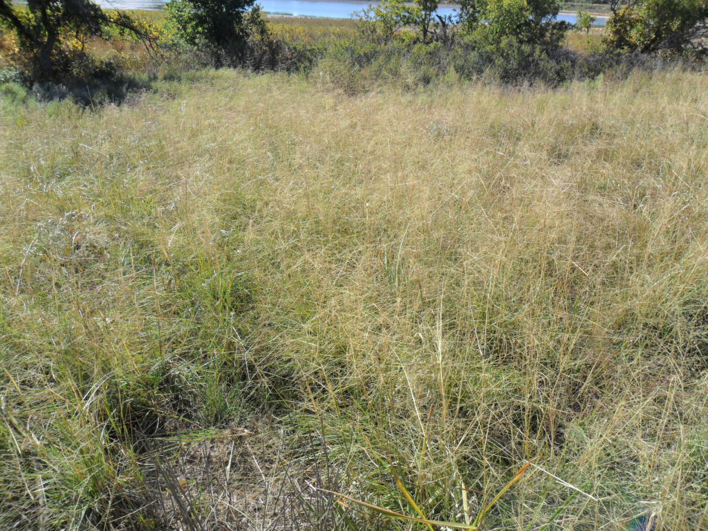
Those of us who live in the Panhandle of Texas become accustomed to the lack of trees and semi arid climate.  It is always a huge surprise to find those rare spots with numerous trees, water, and thick vegetation. Lake Marvin and much of the area near Canadian provide a total contrast to what we usually see.  JR  Bell, an expert on native grasses and plants, lead the hike around Lake Marvin, a manmade lake constructed for conservation purposes in the 1930’s on Boggy Creek.   Regretfully, I failed to carry a pen and pad to write down the name of all the grasses, some of which exist in the area where I live and others I had never seen before.  Perhaps some of you who read this will be able to identify the various grasses which include blue grama, side oats grama–the state grass of Texas, little blue stem, and two other species of blue stem, switch grass, buffalo grass, and wheat grass.  Unfortunately, Johnson grass, a non-native,  invasive species, also grows near the edges of the lake.

SAM_1321

The hike began near what was once the water’s edge before silt and drought made the lake half its original size.  Johnson grass, the outsider, is not too difficult to identify because of the bright maroony red on the leaves.  This enables an non-expert like me to differentiate among Johnson grass and a few other similar looking species.  While I tried to listen and watch grass identification, rather quickly I realized that without pen and paper remembering all of them would be impossible so I focused on photographing the natural beauty surrounding me.

SAM_1326

SAM_1323

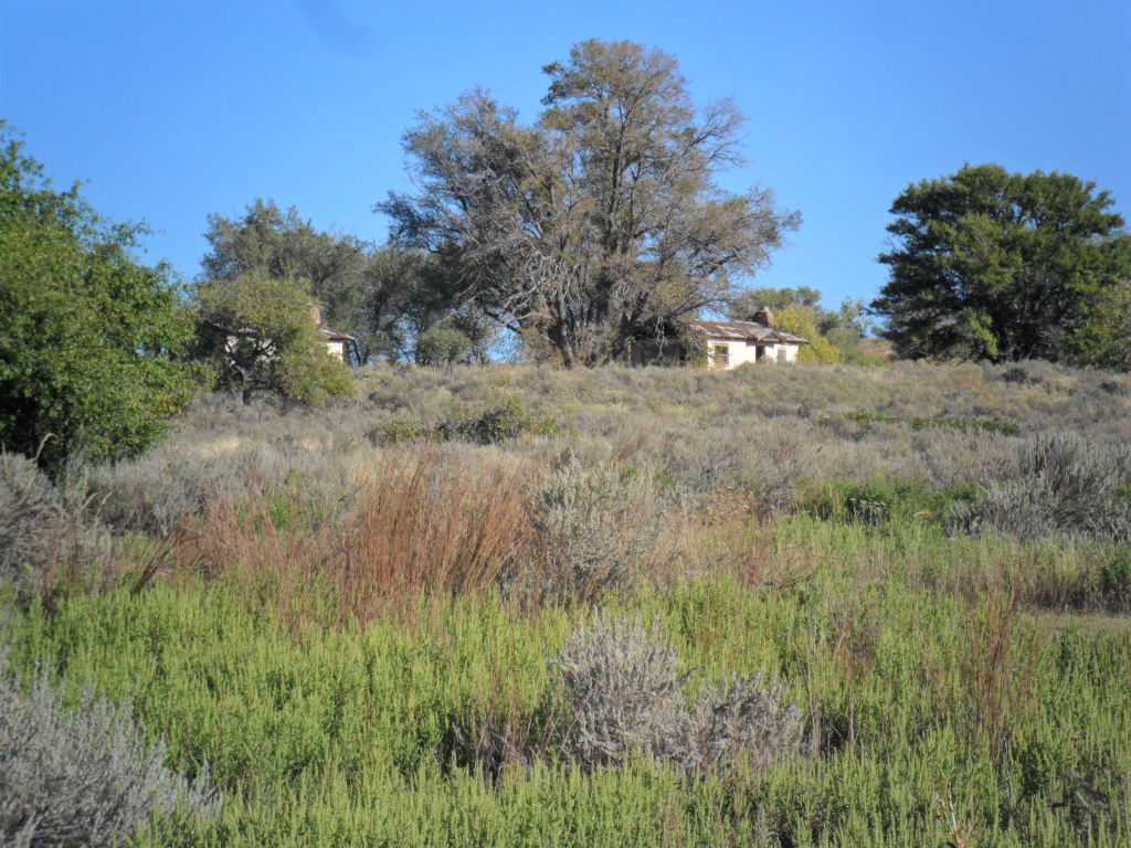
No one told me the origin or purpose of the abandoned buildings up the hill from the lake.  The change in flora one sees by facing the hill rather than toward the lake is amazing.  One could almost draw an imaginary line with certain grasses and shrubs on one side and totally different ones on the other.  The magic key, as always, is water.  Where I live, two hours away, no sage brush grows.  Here on the hillside, it grows everywhere with various grasses, some rather small and semi hidden, interspersed.

SAM_1328

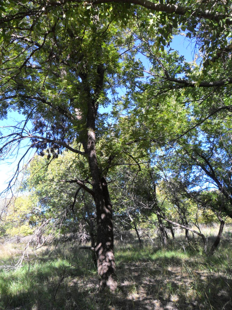
I learned several keys to identifying grasses:  seed heads, texture of leaves and stems–some rough and others smooth, size of leaves and stems, some variations in color.  Height helps but does not necessarily determine differences because the same grass species can vary depending on amount of water and type of soil.  The amount and size of the trees continually astonished me, like this tunnel through the trees, something I never expected to see in the Panhandle.

SAM_1330

Where I grew up in northwestern Missouri, huge black walnut trees grow everywhere.  I recall exploring the walnut grove on the farm repeatedly as a child.  I certainly never expected to see them on this little trip.  Suddenly, astonished me stood there surrounded.

SAM_1334

While these trees never reach the size of the ones where I grew up and the nuts remain considerably smaller, here they stood, their distinctive leaves giving them away.  Before I went away to college, every autumn, we picked up the nuts, cleaned them–while the outside is a lovely lime green, the area between the seed and outside, is a sticky, dark brown mess which makes excellent natural dark brown dye, and cracked them to retrieve the meat inside.  Black walnut nuts are much harder than English walnuts and cracking them requires a hammer and something really hard on which to place the nut. After I left home, every year Mom spent hours working on these nuts and brought me at least a pound at Christmas, a true labor of love.  They are especially tasty with in recipes with chocolate or bananas.

SAM_1331

SAM_1332

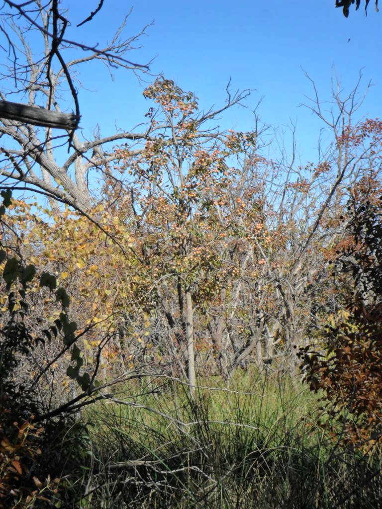
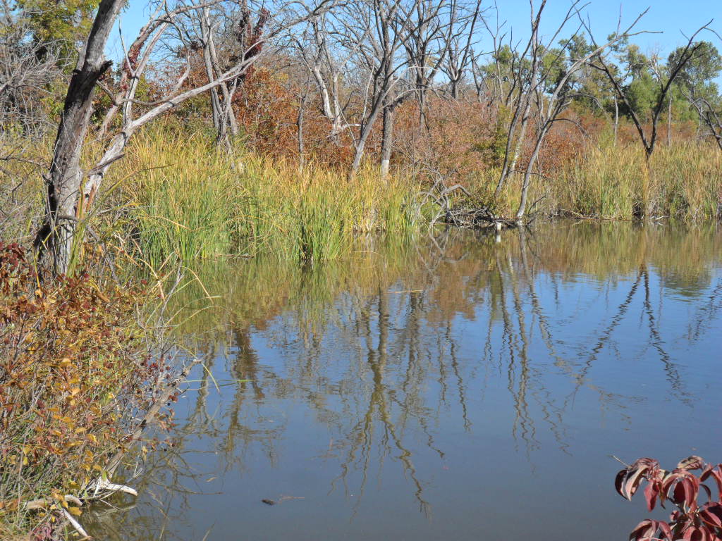
The hike provided continual surprises, a boggy pool, persimmon trees, a plant whose leaves resembled miniature spectacles, a grass so fine and thick in a glade between the trees that it looked like a tiny patch of fog on the ground, and poison ivy.

SAM_1336

Persimmons.

SAM_1343

This particular tree was loaded with persimmons.

SAM_1339

SAM_1340

Cattails in the background.

SAM_1341

SAM_1342

SAM_1344

When I first walked up to this spot, the fine grass toward the back of the photo looked exactly like a tiny patch of fog nestled in a miniature glade among the trees.

SAM_1346

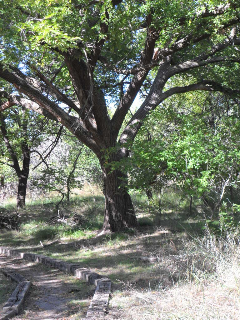
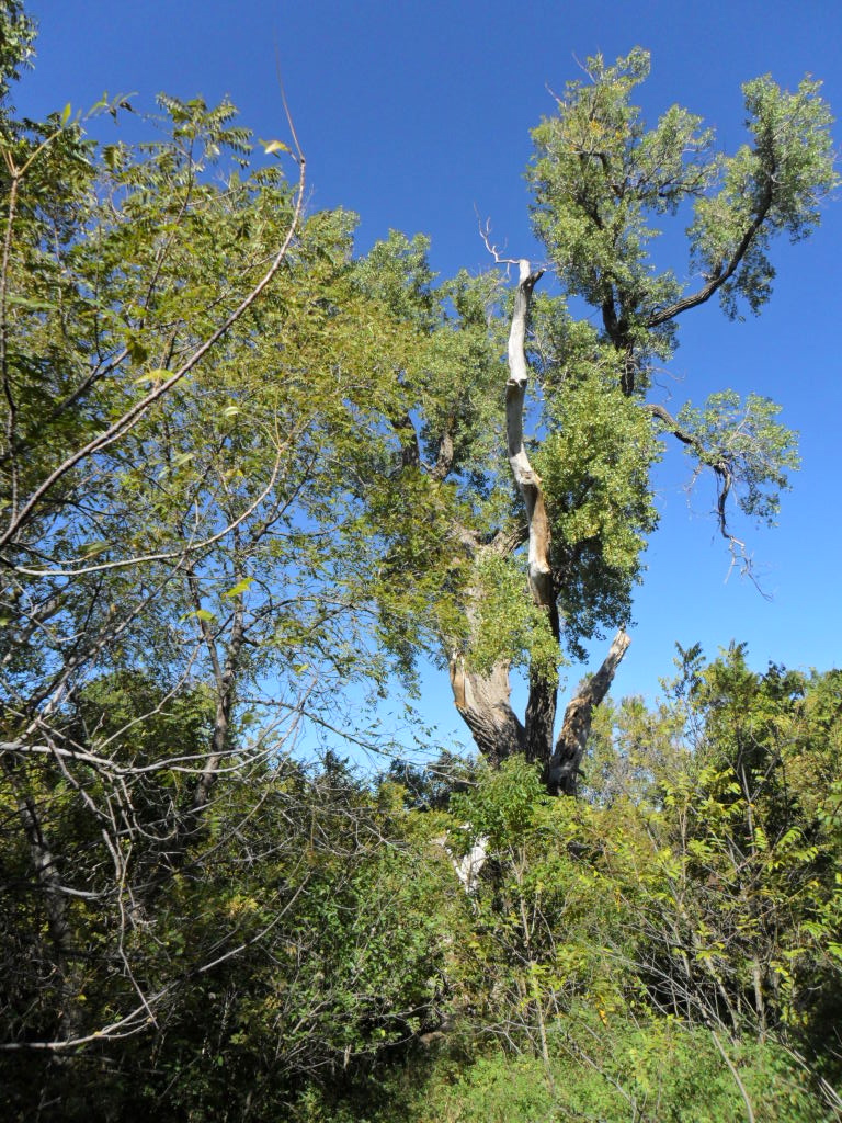
We took off from the main trail especially to come to this cottonwood tree, one of the oldest, if not the oldest, in the Panhandle. Over a hundred years ago this tree stood as the sentinel for the overland trail that went through this area.  The military, ranchers, and Native Americans all used the trail across this area of the plains.  The tree’s height enabled it to be seen for miles and helped travelers keep on their way with accuracy.  Once we reached the end of the main trail, some of the group took off in their vehicles while a few went on around the lake.  It saddened me to see so much of it dried up and old tires sticking out of the dried mud.  However, along the way, we saw numerous trees I could not identify.  The bark of this tree is particularly distinctive.

SAM_1347

This field trip coincided with the fall festival held annually in the small town of Canadian which gets its name from the Canadian River which flows beside the town.  The town is unique in the number of large, elaborate Victorian houses there.  Several of us ended the trip at the local elementary school with a big craft fair and a barbecue lunch.

Geronimo: A Manly Legend, No Women Allowed!


Geronimo: A Manly Legend, No Women Allowed!.  This is from a blog I follow.  If you are interested in Native American history, this is definitely a must read, complete with photos of the Apache women who have totally been left out of most tellings of the Geronimo and Apache histories.  I also recommend the story by Leslie Marmon Silko, my favorite author, which relates another view.  The story is, “A Geronimo Story”.  It can be found in her book, Storyteller.  There is a belief among some that the real Geronimo was not the person captured and imprisoned.  Supposedly, the Apache tried to tell this to the whites, but they refused to believe it.

Blackwater Draw-Part Two


The ancients hunted here at the shores of a lake

nearly 12,000 years ago.  In 1929, an amateur

archeologist discovered an ancient spear

point lodged in bone.  I walk the mile long trail

down into the depths.   Caliche, gravel,

larger rocks strewn by millennia.  For

thousands of years Clovis, Folsom, and Portales

Man left remnants of their hunting life.

The scattered cottonwoods whisper in the wind,

timeless voices call me, beckoning.

Who were these people?

What did they look like?

Where did they come from?

In whose gods and goddesses did they believe?

Doubtless hunger drove them to this place of water

and plenty.  Columbia Mammoths, giant sloths, dire wolves,

saber toothed cats  gathered here for thousands of years.

The diggers found an obsidian spear head with a

bison whose horns spanned seven feet and

mammoths twice the size of elephants.

Saber toothed cats competed with these

ancient ancestors at this place, all driven by

hunger, thirst, and instinct.  I wonder how

these people overcame danger, fear?

I walk the mile long path, stand in the shade

of these cottonwood trees , read the signs that

tell me what diggers found at specific spots along the trail.

The cottonwoods whisper to me.  They

tell me ancient tales of hunger, strife, fear,

beauty, love, endurance.  I hear the ancient voices

calling.  They tell me ancient tales of woe, war,

weaponry, courage, and community.  My

skin tingles strangely in the summer heat.  Now

this land is dry, a desert, the water that sustained

teeming life evaporated in the crystalline air.

Twelve thousand years from now who will stand here?

Will this place exist?  Will someone wonder the meaning

of our bones, who we were, what we believed?

Blackwater Draw–Part One


Annually, I make a pilgrimage to this ancient place where people hunted on the shores of a lake nearly 12,000 years ago.  It continues to be the oldest evidence of human habitation in the Americas.  For a large part of the twentieth century it was a gravel pit.  The gravel mining created both positive and negative consequences.  Without it, the bones of giant bison, mammoths, dire wolf, saber toothed cat and camels might never have been discovered at all.  However, because the owners of the quarry refused to stop mining, some portions of the site were destroyed by big swoops of the excavator machines.  Frequently archaeologists worked simultaneously along with mining operations, continuing within sight of each other.    Various groups, including some private individuals, attempted repeatedly to buy the site to save its precious stash of bones, artifacts, and ancient wells.  The owners refused to sell.  Finally, in 1978, Eastern New Mexico University purchased the site and continues archaeological excavation there.  They also run the nearby museum adjacent to the university football stadium.

If you expect something wondrous and grandiose, you will be severely disappointed.  A small building houses a teensy museum, restrooms, a few sweat shirts and posters and books for purchase.  An individual sits by the door to take your meager entrance fee–at most five dollars–and answer questions.  These individuals explain they are majors in disciplines related to the site, archaeology, paleontology, anthropology, that sort of thing.  A simple gravel trail traverses the site and a smaller trail goes to an ancient well–16 have been found at or near the site–and to a dig inside a building where you can observe the layers unearthed, which group of people left which type of artifacts, and actual bones of mammoths, giant bison, and other animals from the end of the last Ice Age.

People react differently to such sites.  I always remain entranced, overwhelmed, reflective, thinking to myself, “I am walking where people walked and hunted and went about their lives more than 11,000 years ago.”  The most ancient evidence of people is labeled Clovis Man–Clovis, NM, is just up the road.  They never found human bones of these people here , just their spearheads stuck in the ribs and shoulders of mammoths which stood 15 feet at the shoulders.  The people who came later made a different type of spear, called Folsom points.  These people, Folsom Man, lived later by 1-2 thousand years.  Another site, called Folsom, is near the tiny town of Folsom, NM, farther north at the edge of the mountains.  This site is on private land and tours are available only twice a year.  Although I visited the town last year, I have not visited this site.  Other people arrived later and although the collection is smaller, their spearheads remain available for viewing at the nearby Blackwater Draw Museum on the main road between Clovis and Portalis, NM.

When I look at the list of animals who lived here at the end of the last Ice Age, I feel amazed because they include both camels and horses as big as our horses now.  Both of these became extinct as did the saber toothed cat with the humongous canine teeth and the dire wolf.  Giant sloths lived until modern times but nowhere near New Mexico.  How could all these animals live here?  It was wet and green then.  Until the last couple of decades, bodies of water of varying sizes have drawn animals and people to this area.  Giant fields of irrigated corn and dairy farms lowered the water table sufficiently to eliminate any evidence of water.  At the time of Clovis Man a large lake covered the site.  Later, during a 3000 year drought, people dug the ancient wells to reach water.  Because this remained the only place for hundreds of miles with a supply of water, people came.

The trail begins just to the northwest of the tiny building and goes along the top for a couple of hundred feet before it drops down into the gravel pit remains.  The gravel was below all the layers containing human artifacts and ancient animal bones so the pit is wide and deep.

SAM_1302

SAM_1301

If your sight is good, you can read this.  The primary source of food for Clovis Man, giant bison and Columbian mammoths, came here for the water.  Archaeologists  theorize that hunters often killed these huge animals while they were in the water where it was more difficult for them to escape and move quickly.  In one place on the trail, evidence of a five bison kill complete with spearheads makes one think just how difficult and dangerous this hunting activity must have been.  I stand there, think about my own 5’4″ height, and wonder what it would be like to have a Columbian mammoth close to me.  Doubtless many died from injuries during such activities.

SAM_1304

The train meanders along the bottom of the gravel pit.  This year, plentiful rain grows abundant grass.  During the last several years, little rain has fallen as evidenced by all the dead trees and bushes scattered around the site.  Normally, this area is semiarid with less than 18 inches of rain per year.

SAM_1303

If spectacular scenery appeals to you, do not go here.  Most of the bones and artifacts were found in the layers at the sides of the pit.  As you walk the trail, markers indicate the location of findings.  Few human remains are found at such sites because these were not permanent settlement places.  Ancient peoples roamed the land in search of water and food.

SAM_1305

Signs, such as this along the trail, illustrate different places where specific bones and artifacts were found.  They also explain the different types of artifacts, their specific uses, and the history of the site.  Maps, like the one on this sign, help the viewer hone in on specifics in relation to where one is standing.  The photo illustrates archaeologists in action during site digs.

SAM_1307

Cliffs, like the one here, surround the site.  In these small cliffs each layer indicates a different age of human activity by not only the type of sediment but also by the type of artifacts and animal bones found.  Just beyond this particular cliff at the west edge of the site, irrigation pivots run in a huge corn field.  The grey at the bottom of the cliff indicates an immense pile of dead, dried, tumble weeds.  This is dry country.

SAM_1308

Approximately three fourths through the trail, the site mangers have erected several structures.  This one is the most primitive.  Others are modern with picnic tables and in one place I saw a giant sand box.  Guessing, I think it must be used to illustrate how one sifts through layers of soil to carefully remove spearheads, bones, pottery, etc.  This is the perfect place for a field trip, not too long, but full of geological and paleontological information.

I go here usually once a year.  If you ask me why, I may articulate something about how it has the oldest artifacts and bones found in North America.  The real reason??  I am not quite sure.  This place fascinates me, connects me with something ancient and wondrous, something undefined and mysterious.