My Ethiopian Adventure–on the Road from Lalibela to Gonder


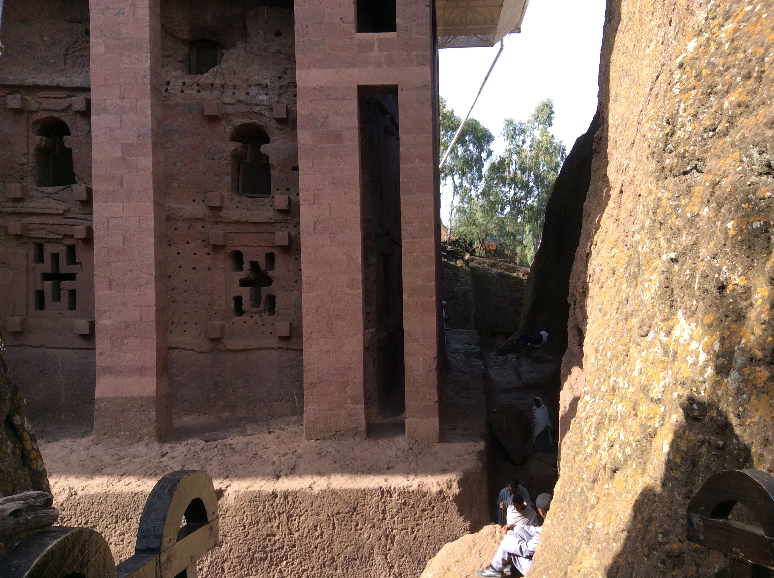
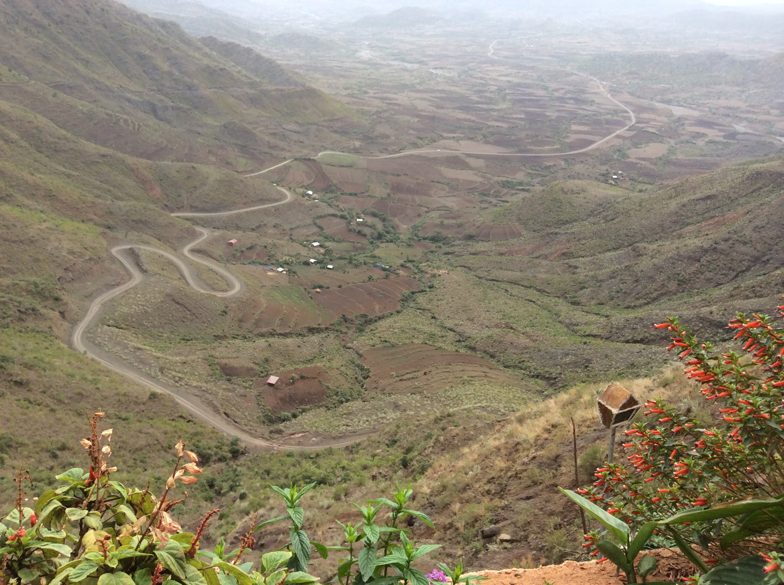
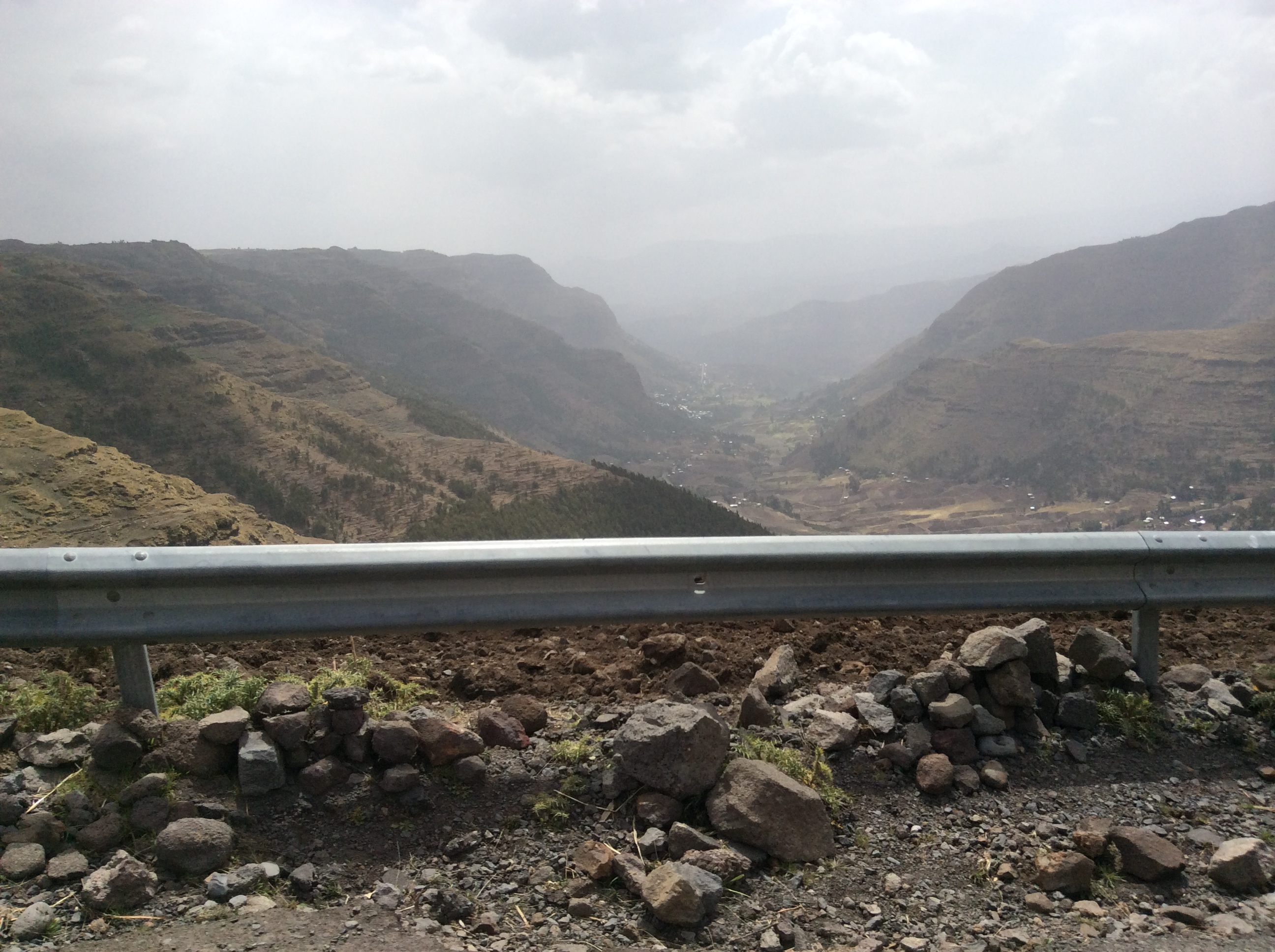
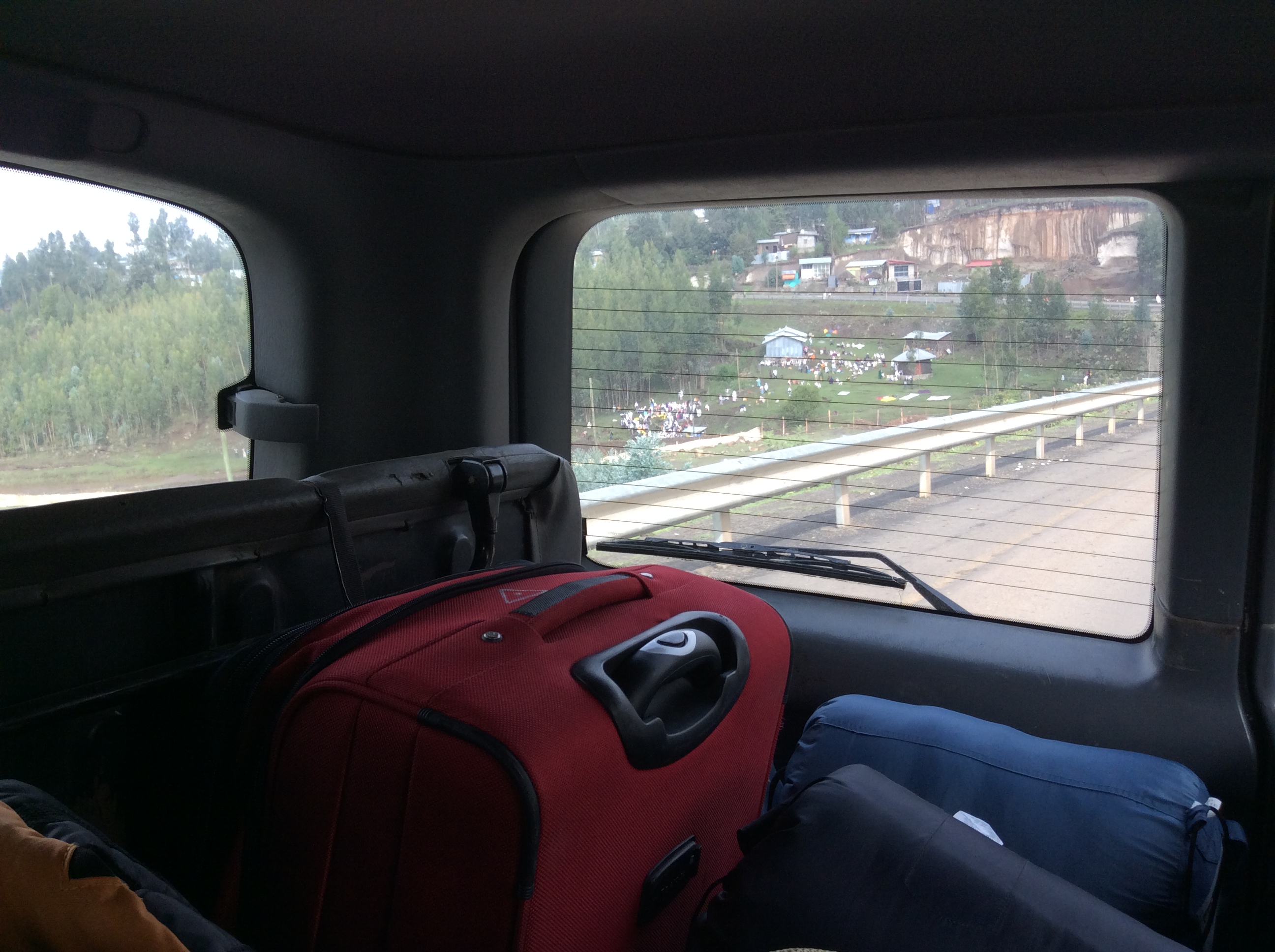
Since there is only one road in and out of Lalibela, we headed back to the main road after an 8:00 breakfast.  By this time, after three times on this road, the heights hardly bothered me.

IMG_0491

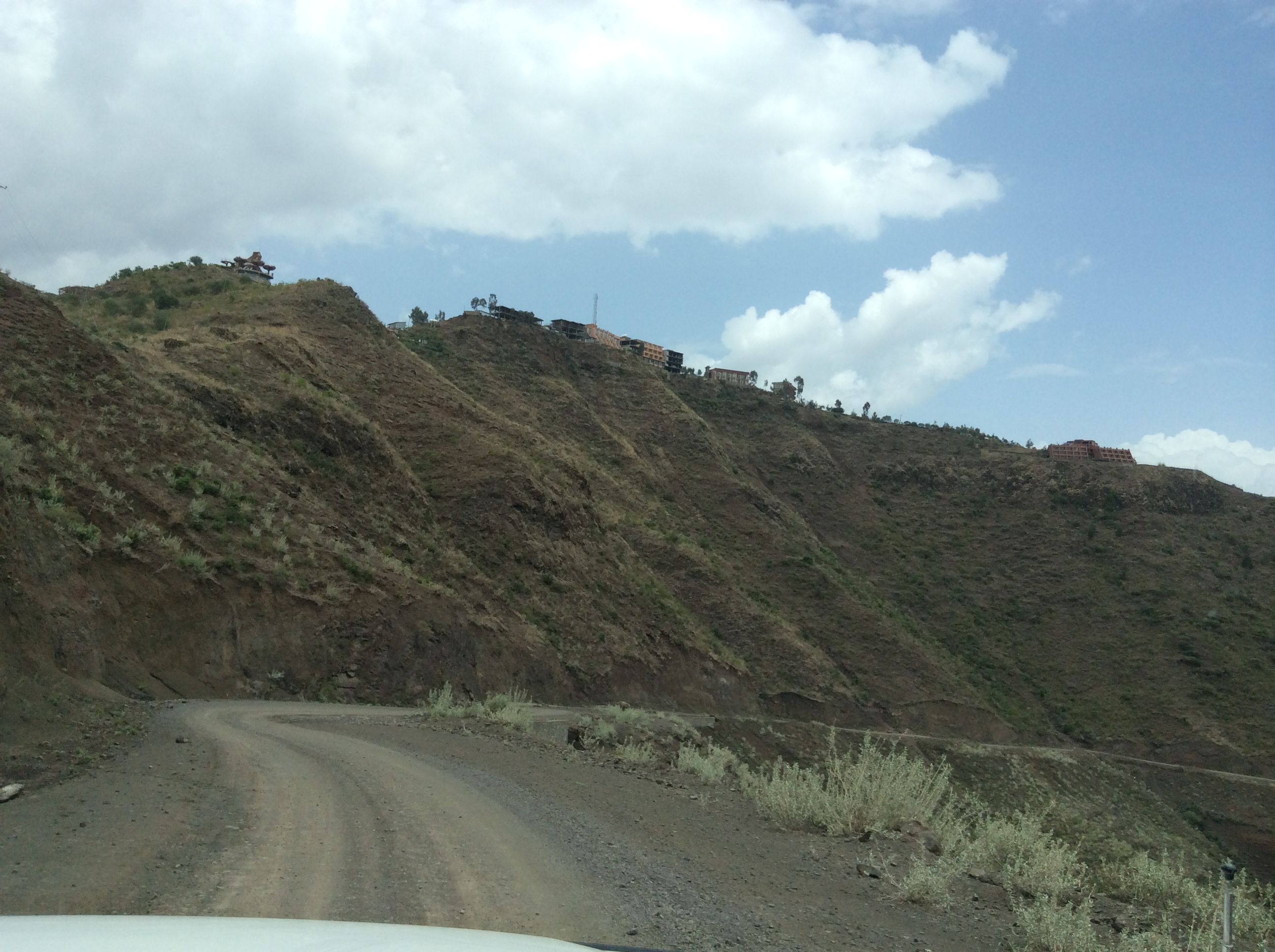
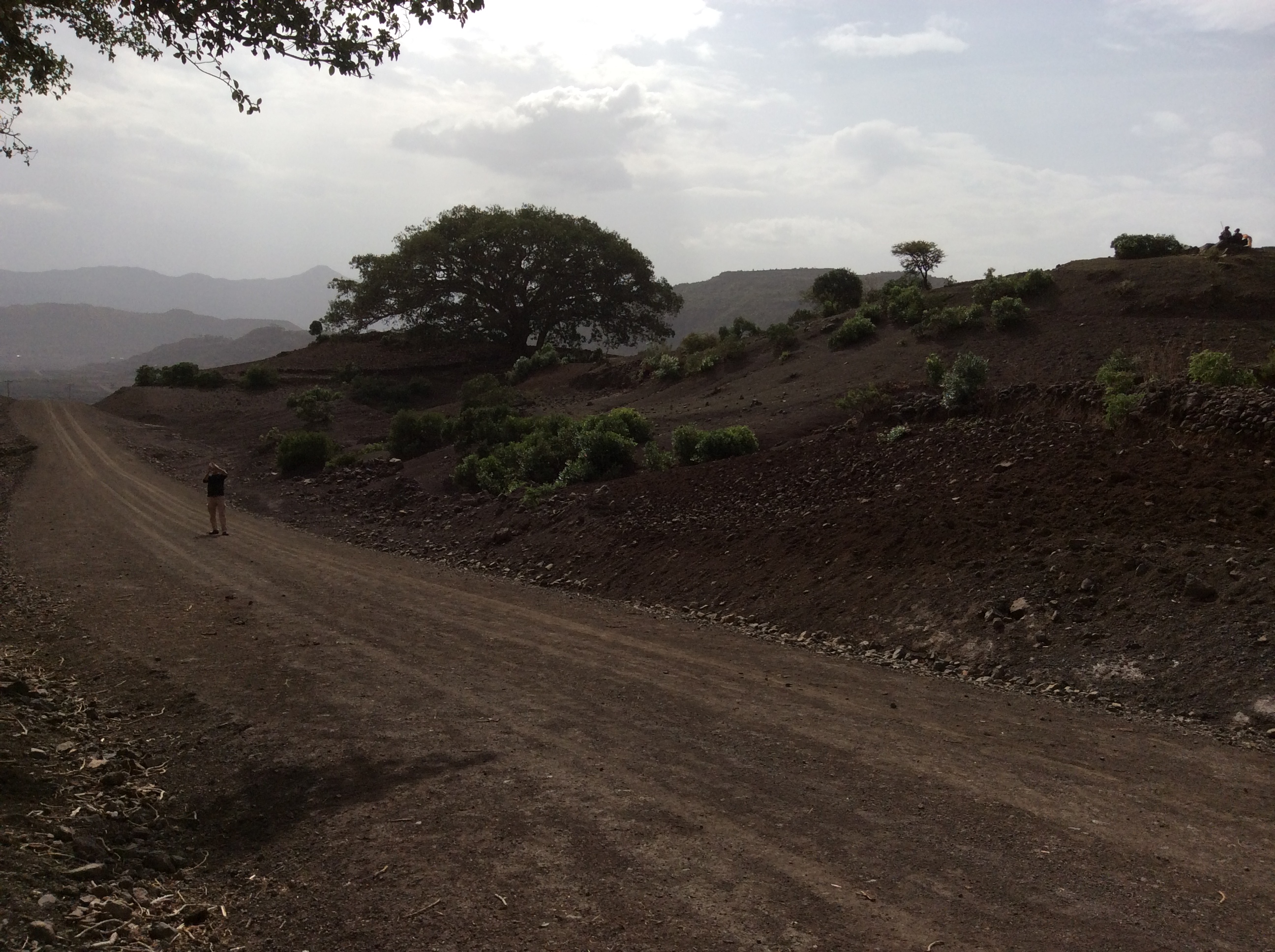
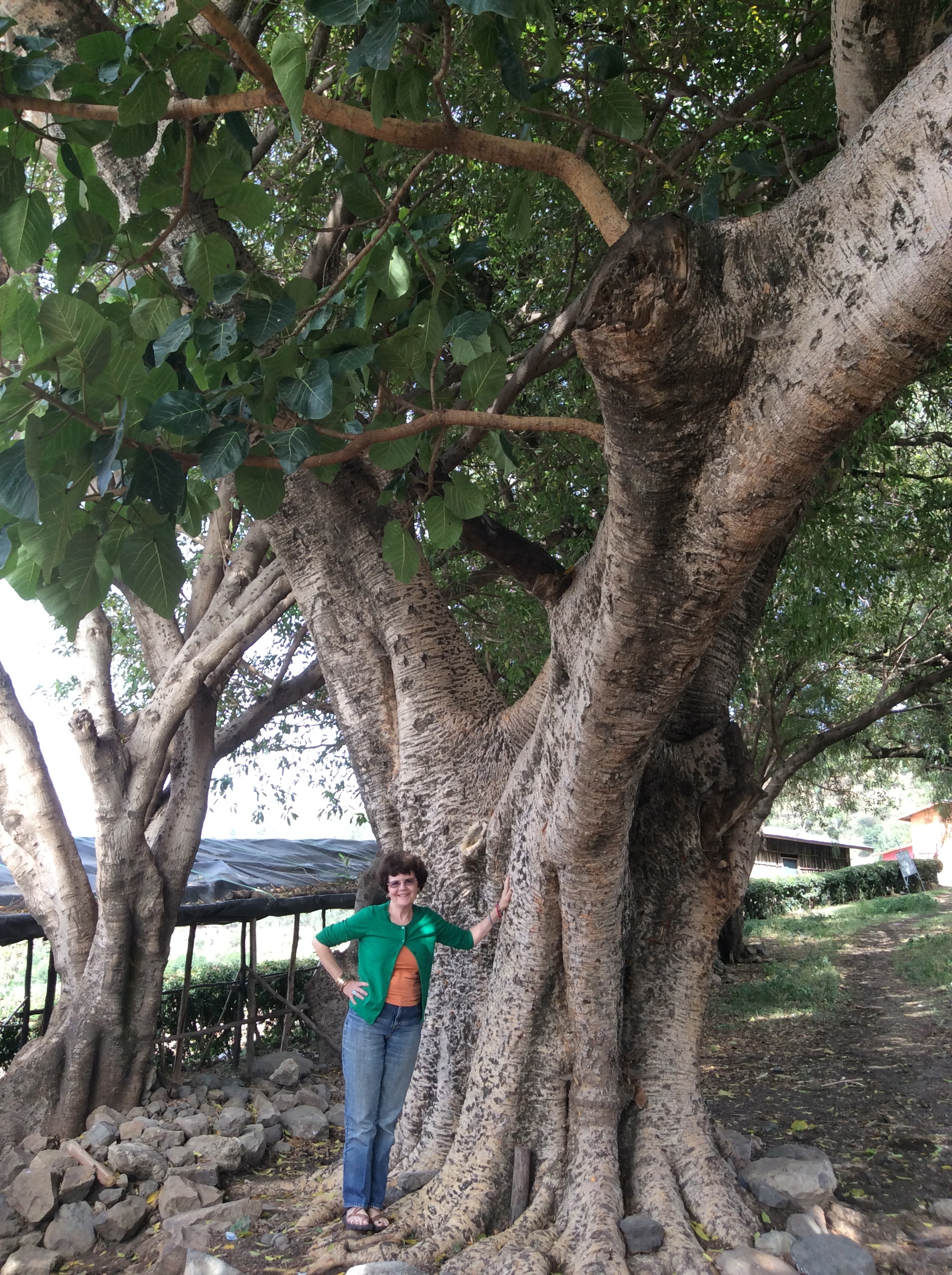
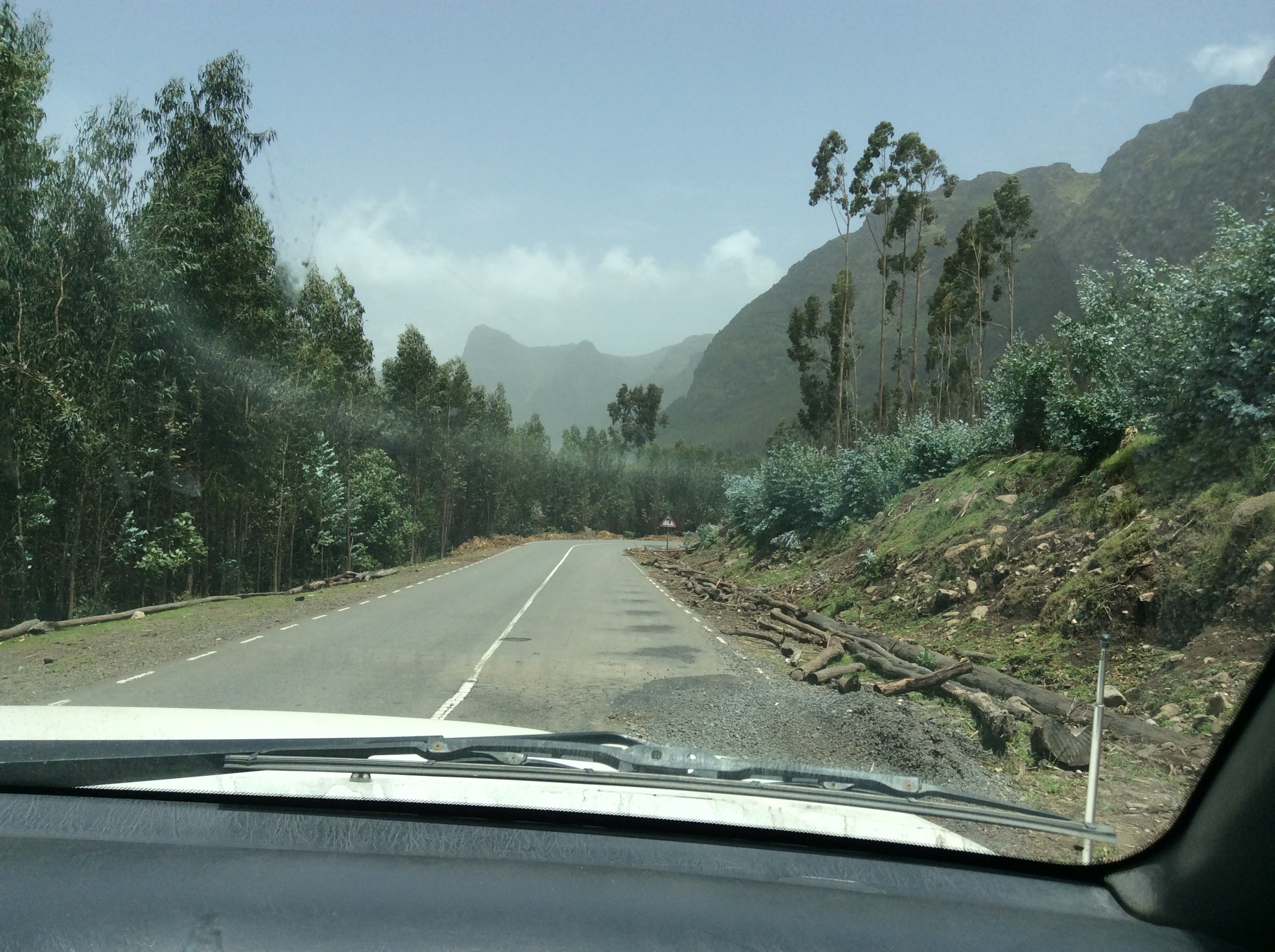
We drove through mountains a large part of the day, through the large towns of Nesfas Mawcha, Debre Tabor, and turned north at Wereta. By this time, I had become accustomed to seeing endless beautiful scenery, hardly knowing when to take photos.

IMG_0501

IMG_0502

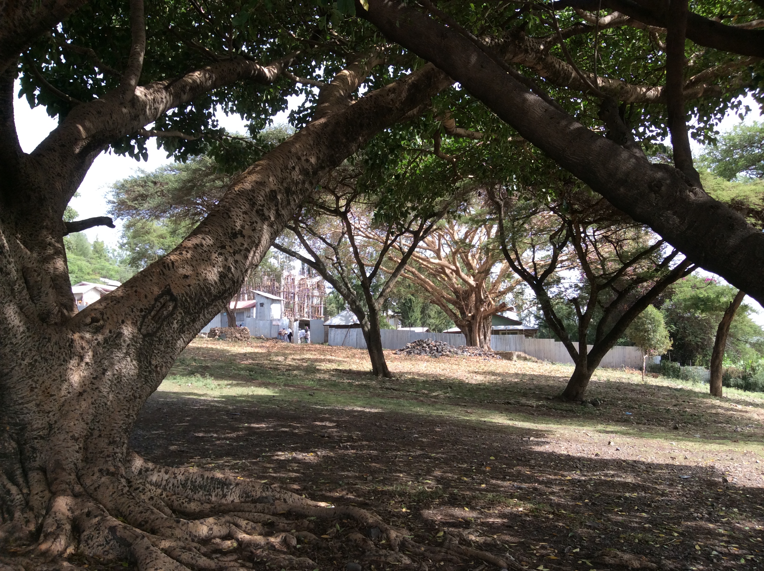
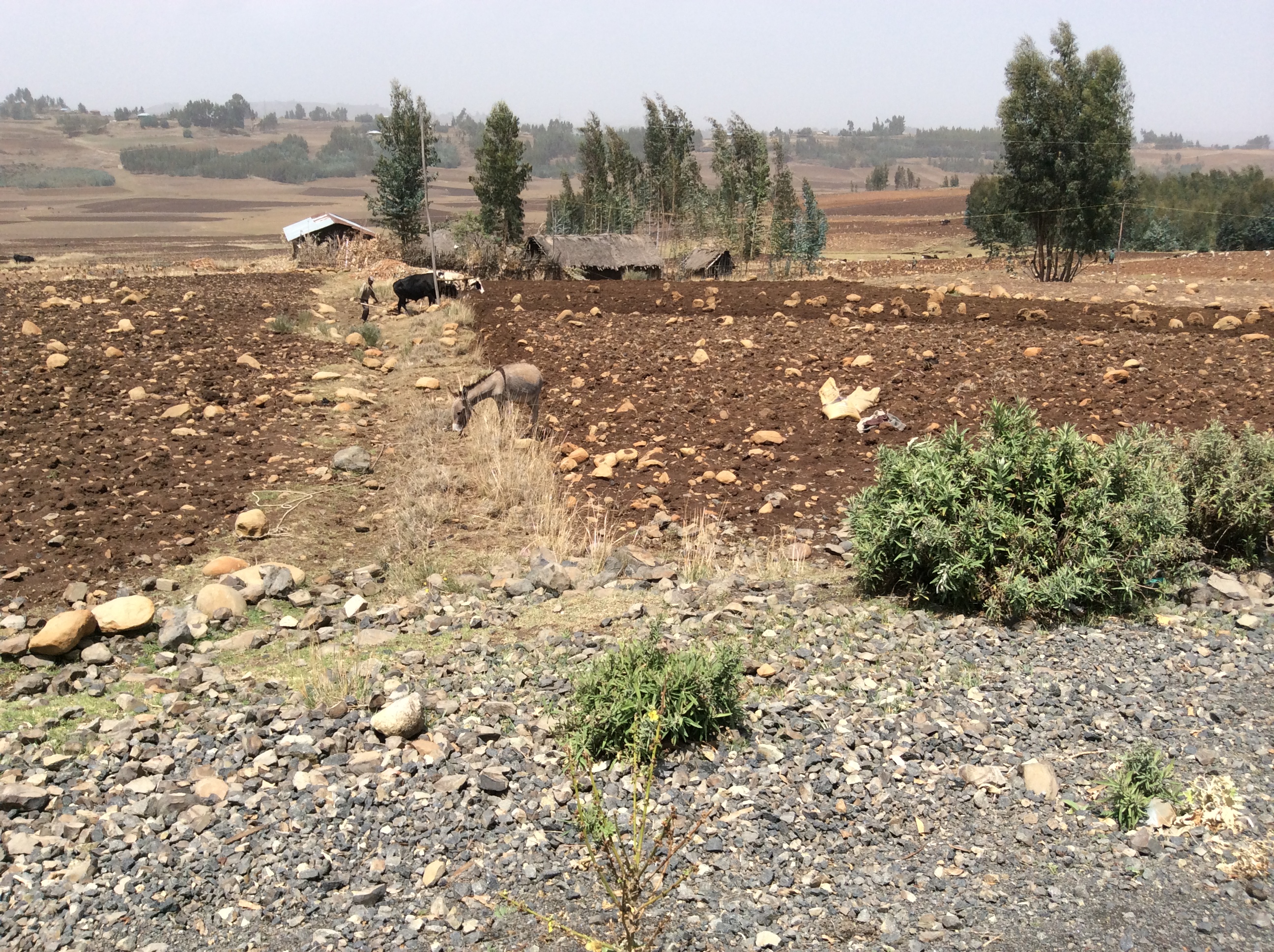
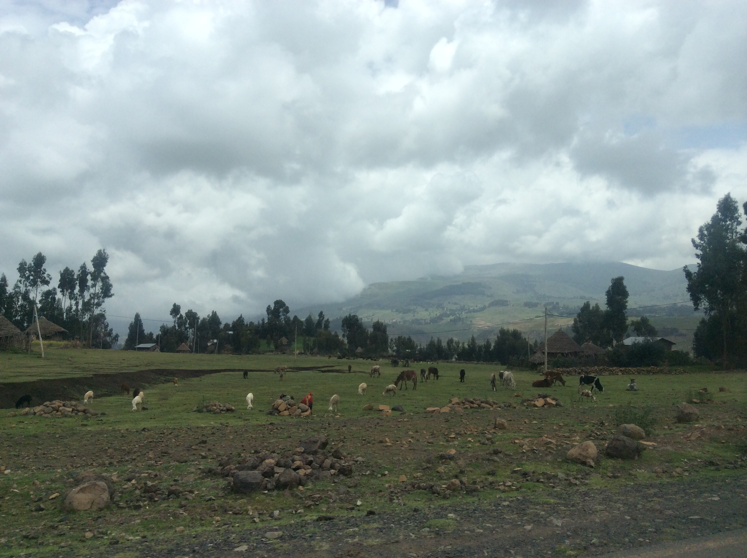
The invasive eucalyptus trees and pastoral mountain villages show up everywhere.

IMG_0503

IMG_0505

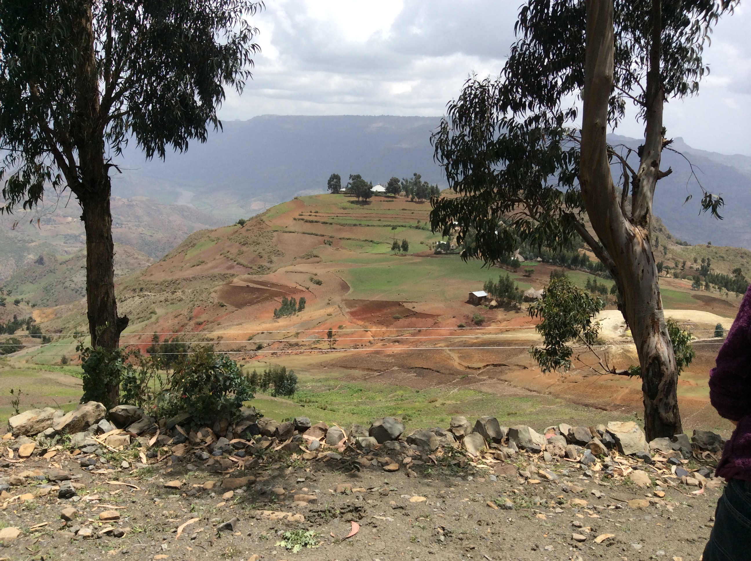
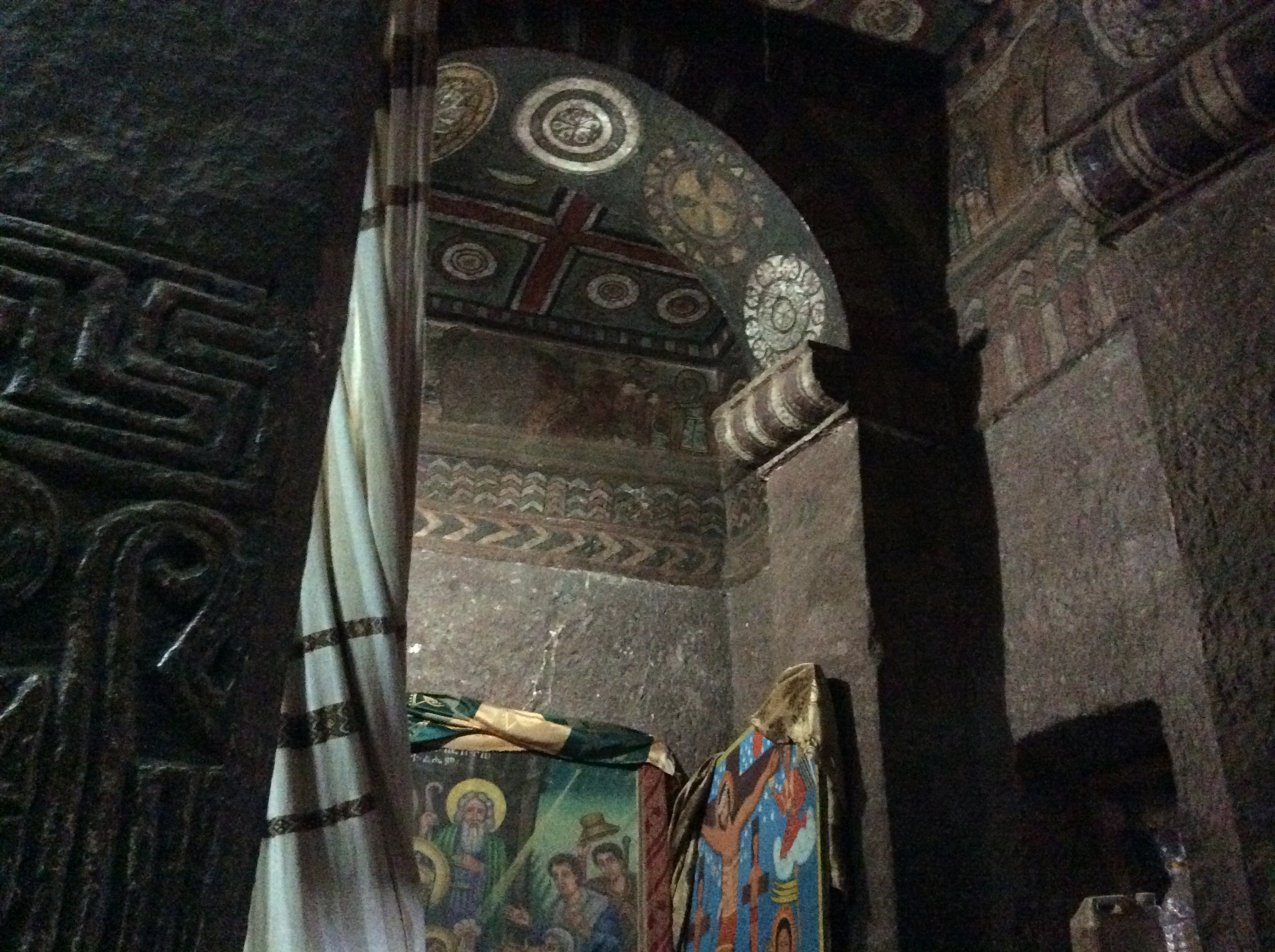
Most villages have their own church.  The building with the round roof in the distant middle is one such little church.

IMG_0507

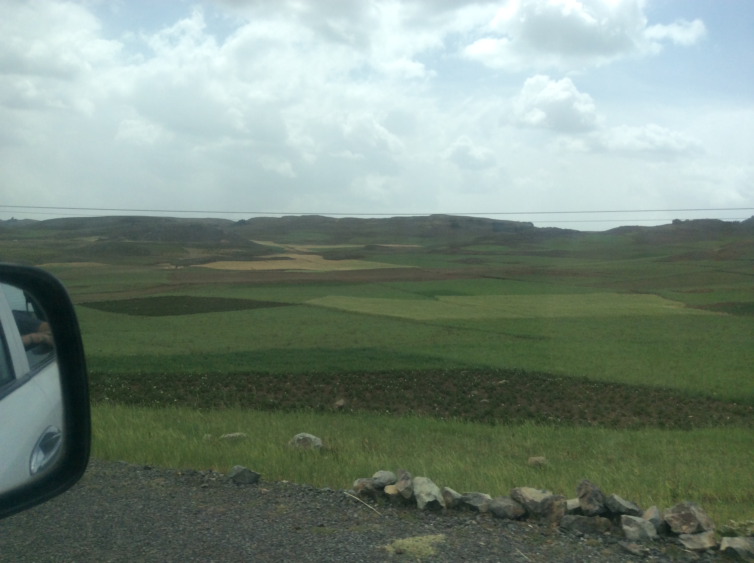
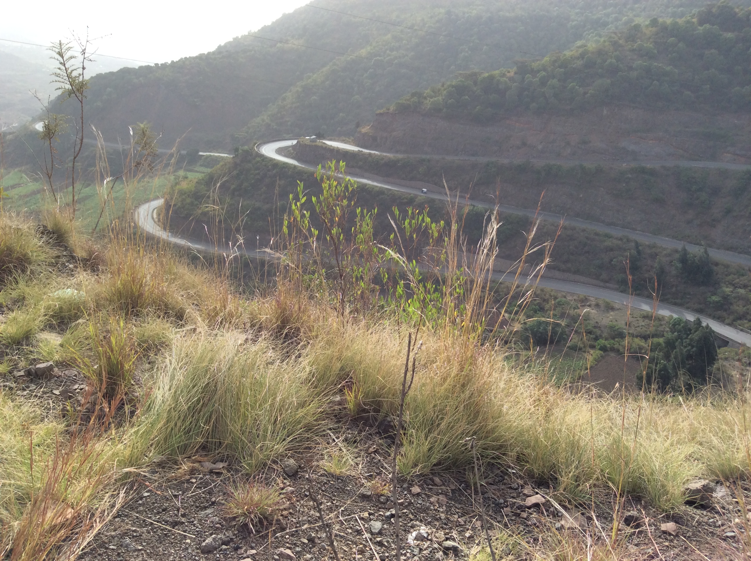
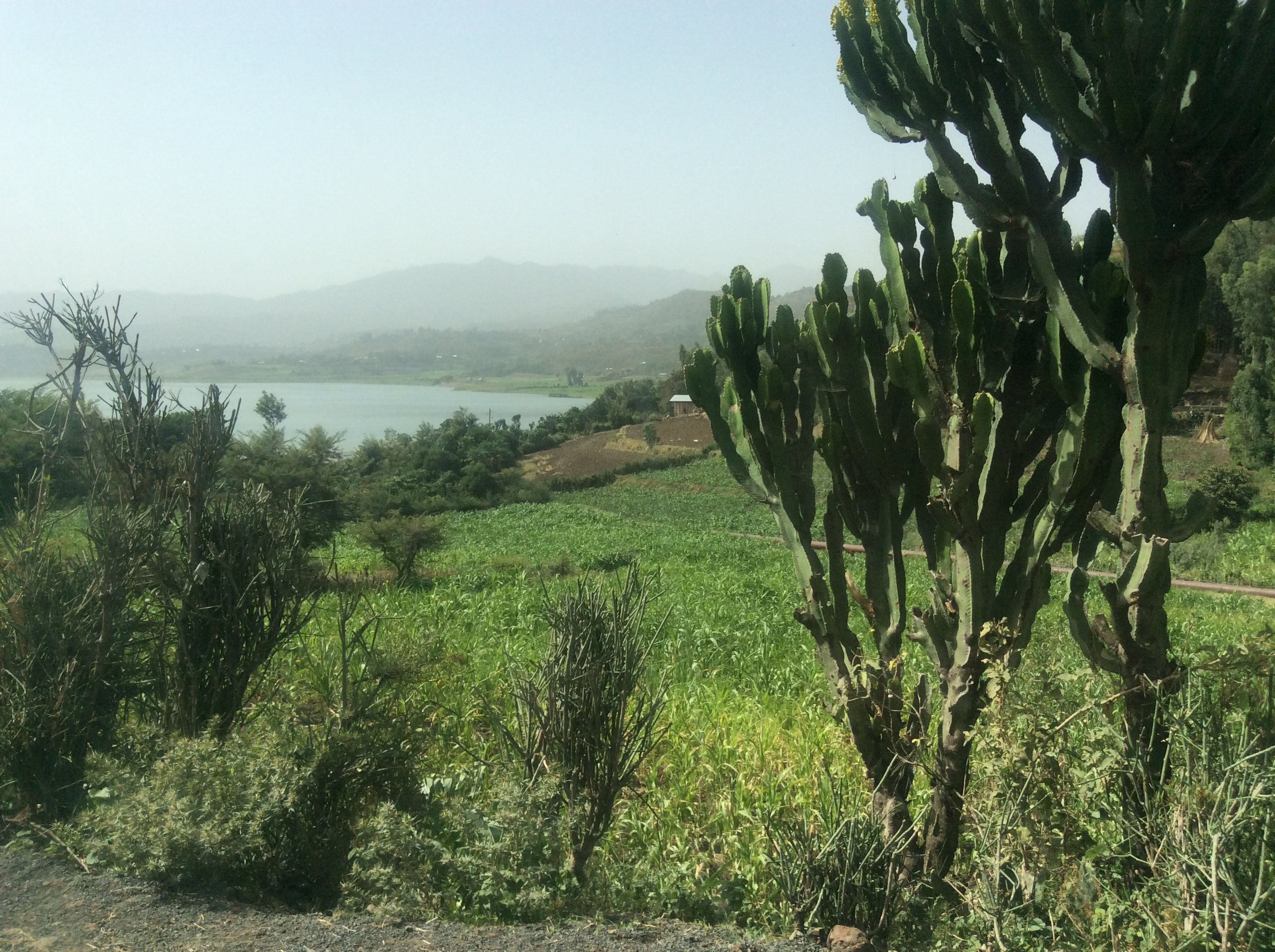
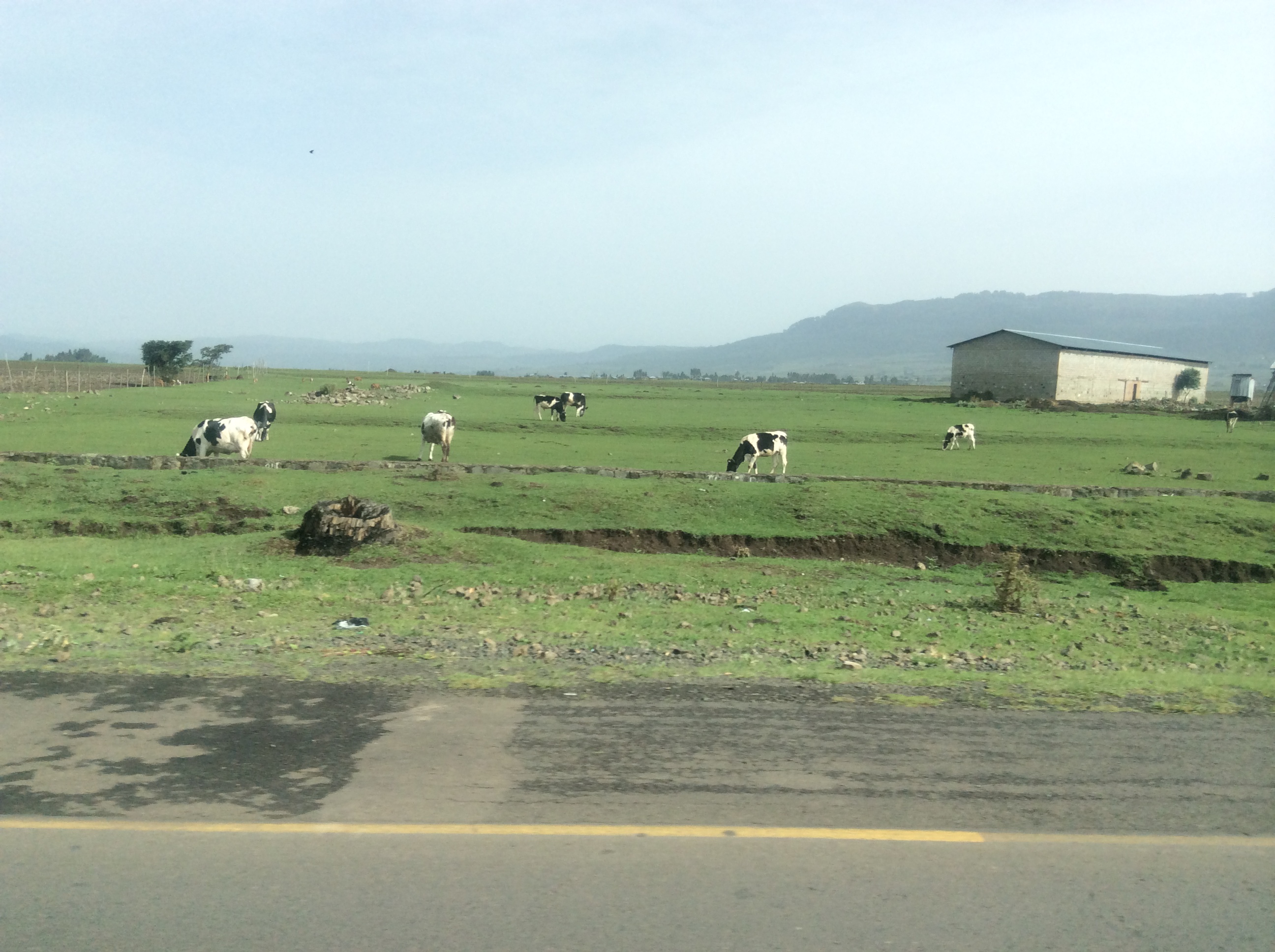
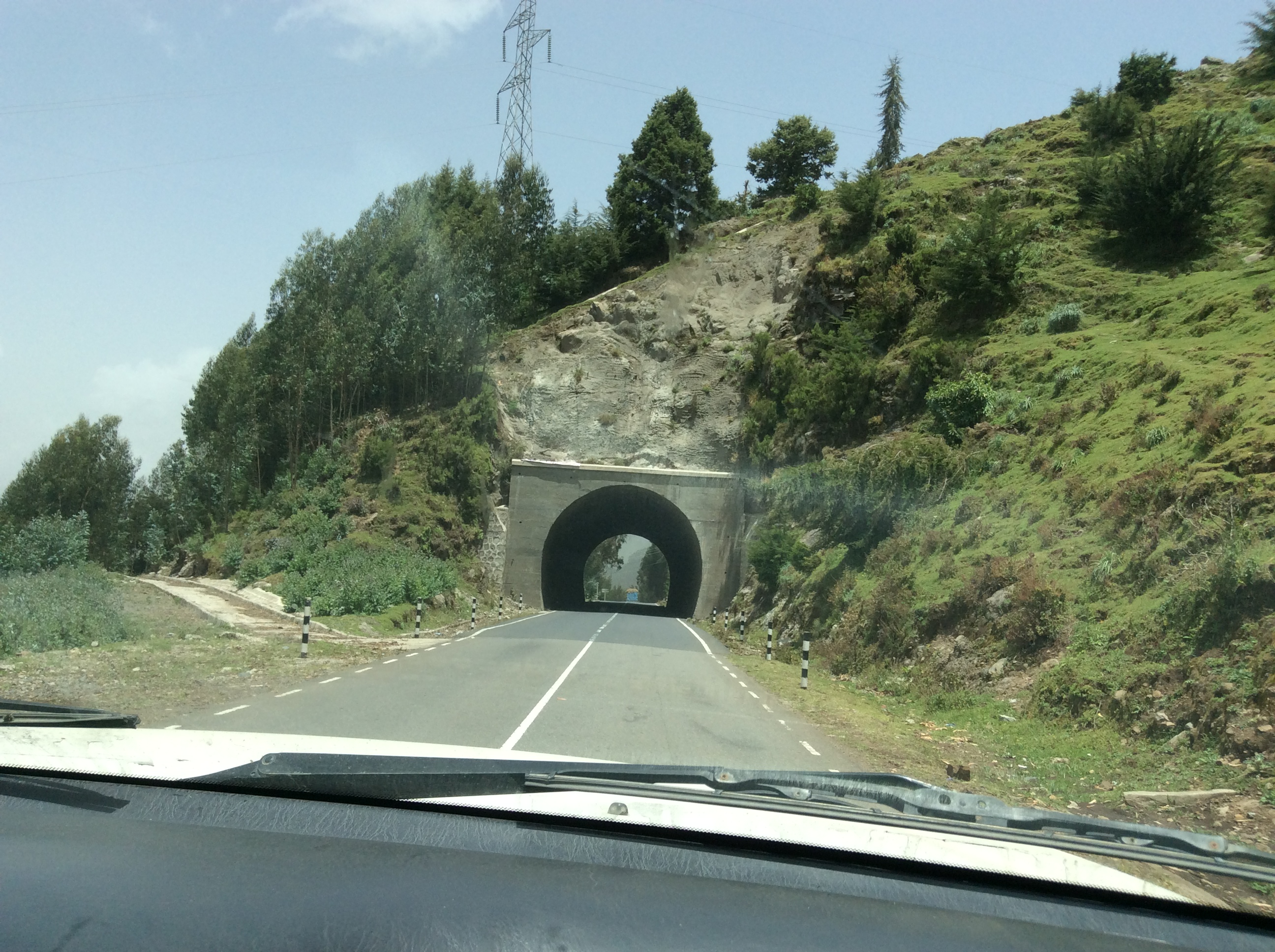
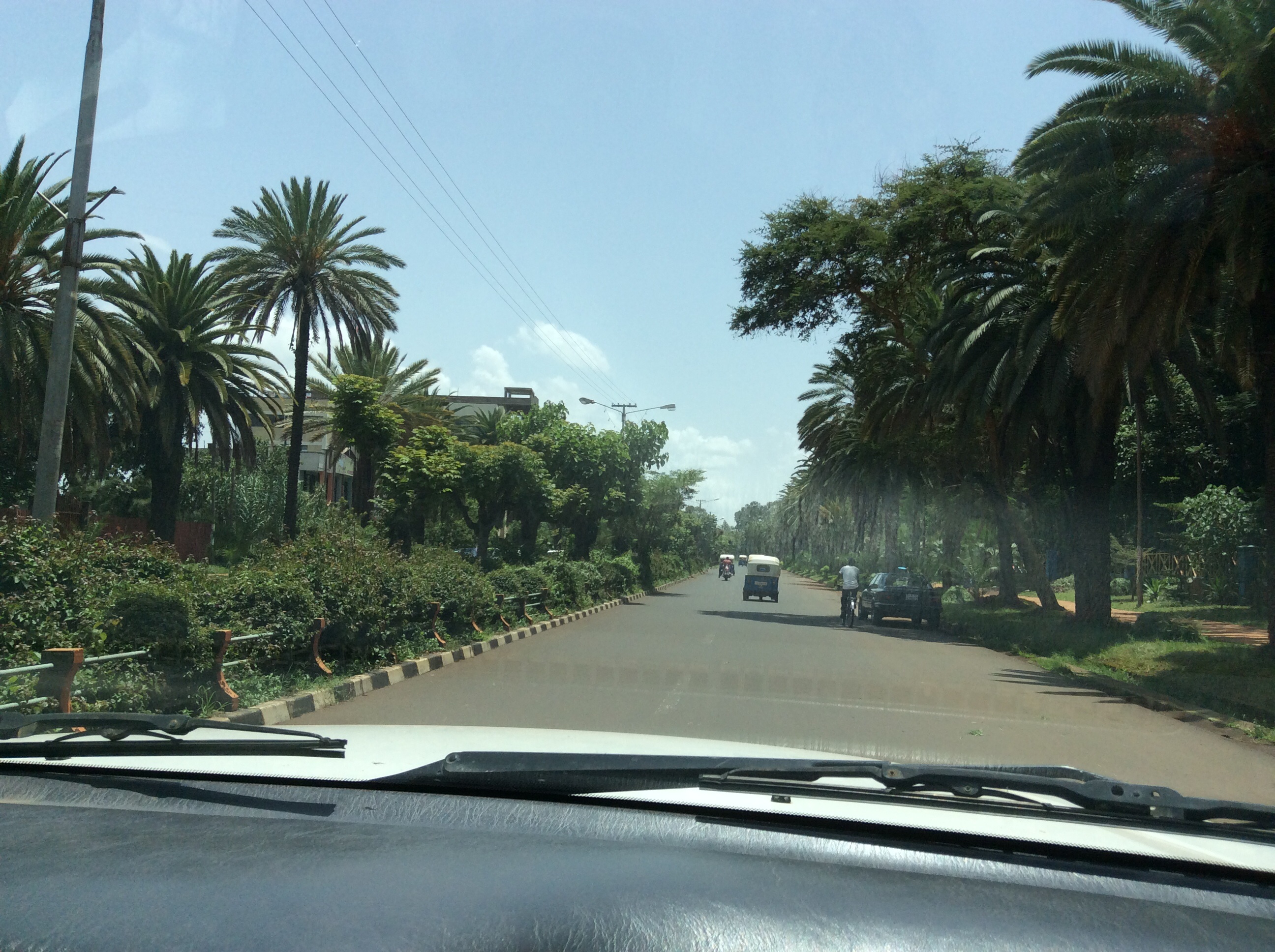
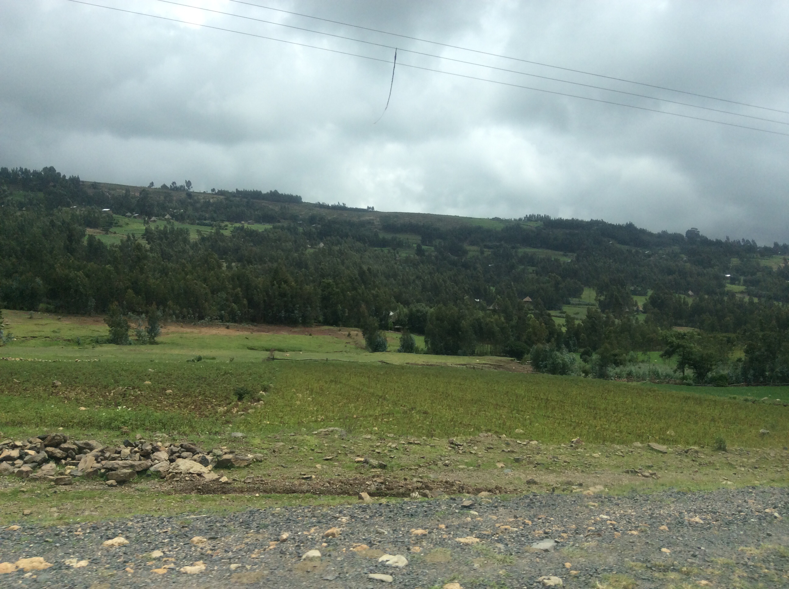
Excellent roads, mostly built by the Italians years ago,  crisscross this part of the country. Some newer roads have been built by the Chinese.  Many Ethiopians made jokes about this, implying they do not expect them to last  long.  After reaching a high plateau, we drove through endless pastures and fields of green.

IMG_0508

IMG_0509

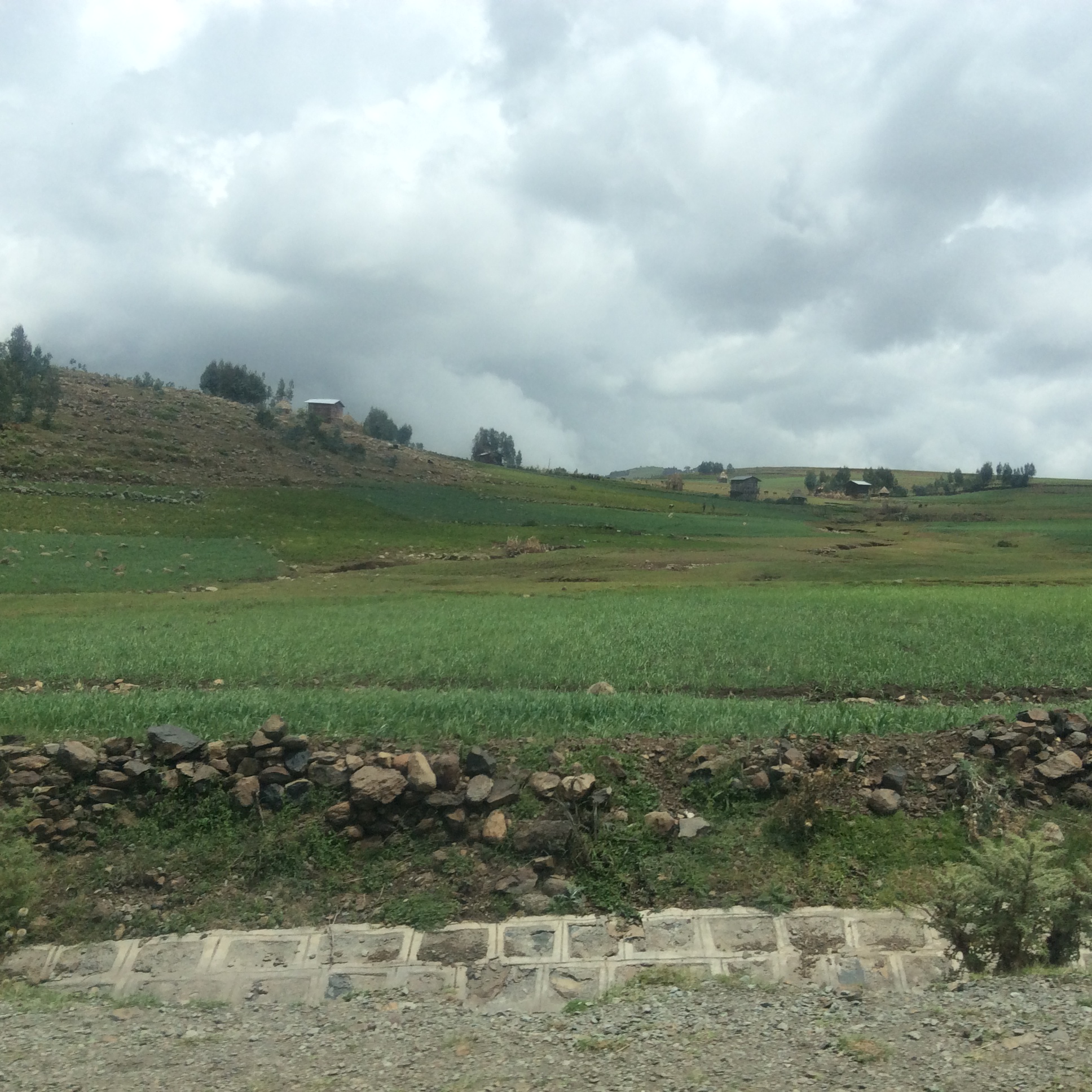
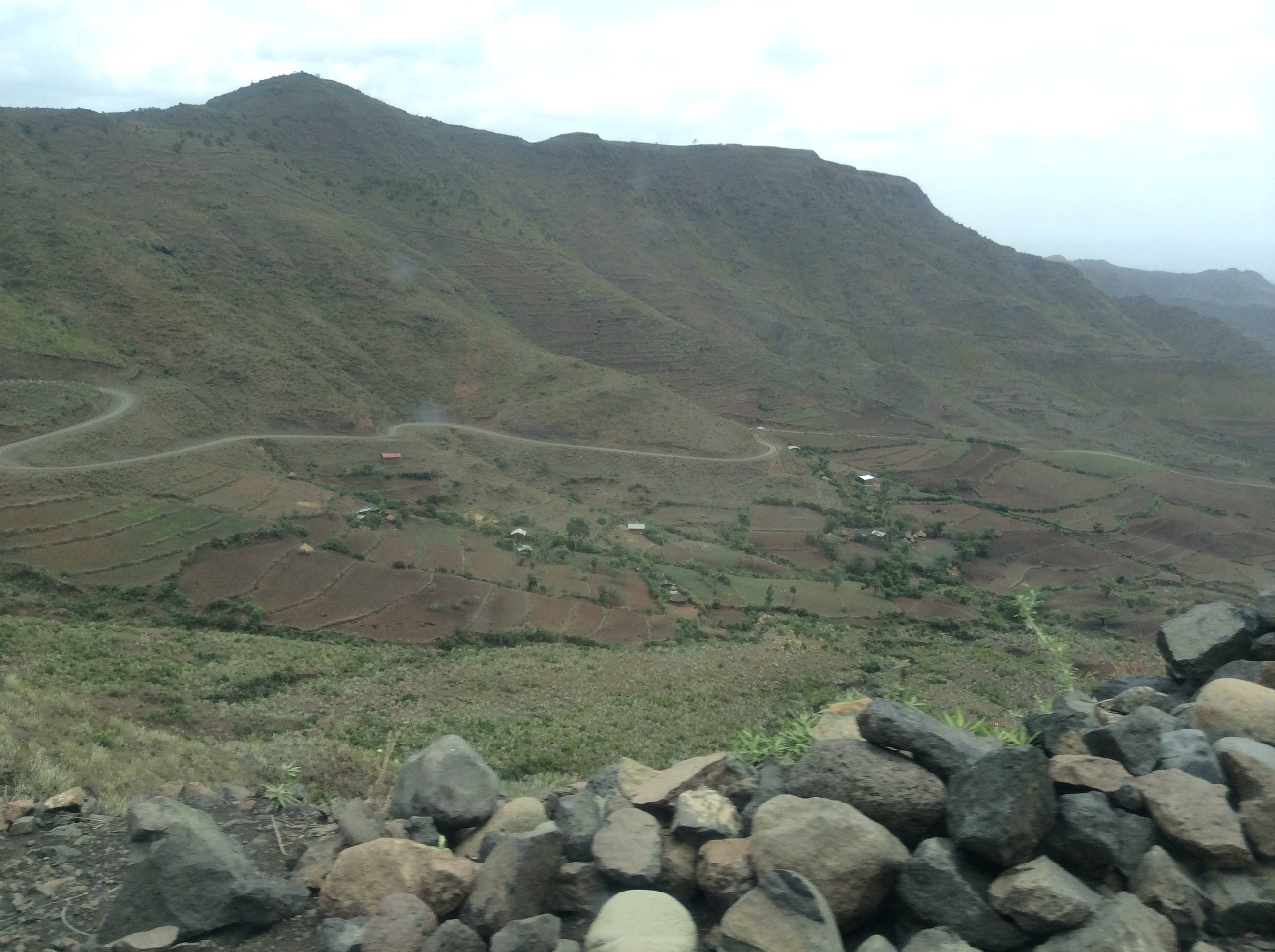
Up in this high country, farmers grow wheat, barley, and oats.  Horses and cattle graze in large pastures.

IMG_0510

IMG_0512

IMG_0514

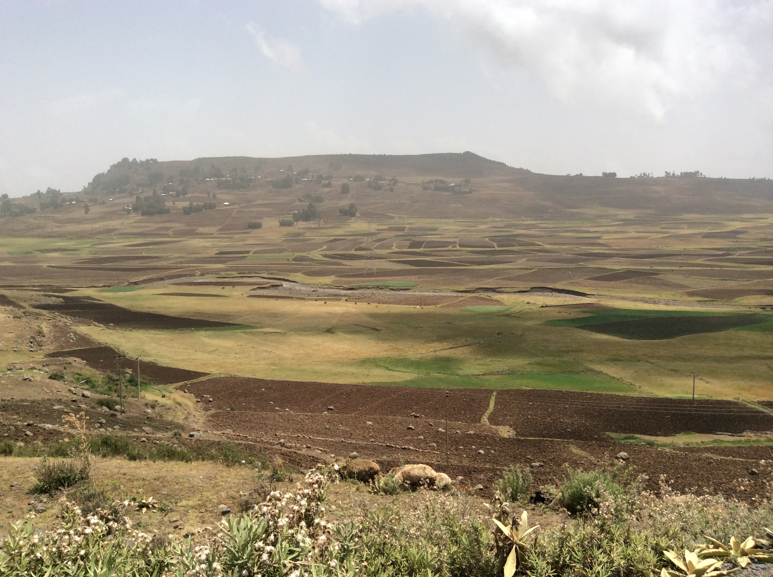
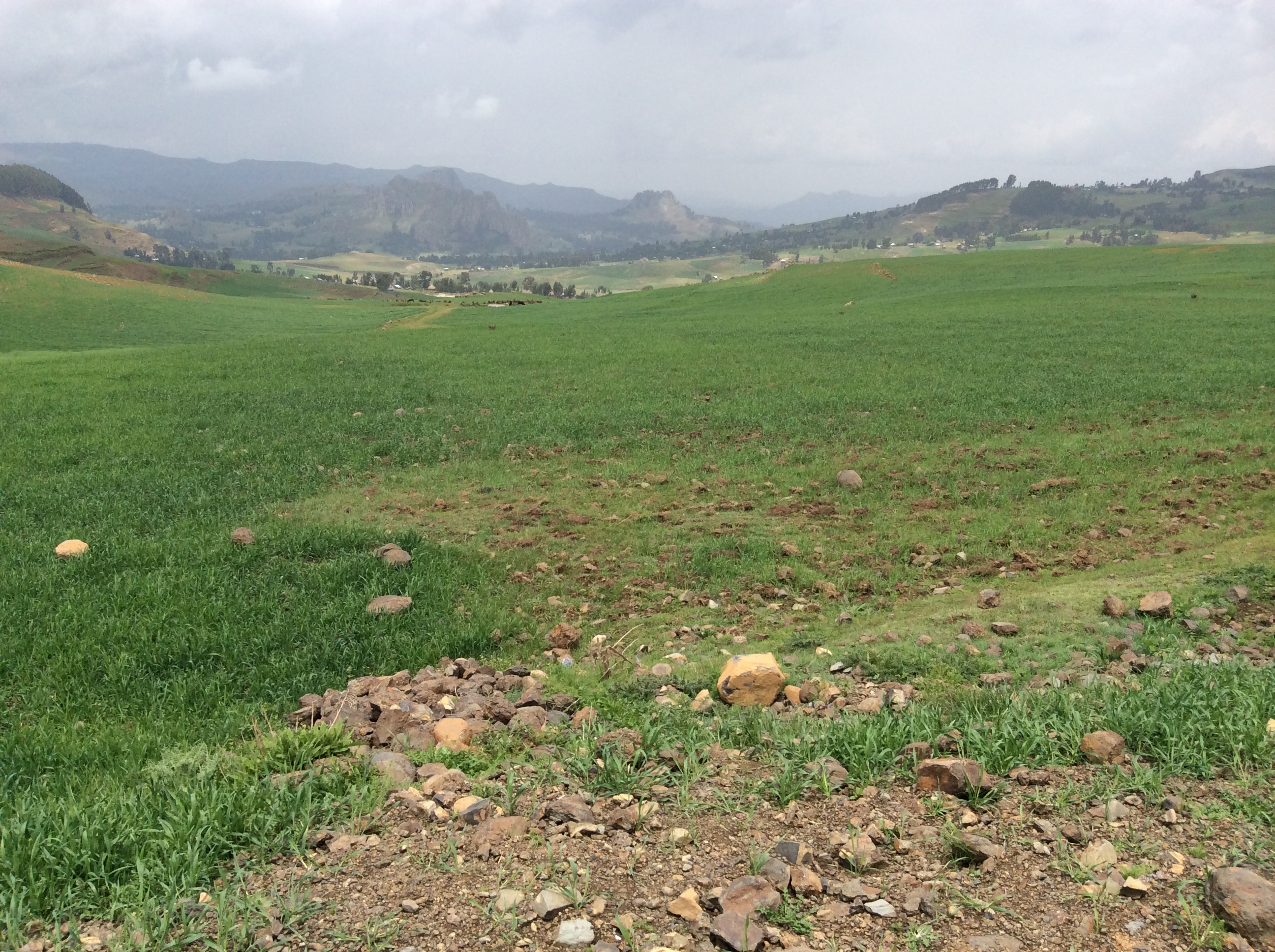
The mountains appear to continue forever.

IMG_0515

IMG_0516

Buildings, like the one in this photo above, usually house animals at night to protect them from predators such as hyenas.

IMG_0517

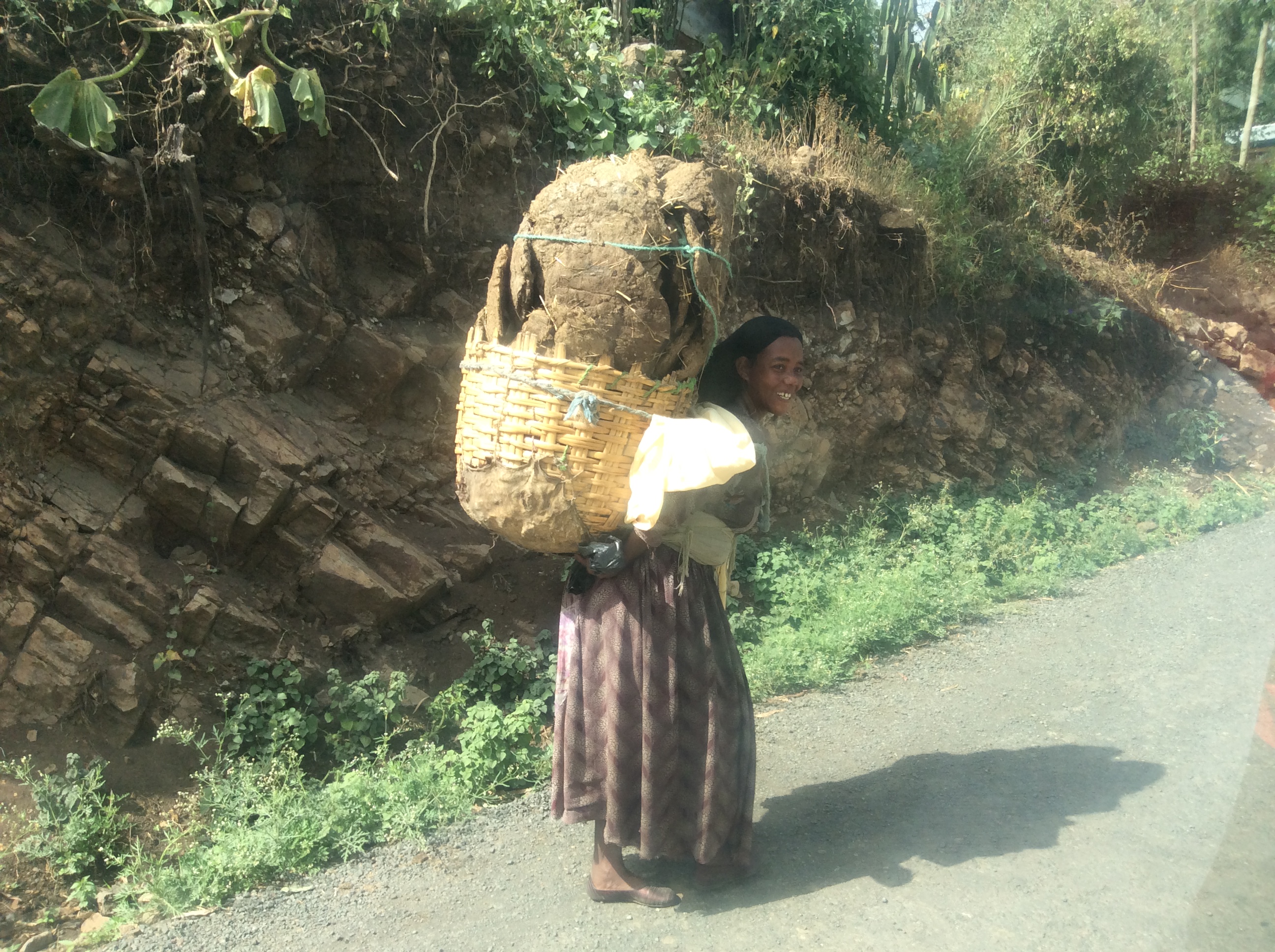
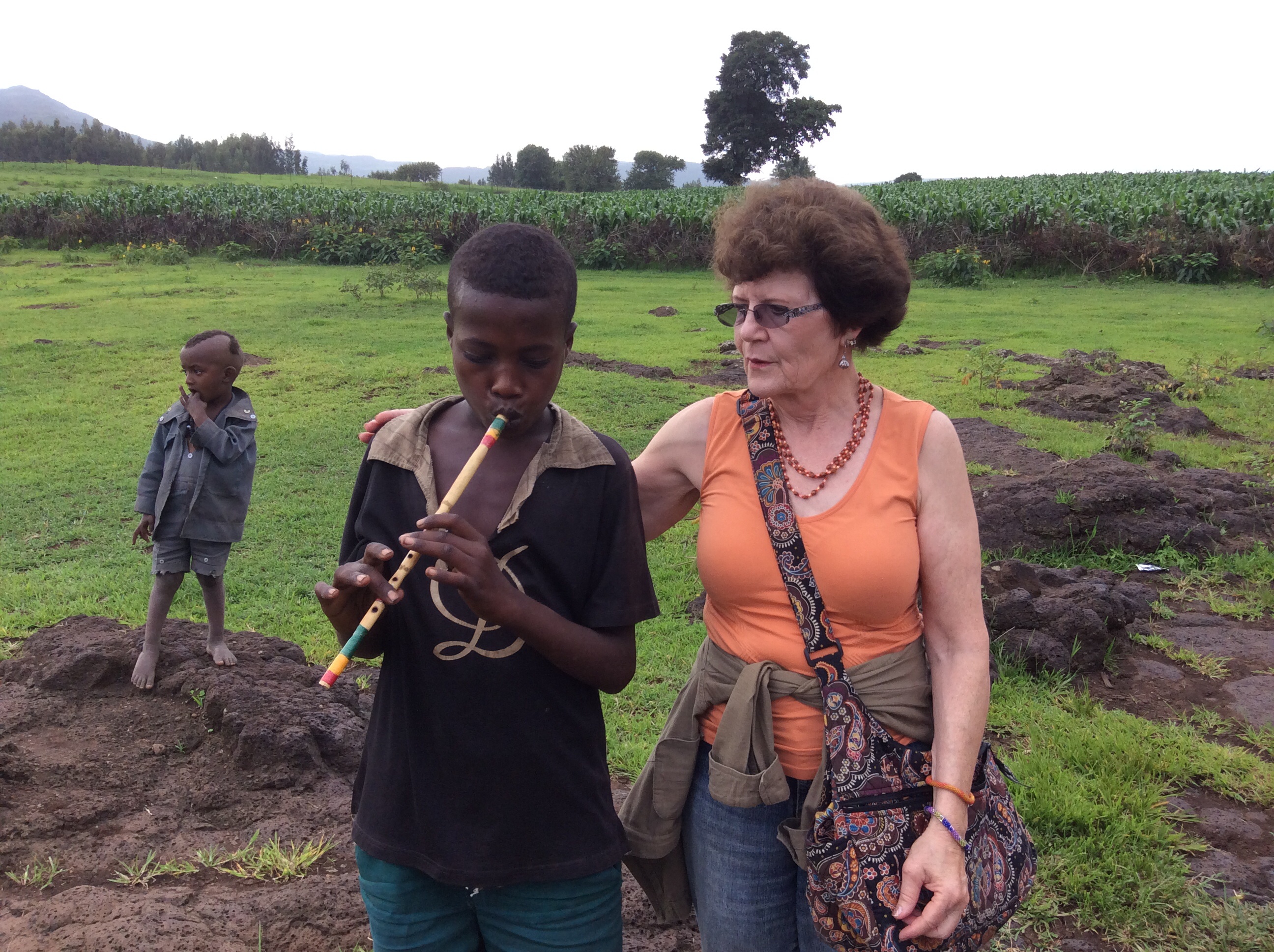
Whenever we stopped, children ran up sometimes asking for pens, occasionally for money.  Dino and Alemu, the driver, usually scolded them in Amharic for begging.

IMG_0518

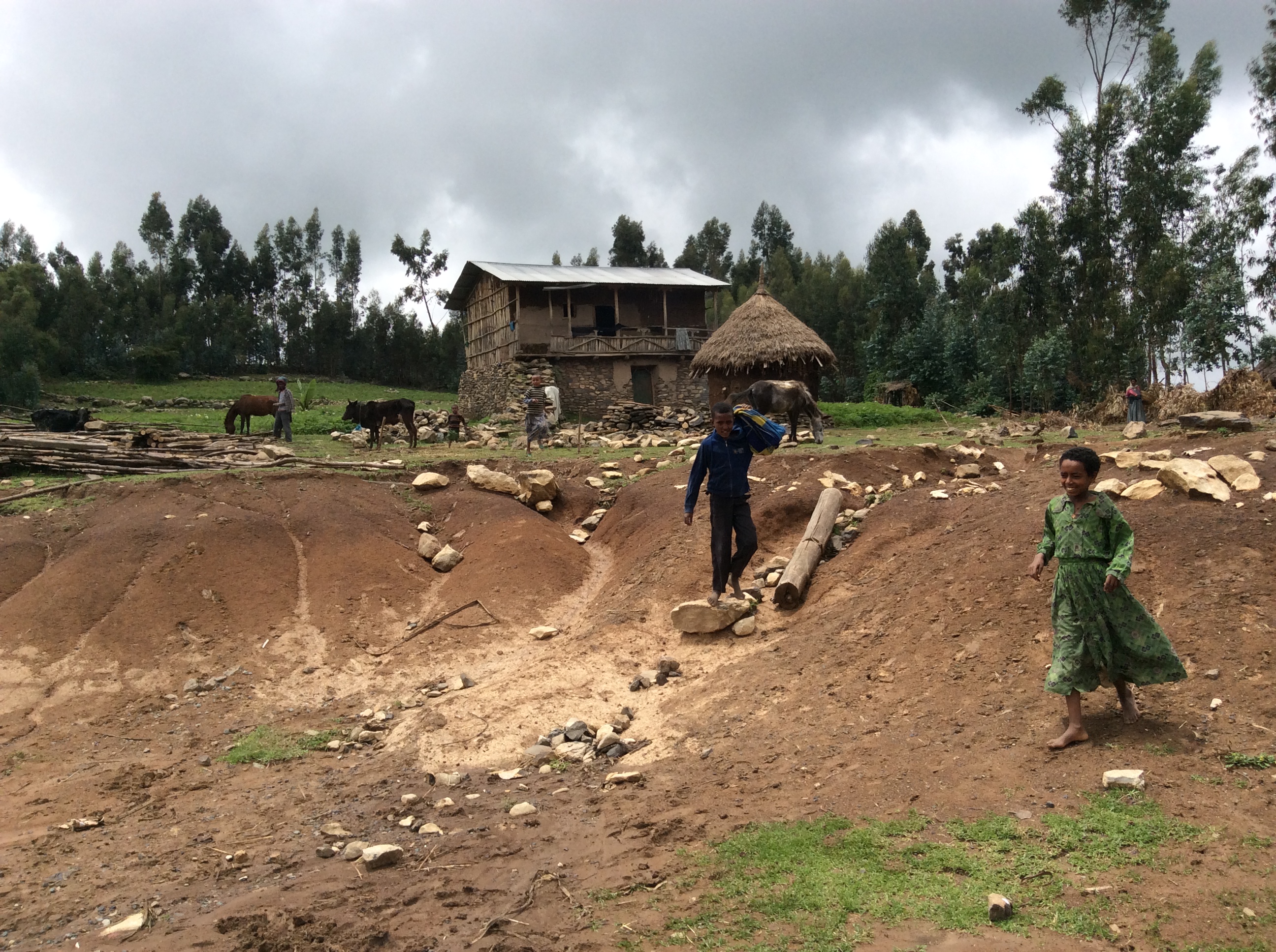
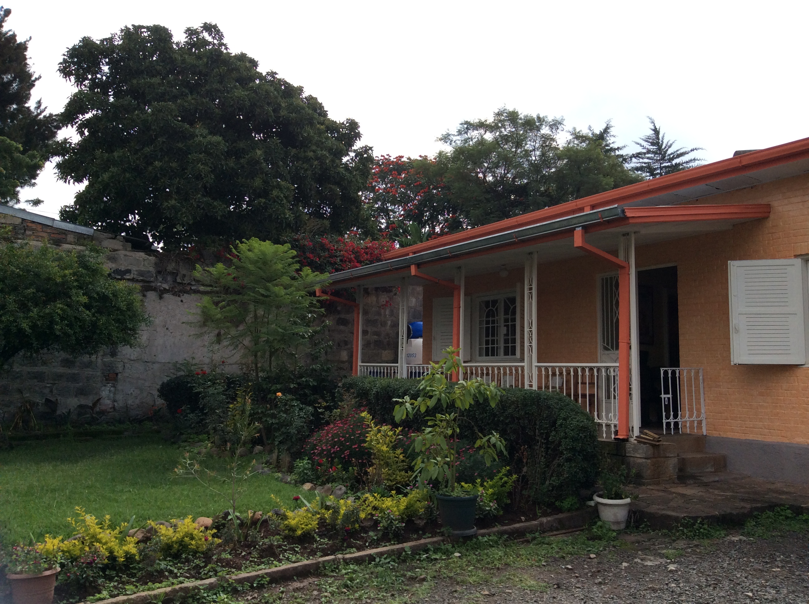
Houses here seemed bigger, usually two story, with rocks used as a main building material.

IMG_0519

We drove by two men galloping along on horseback, their horses adorned in fancy tack.

IMG_0520


IMG_0523

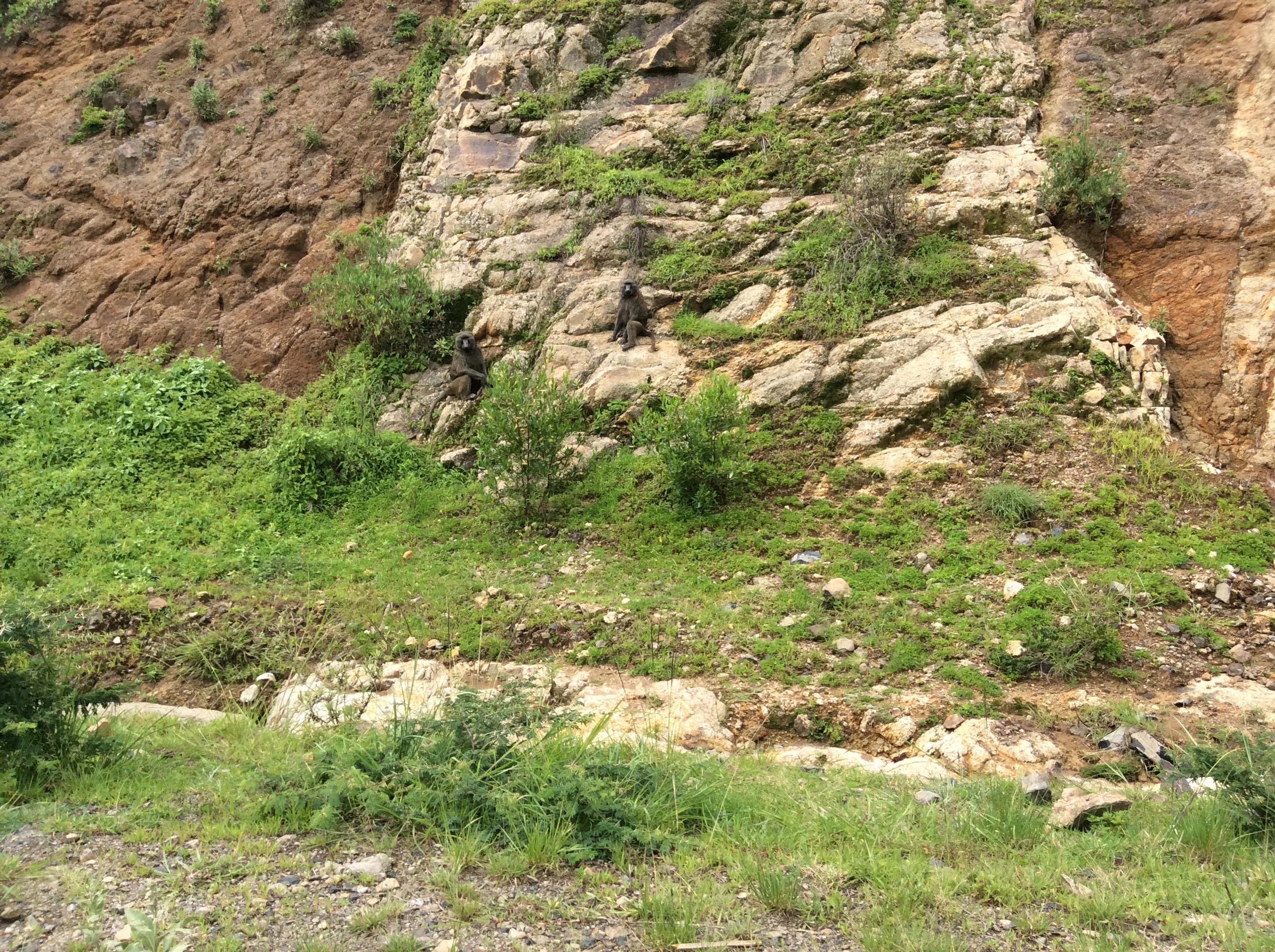
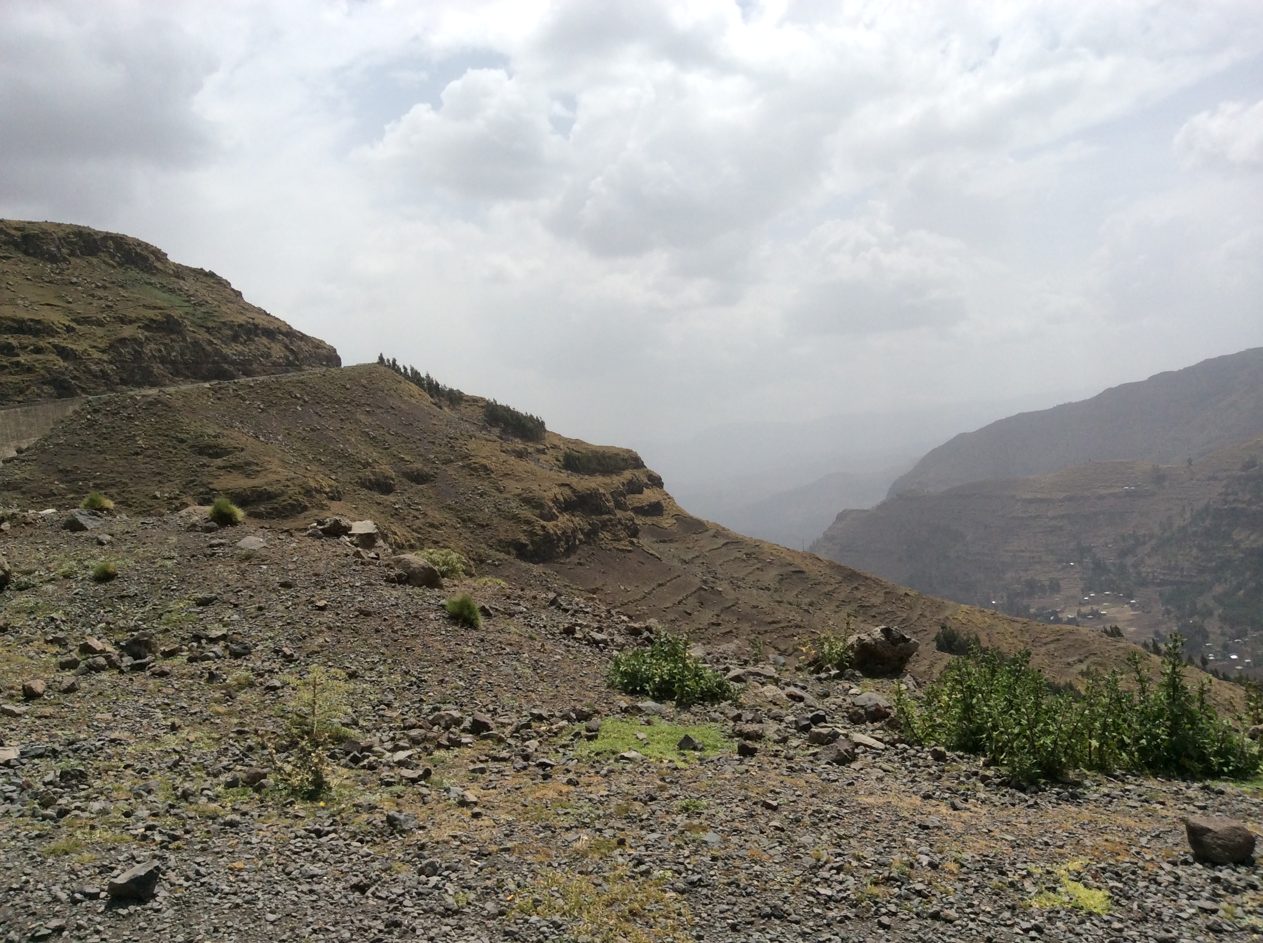
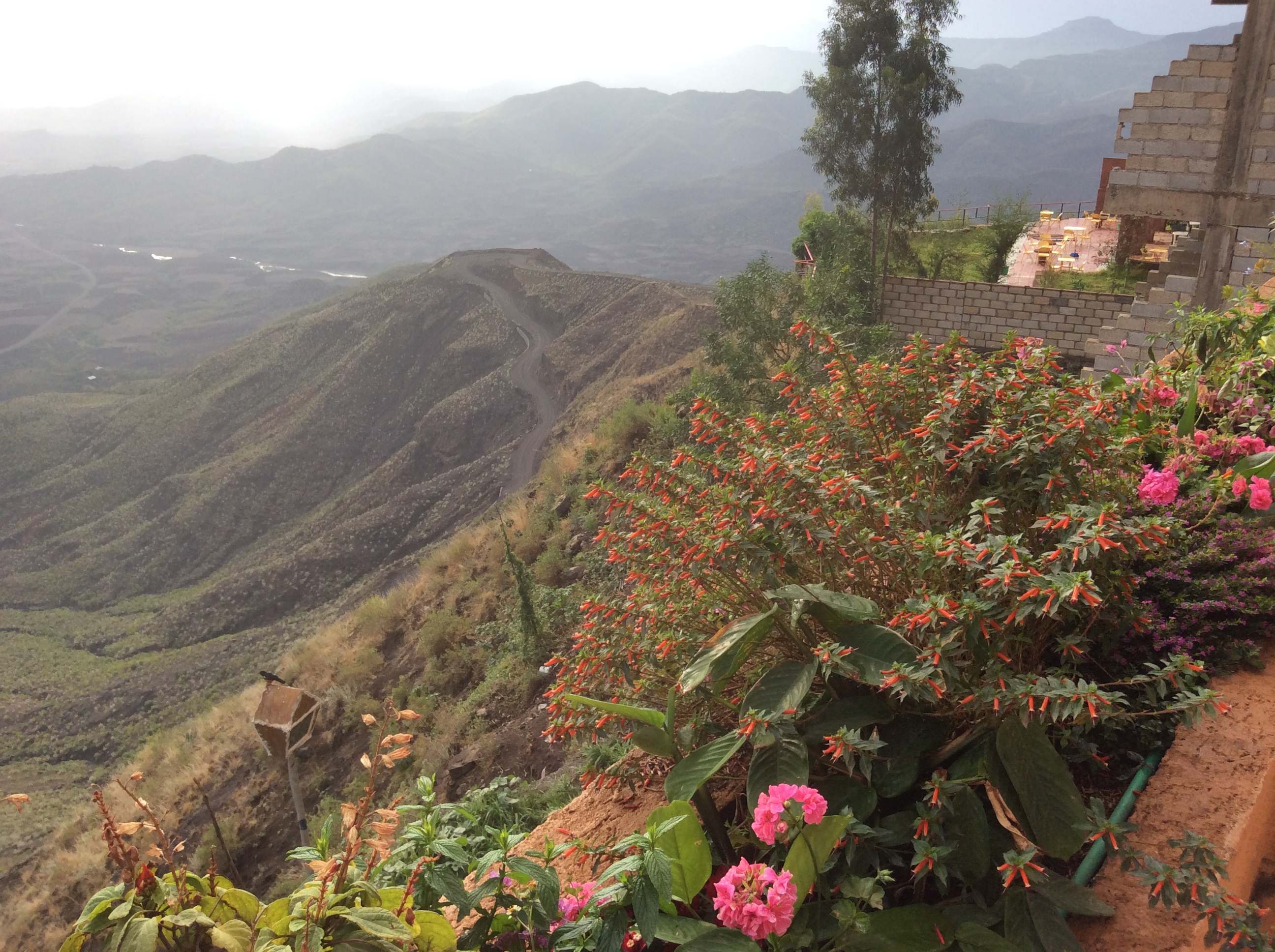
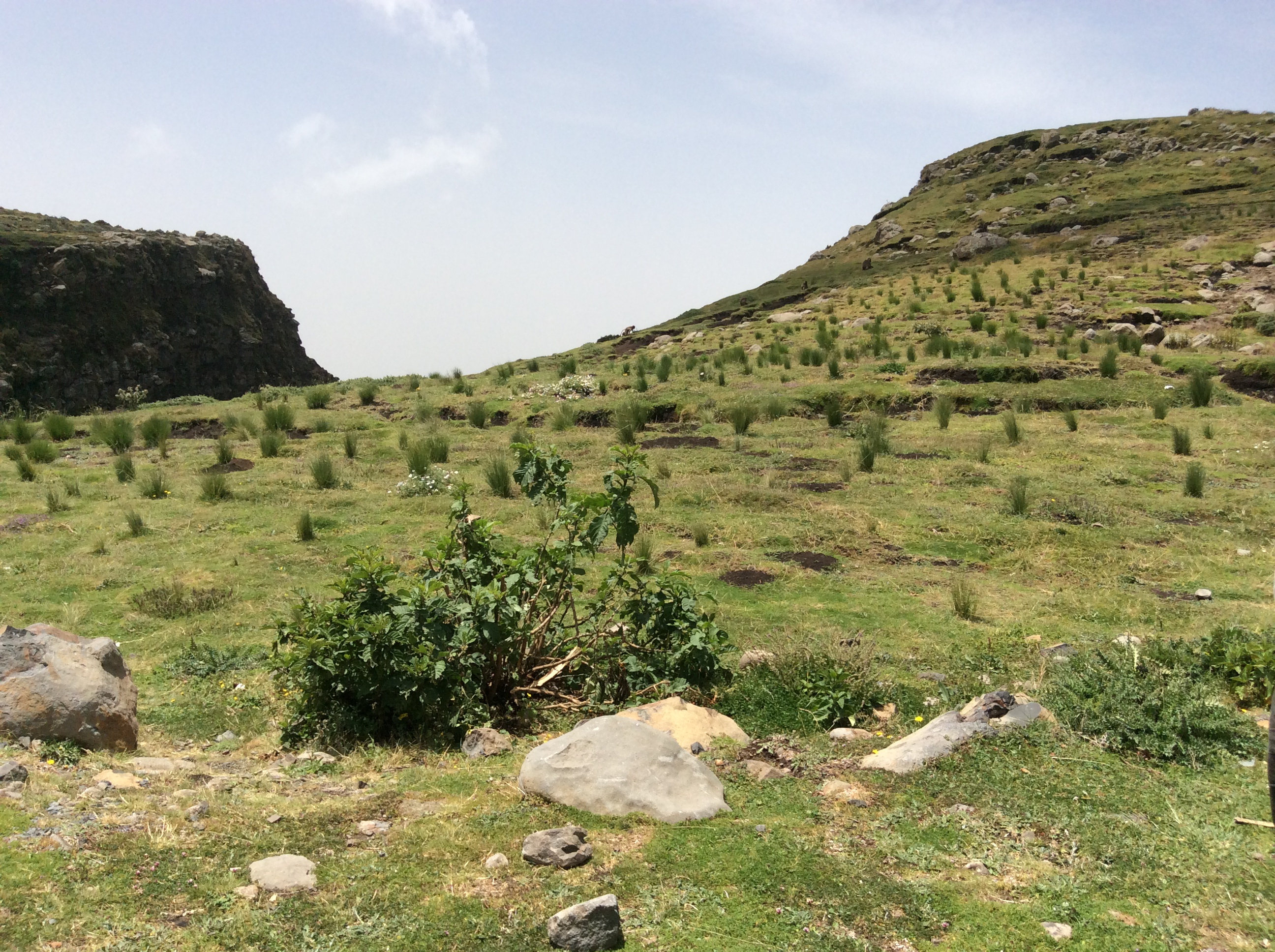
As we began a long descent into a huge valley, common baboons appeared along the road.

IMG_0524

IMG_0525

These huge rocks left my millions of years of erosion, provide a dramatic contrast to the intense green.

IMG_0527

IMG_0528

It took more than an hour to cross this valley.  As usual cattle, goats., burros, people mingled with vehicles.  What a surprise:  Rice fields as far as I could see on either side of the road.

IMG_0530

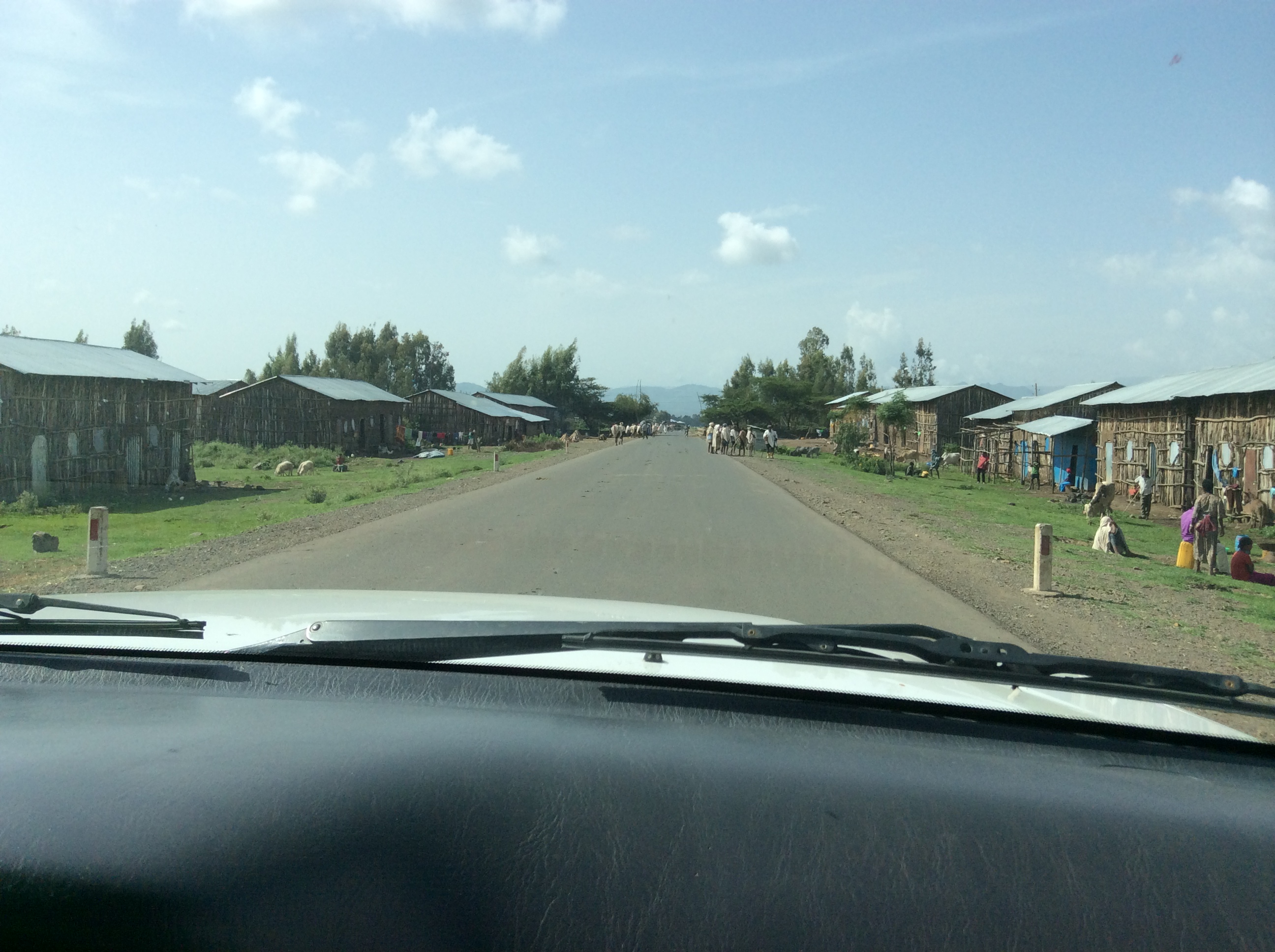
The villages in this area are built higher–above the rice paddies. And then as we climbed out of the valley…

IMG_0533

The name of this rock really surprised me, the Finger of God.

IMG_0535

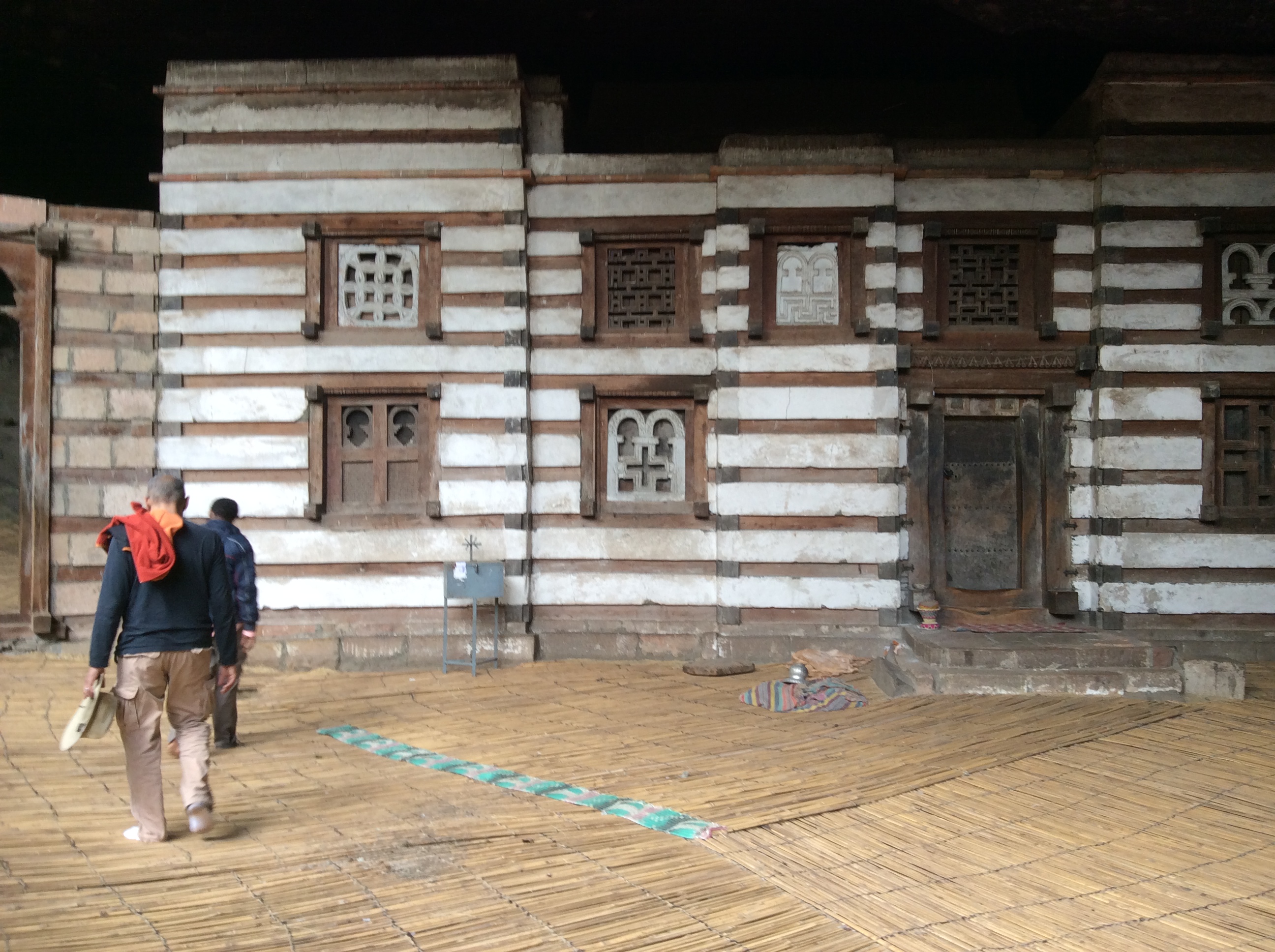
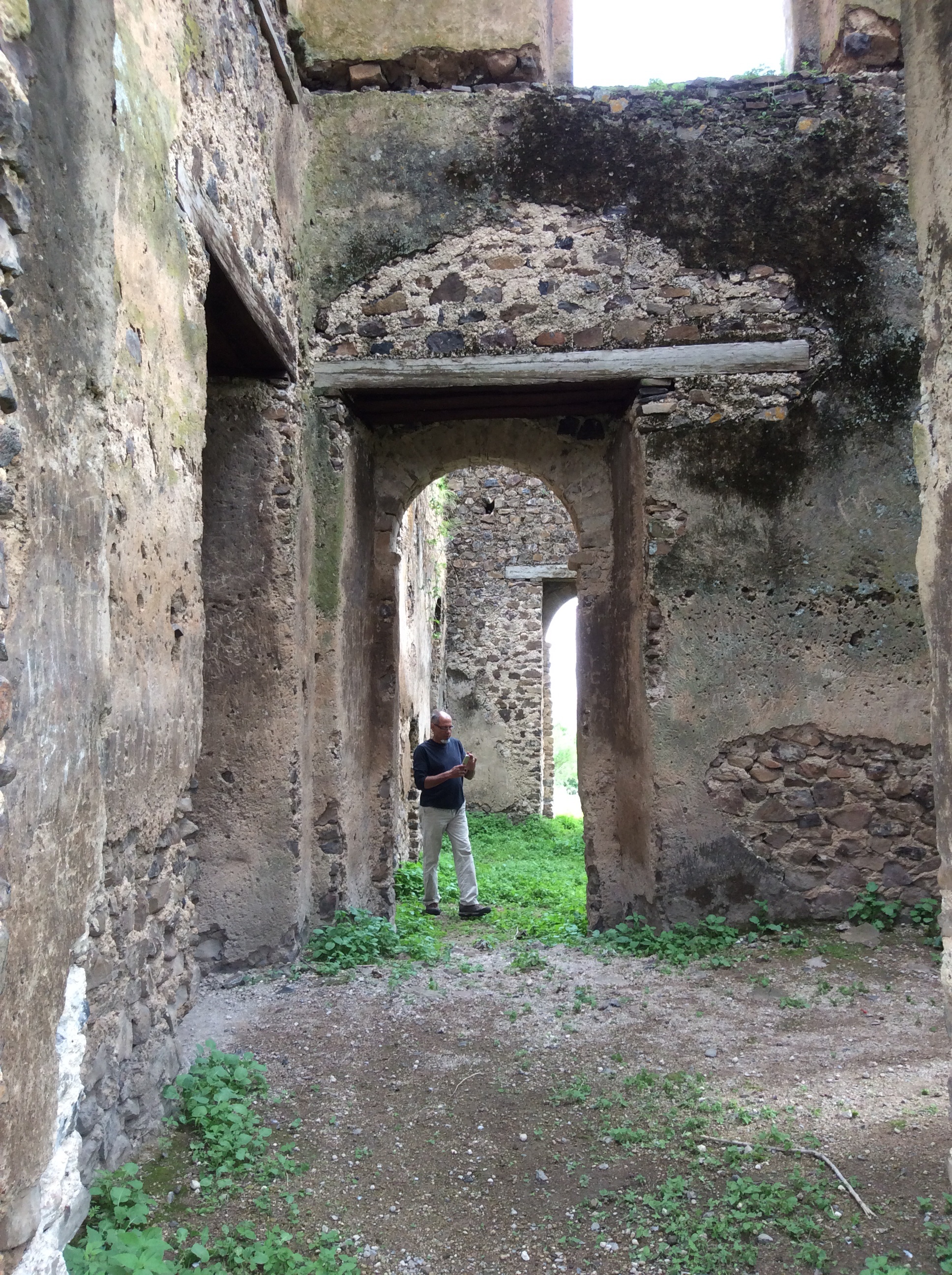
A big later, suddenly Alemu turned off on a dirt road and this appeared.

IMG_0538

The sign says:  Guzara Palace, G.C. 1563-1597.

IMG_0539

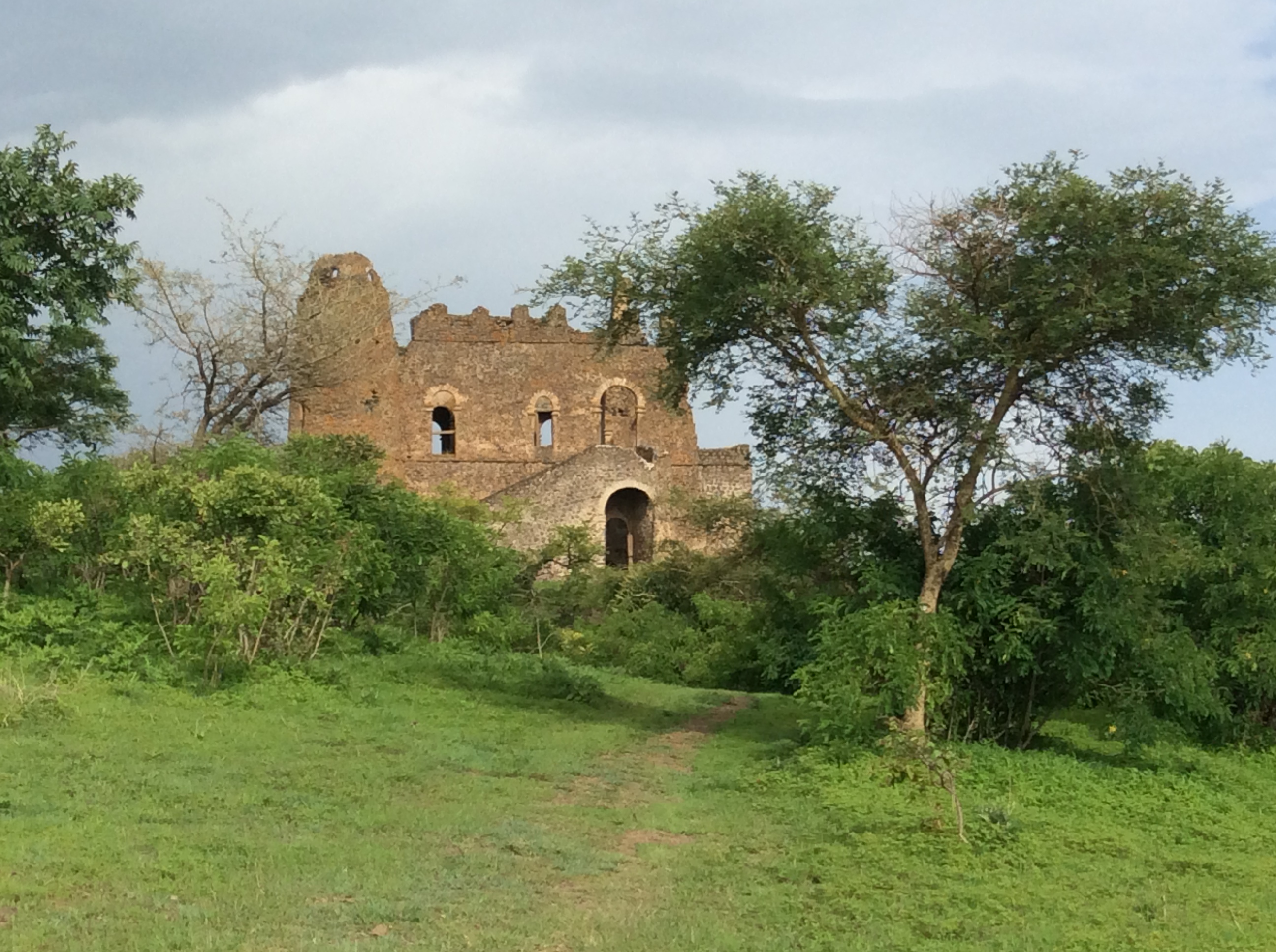
When a person goes on such a trip, sometimes places hold your heart, places unexpected.  I loved this place.  It seemed magical.  With no other people around, it felt private and special.  It becomes obvious quite quickly why a king would build a castle here.  You can see forever, for miles and miles, all the way  to Lake Tana in the background.

IMG_0541


IMG_0542

IMG_0544

We climbed up to the second story and could see Lake Tana even more clearly in the distance.  I felt a sudden rush of emotion, looking at Lake Tana, my first glimpse of where the Nile River begins.

IMG_0546

IMG_0548

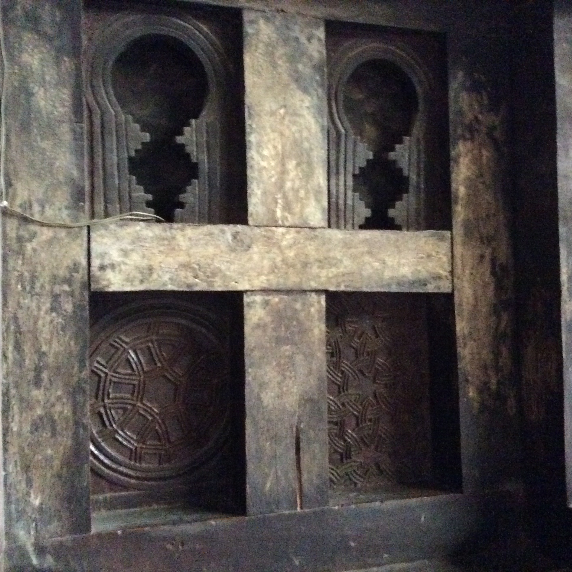
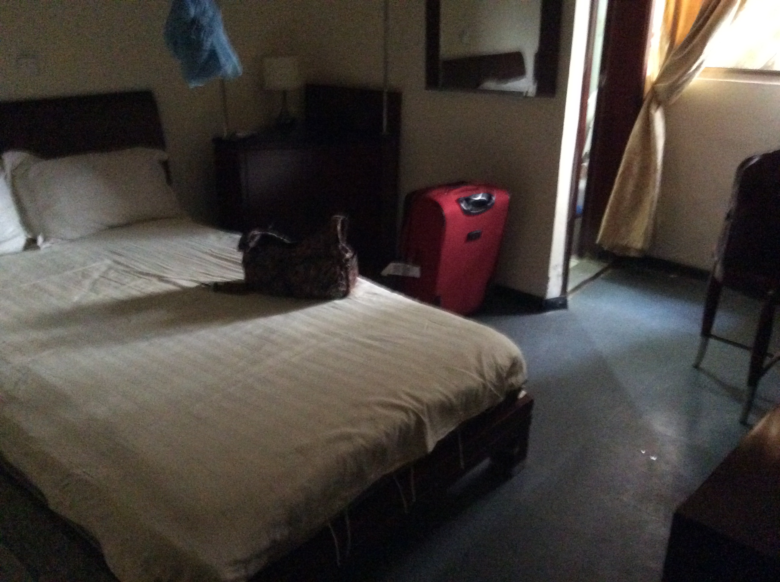
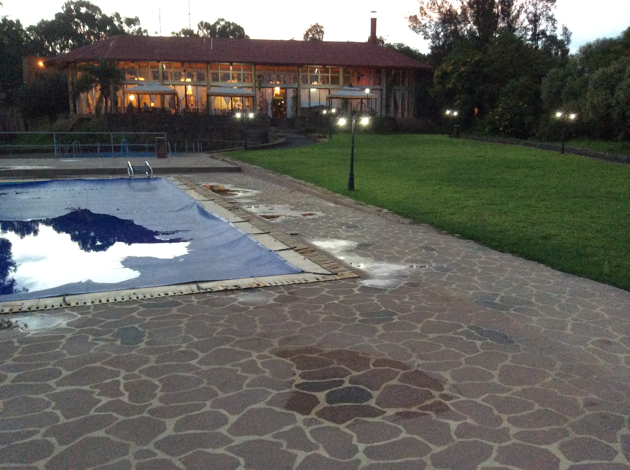
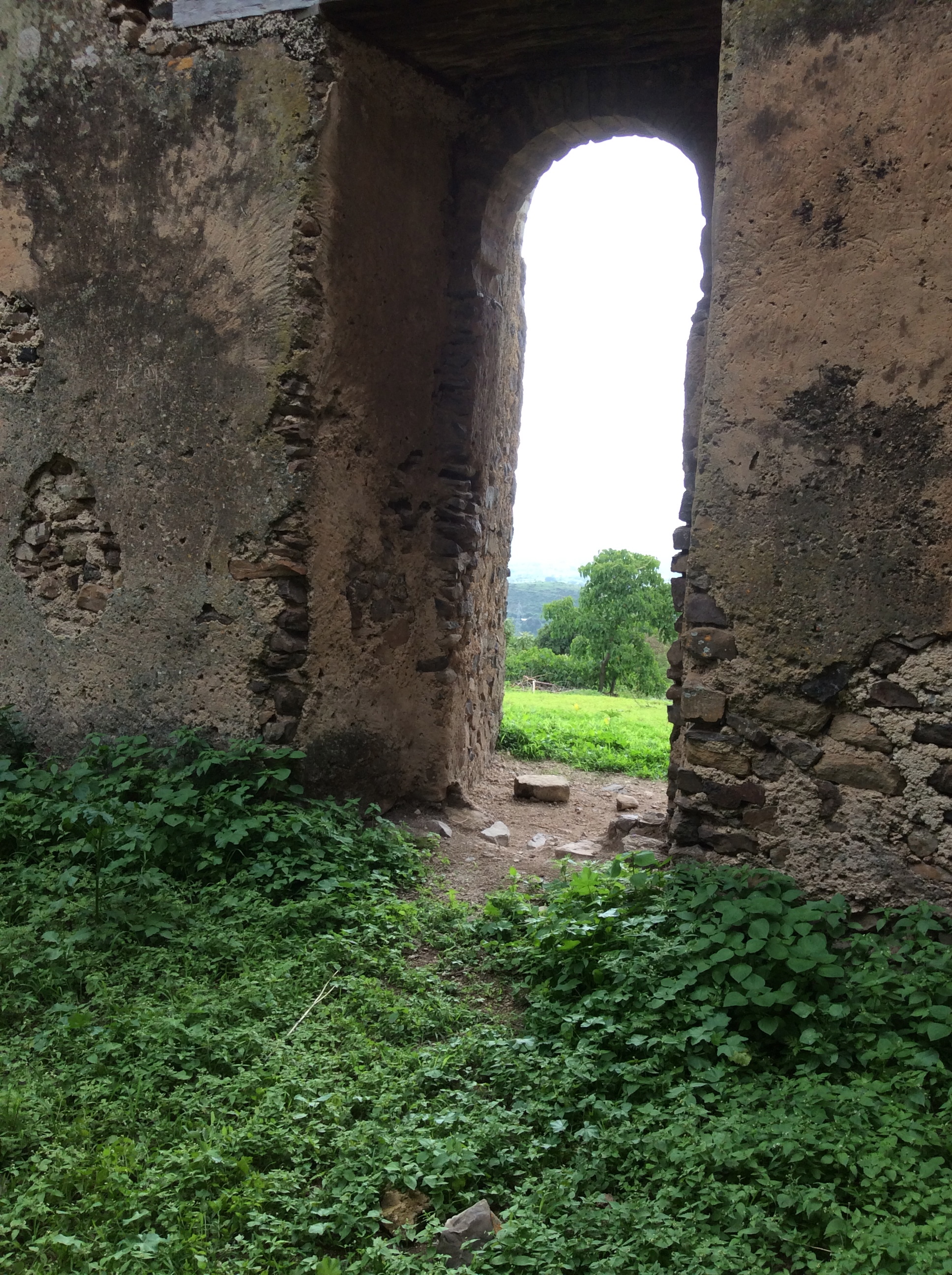
On the other side of the castle, looking toward the mountains, the remains of the old wall around the castle show up clearly.  The part of the wall on the path to the castle has been restored.  This part still awaits restoration. We drove on to Gonder.  We stayed there two nights at  Hotel Goha, but not in sequence.  I found the window coverings so unique I had to take a photo.

IMG_0550

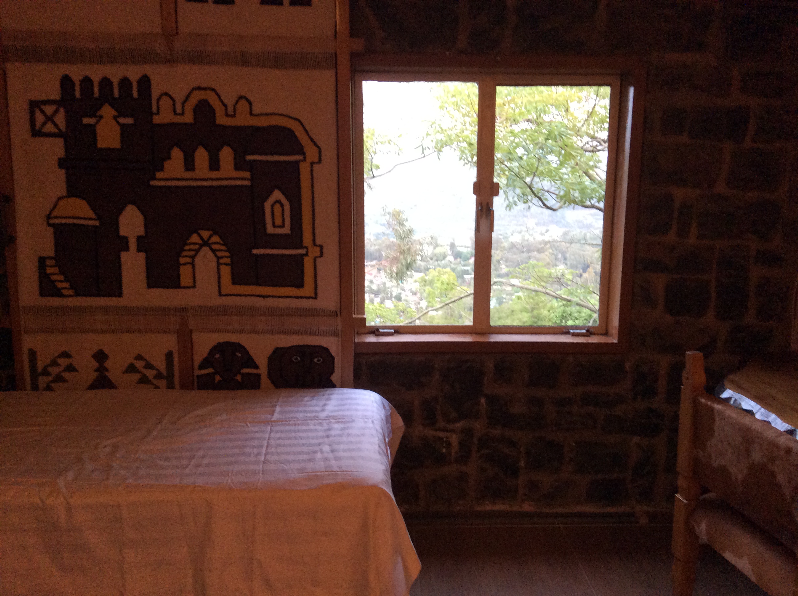
Fabric, stretched over a frame slides back and forth so you can slide it to cover the window.  This hotel possesses fantastic, modern showers.


My Ethiopian Adventure–Lalibela, the Churches, Part Three


After we left the first group of churches, we had to walk to reach the one that is probably the most photographed.

IMG_0428

Like all these churches, this one, Bet Emanuel, was carved and dug out of solid rock and is built so that the top is level with the slope of the land.  Thus, it is purposefully nearly invisible unless you are quite close to it.  To get to the bottom and go inside you have to climb down rather steep steps. Built in the Auxumite style (Auxum was the original “capital” of the Ethiopian Orthodox Church), some art historians consider it to be the most impressive church in Lalibela.  It is 18 meters by 18 by 12 (58.5 feet by 58.5 by 39).

IMG_0429

The guide explained that because this church is of harder stone, it has no protective cover like some of the first churches we entered.

IMG_0430

Like the first group of churches, this one also has a drainage trench around it.

IMG_0431

A pool of holy water–I saw a boy go up to one of the pools and fill a bottle with water.

IMG_0432

A holy space where only priests can enter.  Every church has a copy of the Ark of the Covenant and a symbolic Bethlehem.

IMG_0435

Saint George and the Dragon appear everywhere. Saint George is the national saint of Ethiopia. There is even St. George beer.

IMG_0436

In this second group of buildings, two were definitely designed as churches.  However, even though others are currently used as churches, there is some question as to whether that was their original purpose.  The guide told us that one building is believed to have been the residence of King Lalibela and his family.  Unlike most of the other buildings, its layout does not appear to have been designed as a church. It also does not contain the usual paintings and artwork.

IMG_0437

Another sacred space. Before we could go on to see the other churches in this group, we had to climb out and walk by the River Jordan.

IMG_0438

All the trenches that drain water from the churches during the rainy season flow into this River Jordan.  The design of the churches, the symbolism, this River Jordan, everything was designed to duplicate to the extent possible he Holy Land, to create another Holy Land in the highlands of Ethiopia, a new Jerusalem.

IMG_0439

The road by the River Jordan.  Until recently people lived in the traditional houses you see on the right.  In front of one we saw a group of young men being trained as priests.

IMG_0440

The land near the churches looks just like anywhere.  You cannot see the churches until you are really close to them.  We were told they were built this way intentionally to protect them from invaders who had destroyed earlier visible churches.

IMG_0441

On both sides of the River Jordan are cemeteries. The dead from the tombs in the walls opposite the churches (see Part I and II) were moved here.

IMG_0442

Unlike the first group of churches shown in Part I, not all the churches in the second group are connected by trenches or so close together.To see some of them you have to climb in and out from one to another.

IMG_0443

IMG_0444

The guide took this photo.  Why am I wearing my socks over my jeans?  Fleas.  It is common knowledge that the carpets and bamboo mats on the floors of the churches contain lots of fleas.  We were told to tuck our jeans inside our socks and spray everything below our knees with insect spray.

IMG_0448

IMG_0449

Between this latter group of churches, there are some passageways so you do not always have to climb in and out.  There is a third type of church in this area, churches built in caves, one of which is 40 kilometers from Lalibela.  Churches such as these exist nowhere else in the world. The only way in and out of Lalibela is that steep road below my hotel room.

IMG_0451

It was drier around Lalibela because the rains were late. We headed to the cave church of Yemrehanna Krestos for the afternoon.

IMG_0452

IMG_0457

One disadvantage of traveling to Ethiopia this time of year, especially in the north, is the weather, cold and rainy.  On the positive side, often we were the only tourists.

IMG_0458

The climb up to the church was long and a bit steep but with good steps and handrails.  Rain had made the stones a bit slippery.  The churches have served an unintentional good in that around most churches in the country the original forest is left to hide the church.  This was one of a few places where we could see what the land looked like before deforestation and before invasive species were brought in from elsewhere.

IMG_0459

The guide who took us through the churches in Lalibela came with us here.  I walked with him and Dino and Zuriash walked with the priest who did not speak English.

IMG_0460

This is what you see when you first arrive at the top.  Like in all the churches, you have to take your shoes off.

IMG_0461

An entire church resides inside the cave.  We were told that the white marble and wood were brought from Egypt by elephants. The church dates to the 11th century.

IMG_0463

The cave is big with lots of space around the church.

IMG_0462

IMG_0464

IMG_0465

IMG_0472

The decor and carvings inside the church are very detailed and elaborate.  Services are held here weekly and at certain times of the year many pilgrims journey here some walking for many miles.

IMG_0473

The priest who resides in the village.  This is “his” church.

IMG_0468

Behind this fence at the back of the cave lay the bones of pilgrims who died here.

IMG_0477

The Ethiopians believe that one of the Three Wise Men came from Ethiopia.

IMG_0470

The tomb of Yemrehanna Krestos resides behind the church inside the cave.

IMG_0484

The road to this church is relatively new.  Before pilgrims had to either walk or ride a horse or donkey to get here.  The road continues above the village, but we turned around and headed back to Lalibela.

IMG_1263

There were two shops in the village that sold sacred objects and souvenirs.  I bought this cross which has St. George and the Dragon on one side and the Virgin Mary and baby Jesus on the other.  Mary is exceedingly important in the Ethiopian Orthodox Church.

IMG_1265

I like to bargain and generally did quite well with it when purchasing various items.  However, the man in this shop for this particular item refused to come down.  I really wanted it because it seemed quite unique so bought it at his price.  Nowhere else did I have to do that.

On the road back to Lalibela we decided to stop and admire a couple of huge fig trees.

IMG_0485

IMG_0486

My Ethiopian Adventure–Lalibela, Part Two–the Monolithic Churches


IMG_0397

This is the first of the monolithic churches we visited.  Because the churches were built from the top down and actually cannot be seen until you are very near them, you have to climb down a lot of steps to get to the bottom level from which you can enter into the interior.  The “trenches” around them are the same depth as the churches are high because they were carved out of the solid stone.  As you look at these photos, you will notice multiple cross designs, including Greek, the type found in Axum, those referred to as Lalibela.  Every carving, every painting, every design possesses an explicit symbolic meaning.  I wish I had been able to record all the information provided by the guide.  This church, Bet Medhane Alem, is the largest of this type.  It’s approximate size is 33.7 meters  by 23.7 meters with a height of 11.5 meters (109.5 feet by 77 feet with a height of 37.4).  All sides have columns.

IMG_0399


IMG_0400

These churches are not mere tourist attractions.  We saw many people walking around, praying, and worshipping.  Services are still held here.  Carved into some of the “trench” walls opposite the church are tombs.  Those buried in these tombs have been removed and their graves now lie on either side of the River Jordan–photos of that later.

IMG_0398

The interior decoration includes detailed carvings, elaborate drapes, and paintings.

IMG_0403

Certain areas, like this one behind the drapes, only priests can access, mainly because they contain the sacraments.  The floors of all the churches are hard rock so all contain coverings of cloth, Persian type rugs, and bamboo.  Accessing the interior requires a lot of climbing up and down very worn, slick, stone steps.

IMG_0405

While smaller trenches and areas separate this first group of churches from each other, the entire group is surrounded by the deepest, large trench.  This is the next church we visited.  It lacks outside columns.

IMG_0407

At first the sight of swastikas everywhere startled me until I remembered how old these churches are and the original meanings attached to this symbol.  Our deacon guide explained that they symbolize everlasting life (the circle of life) and also mentioned its meaning in ancient Hinduism–the continual, everlasting cycle of birth and rebirth.

IMG_0408

This is the fertility pool.  It is so deep that the priest must be lowered into the water attached to ropes as are the man or woman who wants treatment in this holy water.  At one point, someone realized that the pool was no longer as deep as it was originally.  When they investigated, they found the pool had been filled with dirt below where it could be seen.  When this dirt was excavated, a cache of ancient, holy artifacts were found.  They had been buried there to protect them.

IMG_0409

IMG_0411

Ethiopians wrap themselves in white not just to go to church, but in general.  I constantly marveled how they keep these garments so incredibly white in spite of dirt and rain and walking through mud everywhere.  The person on the right is our guide, a deacon in the Ethiopian Orthodox Church.  He knows the meaning of every carving, every painting, every symbol.  The extent of information explained was not only detailed but extensive.

IMG_0412

Only some of the churches possess paintings on the walls as well as carvings.  The wise men, Mary, everyone looks Ethiopian at least to some extent.

IMG_0413

Notice the Star of David.  This symbol is everywhere because the Ethiopians believe they are descendants of Solomon and Sheba.  As a consequence, the paintings, carvings, all the symbols reflect not only the New Testament but also the Old Testament.

IMG_0414

Every church has this curtain behind which only a priest can go.  Every church has a copy of the Ark of the Covenant.  They believe the original was taken by Menelik I, the son of Solomon and Sheba, to its current location in Axum in a special treasury next to the Church of Saint Mary of Zion.  It has been safely kept there through the millennia.

IMG_0415

IMG_0416


IMG_0417

Protective roofs cover some of the churches.  The guide explained that the hardness of the basalt varies.  Because some of the stone is softer, churches carved out of this softer stone had begun to deteriorate.  The coverings protect and preserve them.

IMG_0419

To get from church to church in this first group of churches, usually we walked through these trenches.  To reach the actual church entrances requires climbing up steps.  These trenches enable water drainage into the River Jordan during the rainy season.  The floor of the churches remain above the water.

IMG_0420

Walking through these churches kept me in a constant state of awe.  They were built more than 800 years ago without modern tools.  And there are eleven of them all here, carved out of solid stone.

IMG_0421

St. George and the Dragon hold a prominent place in Ethiopian Orthodox symbolism.  The dragon represents paganism.  St. George slated the dragon.

IMG_0422


IMG_0423

We left this  group of churches, climbing out from this trench and headed to one of the most photographed.

IMG_0425

We encountered two walking funeral processions complete with chanting.  I took no photos because it seemed disrespectful.


My Ethiopian Adventure–Lalibela, Part One


IMG_0393

The final climb to Lalibela nearly terrified me–switchbacks up and up, no guard rails as I recall, and drop-offs more than a thousand feet.  This photo, taken from my hotel room patio, fails to really show just how far down the drop really is.  The other buildings in the photo are also hotels.  Having been told that only one really good restaurant exists there, we ate at the same place two evenings.  It rests at the end of a narrow unpaved road at the edge of a cliff.

IMG_0497

The second evening there, we met the owner, an older woman from Scotland who originally came to Lalibela at the request of a friend to teach.  She stayed, bought this land, and hired two young architects from Addis to design the restaurant–to look like a flower.

IMG_0498


IMG_0494

To get to this restaurant from the hotel, Alemu had to turn the corner as tightly as he could, backup a bit, and then proceed on this road.  Immediately below where we backed up,  there is a steep cliff.  I asked him if anyone ever fell off. He said a friend of his did.  I assumed he had died, but no, his vehicle was caught by a tiny ledge and he survived.

image

The road up to Lalibela as viewed from my hotel patio.  We stayed at the Maribela Hotel which was one of the nicest on the road trip.  They were still building a restaurant but served an excellent breakfast.

IMG_0395

Lalibela is to the Ethiopian Orthodox Church what Jerusalem is to Jews and many western Christians.  It is famous for its eleven churches carved from solid rock.  It has been called the New Jerusalem, a New Golgotha.  In approximately 1200 AD, King Lalibela, one of the last kings of the Zagwe dynasty, came to power after God told his brother, who was king, to abdicate.  The name Lalibela comes from honey, sweetness because when a baby, King Lalibela was surrounded by bees which prophesied his future greatness.  The story becomes quite complicated but in essence, angels took his soul to heaven and showed him the churches he was to build.  They were built in twenty four years with the help of angels.  Lalibela then became the holy city.  Like the ancient rulers from Axum (the original holy city where they believe a church holds the Ark of the Covenant), the Zagwe dynasty traced their origin to King Solomon and the Queen of Sheba.

In Lalibela two types of rock churches still stand:  rock hewn monolithic churches which were cut out of solid basalt from the top down with trenches surrounding them and rock hewn churches which were cut inward from a cliff or by using a natural cave or indentation in a cliff as a starting point.  The architectural and technical building skill required is clearly evident.  The churches are on several levels and built in such a way that they drain to carry off the heavy rain flow during the rainy season.  The trenches around the churches also serve to feed the River Jordan–an area made to duplicate the original River Jordan.  The architecture of the monolithic churches exists nowhere else in the world.

To tour the churches requires a professional guide who knows the history and architecture intimately.  Our guide held the position of deacon in the Ethiopian Orthodox Church.  While many Muslims live in parts of Ethiopia, Lalibela is a Christian town in a heavily Christian area.  Deacons and priests can marry, but if a male wants to become a bishop, he cannot marry.  The Ethiopian Orthodox Church, like the traditional Catholic Church with Latin, has its own ancient religious language, Ge’ez.  The alphabet of modern Amharic is the same as Ge’ez. Priests learn to read Ge’ez.  Later, in Gondar, we were able to get a priest to chant from a religious text in Ge’ez.  For more details regarding the Ethiopian Orthodox Church, a list books in both the New Testament and Old Testament, as well as other sacred texts and hymnals, go to:   http://www.ethiopianorthodox.org. There are many more books in the Orthodox Bible than in those used by European and American churches.

IMG_0396

My Ethiopian Adventure–On the Road to Lalibela, Part Two


IMG_0344

Mountains pervade everywhere it seems.  We continually drove up and down mountainsides.  Eucalyptus is not native.  They were brought in by the Australians many years ago and became invasive.  They are a mixed blessing–grow rapidly and have many uses, but they take a lot of water and drive out native species.  When simply cut down, they grow right back.  In some places, we saw preserves where the original species of trees still exist and are protected.  Otherwise, eucalyptus reign.

IMG_0348

IMG_0350

And there are several species of eucalyptus as you can see here.  Not only do the leaves differ, but also the color of the trunks.

IMG_0352


IMG_0353

Almost all the mountainsides are covered with fields.  Ones, like this one, may have been just plowed or just planted.  In the mountains barley, wheat, and oats are grown and sometimes teff.  Barley seems to ripen first.

IMG_0356

At first, I suffered minor terror because of the steep roads and huge drop-offs, sometimes thousands of feet.  However, eventually I became rather used to it.

IMG_0357

These roads, mostly built a long time ago by the Italians, remain excellent and do have guardrails.  The Chinese have built some of the newer roads.  The Ethiopians make jokes regarding how long they think these Chinese roads will last.

IMG_0359

Eventually, we rose to a high plateau area across which we drove for hours.

IMG_0360

The endless shades of green, indicating different crops, or in some cases, the gold of ripening grain.

IMG_0363

Winnowing grain the old fashioned way.

IMG_0364

IMG_0365

Houses on this high plateau seemed mostly built of rocks which lay everywhere.

IMG_0366

IMG_0368

Amelu asked us if we wanted to see inside one of the houses and visit with some people.  Of course, we said yes.

IMG_0373

This couple had a somewhat older child who was out herding their animals–cattle as I recall.  At night they bring the animals inside their house to protect them from predators, e.g. hyenas.  They also provide body heat which helps them keep warm.  He explained in Amharic that   he did not own land, but was saving up and when he could, would build a separate house so that their animals would be able to stay in one and his family in another. I thought Amelu knew these people, but he did not.  His own children had outgrown some of their clothes.  He had brought them to give away so he gave them to this family.

IMG_0375

After we crossed the plateau, we dropped down and crossed a river. Because it was the rainy season, rivers raged everywhere, running dark with mud.

IMG_0381

The little shed is for the river guard.  We did not see anyone here when we crossed, but major rivers have guards often armed with an assault rifle.

IMG_0385

IMG_0388

Almost to Lalibela–we discovered later that the rains were late and people were very concerned.  Crops had been planted and they were waiting.

IMG_0379


IMG_0392

The first photo in Lalibela–the view from my room at the edge of a cliff–the Maribela Hotel.


My Ethiopian Adventure–on the Road to Lalibela, Part One


Although the Sunny Side Hotel’s rooms in Kombolcha seem elemental to say the least, the food there is some of the best I had in Ethiopia.  One of the reasons for this may be their extensive gardens which not only hold flowers, but vegetables and fruit trees.

IMG_0292

IMG_0294

That’s a papaya in the middle.

IMG_0296

IMG_0290

Dinner consisted of fresh talapia–Lake Tana is full of talapia and is a common item on menus, perfectly grilled, julienned vegetables sautéed in sunflower oil and seasoned with a sprig of rosemary.  The next morning we headed for Lalibela.  The first larger city through which we drove is Dese.  As in most Ethiopian cities, new construction could be seen everywhere.  They do not use steel for scaffolding.  They use eucalyptus as in this building.

IMG_0307

IMG_0305

We continually climbed switched back roads.  Usually, terraced fields lay as far as we could see on the mountainsides.

IMG_0303

IMG_0301

IMG_0311

Not too far from Dese, we came to the smaller town of Hayk.  Hayk is the Amharic word for lake.  The town is named after this nearby lake.

image

Seven species of acacia grow in Ethiopia.  These, higher in the mountains, appear considerably more lush than those farther south in semi arid places. You cannot swim in this lake because, like many bodies of water in Africa, the schistosomiasis parasite lives here.  There is a cure, but not very pleasant.  Huge fig trees and acacias provide a setting like one sees in movies.

IMG_0316

IMG_0317

IMG_0319

This monastery resides on a small peninsula that juts out into the lake.  The sign says no women allowed.  Foreign male visitors may enter for a fee–locals free. Lush fields surround the lake.

IMG_0314

IMG_0322

Yes, that is cactus on the right–not exactly a place I expected to see cactus.  On the road out of the lake, we saw this girl walking and asked to take her photo.  She is carrying dried dung.  Houses are first framed in eucalyptus and then plastered with a mixture of dung and mud or just mud.  Sometimes they are left the natural dark brown color.  Some home owners prefer to paint them bright colors.

IMG_0324

IMG_0331

This is a typical house in most areas left unpainted with a metal roof.  Everywhere people worked the fields the “old” way with a beautiful result.

IMG_0327

IMG_0328

We passed villages and towns of all sizes.

IMG_0330

And always children as well as adults drove animals along the road.

IMG_0335

IMG_0336

IMG_0343

Eighty languages are spoken in Ethiopia.  Some, like Amharic and Oromo, are spoken my millions, others by only a particular small tribe. Everywhere we went people knew Amharic, an Afro-Asian, Semitic language (like Arabic and Hebrew) which originates in the ancient language of Geez, a language now only used as the sacred language of the Ethiopian Orthodox Church.  English is taught in elementary school, which is compulsory through the eighth grade.  Because of too many students and too few schools and teachers, especially in rural areas, school is half a day.  One group goes in the morning and another in the afternoon.

My Ethiopian Adventure–from Addis to Kombolcha


Saying goodbye to Addis at 8 in the morning, we headed northeast and later north toward Kombolcha–spelling differs, depending on whose map you view.  The official Ethiopian map spells the town as Kombolch.  Addis is high, the second highest capital in the world.  We drove northeast all morning across rivers and through green fields.

IMG_0246

Not far outside Addis we saw this scene, a river with many people near it.  Our driver, Alemu explained this river contains holy, healing water and all those people you see through the window are pilgrims coming to be blessed by the resident priest and hopefully healed by the river waters.

IMG_0249

Who would know this is Ethiopia if no one told you? Not what I expected at all honestly.

IMG_0248

IMG_0250

Most of the farmland is very rocky.  Farmers gather rocks, in some places make fences out of them or just pile them up.  Even with these efforts fields remain full of rocks.

IMG_0251

We drove for hours through this type of farmland.

IMG_0257

This is a typical country village which appeared off and on continuously along the highway.  Traditional buildings are usually round with thatched roofs.  More and more people have begun to use metal roofs which forces the building shape to rectangular rather than round.  We heard a story about a thatched roof house that caught on fire.  Nothing but the thatch burned because underneath the thatch was a meter of mud.

IMG_0258

Most Ethiopian farming is done the old way:  either horses or cattle pull the plow with a man guiding it usually through a lot of rocks.  I commented about seeing no tractors so then every time we saw one everyone shouted, “Juliana, there’s a tractor.”  I think I saw only five of them in ten days and only one was actually working in a field.  It became obvious rather quickly how totally impractical a tractor and its equipment would be in much of the farmland:  too many rocks and as you will soon see, too steep.  The tractor would fall over.

IMG_0261

Eventually we started climbing higher and higher.  To the left was one of Ethiopia’s high peaks near or over 4000 meters–13 to 14 thousand feet.

IMG_0262

And then, there it was, Menelik’s Window.  This was the first area we saw with numerous gelada baboons.  However, these ran away unlike the ones later in Simien National Park.

IMG_0266

That’s Dino down on the edge.  At this point in the trip, I was still quite horrified by all the steep cliffs and stayed way back.  He was trying to get a good photo of the baboons.  Menelik II, the last Ethiopia leader to be able to claim himself as a direct male descendant of King Solomon, found this place special, a view into the real Ethiopia across miles of mountains. He is known for defeating the Italian invaders, expanding the kingdom, and especially for modernizing Ethiopia.

IMG_0267

My grandson now owns this hat.  This boy and his friends spend their days chasing the baboons away from the tufts of grass, which their families use to make the thatched roofs, and making hats for sale.

IMG_0264

You can see the selection of different styles of hats on display on the grass.  On the mountainside in the back lots of herbs grew, including thyme.  The boys also sold packets of herbs they had gathered and dried.

IMG_0268

We dropped down on a winding mountain road through eucalyptus forests.  Eucalyptus is not native to Ethiopia, but grows everywhere there.  It is used as a basic material for building their houses, for scaffolding to build tall city buildings, for just about everything.  Several different species grew along the road.

IMG_0271

Ethiopia’s main highways are excellent.  Many were built years ago by the Italians, more recent ones by the Chinese.  Ethiopians make jokes about how long the Chinese roads might last.

IMG_0272

Eventually, we dropped down out of the mountains into an area that was much drier.

IMG_0276

A typical town with all sorts of shops right along the road.  When driving in Ethiopia, dodging people, cattle, camels, horses, burros, and goats is the norm. Everything it seems likes these good roads.

IMG_0279

A boy driving camels down the highway.  Loose animals, like the burro on the right, roam seemingly unattended.  I saw few fences.

IMG_0280

In the small towns in this semi arid area, we saw several totally veiled women, faces covered totally except for their eyes.  Alemu informed us that this was a new thing, not seen until the last few years.  He seemed to think it had become fashionable to copy Saudi women.

IMG_0281

We stopped to look at certain plants beside the road.

IMG_0282

Dino recalled playing with these pretty green balls as a child with this forewarning,  “Do not eat them, do not touch your eyes or you will go blind.”  They are called the Apples of Sodom.

IMG_0284

At this juncture near the beginning of this adventure, I had not yet realized how everything in Ethiopia possesses symbolic meaning.

IMG_0285

We drove along this immense, lush valley for miles.  Alemu said this huge herd of cattle belonged to a semi nomadic group who brought their cattle here during the rainy season to graze and fatten.  A bit farther down the road the land belonged to one of the richest men in Ethiopia, indeed the world, Al Amoudi.  It was the only place where I saw a tractor actually used in a field.

IMG_0288

Arriving in Kombolcha, we saw this new college in the process of creation.  This became a common sight–new buildings, new schools, construction everywhere.

IMG_0289

My first hotel room in Ethiopia at the Sunny Side Hotel in Kombolcha complete with mosquito netting–the blue blob above the bed.  At least it had a shower and toilet.  Many places use the style of accommodations one finds in a lot of Asia.  Forget toilets as you know them–just a tiled area with a hole in the ground and the ever present water with which to wash.  We carried our own toilet paper just in case.  However, many places had both so customers could choose.

My Ethiopian Adventure–the Beginning


After leaving the US on July 2, flying 14 hours to Dubai, spending a day there, I finally made it to Addis Ababa (also spelled Abeba) on the 4th.  I remained in Ethiopia until this past Monday when I left Addis late in the afternoon.  Blog posting from Ethiopia was limited because wifi is available only in certain areas and places and there is no 2,3, or 4G anywhere.  For those of you who saw my four posts from Ethiopia, some photos and a few details may be repeated.  My plan is to post photos and detailed information now that I am back which will require a number of posts because not only did we go on a ten day road trip, we also spent time in Addis Ababa and Adama (Nasret).

I went on this trip with two friends, a couple.  Dino is from Ethiopia, having grown up in Dire Dawa.  His parents now live in Adama where his father owns and runs a printing press.  Two of his sisters and one brother live in Addis.  We spent the first few days before our road trip in Addis, staying with his sister, Anna, who owns a painting company.  She imports the paint from Italy and her clients include individuals and businesses.  Her company also paints cars.  Of course, she painted her own house with this paint.  I loved the colors and textures.

IMG_0209

The front of Anna’s lovely house.  It is the rainy season and flowers grow everywhere.

IMG_0206

IMG_0207

IMG_0208

The translation for these orange flowers, which I had never seen before, is flowers of the sun.

One afternoon four of us decided to take a drive around Addis to see some of the more beautiful spots which mainly included the Addis Hilton Hotel and the Sheraton, which is a five star.  Carlo, Dino’s father drove.  What a remarkable man, in his 80s and still getting to work at 6, driving everywhere.  The Hilton is the older of the two.  The grounds of both display lush greenery.

IMG_0216

IMG_0218

Zuriash and I enjoying the grandeur.

IMG_0219

Papyrus by the pool at the Sheraton.

IMG_0224

The swimming pool at the Sheraton.  You cannot use it unless you are staying there.  However, the pool at the Hilton is available on a membership basis–you do not have to stay there to use it.

IMG_0226

The rooms at the Sheraton overlooking the gardens and pool.  Dino and Carlo, son and father, walking down the path to the pool area.  Apparently, many visiting dignitaries stay here.  Inside walls are filled with excellent local art.

IMG_0227

And then there is Addis traffic.  Approximately six million people live there.  In five or so days, riding here and there all over the city, I saw only two traffic lights, neither of which worked.  Most large intersections contain a traffic circle and around and around you go trying to wiggle into a space and get across the intersection.  Take a look.

IMG_0210

Trying to drive to Guiseppe’s house, Anna driving, we were stuck here.  The big trucks would not let us through.  Finally, a guy in another car, got out, stopped the trucks and waved us on.  It took us 1 1/2 hours to get there.  A couple of days later, he came to Anna’s in twenty minutes.

IMG_0214

In front of Guiseppe’s house.  A typical residential street, sometimes like this one with gates on each end.  People hire someone to watch the gates.  You honk and they are opened and then closed.

IMG_0215

On the last evening before we began our ten day road trip, Anna took us to a cultural restaurant to eat traditional food and watch the dancing from different parts of the country.  I expected it to be just a tourist spot, but no, many locals were there.  During the dancing, locals competed with the professionals to see who could dance the best.

IMG_0242

This dance requires almost no motion except a lot of shoulder action.  I attempted to do it myself when the man behind the girl in white came over and asked me to dance.  I tried but would have to practice forever to get this one right.

IMG_0243

The young men in the background competing.

IMG_0229

Anna and I in front of her house.  She is wearing a traditional Ethiopia dress.

Ethiopia–Lake Tana and the Blue Nile


I spent yesterday evening and today here in Bahir Dar, Ethiopia, looking at, riding across or around on Lake Tana and the Blue Nile.  The out flow of Lake Tana is the beginning of the Blue Nile, the world’s longest river.  I crossed the Nile three times today in a relatively small motor boat.  Due to a diversion of water for hydroelectric power, the Nile falls are only a fraction of what they used to be.  Fishermen still fish Lake Tana in boats made from papyrus, scarves are still woven on hand looms, and corn, beans, and sugar cane are cultivated by hand, The following photos were all taken today, including the exquisite gardens at the restaurant where we ate lunch.


imageimageimageimageimageimageimageimageimageimageimageimageimageimageimage
image

Ethiopia–2


Constantly surprised here.  So incredibly green.  Photos of yesterday’s travels from Lalibela to Gondar, including common baboons.


imageimageimageimageimageimageimageimageimageimageimageimageimageimageimage